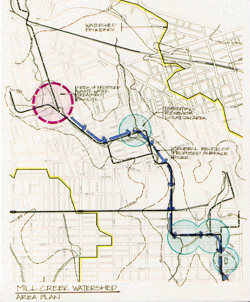
The red circle delineates area for potential new preliminary process water treatment center. Blue arrows indicate general direction of at-grade water flow. Turquoise circles delineate areas most suited to water retention from a purely topographic inventory. Yellow lines indicate watershed boundary.