Houses on Depression areas |
Sewers and Inlets |
Runoff Collection |
| Urban Nature - Water |
Potential Problems
The Mill Creek neighborhood is located on the old Mill Creek. Flooding, wet basements are the usual problems in this area. The followed titles are talking about these problems in this area.
|
Houses on Depression areas |
Sewers and Inlets |
Runoff Collection |
|
| The Pre-urban water ran through West Philly. Time after time, this area is developed and houses are built on the creek valley, from higher part to lower part. |
|
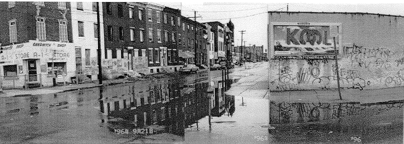
The whole neighborhood is followed the topography of Mill Creek Valley to build up. Some houses are built on lower areas. In the other words, Those are built on the path where the creek used to flow. People who live here would suffer the wet condition without a good drainage system. Even in the dry days, these areas are still wetter than other areas. Many houses are with wet basements. However, a bigger problem is, people do not know the geological conditions of these areas. The earth would subside suddenly due to the change of water table or the volume of the groundwater. Houses on these unstable sites would be sucked into the ground. Several years ago, tragedy happened, and it would happen again.
|
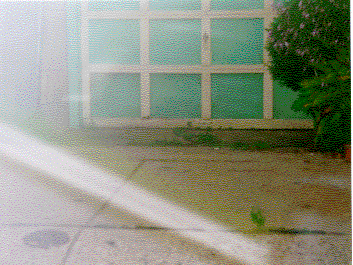
Moss on the ground in front of the garage : indicating the wetness |
|
|
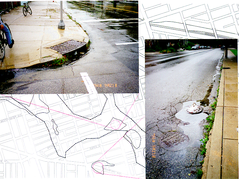
| Inlets are usually constructed at the corners of sidewalks. On the long streets without crossroads, inlets would be constructed by 50 to 100 intervals. What could happen is that those locations are not on the lower parts of those areas. Water just keeps staying on the surface and cannot flows into sewers. |
| The surveyed area is almost covered by hard pavings. Only few lands are covered by lawns, trees, cut grass and gardens. Precipitation which falls on hardpavings flows into the drainage system or sewers, and which falls on soft pavings is absorbed by the soil. The later one would flows into the old path of Mill Creek or into the ground water. If the volume of rainfalls is over the capacity of the sewers, the water would become flooding over the depression areas. The other thing might happen is: the precipitation just cannot flow into the sewers because of the wrong locations of inlets or the trash covers the inlets. In the surveyed area, some inlets are not at the lower points of the blocks and the water just stays at the lower points, as shown above. |
|
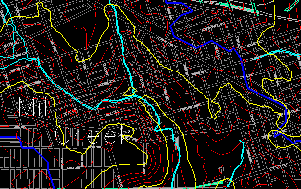
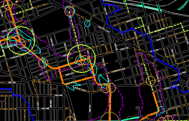
Sewage system in the Mill Creek neighborhood : The biggest circles (yellow) are 10 ft intersections of sewers and the main sewers (orange lines) are greater than 8 ft in diameter. How big the openings of sewers are would affect the storm water collection. When the volume of the precipitation is over the capacity of inlets and sewers, the water which falls in the watershed area (dark blue lines) will flood over the depressions.(light blue and purple lines) |
|
Q=peak runoff rate C=runoff coefficient (depending upon the ground surface conditions of the drainage area) I=average rainfall intensity A=area |
|
|
Coefficients
|
Asphalt or Concrete Brick Lawn Meadows and pasture lands Woodlands and forests |
0.70-0.95 0.70-0.85 0.05-0.35 0.10-0.45 0.05-0.25 |
|
From the above it is clear that different pavements cause different runoff rates. The higher coefficient indicates that more water stays on the surface, in other words, without a drainage system, the precipitation falls on the hard pavings will stay on the surface and cause flooding. The sewage system of West Philly was constructed long time ago, while there were still many woody and weedy lands which could restore the storm water. Nowadays those green lands are developed; however, the capacity of sewers cannot accommodate the increasing runoff generated by those developed lands. We may need more green lands.
|
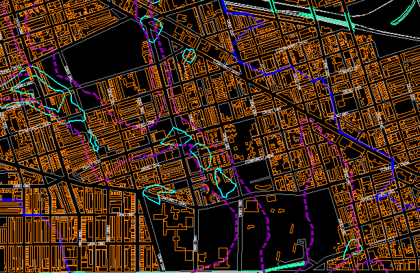
Hard paving areas in Mill Creek neighborhood |
|
Web Links |