A Hierarchy Of Proximity.......

 Rather than directly linking these four golf courses, the Primary aim of this scheme, is to link the people on every street of the Mill Creek neighborhood, to the four courses.

This link will in turn, by a transitive property, provide for a link between the four courses.

 While literally, it aims at gathering water from every street into the four green pockets, which will serve as detention basins, figuratively, it aims at drawing people from all corners to thes zones.


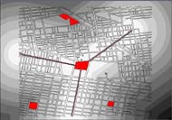
 SITES IN RELATION TO FLOODING...


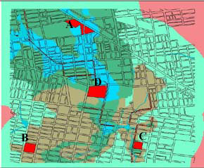
As seen from the map above, the sites are in realtively low lying areas, and can be designed as detention basins. A system of "Water Poles", will be designed on the streets to collect and lead water onto these sites.


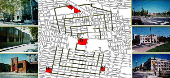
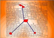
 PROXIMITY TO THE NEIGHBORHOOD...

The concentric circles around the sites, indicate the zones of proximity to the four sites....the darker the blue, the lower the proximity.

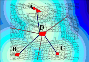
The design aims at using "Urban Poles" of heights reflecting this proximity, to lead people from wherever they are, onto the sites.
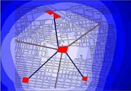
 

URBAN - WATER POLES...

 This sketch of hierarchy of the pole height in terms of proximity has been created by taking cross sections along the radial axes indicated in the proximity map.

Other maps that helped understand this hierarchial proximity are shown below.


MOVING ALONG RADIALS...

1. 

 2.

 3.

Axes With Proximity To Two Sites.

 Axes With Proximity to One Site.

 Combining 1 and 2, showing highest proximity to site D.


ANJALI 'S HOME PAGE