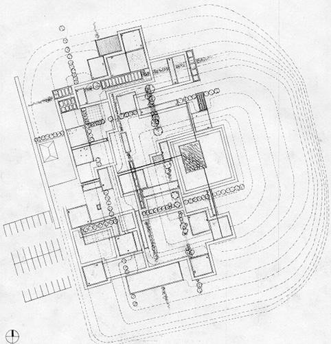
The plan was first drawn as a grid, its angle taken from the 48th Street and Haverford intersection. I then broke the grid apart, stretching, compressing, and erasing parts of the grid, imitating city growth and decay patterns. I envisoned the remaining shapes as platforms or stages. These platforms are set into a gently sloping bowl-shaped landform. At the center is a basin that detains storm water. The planting design begins to construct a new grid, signifying a reconnection to the past and a redefinition of the future.