Charles Darwin Foundation Sensors
Summary
This describes the sensors that the Charles Darwin Foundation has already established on the Galapagos Islands and their system for gaining new knowledge on the well-being of the Galapagos ecosystem. These include the Department of Vertebrate Ecology and Monitoring, GIS and GPS, SeaWiFS, and meteorological and seismological sensors.
The Department of Vertebrate Ecology and Monitoring is a department within the Charles Darwin Foundation that is in charge of conservation science involving the land animals of the Galapagos Islands as well as general monitoring activities. Their work is divided into four different categories:
1. Introduced vertebrates and endemic mammals
2. Birds (such as Darwin's finches and Galapagos penguins)
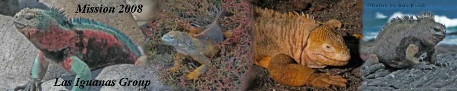
3. Reptiles (such as tortoises and iguanas)
4. General monitoring and the collection of meteorological and seismic data and the development of the Galapagos Geographic Information system (GIS)
Introduced Vertebrates and Endemic Mammals
This category includes work on the eradication of cats (specifically on Baltra Island, north of Santa Cruz), introduced frogs (Scinax quinquefasciata), rock doves (feral pigeons) on San Cristobal, and black rats (Rattus rattus) and rice rats (Nesoryzomys swarthi) on Santiago Island.
Birds
The ornithology staff conducts annual surveys of Galapagos penguins and flightless cormorants with funds mainly coming from SeaWorld. Surveys have also been conducted of the critically endangered Floreana mockingbird. The Floreana Mockingbird is vulnerable to black rats, introduced diseases such as avian pox, and the parasitic fly Philornis downsi. Due to the damage that the fly can cause to Galapagos avifauna, the Department of Vertebrate Ecology and Monitoring has been checking landbird nests for Philornis larvae and has mapped its distribution.
Reptiles
Work done with Galapagos reptiles involves conducting surveys of Galapagos land iguanas on Baltra Island, as well as conducting monitoring projects of giant tortoises by capturing or recapturing them and marking them. This has been done on Alcedo Volano (Isabel Island). The same has been done for land iguanas at Cartago Bay (Isabela) and at Cerro Dragon (Santa Cruz).
Monitoring
Climatic monitoring occurs at the CDRS, Bellavista, Isabela stations. Data is also collected at the Baltra and San Cristobal airports. The department's GIS program continues to develop. It has produced Digital Elevation Models of Champion and Pinzon Islands which have been very important for conservation planning.
Sea Viewing Wide Field-of-View Sensor
SeaWiFS is a program created by the National Aeronautics and Space Administration as well as the Orbital Sciences Corporation. It was first launched in September of 1997 and since then, it has been an important tool utilized by researchers to gain unique information of ocean processes through interpreting the color of the worlds oceans.
Designed to monitor ocean physics, chemistry and biology from space, Sea Star represents a new generation of highly capable, low-cost satellites planned as part of NASA's Mission to planet Earth. The SeaWiFS ocean-color sensor provides the fast, repeated global coverage required for advanced studies of marine phytoplankton, ocean surface currents, and global climate change. "From an orbit of 705 km above the earth it can collect more information in 10 minutes about the color of the worlds oceans than a boat could in 10 years" (Dr Gene Feldman, SeaWiFS program).
The satellite orbits around the Earth and builds a complete picture of the different hues of the ocean. This means that the satellite uses the picture of sunlight that comes off of the ocean surface. Pure ocean water is deep blue but marine plants make the color greener because they absorb the blue light and reflect green light. These plants mostly consist of phytoplankton. Red light can also be created by scattering from atmospheric dust and haze and by land surfaces.
Ocean-color observations from space lets the CDF estimate the concentrations of these green algae over large and often remote ocean regions and permit the study of near-surface phytoplankton "blooms." Long-term ocean color data therefore help trace the movement of plankton in the surface currents, providing current mapping necessary for safe navigation at sea. The data can also be used to track the fate of river discharge, pinpoint fertile fishing grounds, and track water-borne pollution.
Galapagos lie at the junction of three major influential currents that vary in strength and direction throughout the year (including the well documented El Nino effect). The properties of these currents and their seasonality are integral to the biogeography of the marine reserve, dictating the productivity of the surface waters and the species that live there, changing over small scales from day to day.
The SeaWiFS data can be applied across a range of station initiatives from long-term programs such as the fisheries monitoring and development and evaluation of the marine reserve zonation scheme, to species level research.
GIS in Galapagos
The Charles Darwin Research Station (CDRS) have participated in efforts to revive a moribund multi-institutional agreement to develop a comprehensive GIS (Geographic Information System) for Galápagos. GIS uses computerized databases and maps that permit the exploration, interconnection, and analysis of data through the superimposition of various types of information. GIS is helpful because it allows for easier analysis of environmental problems throughout the world.
The Darwin Station has worked with many institutions to develop GIS Galapagos - the Geographical Information System for Galapagos. Two areas have been especially important, the development of basic cartography and the incorporation of relatively cheap GPS receivers into the system.
Many CDRS and GNPS programs are now using GPS to record ecological monitoring data, and a connection has been developed between GPS data and the GIS programs that are currently in use. New monitoring methods have also been developed that combine GPS data with more classical sampling techniques to estimate and record the density of target species. The Isabela Project also used the system to plan a series of monitoring trails on Wolf and Ecuador volcanoes from satellite imagery, which identified areas of high humidity and dense vegetation. The coordinates of proposed pathways were extracted from the imagery and passed to GPS units managed by personnel of the Isabela Project. These trails went through previously unexplored terrain and this led to the discovery of some of the densest giant tortoise populations on the Galapagos Islands.
Meteorology Stations and Seismology Network
In an agreement with the Ecuadorian National Institute of Meteorology and Hydrology, the Charles Darwin Research Station maintains and operates the two meteorological stations on Santa Cruz Island that form part of the National Meteorological Network. The Station's database of climatic information covers more than thirty years. To complete this task, volunteer students from various universities in the country are trained to handle meteorological data and they also produce a bi-weekly bulletin which is distributed to interested institutions on the Galapagos as well as on the mainland. Since August 1997, this group has been working in the Seismic and Volcanic Network of Galapagos, thanks to an interinstitutional cooperative agreement between the CDF and the National Polytechnic School in Quito. This network covers the central part of the archipelago and also continuously monitors signals emitted from the volcano on Fernandina, from Chico Volcano on Sierra Negra, Isabela Island, and from Santiago Island.
Sources:
"Annual Report 2003." Charles Darwin Foundation. http://www.darwinfoundation.org/downloads/ar2003ing.pdf
"GIS in Galapagos." Charles Darwin Foundation. http://www.darwinfoundation.org/articles/n5900049808.html
Meteorological Stations and Seismology Networks." Charles Darwin Foundation. http://www.darwinfoundation.org/articles/ar00040058.html
"Sea Viewing Wide Field-of-View Sensor in Galapagos." Charles Darwin Foundation. http://www.darwinfoundation.org/marine/seawifs.html
"Technology in the Service of Ecological Monitoring." Charles Darwin Foundation. http://www.darwinfoundation.org/articles/ar00040040.html