Subject Links |
|||
| Tsunami-Proof Buildings |
Urban Planning
An urban plan of a city in terms of natural disasters must incorporate a workable public policy for the benefit and satisfaction of the people, care for the environment where the city is being built, a law and order system which keeps the activities of the city in check and assists the people in case of an emergency, and the education of the people so that when face natural disasters, they know what to do.
Law and order in times of natural disasters is especially important; distributing aid, saving lives, and preventing looting and hoarding. In this regard, local policemen, sheriffs, tribal leaders can play a very important role. Aaron D Kennard in When natural disaster strikes: Sheriffs important leaders in emergency response proposes how important sheriffs and their agencies are when natural disasters strike, taking an example from a killer tornado which struck Salt Lake City in Aug 1999.
Planning an
urban city is a huge task in its own right, and planning one where objective is
to reduce damage by tsunamis as much as possible is even harder. No one
department or municipality can work alone on such a system; instead, much more
can be achieved if these various departments and municipalities cooperate and
concentrate together on this single effort. In April 2005, a news item appeared in the Financial
Times, Amendments for disaster management
discussed which detailed how collaboration between various departments
and municipalities in a developing country (
Basic
survival skills taught to people in the areas of risk is especially important.
Knowledge of how to ration food, staying warm and dry, inhibiting water-borne
and common infectious diseases recognizing signs of impending disasters, are
all important parts of the skills. Various news items appeared after the Dec.
2004 tsunami, which noted that some of the most remote tribes in the
The plan must also include monitoring of the extent of the damage and where it is the greatest via the use of the NOAA/AVHRR satellite system, which is already being done in the case of other natural disasters such as forest fires and floods.
Urban Planning Quantitative
Proposals
Urban Planning for tsunamis
should focus on building codes and city layout.
The World Health Organization
in a report states that wave heights reach 30-40 feet at their maximum and
waves penetrate roughly 1km-2km inland maximum
[1]
.
In conjunction with this,
another study stated that waves in a tsunami in 1932 were able to destroy
buildings 500m inland
[2]
.
Our recommendation is therefore
that buildings should not be built less than 500m inland and be below 30
feet above sea level whenever possible. When this is not possible, then
it should be made with reinforced concrete according to the specifications
of the tsunami proof buildings section. From 500m to 1km, the buildings
still should be held to having solid, water proof foundation with the bottom
3 feet saltwater resistant as well as having frontal reinforcements. From
1km to 2km inland, the buildings should have water proof foundations and
roughly 1 foot of saltwater resistant wall. Beyond 2km, there is no significant
danger of direct wave damage and building codes do not have to be as strict.
This tiered approach will enable safety in case of tsunamis and also be
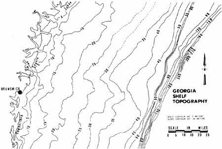
practical economically. Contour charts such as the one to the left need
to be studied carefully.
One thing that is important
to note is that these distance inland estimates are based upon lack of mangrove/sea
wall protection. Given particular configurations of these near shore dampeners,
the safe distance inland may be decreased, further reducing cost. Cost benefit
analysis is necessary for determination of amount of near shore protection
to have.
Another thing that is of vital
importance is having sufficient road ways. Ample arteries of transportation
allows for rapid evacuation of the populace as well as rapid response for
emergency relief. A study provides a clear estimation on how much road coverage
there should be for a given population density
[3]
. For example, for a densely populated city like 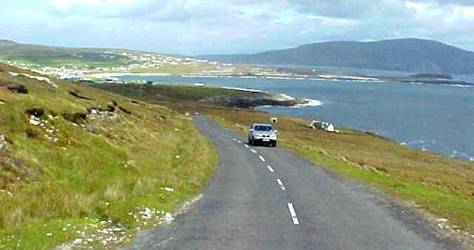 the coast do not meet such requirements.
One may want to revise such
figures as the Reilly and Gottlieb article was a case study in
[1]
World Health Organization. Assessing Needs and Measuring
Impact of the Grorokhovich Tsunami. http://www.who.int/hac/events/tsunamiconf/presentations/2_1_assessing_needs_measuring_impact_gorokhovich_ppt.pdf
[2]
[3]
James Reilly; Paul Gottlieb. "PROJECTING COSTS
FOR ROADS UNDER VARIOUS GROWTH SCENARIOS"
[4]
Wikipedia,
Page by: Shahab Umer and Peak Xu