DEALING WITH PROJECTIONS
The bottom line is, the Earth is approximately spherical, and your computer screen is not. Therefore, we have to project spatial data onto a flat plane to display it on our screens. There are many different methods of projecting data which variously preserve area relationships or angular relationships, or designed for specific parts of the globe. If we were to simply overlay two spatial data sources with different projections, we would expect that the topological relationships between the two would come out wrong - they wouldn't line up right. ArcGIS (on the computer) compensates for this by projecting on the fly. That is, when you put two data sources into your map that have different projections, it transforms the data sources to fit into a single map projection. ArcPad (on the iPaq), doesn't have this capability. Therefore, all the spatial data used in ArcPad must be in the same projection.
So, we need to understand how projections are defined in Arc, and how to change them.
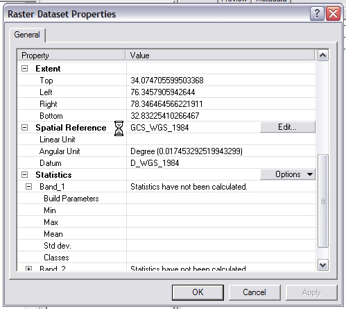
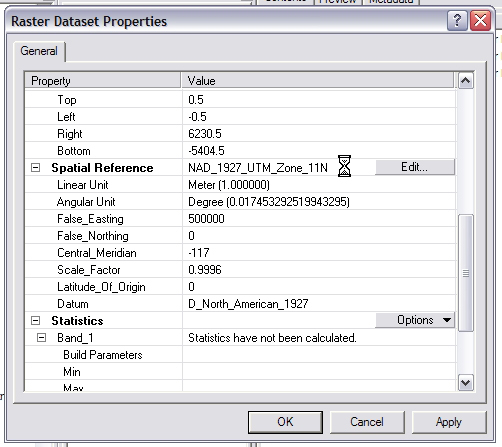
1) Let's start with Raster datasets. You can see the projection, or spatial reference information of any raster by right-clicking on it in ArcCatalog and selecting properties. In ArcGIS 9 (on the field camp laptops but not on the computers in Kelin's lab...), you'll see a Properties window that looks like this:
If you're using ArcGIS 8, you're behind the times, and this is much more difficult (Ask your TA for instructions)
Scroll down to the Spatial Reference field, where it tells you the projection the raster is in.
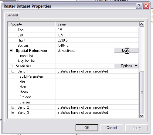
If the Spatial Reference field says undefined, then there is no projection defined for that data source. This is where things get a bit confusing. When that data source was created, it was created using some specific projection - it had to have been, since it is now on a flat screen. However, for whatever reason, there is nothing telling Arc what that projection is. The data source likely has some georeferencing data, but Arc doesn't know how to interpret it. If you put the data source into a map in ArcMap, you'll find that it behaves strangely. For instance, if you define the Map Projection as WGS84, the upper left corner of the map will be at some specific value, say 84°37’44” Lat and 25°12’14” Long, but if you change the projection to a UTM coordinate system, the data source will move so that the upper left corner is at 843744 meters N and 251214 meters E of some datum. We see that Arc has some number pinned to the upper left corner, but doesn't know what it means, and so puts it in the units of whichever coordinate system is defined as the Map Projection.
What it all comes down to, is that you need to figure out the projection that the raster was created in, and then define that projection so that Arc can properly assign units to the numbers it has.
To do this, simply click the Edit button next to the Spatial Reference field that says <Undefined>.
This brings up the Spatial Reference properties window. Click Select.
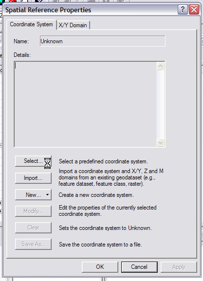
Now browse through the spatial references until you find the one that your raster was created in.
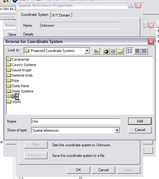
Clicking Add selects the spatial reference, and brings you back to the Spatial Reference Window. Clicking OK again defines the spatial reference of you raster.
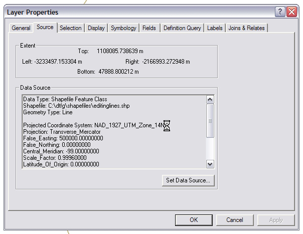
2) Seeing the Spatial Refernce of shapefiles. Luckily, you cannot create a shapefile without defining its spatial reference, so there are no problems there. However, I can't find a way to see that spatial reference information in ArcCatalog, so the easiest way to see it is in ArcMap.
Add the shapefile to the map. In the Table of contents, right-click on your shapefile of interest and select Properties.

The Data Source field in the Source tab gives you spatial reference information.