About WPLP Projects Stories Resources Honors Search
West Philadelphia Landscape Project

Mill Creek Watershed

The largest areas of vacant land in West Philadelphia occur within the floodplain of Mill Creek (now buried in a sewer), primarily in the Mill Creek neighborhood near the Sulzberger Middle School. There are continuing problems of flooding and subsidence over and near the sewer in this urban floodplain.

Professor Spirn has taught several studio courses investigating how vacant lots might be redesigned to detain stormwater and provide local open space. The goal of the Mill Creek Watershed Project is to further investigate the feasibility of such measures, to develop new material to support further courses.

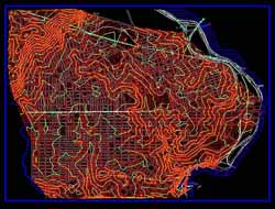
Laura Aibel, a graduate student in regional planning (and a civil engineer), worked in 1995-1996 on a hydrologic model of the Mill Creek watershed with particular focus on the area surrounding the Sulzberger Middle School. Using data from the Philadelphia Water Department and from the West Philadelphia Digital Database, she tested the potential of various design strategies for reducing stormwater flow into sewers and compiled a course packet for landscape architecture students.

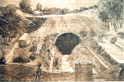
Vacant land, flooding, and subsidence on and around the Sulzberger Middle School property present an opportunity to study these hydrologic processes at work and for neighborhood development and water resource management. Vacant lots afford an opportunity to integrate science education with first-hand observation and hands-on experience for both Penn and Sulzberger students. This project provided the background for a landscape architecture studio course in fall 1996 and fall 1997 which will explore these possibilities.


This project was supported by a research/teaching grant from Penn's Center for Community Partnerships.


Maps

The following maps were produced using Intergraph Corporation's road alignment and terrain modeling software, InRoads v. 5.0, a plug-in software package for Microstation v. 5.0. The software was made available to the Graduate School of Fine Arts through an University Partnership agreement with Intergraph Corporation.

Topography - 2ft Intervals (115 Kb JPEG)


Digital Terrain Model (97 Kb JPEG)


About Projects Stories Resources Honors Search Home
Home