
Ferries as Ships of Opportunities: Research Seeks to Improve Understanding of Plankton Diversity in the Coastal Ocean
by Kate Madin, Woods Hole Sea GrantThe islands of Nantucket and Martha's Vineyard, lying off the coast of Cape Cod, are well-known tourist destinations: their summer populations can soar to five and ten times those of winter levels. Residents and tourists alike travel there and back across the same body of water, Nantucket Sound. As they make the crossing to and from the ports of Woods Hole or Hyannis, most travelers have little understanding of what's happening in the water beneath them. But to Woods Hole Oceanographic Institution (WHOI) biologist and zooplankton ecologist Scott Gallager, gaining a clear picture of the complex physical, chemical, and biological factors operating in Nantucket Sound waters is critical. And he has forged an unusual partnership to help him get it.
With Woods Hole Sea Grant support, Gallager and his WHOI colleagues have teamed up with The Steamship Authority, a provider of ferry service to the islands, to install instrumentation on two of its ferries. The goal is to collect high-resolution data about the Sound that will help scientists better understand the coastal Atlantic Ocean, its food webs, and its future. While the idea is not unique - ferries have been used to collect data throughout the world for over a decade - it has local appeal.
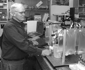
Plankton ecologist Scott Gallager analyzes samples in his lab at WHOI.
Gallager is interested in the smallest animals in the ocean - zooplankton - and the water conditions that affect how they live and grow. These tiny animals, near the base of the coastal ocean food chain, are the food source for the larger animals that people depend on and enjoy, from fish to whales. Gallager has good reasons to be interested. The availability of plankton determines whether there will be healthy populations of commercial fish and other animals. If human activity or climate changes drastically alter the types of plankton that flourish, the quantity and quality of food for fish and marine mammals - and for humans - would be affected.
So Gallager set about studying the physical, chemical, and biological factors that control how the many kinds of plankton coexist and form communities. The community changes over the year, based on environmental conditions, and on who eats how much of whom: "Seasonal changes in plankton diversity are a reflection of nutrient input, light, and temperature, coupled with biological processes including predatorñprey interactions, growth, and reproduction," Gallager says. Zooplankton depend on plant plankton (phytoplankton), which depends on light, nutrients, and seasons. If we learn enough about how zooplankton will respond to changing conditions - including climate, and contaminants, and nitrogen loading - we may be able to predict what can happen to our fish stocks.
A warming climate and more human activity will inevitably affect coastal ocean conditions and the plankton that live there, Gallager knows. "Nantucket Sound is highly exploited by current uses," he says, "but future use of the area may be even more demanding, including [proposals for] the development of a wind farm system and dredging for sand recovery operations. There is a paucity of data on the physical and biological dynamics in the Sound."
With Woods Hole Sea Grant support, Gallager and WHOI colleagues Steve Lerner, Emily Miller, and Andrew Maffei have installed a package of sensors designed to measure water temperature, salinity, and pressure, water clarity, oxygen, and take digital images of the plankton on the ferry Katama. Now, as a "ship of opportunity," Katama tirelessly collects data on the Woods Hole-to-Martha's Vineyard run, building up a portrait of Nantucket Sound over time. The data travel over a wireless connection to shore, where Gallager makes them available in real time to scientists and the public on the project web site, http://sealion.whoi.edu/ferries/.
Already, an interesting picture is forming of the western side of the triangle: he can match chlorophyll amounts - a measure of how much phytoplankton is in the water - with tidal flow and the salinity of the water. On a flood tide, when water flows into the Sound from the west, salinity is higher and chlorophyll lower. The situation reverses on an ebb tide, when water flows the other way. Gallager uses the data to construct 3-D diagrams of temperature, salinity, and chlorophyll. "We know that the phytoplankton is patchy," he says, but it will be neat to follow the diagram over time across the Sound, and see that it's patchy, and why."
Most recently, Gallager and co-workers have outfitted the ferry Eagle - which runs from Hyannis to Nantucket - with the same suite of sensors, essentially completing two legs of the triangle. He now can monitor changing seawater conditions and plankton assemblages on both sides of the Sound in real time. Are plankton communities hurt by the increasing nitrogen outflow from the coast? Do warming water temperatures change plankton species or abundance? How do storms change the picture, and how quickly do conditions and plankton communities return to normal after a storm?
Soon, Gallager will have answers: "Instrumentation on the ferry transects across Great Round Shoals to the east, between Oak Bluffs and Nantucket to the south, and between Woods Hole and Vineyard Haven to the west, will allow us to have a complete description of the incoming and outgoing plankton communities in surface waters," he says. Such studies of plankton dynamics can provide evidence for what might happen to plankton in the future.
The goal is simple - and difficult: to build a complete picture of Nantucket Sound's coastal water, its movement, properties, and plankton. Gallager wants "to create a regional model to allow real time readings and forecasts of environmental perturbations, providing an understanding of what affects plankton diversity in the light of coming climate change." And via the website, the public is invited along for the trip.