Dominican Republic
Pico Duarte - 10,164ft
Eric and Matthew Gilbertson
Date: August 25, 2013
More pictures here: http://mitoc.mit.edu/gallery/main.php?g2_itemId=396842
Pico Duarte (10,164ft) - Roof of Dominican Republic
Aug 25, 2013
6:00am-6:15pm
26.7 miles
9,267 ft net elevation gain
Matthew Gilbertson, Eric Gilbertson, Kate W., Daniel G.
LINKS:
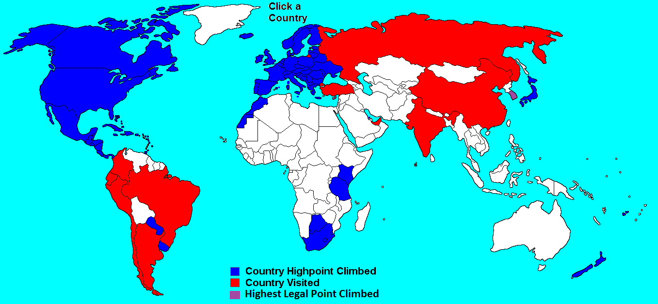
Our country highpoints page
Our adventures page
“Halfway there,” Eric said as we raced through the desert, just outside of Jimaní, Dominican Republic. “One mountain down, one to go.” But with the windows down, pedal to the metal, and “Born to Be Wild” blasting through the speakers in our little Chevy Aveo, it felt like we were finished. It felt like we were already on our victory lap. As the cacti zoomed past, the artificial breeze made the dry, sunny 100F air feel downright pleasant. We hugged the shoreline of Lago Enriquillo, a palm tree-ringed, turquoise-green lake 90 ft below sea level, and I contemplated the map.
The previous evening, we had summited Pic La Selle, the highest point in Haiti, and had passed a parched, thirsty night at 7,500ft on the mountain. We had run out of water earlier that day and had been forced to barter with villagers in French for water, and later, to drain rainwater from concave agave leaves. Today, after a long descent by foot and foldable bike, and more than an hour of hassle filled with corruption and bribery at the DR/Haiti border, we had finally arrived back in Jimaní at midday.
When we crossed back into the DR from Haiti, it felt like we had entered the land of milk and honey. The road was paved instead of the rough, dusty limestone gravel we had biked through in Haiti, the buildings were well-maintained, children weren’t shouting “blanco” wherever we turned, and there were no United Nations Humvees rumbling by. We stopped by the Jimaní police station, where we had parked our rental car for the last 25 hours, hopped in the car, and stocked up on food and water at the supermercado with the help of Tommy, a Dominicano whom we had befriended yesterday, before leaving town. Next on the hit list was Pico Duarte, highest point in the Dominican Republic.
“Well, Daniel said 6 hours from Jimaní to Jarabacoa, so we ought to be there by 8pm,” said Eric. To save a few dollars on the car rental, for this trip Eric was the single designated driver and I was the designated navigator.
“The hike up Pico Duarte tomorrow is going to be longer than Pic La Selle,” I said to Eric, “but I feel like it’s going to be much easier. First of all, we’ll be taking a trail, so we know that it’s actually possible to get to the top, unlike Pic La Selle, where we followed a route that we had planned just from satellite photos. And we’re going with someone who’s been there before and who has the second-fastest speed record. And in terms of tourism, it’s a much more trodden path up Pico Duarte than Pic La Selle. So even though the hiking portion of Duarte will be more difficult, there are a lot fewer variables.”
“Yeah, it’s a good thing we did our homework for this trip,” Eric said. “We don’t want a repeat of South Korea here.”
§§§§§§§§§§§
THREE INGREDIENTS
Eric and I have come to realize that the recipe for every successful trip requires a few key ingredients: thorough background research, physical stamina, and luck. Proper background research gets you to the trailhead and informs you what you’re up against. Physical stamina gets you from the trailhead to the top. And luck is the great catalyst, helping the trip go smoothly and safely. For Pico Duarte, we would need all three elements.
A few months earlier, on Jeju Island in South Korea, I had learned the hard way the consequences of not doing your homework. On that trip, my friend Jake and I had attempted to climb Hallasan, the highest point in the country. But when we reached the point on the trail that all of the maps had designated as “the summit,” we discovered that we were actually standing on the second highest point in South Korea. The true summit, we discovered, is located a tantalizing 0.75 miles away along a crater rim, is officially off-limits, and trespassers face a $500 fine. Although more thorough prior research would have neither reduced the fine nor made summitting any less illegal, at least it would have given us a Plan B and some ideas for how to find a “backdoor route” to the top. In the end, Jake and I were forced to turn back, summit-less, to catch an afternoon flight.
Keen to avoid a repeat of the defeat on Hallasan, I vowed to research Pico Duarte thoroughly in order to maximize our chances of success. A month before our trip, the first surprise came when Eric discovered a webpage stating that you are required to hire a guide for Pico Duarte. “Well we’ve heard that before on plenty of other mountains,” I said to Eric skeptically. “Do they mean ‘to make your life easier, you should hire a guide so you don’t have to figure out any logistics yourself, and so someone can hold your hand and lead you to the top’ or ‘you’ll get arrested and fined if you don’t hire a guide’? Those are the two opposite ends of the ‘you must hire a guide’ spectrum.”
“Unfortunately, it’s the latter,” Eric said. “Summitpost says it’s a park service requirement, and a book at the COOP said it’s against the law to hike it unguided. Sounds like it’s the government’s attempt to help boost the local economy. So I guess it’s hard to argue with that.”
“Ok, so let’s find the cheapest guide,” I said.
More research uncovered several tour companies who will pick you up at the airport in Santo Domingo, give you a place to sleep, drive you to the trailhead, provide a guide, mules, and food, and bring you to the summit and back down in 2 or 3 days. Total prices ranged from USD$300-$900/person.
“$300 per person? 2 or 3 days? That’s just crazy,” I said to Eric.
“Yeah, that’s got to be a lot of money for the Dominican Republic, I’d expect things to be much cheaper than that down there.”
“Yeah, and the hike is 26 miles roundtrip. That’s a decent hike, but I’m sure we could easily do it in one day. It certainly won’t take three days.”
We emailed the four guiding companies for whom we could find an email address, and asked them if they’d be willing to run a less all-inclusive trip (we provide food and carry our own gear) in one or two days for less money. Both of the companies that responded said that the price was not negotiable.
“Well, there’s always the option to just show up at the trailhead and see if we can connect with a guide directly,” Eric said. “Some websites say that you can save a lot of money if you deal directly with a guide, and not through a tour group.”
“Yeah, that’s a possibility,” I said, “but finding a guide could cost us an entire day. Since our timing for this trip is so tight, it’d be great if we could have things figured out beforehand.”
Originally, we had budgeted just one full day for Pico Duarte. We’d (hopefully) arrive at the Duarte trailhead on a Saturday evening after climbing Pic La Selle (the highest point in Haiti), climb Duarte on Sunday, then fly out Monday afternoon. But it sounded prudent to give ourselves an extra day, so we booked a flight that’d leave Santo Domingo Tuesday afternoon, giving us two full days for Pico Duarte. The timing still seemed tight. What if we couldn’t find a guide on Saturday night? What if no guide would let us hike it in fewer than two days? Has it ever even been hiked in one day?
I googled “Pico Duarte one day” and came across a report of two guys who had attempted to climb it in 14 hours roundtrip back in November 2009. Bingo, I thought, so it can be done in a day. Unfortunately, as I read on, I learned the pair was unable to complete the hike in one day, and ended up spending the night in a hut near the summit, finishing in 1.5 days.
Ok, what about googling “Pico Duarte speed record”? Enter. And with that search, I hit the jackpot.
THE GOLD NUGGET
“I, David Bean, climbed Pico Duarte today (May 4th, 2013),” the trip report said, “and did it in 7:36:35, Daniel Gutierrez did it in 8:26. Weather was cloudy and cool until the last hour or so and the trail was terrible like always. I definitely plan on getting back there and taking it under 7, but I am also sure that people could take it down a lot farther than that.”
Until now, in our quest for information, Eric and I had been panning for gold, finding a few small flakes here and there. But now, we had just unearthed a big gold nugget. The game had changed. In his report, David said that his guide Radhames had tagged along behind him and Daniel with a mule, and that his presence was more of a formality than anything else.
Encouraged by this golden nugget of information, I posted on David’s blog and forum asking for the contact info of his guide Radhames or if we knew of other guides who would also permit a single-day climb. David responded almost immediately, giving me Daniel’s contact info. It turned out that Daniel still works in Jarabacoa, not far from the trailhead!
Daniel said that, indeed, you are required by law to hire a guide. He knew someone who had successfully hiked it without a guide several years ago but, upon returning to the trailhead, was shot at and later detained by police. The individual escaped unharmed and un-arrested, but Daniel advised us not to repeat this incident.
Daniel gave us three awesome nuggets of information: 1) he was interested in joining us for the hike, 2) he would coordinate the trip for one day with the same guide, Radhames, and 3) the trip fee would be $75 total – just $25/person! This was absolutely ideal, because, first of all, we knew that Daniel would set a good pace since he had the second-fastest speed record – we might have to run to keep up with him. And Daniel, a native Spanish speaker, would be able to communicate with Radhames more effectively than us, especially because Radhames spoke Campesino – “Country Spanish.” And of course the price was an order of magnitude less than we had anticipated. Getting in contact with David and Daniel had been a miraculous stroke of good luck.
So, we had set a date of Sunday, August 25, 2013. We’d rendezvous with Daniel in Jarabacoa around 8pm on Saturday, drive to the trailhead, camp there, then start hiking in the morning. We’d finish around sunset, drive back to Jarabacoa to drop Daniel off, then we’d be on our way. This itinerary would give us Monday as a buffer day just in case things didn’t go according to plan.
NUEVOS AMIGOS
And so far, the plan had been executed flawlessly. We had summitted Pic La Selle with no significant incidents. And we ended up leaving Jimaní at 1:58pm, just two minutes earlier than we had planned a few weeks ago. In a few hours, we reached Santo Domingo and the traffic density began to increase. Eric and I had had considerable experience driving in nine Caribbean and five Central American countries so far, so Santo Domingo wasn’t all that scary. But still, we breathed a sigh of relief when we began to leave town. We celebrated with a quick pit stop for some fried chicken.
As the sun set, a new danger began to emerge: it seemed that every car had its high beams permanently on. It was as if, long ago, all cars in the country had gotten into an arms race for headlight brightness. Carlos, for example, turns on his high beams. “Wow, I can see much better, I should always drive like this,” he says. Then oncoming driver Juan, blinded by Carlos’s high beams, flicks on his own high beams so that he can see the center line. “Wow, now I can see much better,” Juan says. Carlos and Juan go their separate ways but leave their high beams on, oblivious to the fact that they’re blinding everyone else. In order to see, all oncoming drivers flick their high beams on, and in just a few days everyone in the DR is driving with permanent high beams. Eventually, Carlos decides to switch out his high beams for even brighter ones so that he can see even better, and the escalation continues. It therefore comes as no surprise that the US State Department strongly discourages driving at night in the DR.
By 9pm, we finally arrived in Jarabacoa, and as our pupils began to reopen, proceeded to the designated rendezvous point with Daniel. “We’ll be meeting Daniel and his friend Kate outside of the Doulos Discovery School,” I said to Eric, “that’s where Daniel works.” As we would later learn, Doulos is a “Christian, college-preparatory, Expeditionary Learning, English-immersion school” which sponsors “PK-12 education to students of varying socioeconomic classes in the Dominican Republic” and has more than 200 students. As we waited for Daniel and Kate, we caught a glimpse of the school’s magnificent campus. We would cross paths with Doulos again after the climb.
Right on time, Daniel and Kate appeared, ready for action. We introduced ourselves and all hopped our small car. As Daniel directed us to the gas station and then towards the La Ciénaga trailhead, we learned that he had climbed Pico Duarte numerous times and often mountain bikes in the area. The previous week, he had actually mountain biked all the way from Jarabacoa to Radhames’ house to speak with him in person and discuss logistics. Meanwhile, this would be Kate’s fourth climb and first attempt in a single day; in fact, with a successful ascent tomorrow, she would set the new women’s speed record. Both Kate and Daniel were in top physical shape and together we formed a great team.
One hour later, after a long, windy drive up a gravelly mountain road, we reached the trailhead at a village called La Ciénaga.
“This is where we’ll sleep tonight,” Daniel said, pointing to concrete-floored the open-air ground floor of a large building. “We’d normally sleep inside this building, but there are some park officials there tonight so we’ll have to sleep underneath.”
By 11pm, we were finally in bed. Unfortunately, I had forgotten my air mattress, so I laid on the cushiony part of my backpack, and pulled on the sleeping bag liner, shivering to stay warm. But, fatigue overpowered discomfort, and I was asleep in minutes.
THE CLIMB
6.5 hours later, our alarms jolted us awake and we prepared for battle with the mountain. As Eric and I scarfed down some cereal and powdered milk, Daniel and Kate prepared their ultralight backpacks. Soon, Radhames appeared with his mule, and was surprised that we hadn’t started hiking earlier. I think that he thought we were hoping to set a new speed record for Pico Duarte. Eric’s and my goal was simply to make it to the summit and back in less than a day – Daniel’s and David’s records sounded hard to beat.
We crossed the starting bridge at 6:00am and the clock began ticking. Thankfully, we had started just late enough not to need the headlamps and hoped that wouldn’t need them at the end of the day either. David’s GPS track indicated 9,279 feet of net elevation gain over 13.4 miles, for an average grade of about 700 ft/mile. It would be a long, sustained climb.
Eric and I have discovered that the best way to make a long hike seem shorter is to talk. So talk we did. We learned more about Doulos, Kate’s aspirations to climb higher mountains like Kilimanjaro and the seven summits, and Daniel’s mountain biking and running adventures around the Dominican Republic. After 7.5 miles, we reached a quasi-peaklet and descended a short ways to a nice cool spring, appropriately called Aguitas Frías. Kate and Daniel, accustomed to the local water, sipped directly, while Eric and I popped in some iodine pills to ensure that the water was gringo-friendly.
A few miles later, we reached a magnificent complex of buildings called La Compartición. This is where most people spend the night, Daniel said. Those climbing the mountain in two days hike up to La Compartición on the first day, spend the night, then get up early the second day to hike up to the summit for sunrise. The complex consisted of a ranger cabin, sleeping cabin with space for a hundred people, and cooking cabin with two dozen concrete fire rings for preparing meals. As we walked through the cooking cabin, the wonderful collective aroma from thousands of delicious meals wafted from the woodwork and into the air.
We hung around La Compartición for about ten minutes, preparing for the final push to the summit. The cool interior of the cabins provided welcome shade from the hot, dry August sun. The pleasant smell and quietude of the pine forest beckoned us to linger but, eager to complete the hike before nightfall, we quickly scarfed down a few granola bars and headed out.
When we stepped out the door, we were surprised to see Radhames with his mule. He was the first other person we had seen since 6am. Turns out he was close behind us the whole time and had caught up while we were taking a break. His role was to stay at the back and act as a sweeper; if anyone got hurt, he would give them a ride down on the mule. Daniel, Kate, and Radhames chatted for a moment, and then we continued hiking.
“If we reach the summit and cover the thirteen miles back down the trailhead within the next hour,” I said to Daniel, “then we’ll break your record.”
“When David and I set the record,” Daniel said with a smile, “we took our first rest here at La Compartición at about the three hour mark. Then we dropped our packs and ran to the summit.”
“Something tells me we’re probably not going to break the record today,” Eric said, “but we weren’t trying to break the record today. Our goal was just to finish in one day.” We all nodded in agreement and continued hiking.
LA CIMA
The trail wound upwards through the thin pine forest and began to level out in a plateau. “Almost to the summit,” Daniel said. Soon, a large rock outcropping appeared and, after a little scrambling, we ran out of mountain to climb. We were on top of the Dominican Republic!
We were rewarded with a spectacular view of the countryside. Forests spread out for miles in every direction and few cities were visible. Near the mountaintops, the forest was generally thin, dry, and piney, while lower down it was dense, wet, and jungly. Over the past thirteen miles, we had really traversed the full spectrum of ecosystems. Daniel pointed out his favorite mountain biking locales far below.
There was no mistaking that we were at the top. The summit’s precarious rock pile is christened by an 8ft wooden cross, a large Dominican Republic flag, and a 1.5x scale bronze bust of the honorable Juan Pablo Duarte, a founding father of the country, and the mountain’s namesake.
From the summit, we spotted another mountain of seemingly similar height about a mile away. “Which mountain is that one,” Eric asked, “it looks just as tall?”
“That one,” Daniel answered, “is called ‘La Pelona.’ A few years ago, it was surveyed and found to be just four meters shorter than Pico Duarte, but I’m not sure how accurate that survey was. Since there are trees on the summit of La Pelona, nobody every hikes there. Pico Duarte has the best views anyhow.”
For a fleeting moment, I was tempted to suggest that we go ahead and tag the summit of La Pelona on the way down. Only four meters shorter? That’s just barely greater than the resolution of a handheld GPS. What if it’s surveyed a few years from now and found to be taller? Does that mean we’ll have to come back to the DR so that we can officially climb the actual high point?
I thought back to our bike tour in Europe and the story of the Denmark high point. For years, people thought the highest point in continental Denmark was a hill called Ejer Bavnehøj, so a really nice monument was built on top of that hill. Then, recently, it was found that a nearby hill called Møllehøj was actually a few centimeters taller. So the second highest point in the country has a magnificent monument, while the actual high point is christened with hay and cowpies. And there’s a similar story for Knieff, the highest point in Luxembourg.
But, eager to start the long hike back down to the trailhead, I quickly dismissed the idea of adding one unnecessary mountain. The five of us – Eric, Kate, Daniel, me, and Radhames – gathered around the bust of old Señor Duarte and snapped a triumphant summit photo. Radhames’s mule, parked a hundred feet down the trail and busy munching grass, missed out on the photo.
“Vámanos!” I said. We activated our descent muscles, lengthened our trekking poles, and mentally engaged downhill mode. The time was 1:23pm, and we had about 4.5 hours of daylight remaining.
LOS CAÑONES DEL DUARTE / THE CANYONS
“Man, it’s hard to believe we climbed all of this,” I said. Pico Duarte produced a mysterious effect called “time dilation” in which a mile of descent at the end of the day seemed to take longer than a mile of ascent at the beginning.
We hopped over fist-sized rocks and skidded down gravelly boulders while Kate, in the front, set a blistering pace. Around 3:30pm, Kate turned on her turbo-boosters and started running.
“Now that’s a pace that I don’t think I should keep up,” I said. A few years ago, I had injured my knee on a long, hard run down a rugged trail and wanted to avoid a replay of that injury.
“Yeah,” Eric replied, “I’m OK with not running.”
Soon we entered what an area that I’ll call “the Duarte Canyonlands,” also in honor of old Señor Duarte. In this section, we passed through the most deeply-rutted sections of trail that I’ve ever seen. At times, the trail was a few feet wide and fifteen feet deep! Daniel said it was caused by a combination of erosion – the area received a lot of rainfall during the wet season – and also trail maintenance by the guides. For example, a big rainstorm would come and cut a deep new V-shape in the middle of the trail. The guides then shovel out enough sand from the trail to make it wide enough for the mules to walk. Then a big rainstorm comes again, cutting the trail even deeper. On this trail, the whole situation had gotten out of control. We’d be walking on sand at the bottom of a narrow mini-canyon, with the bushes hanging ten feet above us.
“I don’t think I’d want to be here during a hurricane,” Eric said.
SOUTHERN HOSPITALITY
Daylight began to wane as we exited the Duarte Canyonlands and entered the homestretch – a.k.a. the “Duarte Mudflats.” The dense jungle canopy did an effective job of capturing all the daylight, which perhaps explained why the trail stayed so wet. Keen to finish the hike sans headlamps, we started jogging again and reached the finish line at 6:15pm – 12 hours, 15 minutes since we had started. Kate, meanwhile, had finished in just under twelve hours, setting the new women’s record!
Her parents were there to greet us all at the other end of the final bridge. We chatted for a while about the hike. It turns out that they had first come down to the DR from the States more than a decade ago and had fallen in love with it. They had started the Doulos Discovery school down in Jarabacoa to give back to the community.
“You guys ought to take a quick swim in the river!” they said. Eric and I jumped into the cold mountain stream. Swimming in the nice cold jungle brook was a far cry from the dry, dusty, Haitian desert we had biked through 30 hours ago.
As we dried off, Kate’s parents invited us to spend the night at their house and celebrate with a home-cooked dinner. At first, thanking them for the invitation, I said that we didn’t want to impose, and that we could just camp here at the trailhead. “Are you sure?” Kate’s mom asked.
“Matthew, what about dinner?” Eric said turning to me. “We don’t have anything good to eat.”
“We can always scrounge something together,” I offered.
“All we’ve got is some cereal and powdered milk,” Eric replied.
I began to realize that a nice non-cereal dinner and a real bed actually sounded pretty good. We decided to take Kate’s parents up on their extremely generous offer.
“Ok,” said Kate’s dad, “follow us.”
Eric and I hopped in our little sedan and followed behind their high-clearance Nissan truck. “Now that’s the vehicle you’d want to have if you lived around here,” Eric said as we inched cautiously through a giant mud puddle.
A few miles down the road, an annoying scraping sound began to emanate from the front of the car. “Great, it’s probably the brakes,” I said. “Just like that rental car in Guatemala.”
Ignoring the sound, we continued following Kate’s family for more than an hour, until, at last, we rounded a corner and reached a magnificent house perched on the hillside. The villa, which was actually designed by Kate’s dad, and his company, Colorado Designs , reminded us of a western-style ranch house, with numerous stone fireplaces, wall-mounted antlers mounted, with plenty of timber and wrought iron. A beautiful porch offered spectacular daylight views of Jarabacoa, the jungle, and the mountains.
Kate’s parents prepared a superb appetizer of tortilla chips and homemade salsa, followed by an outstanding pasta feast, which we dined on as we chatted around the cozy porch campfire. Their hospitality was incredible. Now I was glad that Eric had suggested we take them up on their offer.
After dinner, they led us to a cozy guestroom downstairs, equipped with a plush bed and a large shower. Now, I had been fully prepared to call the plunge in the river sufficient, and to sleep in my sleeping bag on the porch; but, a warm bed and a nice shower were infinitely better that I had ever imagined.
Eric and I had a great sleep and woke up in the morning well-rested, just as Kate’s parents were headed to work. We thanked Kate’s parents profusely for their unbeatable southern hospitality and bid them farewell. It was hard to imagine that this whole connection with Kate, her parents, Daniel, as well as yesterday’s one-day hike up Pico Duarte had all be initiated by a simple Google search: “pico duarte speed record.”
CABARETE
“Well, what do we do next?” I said to Eric as we drove away from Kate’s place and back towards Jarabacoa. “Besides that annoying scraping sound coming from the front of the car, things have gone 100% perfectly so far. We made it up the highest point in Haiti, made up Pico Duarte in one day – much faster and cheaper than most people – we got to meet Daniel, Kate, and her parents, and had an awesome dinner and a great sleep last night. Now we’ve got an extra day and a half in the Dominican Republic to burn.”
“Yeah I don’t think things could have gone any better,” Eric said. “Turns out we didn’t even need the buffer day.”
Before we had left, Kate’s dad had given us some suggestions. We told him that we ought to spend a little bit of time at a beach. He suggested checking out Cabarete, on the north coast of the DR, which is world-renowned for kite- and windsurfing, and is great for body surfing too. He suggested a place to rent mountain bikes and also a good hostel in town. That sounded good to us, so we headed north and made it to Cabarete a few hours later.
We body surfed in the turquoise-blue water for a few hours, checked out town, bought a whole bunch of food, then relaxed underneath some palm trees, munching on some ice cream bars and sipping some orange juice. “I guess this is what people are supposed to do while on vacation in the Dominican Republic,” Eric said.
THE ZERO-STAR HOTEL
After a few more hours of exceptional body surfing, we grabbed our camping gear and headed into the bushes to find a suitable stealth campsite. So far, on the island of Hispañola, the only money that we had spent had been on the car rental, bribes at the Haiti border, food at the grocery store, as well as $25 each for the Pico Duarte guide, and we didn’t want to spend one additional cent on sleeping. “Stealth camping is always more fun that sleeping inside anyhow,” I said to Eric. “It’s always a lot more memorable too.” The night would turn out to be much more memorable than we had expected.
“Let’s set up in those bushes over there,” Eric said.
“Yeah, it looks like it’s going to be clear tonight, so there’s no reason to set up the tent,” I said, looking up at the cloudless, starry, twilit sky. “We can cowboy camp tonight.”
After a little bit of gardening, we spread our tarp over the ground and crawled into our thin liner sleeping bags. Waves crashed in the distance. I tossed and turned for an hour, unable to sleep because it was only about 8pm.
Then, suddenly, we heard a single loud TWAP against the leaves. We both perked up, listening, straining intently to figure out what had made that sound. TWAP! TWAP! Two more solitary, mysterious impacts. Then, in the distance, we could hear a low roar, which began to grow louder and louder. We now knew the source of the sound. It was a sound that we had heard from the inside of our tent countless times on the Appalachian Trail.
“Oh crap,” I said.
WHOOSH! It was as if we had just been engulfed by a tidal wave. One of the most intense deluges that we had ever experienced began to fall in earnest. In the five seconds it took to extricate ourselves from our liner sleeping bags, we were completely drenched; all of our clothes were sopping wet.
“Get the tent!” Eric yelled over the cacophony of the downpour.
We were now an automated machine set in motion. Unroll the tent. Assemble the poles. Insert the poles. Clip on the rainfly. Unzip the door, throw in the wet gear. Look for sticks. Stake out the corners. Dash inside. Zip it up. While we had missed the speed record on Pico Duarte the previous day, we set a new tent pitching speed record on the shore this evening. But it was mostly all in vain, because in the 90 seconds it had taken to set up the tent, all of our gear was 100% saturated.
As the torrent continued outside, we attempted to create a comfortable sleeping area. We threw trash bags on the tent floor, hoping to float above the pool of water, but it was no use. “Well I’m glad that I left most of my clothes in the car,” Eric said. Unfortunately, I hadn’t been so lucky. Mercifully, it wasn’t too cold; despite being soaked, we managed to get a few hours of sleep. It was just another memorable night of stealth camping.
ONE LAST SWIM
We drove the 2.5 hours back to Santo Domingo in the morning and miraculously the mysterious scraping noise quit only about 30 minutes before we returned the rental car. “Maybe it was just a rock?” Eric said. “Maybe it just got dislodged?”
“Or maybe the scraping sound meant our brakes were almost worn out,” I answered. “And now that the sound has stopped, the brakes are done. Let’s hope that it continues to keep quiet when we return the car.”
We pulled into the finish line at the car rental agency and breathed a huge sigh of relief. We had done it. Two country high points, one thousand kilometers of driving, and no major incidents.
“How was the car?” the manager asked. “Oh, it was great,” Eric said.
As we packed up our stuff and moved it out from the trunk, the manager said to us “you can leave your backpacks in the trunk, I’ll drive you to the airport.”
Oh great, I thought, that scraping sound is sure to come back while he’s driving. Thankfully, however, the car stayed quiet all the way to the airport. The manager dropped us off and bid us farewell.
“The one thing that we didn’t get to do in the DR,” I said to Eric as we approached the terminal, “is to do some cliff jumping. Let’s take a walk over to the shore and see if we can sneak in one last swim before our flight.”
We walked for five minutes toward the coast and were delighted to discover a few ten foot-tall limestone cliffs over crystal clear blue water. For just a five minute walk from the airport, it was impossible to beat. We jumped off the rocks and into the perfect 30ft deep lagoon a few times before packing up.
“Well, I think we can call that a job well done,” Eric said as we slumped into our seats outside our gate, awaiting our flight. “Time to start thinking about Belize.”
Note: for more info, including the GPS/GPX track of our route up Pico Duarte, contact us at matthewg@alum.mit.edu and egilbert@alum.mit.edu.