John Muir Trail Trip, Summer 2005
Day 4: Onion Valley, CA to Upper Vidette Meadows
Days 0-3: Boston, MA to Onion Valley, CA
Day 5: Upper Vidette Meadows to Diamond Mesa
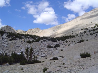
Heading up towards Kearsarge
My lungs and heart were not happy with the uphill climb- there was too little oxygen at this altitude to support exercise, especially considering my asthma. Downhill was better, however - my knees were jelly but weren't terribly unhappy with me. I think I managed to bruise my hipbone from the backpack, however, and my shoulders were quite sore afterwards - a legacy of using my mother's pack instead of one fitted to me. 600 milligrams of ibuprofen (Vitamin I, as MITOC holds it) saved the evening, however.
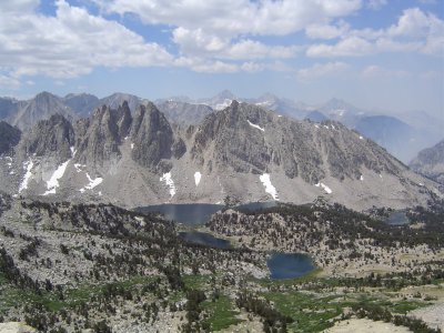
Kearsarge Pinnacles on the way down
My hiking poles have been quite excellent. They helped me get up the pass and kept me stable on the way down. When I hiked as a child, I usually made pulling motions with my hands when I was tired, as though pulling myself up with a rope; the poles duplicate this, only with actual results. The carbide tips actually dig into scree to the point that it becomes useful as opposed to a hazard as it usually is.
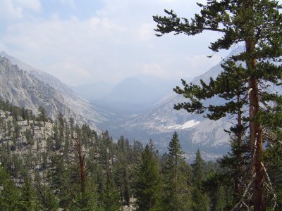
Bubbs Creek valley
Let's see if a flannel shirt and pants and long underwear and my sleeping bag keep me warm enough tonight. Amusing sights on the trail today: a 79-year-old man from Fresno who was disgustingly fit and some religious types on the way up. Amazingly, we also ran into a pair of women and a man who were through-hiking the PCT; they'd averaged 25 miles a day (we're averaging 8) and had gone 1600 miles since April. They were heading down the pass into Independence, CA to resupply. We also met a nice father-son pair past the pass who helped us find a good campsite (they had GPS, while we only had a map and couldn't tell exactly where we were).
Days 0-3: Boston, MA to Onion Valley, CA
Day 5: Upper Vidette Meadows to Diamond Mesa
Back to top.