John Muir Trail Trip, Summer 2005
Day 5: Upper Vidette Meadows to Diamond Mesa
Day 4: Onion Valley, CA to Upper Vidette Meadows
Day 6: Diamond Mesa to Wallace Creek
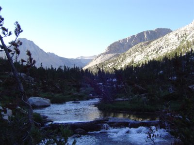
Looking up Bubbs Creek towards Forester Pass, early morning
After climbing a long ridge out of Bubbs Creek Valley, we reached a lovely alpine meadow with granite boulders and a crystal-clear lake. We had a small snack there and continued up the trail. At this point we were passed by some hikers from the United Kingdom, having previously been passed by a single woman hiker who was going ultralight (almost no gear, one water bottle and a pump - not my style).
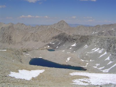
Looking north from just below Forester
We reached the top of the pass, which was about 6 miles from our campsite last night, at 1400. I love hiking in the Sierra because you don't run into the same weather problems as in the Rockies; instead of having to worry about inclement weather after noon or so, you mostly just have to worry about adequate water supplies, as they're a much drier range.
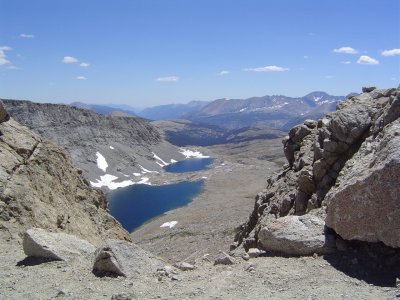
Looking south from Forester towards the Kern Trench
We had more energy bars for lunch (tasty and filling and nutritious, even if they'd have been boring and chewy at home) and met a pair of nice hikers on top of the pass; the man of the pair was even carrying a laptop with him! It weighed almost nothing, but it was very bizarre to see a laptop on the trail. We discussed the possibility of installing Ubuntu on it, and he seemed interested in learning about Linux. Sadly, I lacked an install CD, and wireless was out of the question...
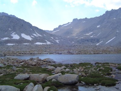
Just below Forester pass - lovely above-treeline scenery
Our camp is at about 12,000 feet - very cold and windy but quite beautiful. There aren't any trees up this high; 11-12,000 feet seems to be the average treeline altitude in this part of the range. It's all just low grasses and granite, not even any bushes. Below us is Tyndall Creek valley, which even has trees. Up here the granite is golden and smooth, and the water is as clean and clear as glass. We camped a suitable distance away to avoid contaminating it.
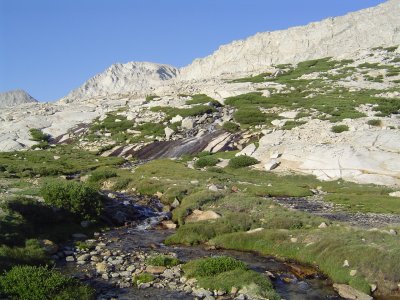
Near the campsite: waterfalls on Diamond Mesa
The hiking poles were extremely helpful today with both the snow on the way up and the steep trail on the way down. Some more ibuprofen and a few yoga exercises have helped me relax; Dad was very sore after the hike down, so I was the one dealing with the camp stuff for the evening. It's nice to be able to trade off. We're going to sleep around 2030 at night; the sun is already down below the peaks in August, and this week we'll be living with its rhythms. Very nice.
Day 4: Onion Valley, CA to Upper Vidette Meadows
Day 6: Diamond Mesa to Wallace Creek
Back to top.