John Muir Trail Trip, Summer 2005
Day 6: Diamond Mesa to Wallace Creek
Day 5: Upper Vidette Meadows to Diamond Mesa
Day 7: Wallace Creek to Rock Creek
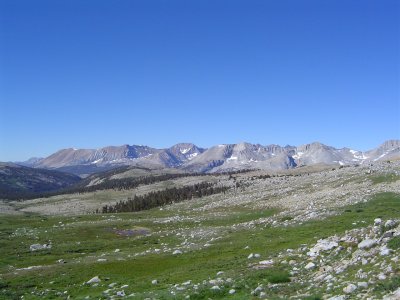
Tyndall Creek and the Great Western Divide
We started down towards Tyndall Creek, which is the headwaters of the Kern River, one of the most dangerous rivers in the United States due to its violent rapids farther west of us. The Kern is formed by the joining of Tyndall Creek with the Kaweah River in the Kern Trench just below the Great Western Divide.
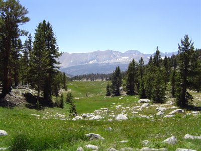
Alpine meadows - beautiful scenery but full of mosquitos
After crossing the creek, we headed up towards Bighorn Plateau, a fairly strenuous climb. At the top we were rewarded by a beautiful alpine meadow with a lake and spectacular views of the back side of Mt. Whitney; I'd only ever seen it from the front before, so this was quite nice. We then headed down, and down, and down some more until we crossed Wright Creek (again with water shoes). We then went repeatedly up and down across small ridges with spectacular views of the Divide and the Trench. Near the day's end we reached Wallace Creek and crossed it. I was very tired, but we pressed 300 feet up the next ridge to a more mosquito- and human-free campsite.
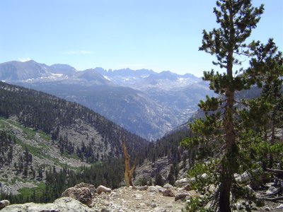
A better view of the Kern Trench and the Divide
Tomorrow we'll continue up this ridge, pass Crabtree Meadows, and head down towards the Cottonwood Lakes district. It will be our last day on the John Muir Trail, which goes back across Mt. Whitney to Lone Pine. We'll be heading south on the PCT alone and will bypass Mt. Whitney. It will be interesting to see how many fewer people there are on the trail after the JMT turns off; many people seem to like Whitney as an exit point from the PCT as well, so I predict we'll be pretty much alone after tonight.
Day 5: Upper Vidette Meadows to Diamond Mesa
Day 7: Wallace Creek to Rock Creek
Back to top.