John Muir Trail Trip, Summer 2005
Day 7: Wallace Creek to Rock Creek
Day 6: Diamond Mesa to Wallace Creek
Day 8: Rock Creek to Lone Pine, CA
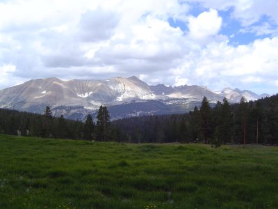
The Great Western Divide and some worrisome clouds
We headed off upwards towards the top of the ridge, then descended a long way down into the Meadows themselves. Crabtree Meadows is a very special place - green grass (very green, for once!), a very blue sky with puffy white lamb clouds, whitish-gray granite to sit on, and green forest and mountains all around us.
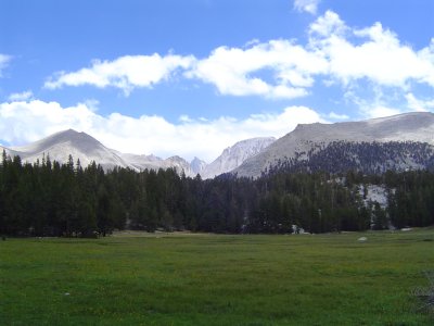
Crabtree Meadows, backside of Mt. Whitney, and a jagged spire
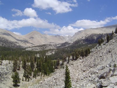
We headed up a steep divide from the Meadows. Before we'd reached the Meadows we'd left the John Muir Trail and were now solely on the Pacific Crest Trail. The trail condition worsened significantly after the Meadows - very steep, rocky, and extremely hard on knees, ankles, and hips. Worst, however was summiting and descending from the small ridge/saddle between two peaks further down the trail. We descended over 600 feet along a very bad trail into Rock Creek, where we set up camp near some Boy Scouts. The trail wasn't terribly steep itself, but had some nasty dropoffs and was of poor enough quality to make my knees very sad.
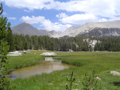
Crabtree Meadows again, with Crabtree Creek
I made dinner- chicken and noodles, not nearly as tasty as the pasta and meat sauce, sadly. There are still lots of storm clouds around, but no rain or lightning yet. I'm quite a bit worried, though. The moon is now a waxing gibbous - has it really been that long already? - it's almost diffracted through the netting in the tent, giving us moonbows.
Crabtree Meadows; farewell to the JMT
Lots of wildlife today; we saw a lovely mule deer doe at Rock Creek, who was scared off by the regional ranger (they live every 10 miles or so on this stretch of trail and provide emergency services and trail updates) walking through the meadow. The most exciting wildlife sight of today was an ermine in summer coat - he was an amber weasel-shape with black tips on his tail and feet.
Day 6: Diamond Mesa to Wallace Creek
Day 8: Rock Creek to Lone Pine, CA
Back to top.