Downtown Crossing
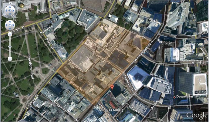 The chosen borders run through Tremont Street, School Street, Washington Street, and Winter Street.
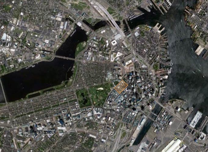 This zoomed-out view shows the context of the chosen site within Boston
Getting off the T at Downtown Crossing stop seems like any other station at first glance, as a multitude of department and big-name stores surrounds the viewer: Macy’s, Bath and Body Works, TJ Maxx, Payless, CVS, and Marshalls to name a few. But a quick walk around the block marks an obvious difference. Just one block northwest of the monstrous TJ Maxx building lays a tiny pawnshop and one of many small stores that buys and sells gold bullion, among other antiques. And this isn’t the only eccentricity in the neighborhood: within a two-block radius of the TJ Maxx the buildings range from historic landmarks such as the old City Hall to modern high-rises built within the past five years. Just across the street from one of the numerous jewelry stores on the next street over, there is a cemetery by the name of Granary Burying Ground. And to top it off, part of Suffolk University’s campus is situated right in the middle of all the chaos.
I was initially intrigued by this area because I wanted to learn more about the evolution of these traditional-style buildings that lined the main road—Washington Street, and the reasons behind why the streets remained cobblestone while the storefronts embraced the neon colors and bright signs. But I found that the wide range of land usage in such close proximity to each other adds a completely new dimension to this puzzle, and the mystery of how such a neighborhood has transformed into what it is today continues to grow.
During this upcoming semester, I want to focus on how this area has been affected by the commercialization of its traditional buildings, and to try and discover the traces left behind by this urban renewal period. As Grady Clay aptly puts it in Close Up: How to Read an American City, “a typical downtown big-city American building site, I would estimate, has been re-used at least four times since 1800” (14). I hope to unveil the numerous reincarnations of each building site in my four-block region to understand the development of the Downtown Crossing area in a deeper sense.
Something that particularly irked me was that, while the cobblestone streets on Washington Street were lined with name-brand stores such as Macy’s and Payless, School Street (which boasts the privilege of housing the old City Hall building) is newly paved and inhabited by a Ruth’s Chris Steakhouse restaurant. I originally thought that the cobblestone was an attempt to maintain the traditional “feel” on Washington Street, but my assumption makes no sense if such a historically rich site one street away isn’t regarded as such. Which brought up another question: how did certain historic landmarks get taken over by the commercial pressures while other areas like the cemetery remain relatively untouched?
Even looking further into the historic buildings and their placement, it’s interesting to see how old City Hall and King’s Chapel reside next to each other, with Park Street Church not two blocks away. The classic comparison between religious and political institutions would be a potential path to pursue as well, to discover any reasons behind that particular organization (if any).
And on a larger scale, as we’ve talked about in class, I am interested to look more into the distribution of land uses in the area: including residential, commercial, institutional, and recreational. The recent addition on 45 Province Street—the 30+ story condominium complex mentioned previously—adds variation in the vertical direction and begs for attention from the more-or-less uniform skyline of the surrounding older buildings.