
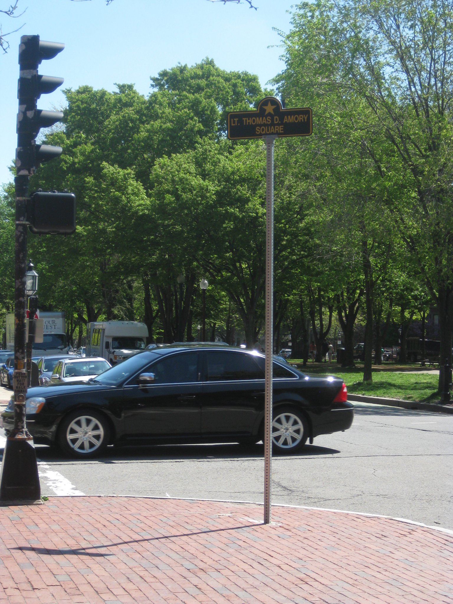
Lt. Thomas D. Armory Square (photo by author)
Click on the embeded links for larger images.
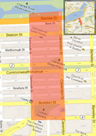
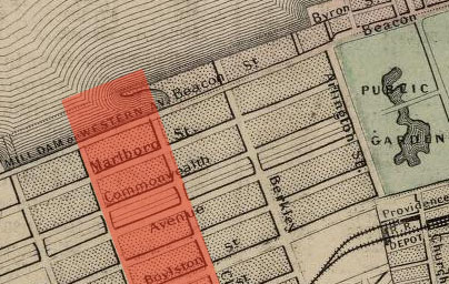
It is often easy to mistakenly, and superficially, take in the contemporary, urban landscape as an entity of its own, out of context from, and unconnected to its past. In overlooking the history of an environment, of which the contemporary state is merely a product of its past, only an incomplete concept of the space can be gleaned. Previous, critical study of Boston’s Eastern Back Bay, bounded by Clarendon, Dartmouth, and St. James Streets, and the Charles River Esplanade (Fig 1), through use of historical maps1 and first hand observations, detailed the site’s chronological development; in this context traces of the site’s past become manifest in the modern landscape, revealing greater, long term trends in the development of the site. Notable among these trends are the influence of transportation on the continuing development of the site, clues to the processes of filling the land in the Back Bay, and the commercialization of the site which has led to the composition of its current state.
![]() Site bounded by Clarendon St., Dartmouth St., St. James St., Charles River
Site bounded by Clarendon St., Dartmouth St., St. James St., Charles River
Figure 1: Boston 2013, Google Maps
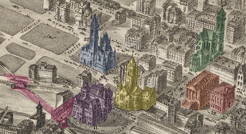
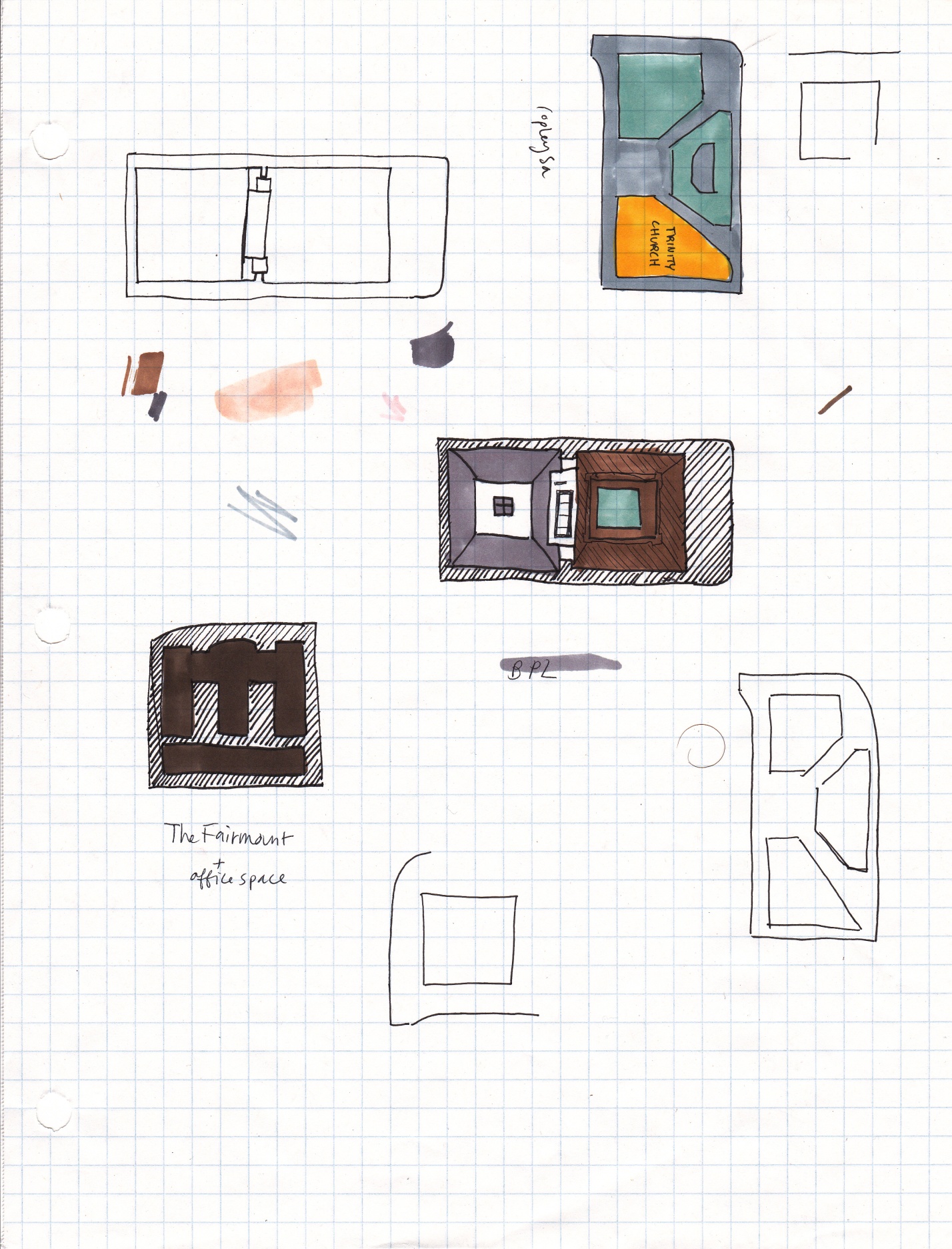
Among the most obvious traces of the early history of the Back Bay are a number of complete structures which have remained, more or less, unchanged since their construction in the mid to late 1800s. The Natural Historical Society (Fig I1,2, 9b), Trinity Church (Fig K, 9b), First Baptist Church, and Old South Church(Fig J, 9b), and the row houses north of Newbury St (Fig 12), with regards to layout, seemingly remain untouched. It is interesting that the structures which would survive in their entirety are largely theological. At the time Back Bay was created as a residential neighborhood for wealthy, white collar Bostonians, religion was inherent to family life; the proximity of places of worship to one’s home would have been a serious consideration in choosing a residence. The grandeur of these churches and their rank among the first structures to be built when the Back Bay was filled at some point likely garnered them the status of historical landmarks, ensuring their preservation into the modern day. It is the constancy of the brownstones, however, which ensured that the Back Bay would remain a residential area and allowed for the preservation of such structures which are tailored to this type of environment, such as the churches.
Fig I1 and I2: Natural History Society modern, Dave DeBaeremaeker; NHS 1800s, BPL
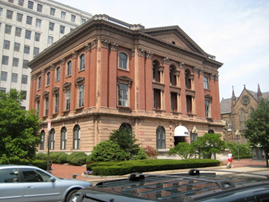
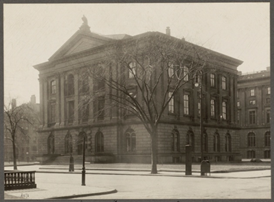
Figure J: Old South Church modern, Boston College Archives; Figure K: Trinity Church modern, Highsmith
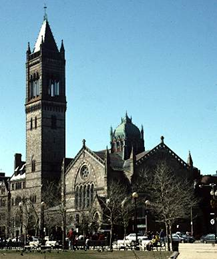
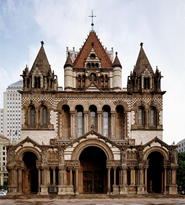
Figure 9b: Boston 1879, The City of Boston, Bailey and Co.
Red: Natural Historical Society
Orange: original MIT Rogers Building
Yellow: Trinity Church
Green: First Baptist Church
Blue: Old South Church
Purple: original Museum of Fine Arts building
Pink: Boston and Albany Railroad and overhead bridges

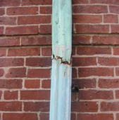
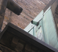
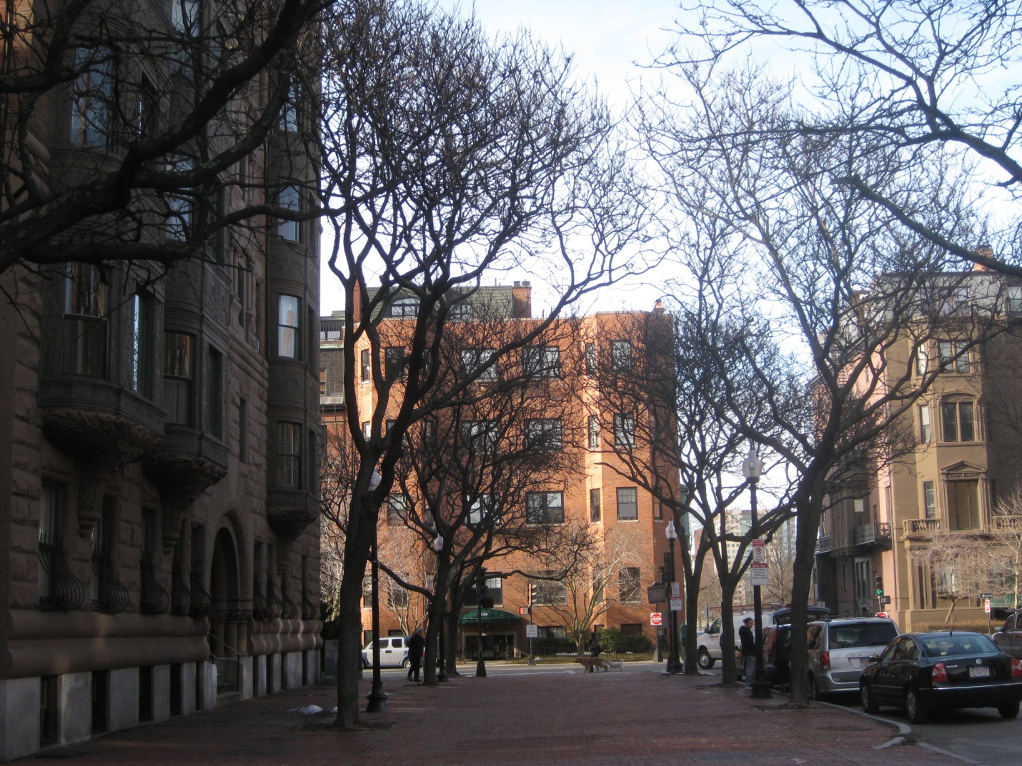
The degree to which the brownstones have remained unchanged is remarkable; to a great extent, the row houses still front their original building materials, which include brick, stone, and copper features (Fig B1,2,3). Although there are many homes which display clear signs of renovation and more modern building materials, the current layout of the row houses is nearly identical to the original layout. Because of the problems often associated with filled land, such as subsidence, it was not surprising that there seemed to be a pattern of renovated homes being clustered together. It is possible that certain sections of the land were more prone to subsidence, causing the homes within that area to need renovations earlier than those in surrounding blocks and in a similar timeframe to those within the same area. It is also possible that this pattern is more a result of pressure from neighbors to keep the area looking kept up, perhaps for property value or simply aesthetic reasons. Regardless, through the history of the Back Bay land use has cycled through various trends, with only the row houses remaining constant, setting the tone for the type of developments that would take place in the surrounding areas.
Figures B1, B2 and B3: copper gutter and window on residence off of Back St, and copper drainage feature on First Baptist Church
The Back Bay is clearly reflective of its current residents. In the present day it is a wealthy neighborhood surrounded by expensive boutiques and commercial spaces devoted, for the most part, to commodities rather than necessities such as food; the Barbour and Cole Haan stores between Clarendon and Dartmouth, for instance, are typical of the echelon of vendors along Newbury St. It is interesting to note that there are no gas stations in the area and only one supermarket; however, most of the alleys behind the rowhouses have at least one car, not infrequently a relatively expensive model, in the lot behind each individual home. It is also quite common to see residents walking their dogs along the Commonwealth Ave Mall and there are numerous pet sitting and walking businesses in the area (one lies on Commonwealth Ave between Clarendon and Dartmouth Streets) as well as specialty pet boutiques (accessories such as clothes, treats, etc). These observations reveal that residents of the Back Bay tend to own at least one car of a mid to high price range, tend to be pet owners, are surrounded by/have easy access to commodities, and likely have to commute to buy basic necessities; conditions which would seem to fit a community of wealthy families as well as the general trend of commercialization in the site. The Back Bay, which was originally settled by wealthy Bostonians, has remained relatively constant in this regard as well.
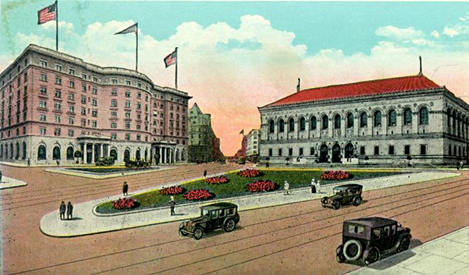
As the Back Bay became more commercial, and less institutional, the lots in this area were sold and redeveloped, leading to quite a few changes in the surrounding street layout. The commercialization of the area in particular, would have led to an increased demand for recreational, public spaces for pedestrians. The restructuring of Copley Square, formerly merely a triangular green lawn, to now feature paved walking paths and open square, a fountain, benches, statues, information booth, subway stop, and improved landscaping to include trees, would have satisfied this demand. Moreover, the major advancements and shift in transportation which led to the implementation of the Major Boston Transit Authority subway lines, known as the T, and bus routes throughout the city, would have provided further cause for the restructuring of the street layout.
The deinstitutionalization and increased commercially and recreationally devoted spaces in the eastern Back Bay also led to alterations in the development of preexisting structures. The modern manifestation of the Boston Public Library (BPL) building reveals clear signs of its original form at the time it was constructed. The original BPL remains entirely intact; however, it has very clearly been added onto (Figs E1,2,3, 11). When the property adjacent to the original building was purchased, a new wing was built, as is evident by the stark difference in style and material between the wings. This very distinct division between the original half and the addition provides an excellent instance of a trace/clue to the past development of a site.
Figure E1, E2, E3: modern Boston Public Library building, Architectural Record; modern BPL layout; boundary between orignal building and addition; Figure 11: Boston 1895, Part of Wards 10, 11 & 12, City of Boston, Bromley
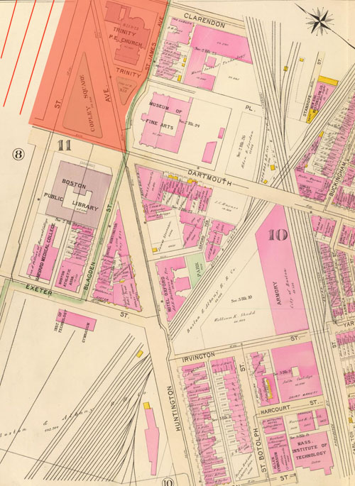
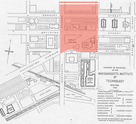
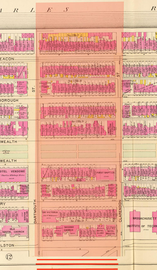
The modern layout of the property now bounded by Trinity Pl, Stuart St, Dartmouth St, and St James Ave, which was formerly owned by, and the original location of, the Museum of Fine Arts also reveals traces of its original state. The division of the Fairmount Hotel and the adjacent office space just to the south reflect the original property divisions of the space, and even slightly recall the original geometries of the past structures (Figs F, 9b, 11). Similarly, the division of property in the block bordered by Clarendon, Berkeley, Newbury, and Boylston Streets has remained the same. The entirety of the lot, besides that owned by the Natural Historical Society, was previously owned by the Massachusetts Institute of Technology (MIT) (Fig 9b, 13). When MIT relocated, the institution clearly sold the lot, in its entirety, to a wealthy developer; this would have lead to the Walker and Rogers buildings being torn down and the erection of the large, new structure which now occupies the whole lot.
Figure F: modern layout of property bounded by Trinity Pl, Stuart St, Dartmouth St, St James Ave (formerly owned by Museum of Fine Arts); Figure 13: Boston 1905, Location of the Buildings of the Massachusetts Institute of Technology, MIT Archives


The main campus buildings, formerly between Trinity Pl, Clarendon, St James, and Stanhope Streets, must have been sold, in a similar process, to another wealthy developer, leading to the construction of Hancock Tower. The relocation of MIT, which had previously been a major feature in this landscape, would have opened up the area to many new developments all at once, leading to a large and sudden shift in the makeup of the site.
Figure 1b: Massachusetts Turnpike underpass, Boston 2013, Google Maps
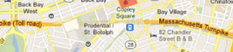
The traces of Harvard Medical College’s former location adjacent to the original Boston Public Library building (Fig 11) are even more minimal than those indicating MIT’s former presence; only the Harvard Vanguard Medical Associates in the office space just above the Massachusetts Turnpike underpass (Fig 1b) provides any connection or hint to the institution’s former presence. This location of this practice may even be entirely unrelated to the college’s former presence in the area.
The ownership of the residential lots also reveals some interesting correlations to the present state of Boston. Upon closer examination of the previous ownership of some of the residences north of Newbury St, a few family names are recognizable as the namesakes of various features of the Boston landscape, often in the form of street names (Fig 12). Although some of these names may be common and unrelated to the features which share their name, the density of names recognizable in this way makes them notable as a possible trace. Among these quite a few share names with major buildings of the MIT campus; as MIT was originally located just a few blocks away from this residential area, it is not unlikely that the namesakes for these buildings once lived there. For instance, within a few blocks of each other, the names Walker, Rogers, Briggs, Johnson, and Baker all appear on multiple residences (Fig 12). Other notable names include Davis, possibly related to Davis Sq or Davis St (recognized from in class study of the class site), Shaw, and Peabody, possibly related to Harvard’s Peabody Museum. A few relatively large homes under the ownership of the Amory family are notable for their correlation to the modern day Lt. D. Amory Square at the corner of Dartmouth and Commonwealth Avenue (Fig A1,2).
Figure 12: Boston 1895, Part of Ward 11, City of Boston, Bromley; Figure A: Lt. D. Amory Square, Dartmouth St and Commonwealth Ave
FigureL: More modern building faces between Beacon St and Back St


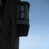
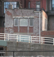
Also notable are the modern day clues to the very beginning of the existence of the Back Bay. The traces revealing that the Back Bay consists of filled land, which often exhibits subsidence, and was initially occupied by tidal mudflats (fig2), and of the former banks of the Charles River are manifested by the sinking or sagging of some of the Back Bay residences. These signs are most frequent, and severe, along Back St (Fig C1,2) and Beacon St (Fig D1,2), which were both previous boundaries where the Back Bay met the Charles River (Figs 7, 12). The expansion of the shoreline of the Back Bay is also evident in the difference in the styles of the homes through the area. The residences between Beacon St and Back Street appear to be more modern (Fig L1,2,3), which would make sense considering that the land between Beacon and Back St was an extension of the original Back Bay fill. However, the timespan between the filling up to Beacon and up to Back St was at most a decade based on previous examination of historical maps (Malouf Assignment 3), and the difference in architectural style seems to be greater than that of a decade. Moreover, many of the homes along Back Street exhibit extreme water damage and subsidence in the back, on the side facing the river; as such, it is quite possible that these homes have continued to suffer more from water damage and tend to require more renovations than those farther inland.
Figure 2: Boston 1722, The Town of Boston in New England, Bonner; Figures C1 and C2: subsidence along Back St

Figures D1 and D2: sagging sidewalk and steps along Beacon St
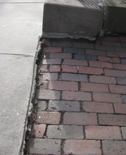
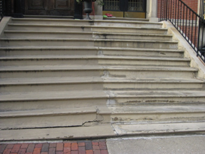
Figure 7: Boston 1869, Boston and Adjacent Cities, Colton

The traces of the past of the site in the Eastern Back Bay bounded by Clarendon, Dartmouth, and St James Streets, and the Charles River Esplanade are, in terms of both intensity and frequency, are largely related to the changing trends of commercialization and transportation and to evidence of the composition of the land. Previous research (Malouf Assignment 3) indicates that the railroad junction just to the south of Copley Square was among the most influential, if not the greatest, factors in the development, and developmental trends, of the site. However, in the present day, the process of commercialization seems to have overtaken the transportation revolution and is largely responsible for the current make-up of the site. Only the effect of the natural world on the site would seem to remain constant in intensity over the site’s history, which is unsurprising given that the urban environment is always subject to the laws of nature. Although the traces of an urban landscape’s past and development may be often, and easily, overlooked, they are in no way inconsequential, but an integral part of the visual information of the landscape. Putting the modern landscape into historical context makes more apparent the developmental trends of the site, and often explains seemingly anomalous features; it can even lead to realizations about features of the landscape may have previously seemed unimportant, in turn leading to a better understanding of the dynamic of the site as a whole, and the roles and interactions of different features.
Figures A-G: photos and illustrations by author (unless otherwise noted)
Figure A: Lt. D. Amory Square, Dartmouth St and Commonwealth Ave
Figures B1, B2 and B3: copper gutter and window on residence off of Back St, and copper drainage feature on First Baptist Church
Figures C1 and C2: subsidence along Back St
Figures D1 and D2: sagging sidewalk and steps along Beacon St
Figure E1, E2, E3: modern Boston Public Library building, Architectural Record; modern BPL layout; boundary between orignal building and addition
Figure F: modern layout of property bounded by Trinity Pl, Stuart St, Dartmouth St, St James Ave (formerly owned by Museum of Fine Arts)
Figure G: modern layout of Copley Square, Google Maps; modern layout of Copley Square
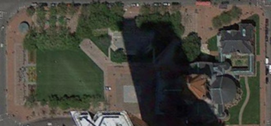
Fig I1 and I2: Natural History Society modern, Dave DeBaeremaeker; NHS 1800s, BPL
Figure J: Old South Church modern, Boston College Archives
Figure K: Trinity Church modern, Highsmith
FigureL: More modern building faces between Beacon St and Back St
![]() Site bounded by Clarendon St., Dartmouth St., St. James St., Charles River
Site bounded by Clarendon St., Dartmouth St., St. James St., Charles River
Figure 1: Boston 2013, Google Maps

Figure 1b: Massachusetts Turnpike underpass, Boston 2013, Google Maps
Figure 2: Boston 1722, The Town of Boston in New England, Bonner
Figure 3: Boston 1837, The American Traveller, Tanne
r
Figure 4: Boston 1838, An Illustrated Atlas, Geographical, Statistical, and Historical, of the United States, and the Adjacent Countries, Bradford
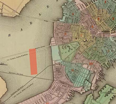
Figure 5: Boston 1855, Map of Boston and Adjacent Cities, Bolton
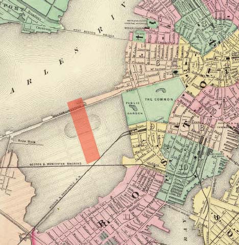
Figure 6: Boston 1865, Boston and Adjacent Cities, Colton
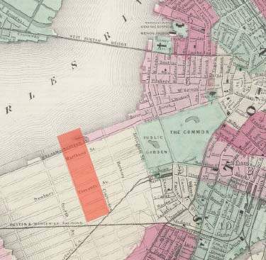
Figure 7: Boston 1869, Boston and Adjacent Cities, Colton
Figure 8: Boston 1871, Map of the Compact Portions of Boston and the Adjacent Cities and Towns, Gray and Walling
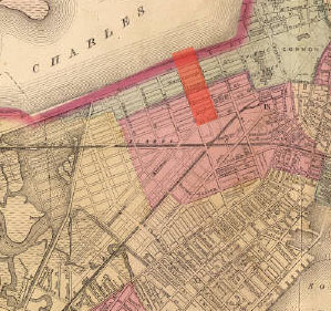
Figure 9: Boston 1879, The City of Boston, Bailey and Co.
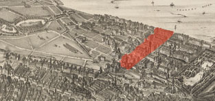
Figure 9b: Boston 1879, The City of Boston, Bailey and Co.
Red: Natural Historical Society
Orange: original MIT Rogers Building
Yellow: Trinity Church
Green: First Baptist Church
Blue: Old South Church
Purple: original Museum of Fine Arts building
Pink: Boston and Albany Railroad and overhead bridges
Figure 10: Boston 1888, Map of Boston, Showing Detail of Back Bay Area, Sampson, Murdock and Co.
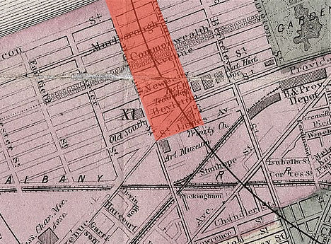
Figure 11: Boston 1895, Part of Wards 10, 11 & 12, City of Boston, Bromley
Figure 12: Boston 1895, Part of Ward 11, City of Boston, Bromley
Figure 13: Boston 1905, Location of the Buildings of the Massachusetts Institute of Technology, MIT Archives
Figure 14: Boston 1908, And This is Good Old Boston
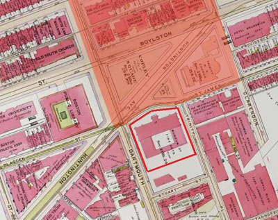
Figure 15: Copley Square Postcard, Boston College Archives
Works Cited :
And This Is Good Old Boston. Map. Blogspot, n.d. Web. 15 Mar. 2013. <http://goodoldboston.blogspot.com/2011/01/museum-of-fine-arts.html>.
Berkely, Clarendon, Newbury, Boylston Sts. 2013. Photograph. Google Maps. By Sanborn, DigitalGlobe, Commonwealth of Massachusetts EOEA, and MassGIS. Comp. Google. Google, 2013. Web. 20 Apr. 2013. <https://maps.google.com/maps?hl=en&ll=42.3514,-71.074097&spn=0.002022,0.004485&t=k&z=18>.
Boston Public Library. N.d. Photograph. Boston Public Library, Boston. Architectural Record. McGraw Hill. Web. 20 Apr. 2013. <http://archrecord.construction.com/features/boston/topten/record-1.asp>.
Copley Square. 2013. Photograph. Google Maps. By Sanborn, DigitalGlobe, Commonwealth of Massachusetts EOEA, and MassGIS. Comp. Google. Google, 2013. Web. 20 Apr. 2013. <https://maps.google.com/maps?hl=en&ll=42.349961,-71.075771&spn=0.002022,0.004485&t=k&z=18>.
Copley Square Postcard. N.d. A Digital Archive of American Architecture. Boston College. Web. 18 Apr. 2013. <http://www.bc.edu/bc_org/avp/cas/fnart/fa267/copleysq.html>.
Natural History Museum. The Boston Society of Natural History, Berkeley Street. 1880 - 1939 (approximate). Photograph. Boston Public Library, Boston. Flickr, 29 Nov. 2010. Web. 20 Apr. 2013. <http://www.flickr.com/photos/boston_public_library/5912762577/>.
New Old South Church, Boston. 1874-75. N.d. Photograph. Boston. A Digital Archive of American Architecture. By Jeffery Howe, Prof. Boston College. Web. 20 Apr. 2013. <http://www.bc.edu/bc_org/avp/cas/fnart/fa267/hvgothic.html>.
Bailey and Co., O. H. "The City of Boston." Map. G3764.B6A3 1879 .O43. Boston: Bailey, O. H. & J.C. Hazen, 1879. N. pag. Norman B. Leventhal Map Center at the Boston Public Library. Web. 15 Mar. 2013. <http://maps.bpl.org/id/10206>.
Bonner, John. "The Town of Boston in New England." Map. The Town of Boston in New England. Boston: Fra. Dewing, 1722. N. pag. Boston, Ma. Web. Mar.-Apr. 2013. <http://www.doak.ws/boston,_ma_.htm>.
Bradford, Thomas Gamaliel. "Boston." Map. An Illustrated Atlas, Geographical, Statistical, and Historical, of the United States, and the Adjacent Countries. 1st ed. Boston & New York: Weeks, Jordan and & Wiley and Putnam, 1838. N. pag. David Rumsey Map Collection. Web. 15 Mar. 2013. <An Illustrated Atlas, Geographical, Statistical, And Historical, Of The United States And The Adjacent Countries>.
Bromley, George Washington., and Walter Scott Bromley. "Part of Ward 11, City of Boston." Map. Atlas of the City of Boston: Boston Proper and Roxbury, from Actual Surveys and Official Plans. Philadelphia: G.W. Bromley &, 1895. N. pag. David Rumsey Map Collection. Web. 15 Mar. 2013. <http://www.davidrumsey.com/luna/servlet/detail/RUMSEY~8~1~29225~1130284:Part-of-ward-11,-city-of-Boston---->.
Bromley, George Washington, and Walter Scott Bromley. "Part of Wards 10, 11 & 12, City of Boston." Atlas of the City of Boston, Boston Proper and Roxbury. Philadelphia: G.W. Bromley and, 1895. N. pag. David Rumsey Map Collection. Web. 15 Mar. 2013. <http://www.davidrumsey.com/luna/servlet/detail/RUMSEY~8~1~29229~1130288:Part-of-wards-10,-11-&-12,-city-of-#>.
Colton, G. W. "Boston and Adjacent Cities." Map. Map of Boston and Adjacent Cities. New York: J.H. Colton &, 1864. N. pag. David Rumsey Map Collection. Web. 15 Mar. 2013. <http://www.davidrumsey.com/luna/servlet/detail/RUMSEY~8~1~208629~5003410:Colton-s-Map-of-Boston-and-Adjacent?sort=Pub_List_No_InitialSort%2CPub_Date%2CPub_List_No%2CSeries_No&qvq=q:Boston%2B1860;sort:Pub_List_No_InitialSort%2CPub_Date%2CPub_List_No%2CSeries_No;lc:RUMSEY~8~1&mi=3&trs=28>.
Colton, G. W. "Colton's Boston and Adjacent Cities." Map. Colton's Map of Boston and Adjacent Cities. New York: G. W & C. B. Colton &, 1869. N. pag. David Rumsey Map Collection. Web. 15 Mar. 2013. <http://www.davidrumsey.com/luna/servlet/detail/RUMSEY~8~1~208968~5003946:Colton-s-Boston-and-Adjacent-Cities?sort=Pub_List_No_InitialSort%2CPub_Date%2CPub_List_No%2CSeries_No&qvq=q:Boston%2B1869;sort:Pub_List_No_InitialSort%2CPub_Date%2CPub_List_No%2CSeries_No;lc:RUMSEY~8~1&mi=5&trs=68#>.
Colton, G. W. "Map of Boston and Adjacent Cities." Map. Colton's Map of Boston and Adjacent Cities. New York, NY: J.H. Colton &, 1855. N. pag. David Rumsey Map Collection. Web. 15 Mar. 2013. <http://www.davidrumsey.com/luna/servlet/detail/RUMSEY~8~1~1664~130023:Map-Of-Boston-And-Adjacent-Cities--?sort=Pub_List_No_InitialSort%2CPub_Date%2CPub_List_No%2CSeries_No&qvq=q:Boston%2B1856;sort:Pub_List_No_InitialSort%2CPub_Date%2CPub_List_No%2CSeries_No;lc:RUMSEY~8~1&mi=1&trs=51>.
DeBaeremaeker, Dave. IMG_0437. 2010. Photograph. Picasa, 26 June 2010. Web. 20 Apr. 2013. <https://picasaweb.google.com/lh/photo/oHoc4dtXXDUByrj7kp6wDg>.
Gray, Ormando Willis, and H. F. Walling. "Map of the Compact Portions of Boston and the Adjacent Cities and Towns." Map. Walling & Gray's Map of Compact Portions of Boston and the Adjacent Cities and Towns. Boston: Stedman, Brown & Lyon, 1871. N. pag. David Rumsey Map Collection. Web. 15 Mar. 2013. <http://www.davidrumsey.com/luna/servlet/detail/RUMSEY~8~1~26374~1100048:Map-of-the-compact-portions-of-Bost?sort=Pub_List_No_InitialSort%2CPub_Date%2CPub_List_No%2CSeries_No&qvq=w4s:/where/Massachusetts;q:Boston;sort:Pub_List_No_InitialSort%2CPub_Date%2CPub_List_No%2CSeries_No;lc:RUMSEY~8~1&mi=50&trs=316#>.
Highsmith, Carol M. Trinity Church, Boston, Massachusetts. 1980-2006. Photograph. Library of Congress, Washington, DC. Library of Congress. Web. 20 Apr. 2013. <http://www.loc.gov/pictures/item/2011630431/>.
Jackson, Kenneth T. Crabgrass Frontier: The Suburbanization of the United States. New York: Oxford UP, 1985. Print.
"Location of the Buildings of the Massachusetts Institute of Technology." Map. N.p.: n.p., 1905. N. pag. MIT Archives. Web. 15 Mar. 2013. <http://libraries.mit.edu/archives/exhibits/maps/index.html>.
Jacobs, Jane. "The Kind of Problem a City Is." The Death and Life of Great American Cities. New York: Modern Library, 1993. 428-48. Once and Future City. Professor Anne Spirn. Web. May 2013. <http://architecture.mit.edu/class/city/>.
Mbell1975. Boston - First Baptist Church on Commonwealth Ave. 2011. Photograph. Flickr, 12 Mar. 2011. Web. 20 Apr. 2013. <http://www.flickr.com/photos/mbell1975/5586358348/>.
Sampson, Murdock, and Co. "1888 Sampson Map of Boston, Showing Detail of Back Bay Area." N.p.: Sampson, Murdock and, 1888. N. pag. Wikemedia. Web. 15 Mar. 2013. <http://commons.wikimedia.org/wiki/File:Boston_1888_SampsonMap_BackBay_detail.jpg#file>.
Sanborn. "Boston, MA - Google Maps." Map. Google Maps. Google, 2013. Web. 15 Mar. 2013. <https://maps.google.com/maps?q=boston>.
Tanner, Henry S. "Boston." Map. The American Traveller; Or Guide Through the United States. Containing Brief Notices of the Several States, Cities, Principal Towns. 3rd ed. Philadelphia: Henry S. Tanner, 1837. N. pag. David Rumsey Map Collection. Web. Mar.-Apr. 2013. <http://www.davidrumsey.com/luna/servlet/detail/RUMSEY~8~1~238345~5511447:Boston---to-accompany--The-American?sort=Pub_List_No_InitialSort%2CPub_Date%2CPub_List_No%2CSeries_No&qvq=w4s:/where/Massachusetts;q:Boston;sort:Pub_List_No_InitialSort%2CPub_Date%2CPub_List_No%2CSeries_No;lc:RUMSEY~8~1&mi=31&trs=316#>.