East Cambridge, located roughly a mile away from the MIT campus, is the location I choose for my site. It is currently a suburban sprawl with some architectural hints at its past.
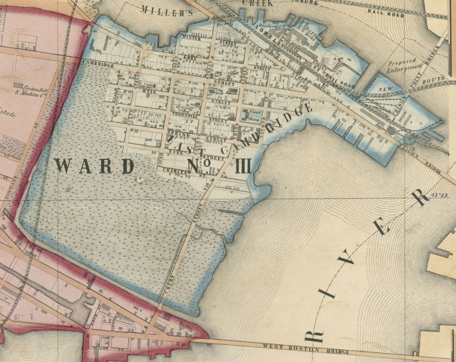 A picture of East Cambridge in 1854.
The map above depicts the Cambridge area in 1854; here one can see the original layout and the small town feel that it was set up as. The courthouse and jail on 3rd street are of particular interest. Also, from the above map it becomes very apparent that this area was filled land and looking back even further by a few years it is confirmed. When comparing this area to the current state, using a satellite image from Google, it becomes very apparent that this location has not changed much in terms of layout and building allocation.
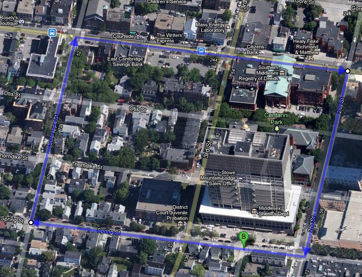 An arial view of my site in East Cambridge.
The boundaries for my site are: Spring St to the south, 2nd St on the east, Cambridge St to the north, and Sciarappa St to the west. This boundary really helps to encompass the bigger image here by including some of the residential neighborhoods, but also including the courthouse and jail. At a glance it becomes very apparent how similar the two photographs are and how time has not upset the initial layout of the area. As one takes a stroll up Thorndike St. towards Sciarappa St. the natural landscape begins to have an effect; the underlying hills begin to elevate the homes. Walking north on Sciarappa St. the view behind one begins to show the nature of the area. Another aspect of the nature of the area that is noticeable from this vantage point is the growth pattern of the trees. From the picture below, north being on the right, the trees have grown outwards extending above the street towards the sun; however the south side trees have not been as stunted as one might have expected. Although the south side trees don’t extend outward as much they have grown upwards with a similar rate to the north trees. This can indicate that the taller buildings that exist there now were not there long ago; the trees were able to grow to a comfortable height such that when the buildings were put in place the tops of the trees received sufficient sunlight.
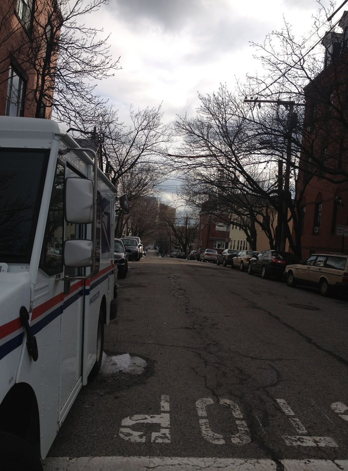 A view from an intersection near Sciarappa St. and Cambridge St.
From the intersection of Sciarappa St and Cambridge St, another artifact of the history of the area appears. Along Cambridge St shops appear, a call back to the downtown of a once smaller town. Shops with large window displays line the east side of Cambridge St; however, the west side is almost bare of shops. This layout might give a clue to the culture from before, where the west facing shops would not get direct sunlight until the afternoon by which time most shops were closing and did not have to deal with the excess heat and potential damage to their goods.
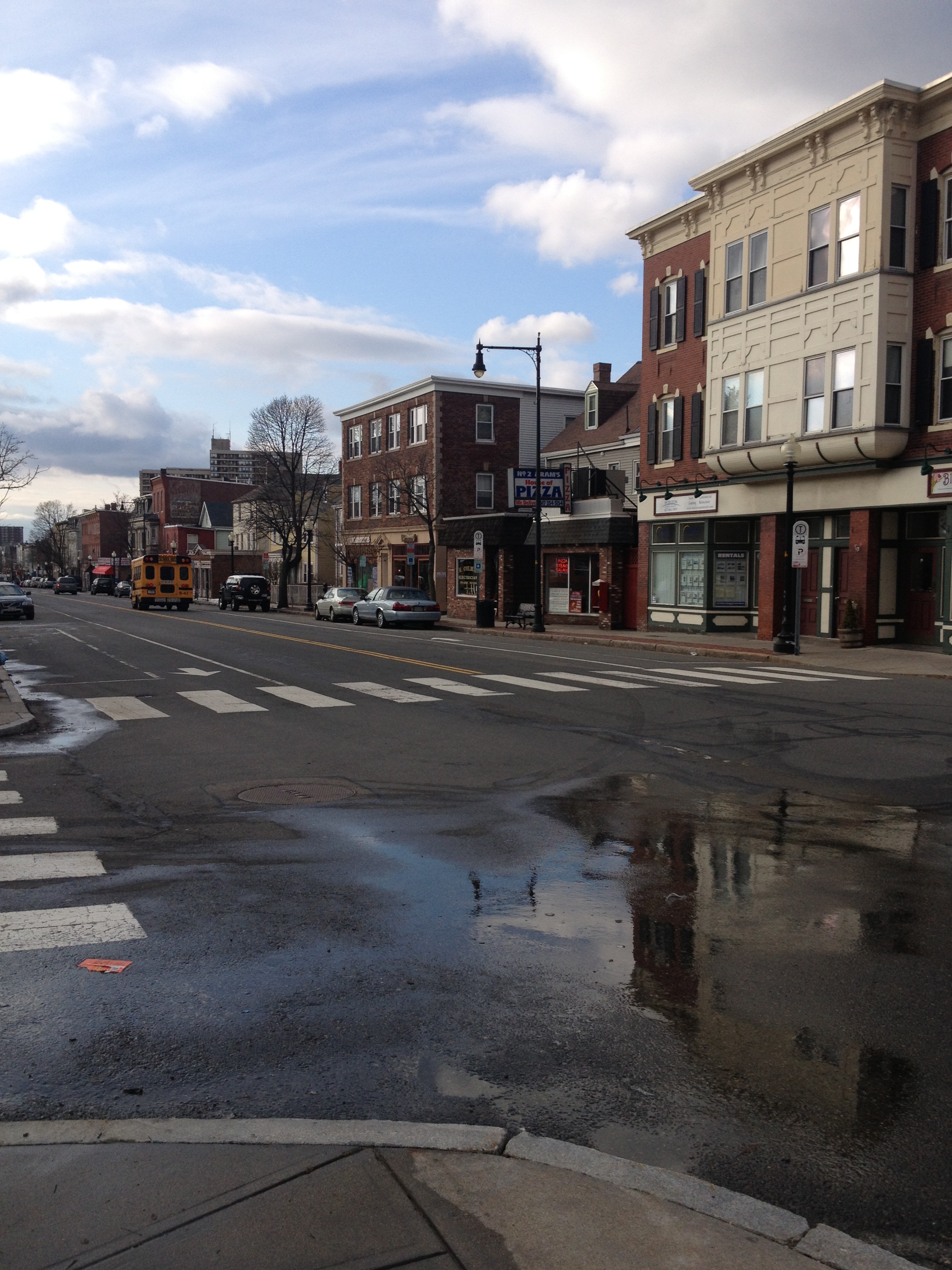 View of Cambridge St. towards the north.
The hints of a once prominent downtown are very apparent here, from the shops to the proximity of the residential area, and even the original brick patterns on some of the buildings, all of these clues can help one picture a much quieter town in the 1800. The map of 1854 East Cambridge helps to see just that, surrounded primarily by water and marshland, this area grew partially isolated from the nearby areas and thus their own downtown was formed.
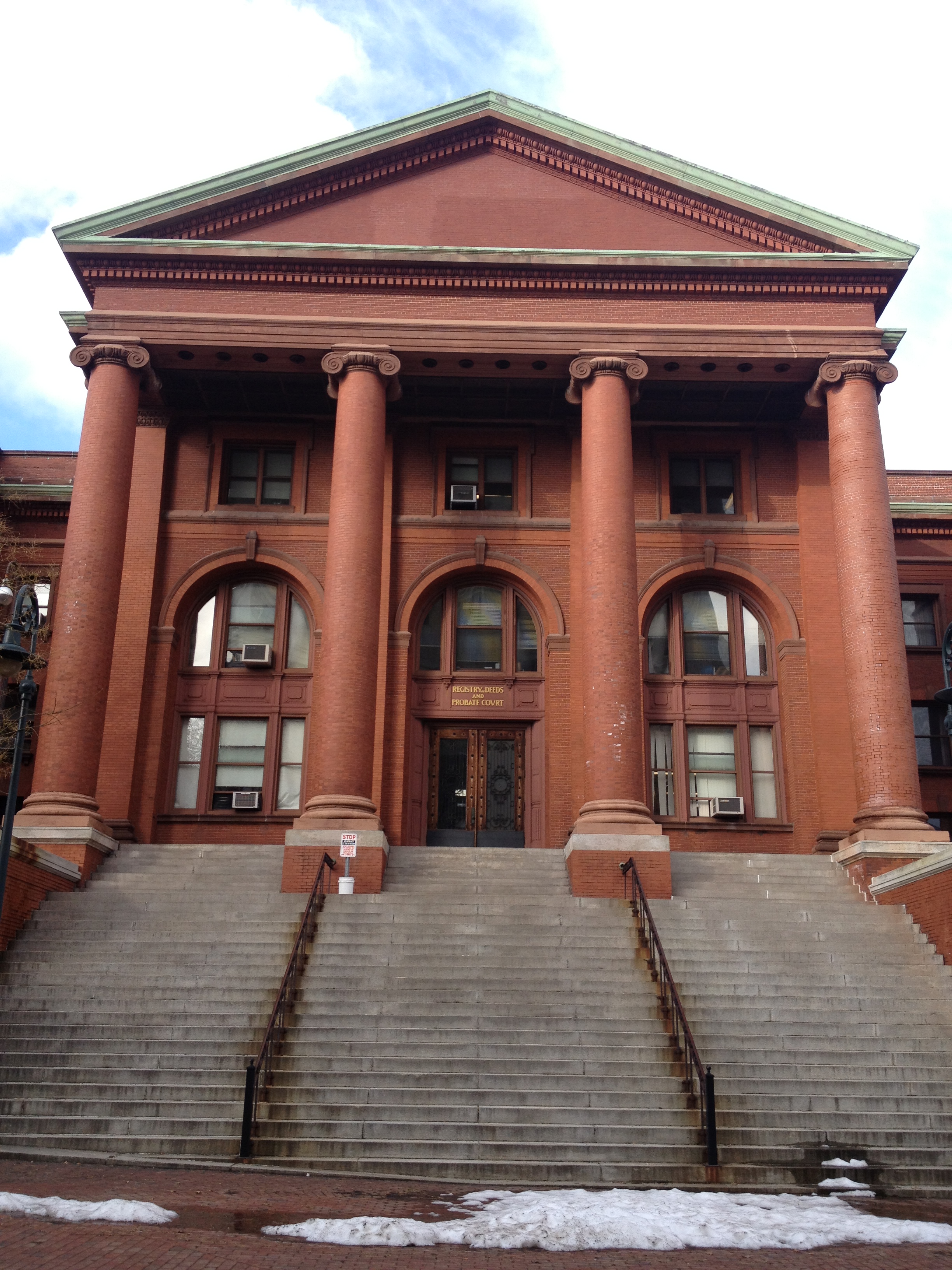
A small walk down Cambridge St. and the courthouse appears. This enormous brick building is mapped out in the map of 1854, which gives one the idea that this structure has always been such a prominent building in the area. Further inspection of the area begins to reveal more clues, the sidewalk brick patters begin to change on different sides of the street, some sections eliminated the bricks altogether. Most sidewalk crossings have been retrofitted with concrete as to create ramps for the disabled, children in strollers, and others who might have trouble going up the original step created by the brick. Following the sidewalk around the building, several interesting signs appear.

One sign gives a brief look into the architectural history of the courthouse; from this sign we can see that the original build date was 1814. This date now creates a reference frame for when this area might have begun to grow and blossom into a lager town. This sign also helps to understand some of the changes that this building might have undergone. Within the courthouse area exists a courtyard.
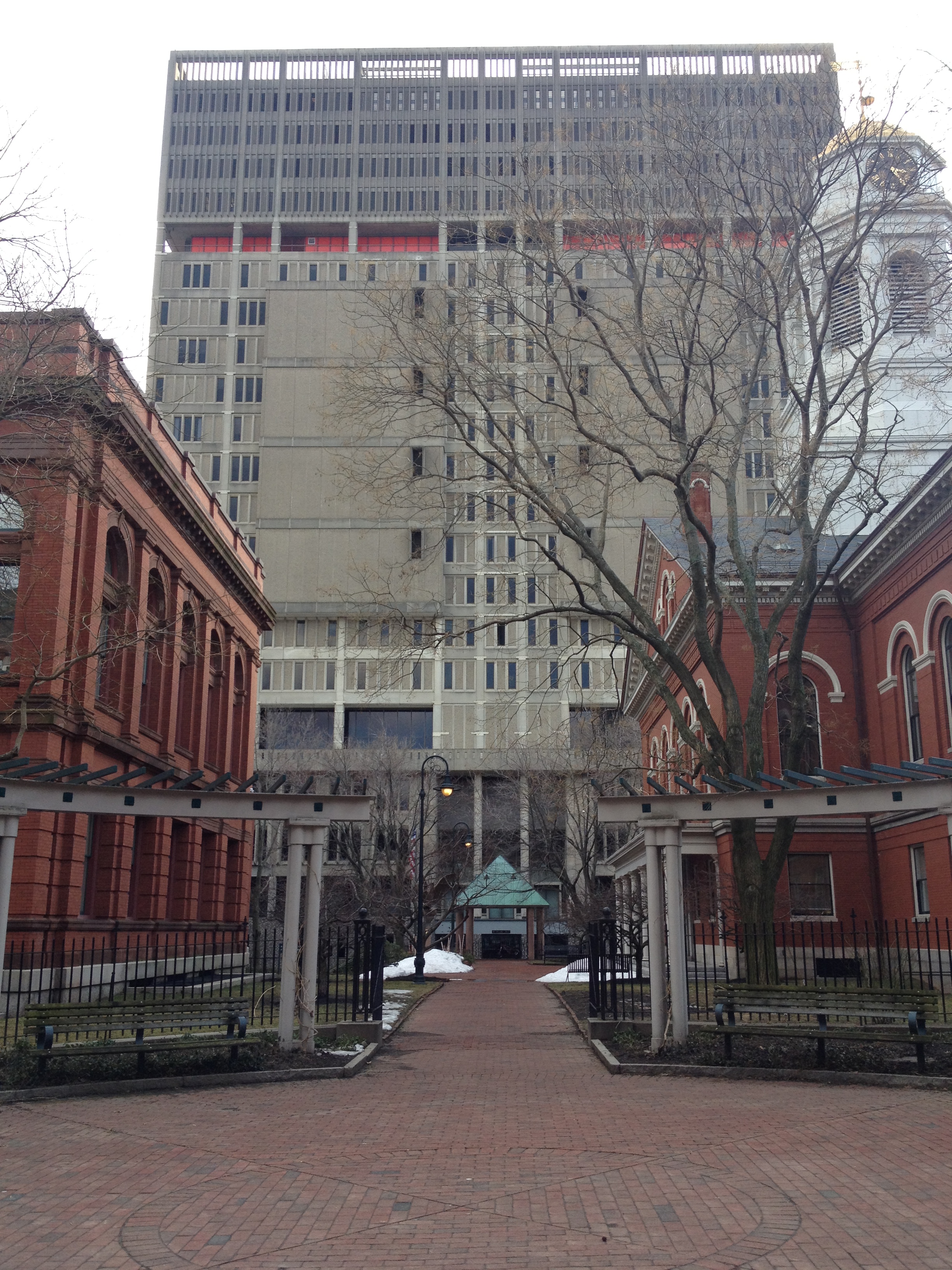
This area is set up very well to circle around the steps of the courthouse to create seating as if an event was to take place. Behind this “auditorium,” sits the Middlesex County jail, in the picture on the right one can see the impact that it would have on this “stage.” Even though its current structure was not built until 1971, this site has been home to a jail since the early 1800s as depicted in early maps. The presence of this jail begins to illustrate what this area might have once been. This area here might have once been an area of great despair, one where criminals might have been sentenced to serve time in the jail just a few steps away, or occasionally even worst fate. The circular brick patter in the center of this courtyard leads an observer to believe that this brick was not originally here. Many residential areas are just across the street from the walls of the jail. The compactness of this entire area creates an interesting urban dynamic, downtown, residential areas and a jail and courthouse all lay side by side. However, the proximity to the jail can create concerns within the town, many residents might have had fears of inmates escaping. Due to the proximity of the jail an escaped inmate posed an immediate threat to the town, primarily to residents who lived closer to the jail.
The houses on Spring St, right across from the jail, all had very interesting red lights on the front wall. As shown in the image, these lights are placed in very visible locations on the jail facing side of the houses. The lights almost seem to resemble warning lights, perhaps lights to alert those in the area in the event of a situation unfolding within the prison walls, they may be to alert if prisoners escape their walls, further investigation is needed. The majority of East Cambridge is located near an older hill, which was used to fill in some of the surrounding land. This hill left some traces of its original location by creating some minor hills in the area of East Cambridge. Another observation made, is the direction of the grid pattern in this area. Although the majority of the area is set up as very effective grid pattern, major streets are not set up to run north-south, or east-west. By creating a non-polar oriented grid pattern, light to the trees can be maximized and trees on opposite sides of the streets can grow at similar rates. From walking in the area and looking at aerial photographs, it becomes very apparent that the trees in the area grow very well regardless of side of the street, this is further reinforced by all the greenery viewable on photographs of the area during warmer seasons, such as photographs on Google maps.
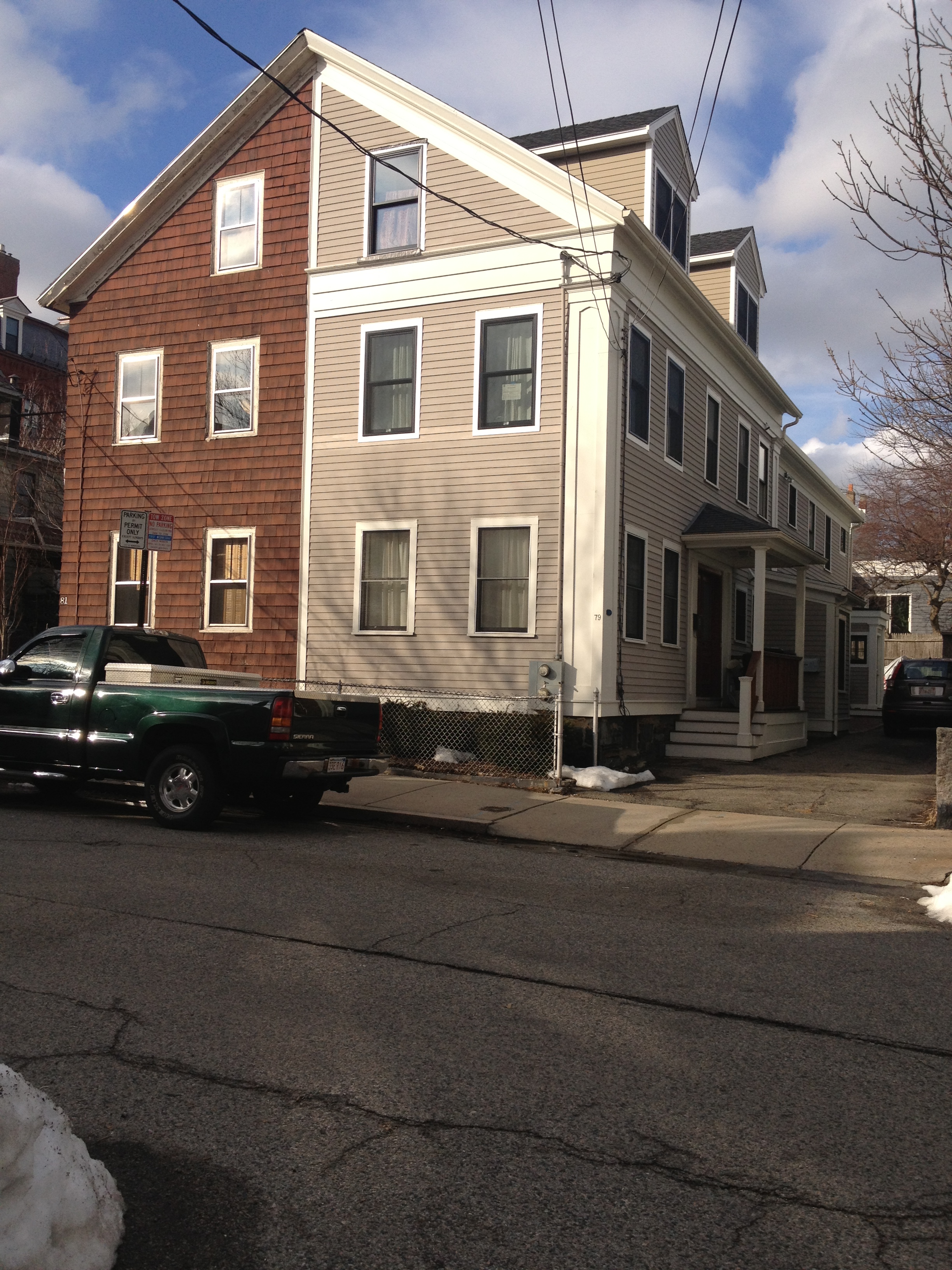
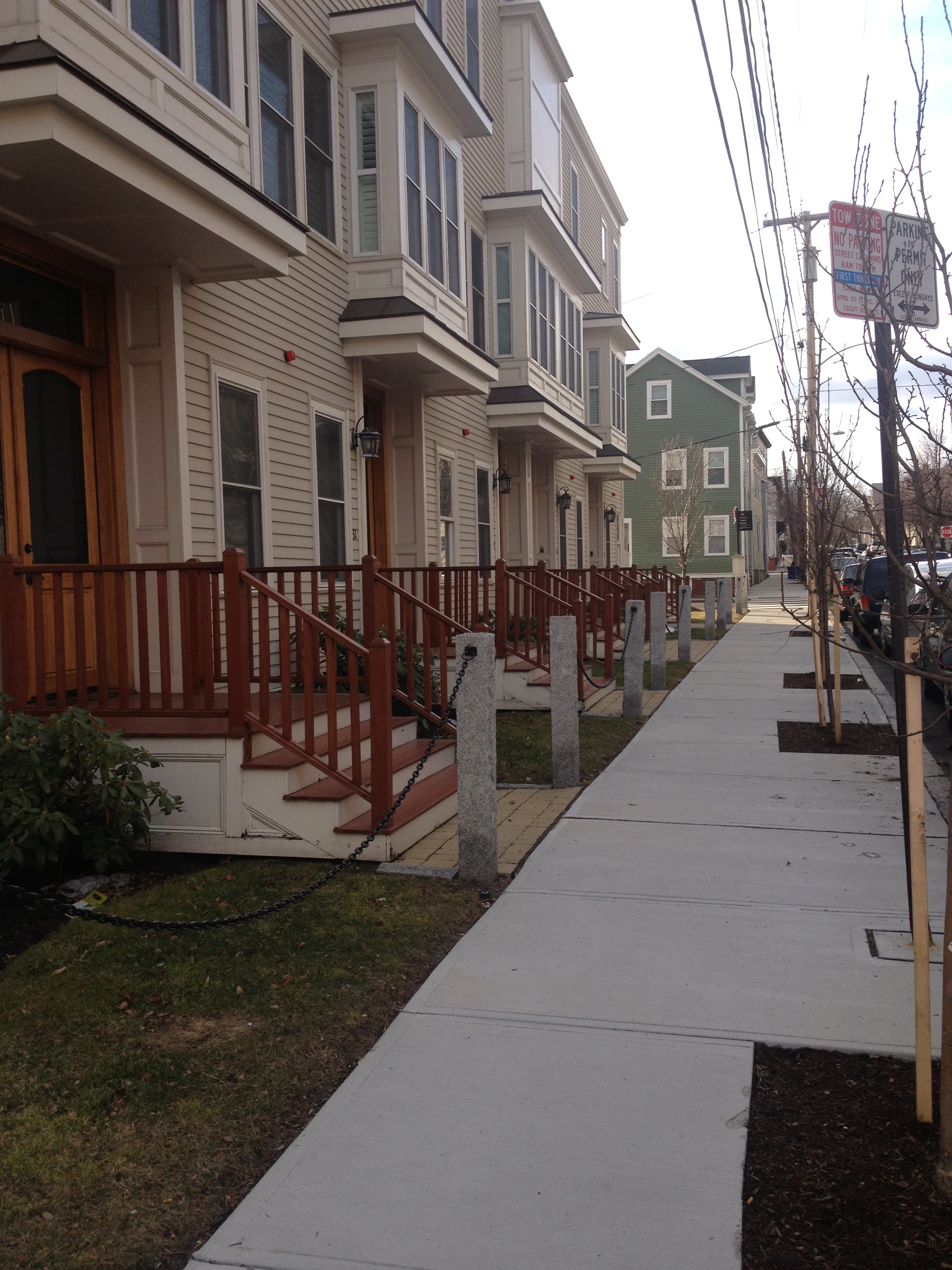
As one walks away from 3rd St., towards Sciarappa St, the more contemporary, suburban life becomes more visible. The house in the picture was of notable interest due to the interesting divide it shows; also seen from the picture, the cement sidewalks. The transition from brick sidewalks on 3rd St. occurs very abruptly as streets branch off from 3rd St. With the urbanization of this area some of the original natural features and natural influence have began to fade. The greenery seems more organized and coordinated, with the addition of parks and equally spaced trees in small plots; however, the landscape itself shows the nature that lies beneath the city. The hills that roll in the area climb up to Cambridge St. which almost seem to glorify the street and with the downtown feel that it has this would have attracted many of the residents to this area. The area of East Cambridge shows that it was once a small town that grew a little isolated from the larger Boston area; this led to creating a downtown and even a judicial area. Due to the defining geographical features, much of this area was packed together very densely and in a very effective grid. This grid did not completely grow outside of the basin that helps define it; however, much of the surrounding area is still in a non-polar oriented grid, which helped the flora of the area grow. Aside from the growth of the entire area into the much larger city of Cambridge, East Cambridge seems almost unchanged since the early to mid 1800s, and this is in part due to proper set up initially.