> East Cambridge: Traces of the Past
IntroductionEast Cambridge has been seen since some of the earliest maps of Boston, it was noted on maps as Lechmere Point. However, Lechmere Point soon became known as East Cambridge. As early as 1836 the area had become a well-defined grid with some notable buildings. It is these buildings that began to frame the area into what it now is. Following the site through time, artifacts of the past begin to appear; the establishment of the Cambridge Historical Commission aids in preserving and educating about the history of the area. However, there is a much deeper story in East Cambridge, about the development of the area and this is still visible today when one carefully observes.
Trends, Artifacts, & Trends
In the early maps of East Cambridge, the Middlesex County Courthouse is very clearly indicated. This judicial building is the foundation and one of the most important artifacts in the area.
 A sign from the Cambridge Historical Commision, dating the courthouse to 1814.
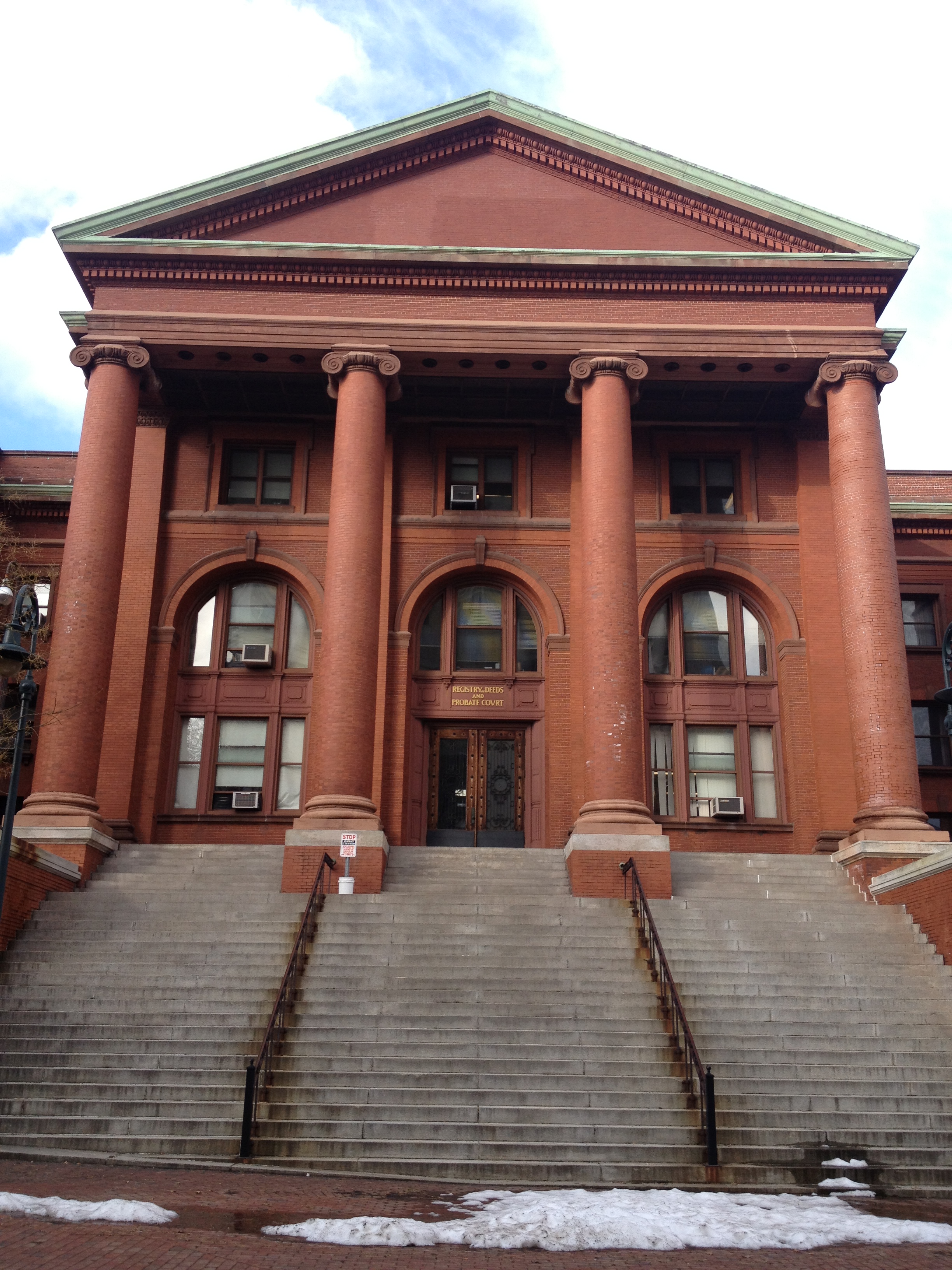 The steps leading up the Courthouse, this side is attached to the Clerk's Office and directly faces the jail.
Another notable judicial building in the area is the Middlesex County Jail.
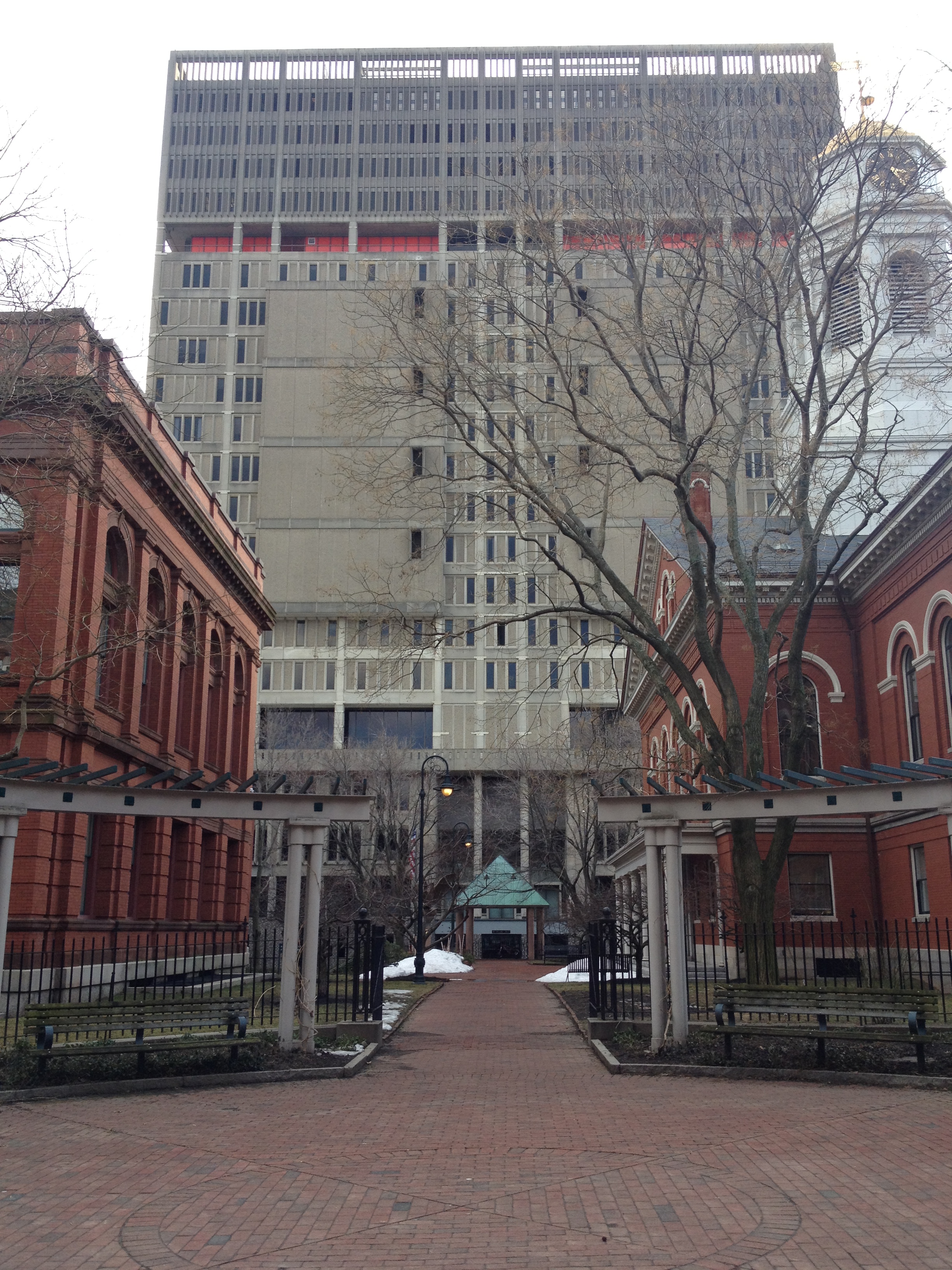 The Middlesex County Jail, from the steps leading up to the courthouse.
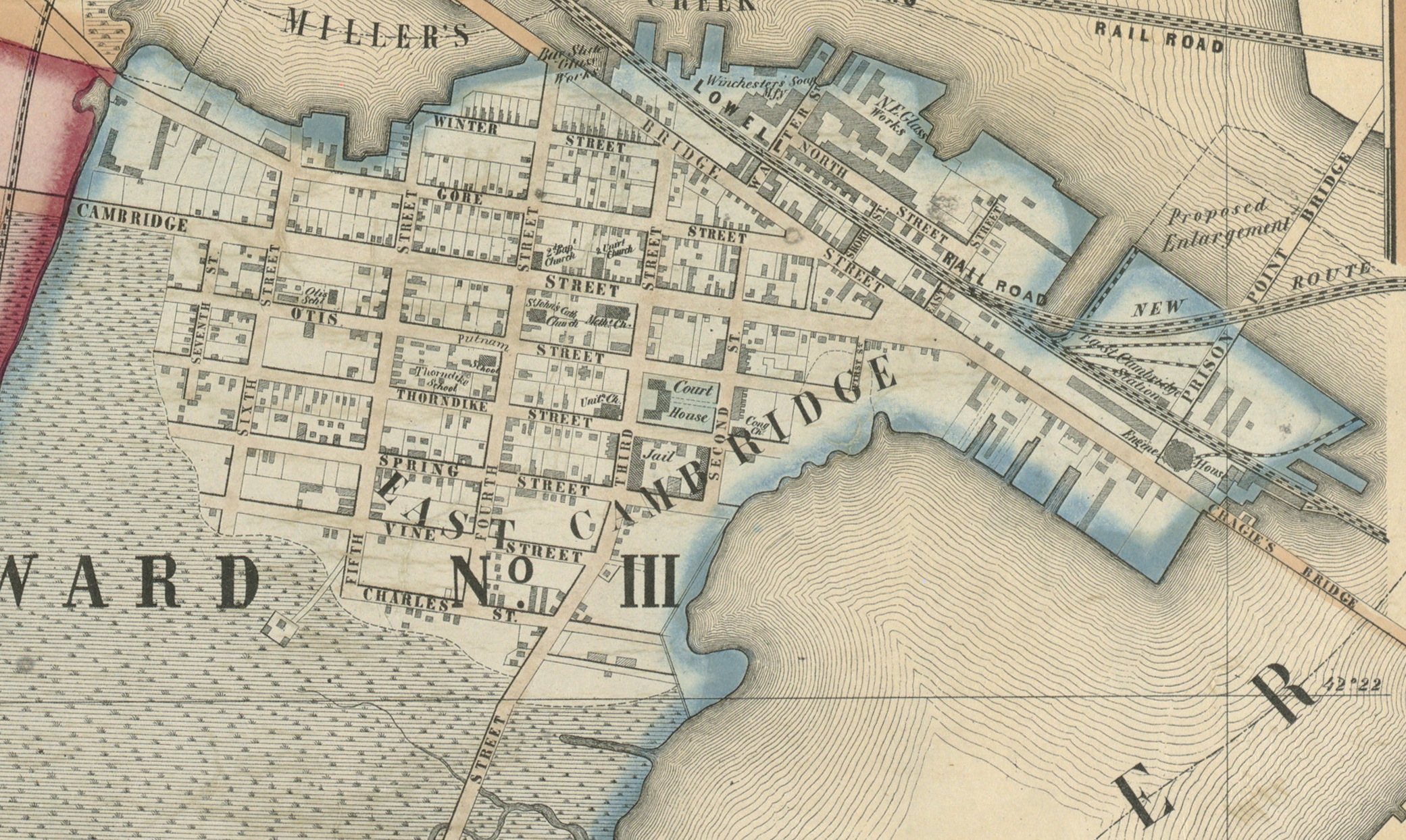 A detailed map of East Cambridge from 1854. THe map clearly indicates the Oldest Church of East Cambridge, the Courthouse, and the Jail.
Due to the high concentration of judicial jobs many of the citizens near the courthouse were often very wealthy. Because of the proximity to the courthouse, 3rd Street was established as an area for the wealthy. Even know this section is still for the wealthy, the trees outside are more well kept than those found anywhere else on my site, the brickwork on the outside of the building is constantly being maintained and reworked to keep that classical feel. Another thing about these buildings is how that the first floor on most of these buildings has been converted into law offices for the wealthy lawyers who live there. As the wealth in the area began to increase and accumulate the rest of my site began to change accordingly. A big notable change, which is now just an artifact of the past, is the East Cambridge Savings Bank. In some of the earlier maps a bank can be clearly seen where this bank now stands. However, from later maps and from visiting the site it is visible that this bank expanded in the mid 1900s. The bank building took over the building next to it and expanded itself. This shows the growing population, the increase in wealth in the area and therefore the need for a larger bank in the area. The increase in wealth can be attributed to the increase in law practice in the area from all of the judicial business that goes on.
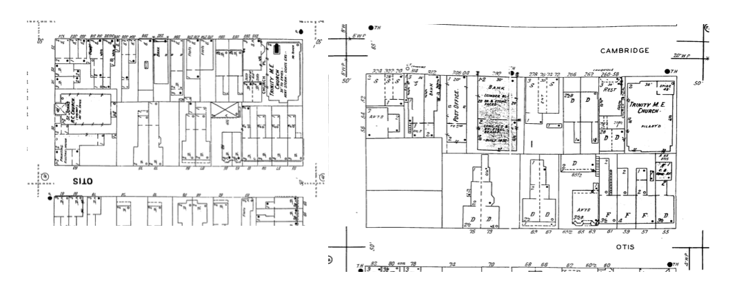 The map on the left is a Sanborn map from 1900 and the one on the right is from 1934. Some of the notable changes here are the increase in bank size. and the disappearance of the two buildings in the corner.
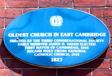 OLDEST CHURCH IN EAST CAMBRIDGE
ERECTED BY THE THIRD CONGREGATIONAL SOCIETY
EARLY MINISTER JAMES D. GREEN ELECTED
FIRST MAYOR OF CAMBRIDGE, 1846
BECAME HOLY CROSS NATIONAL
CATHOLIC CHURCH, 1940
1827.
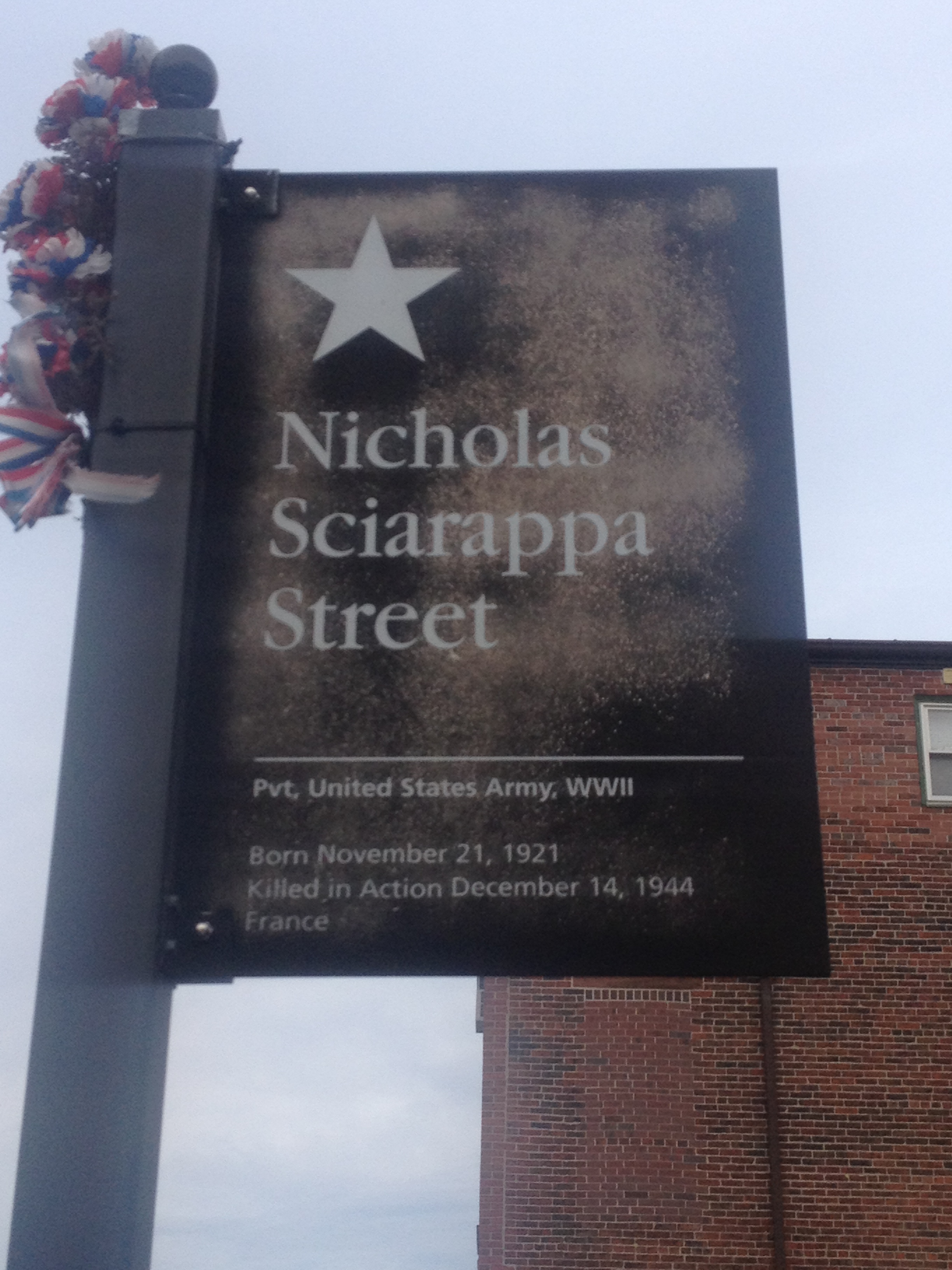 This sign located at the intersection of Cambridge Street and Sciarappa Street commemorates Nicholas Sciarappa, the person who 4th Street was renamed after..
Conclusion
East Cambridge is now viewed by many as the area where the CambridgeSide Galleria exists, or as a quiet neighborhood with a few judicial buildings; however, by looking at the artifacts that remain and the trends still present it can very clearly be seen that East Cambridge hides a much more vivid history. The historical markers aid in trying to inform pedestrians of the historical significance of the area; using these signs, along with some observations in the area more of its history becomes apparent. By walking down Quality Row and then one of the neighborhood directly adjacent to it helps to accentuate what Quality Row really is. In a few years, when the jail is gone, more artifacts will be created that will again help to show its history, but it will keep getting deeper under all the new layers continually being added.