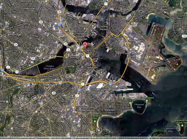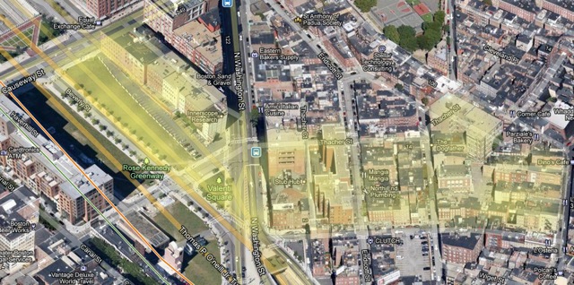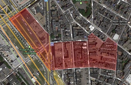
The site selected stretches from the Rose Kennedy Greenway to Salem Street between Thacher Street and Cooper Street in the North End region of Boston. It is an interesting location because of the range of land usage and the great changes that have taken place where the Greenway lies today that have affected the surrounding area.
 The site is located on the
western side of the North End.
The western end of the site includes the Rose Kennedy Greenway, Washington Street, and Beverly Street, which all come together to create a large open space. Beverly Street runs down the middle of the Greenway, and intersects on a diagonal with Washington Street. Large commercial buildings line both sides of the Greenway, giving the area a very large, open feel.
The eastern end of the site is much different from the western end. It has very narrow streets, small property sizes, and older buildings. There are many tiny shops, cafes, bakeries, and services that are connected rather than forming distinctly separate buildings. The streets and buildings are all very close, creating an old and quaint atmosphere that is very accessible and heavily dominated by pedestrians.
The area in the middle of the site serves as a transition between the large commercial area next to the Greenway and the old, compact style of the North End. There are several large apartment buildings and a church along the west side of Endicott Street and smaller residences and shops on the east side, though the buildings look similar and are equally as tall. This mixture of small residences and shops very close together continues most of the way to Salem Street along both Thacher and Cooper, although not in the alley-accessible middle of the block.
 The two breaks in the site
are very apparent in a satellite image, as are the transitions to larger
properties and open spaces nearer to the Greenway.
There is an area larger than a normal block between Cooper and Salem Streets, and the buildings are not aligned in a grid. Access is provided to the buildings by small alleys that go halfway across the block. Instead of the break between the two grid alignments occurring at a street, the awkward disjunction occurs so that the backs of the buildings all face each other at the center of the block.
The Greenway and Washington Street area is the location of a break between two grids. It is unclear at this point if the highway that was once there was placed there because of the break or because of a preexisting road and bridge across the Charles and the road created the break. As Grady Clay points out, breaks often occur where “the first grid followed the alignment of an early bridge or was staked out at right angles to the first town landing or to the water’s edge,” while “breaks… are easy targets for contemporary highway and urban-renewal scouts and for tidy-minded city planners anxious to regulate traffic flow.” (“How to Read a City,” p. 44, 50). The elevated highway that separated the land on either side was replaced with an underground tunnel that rerouted most of the traffic, and the area on the surface was used for the Greenway, which serves as a nice park and recreational area to help break the monotony of crowded buildings and give a whole new mood to the area.
It will be interesting to look into the history and development of the highway and Greenway and how it has affected the surrounding area. There is certainly a noticeable difference from the surrounding area that reaches out a few blocks from the highway location. It is also possible that the removal of the above ground highway has affected the immediate surroundings by allowing easier access to buildings right next to the Greenway and thereby encouraging construction of new buildings or changing the layout of intersections and available parking. Because the North End was settled very early, there is a lot of history preserved in its streets and buildings and consequently a lot of change over time that can be studied.