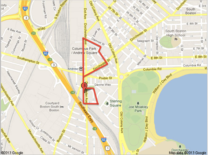
The Loyal Crown smoke stack on Algers Street, symbolic of Andrew's Square industrial roots.
The Andrew Square stop was the farthest I had even rode down the Red Line. Its location was intriguing, a bit south of downtown, clear from the bustle of the Financial District and Chinatown. It is certainly not a venturi; Dunkin Donuts is the most prominent eatery near its three-way junction. While the unattractive but functional units for commercial businesses are most visible from the junction, what made the site worth studying further were the residential sections weaved between laundry operations and auto warehouses. Many clues revealed Andrew Square to be at a turning point, a junction once again deciding its function. I saw an area in transition from its century-old industrial roots towards a future hotspot for young families attracted to urban living.

A sign detailing the major intersection.
The inhomogeneity of the site’s zoning is a consequence of its location. Three roads that form an asterisk at Andrew Square: Dorchester Avenue, Southampton/Preble Street, and Boston/Dorchester Street. The grid pattern all but dissolves for a half mile radius. I observed many of the telltales of a break Clay described: the site is near the edge of a central business district, there are angular, irregular streets, and there is a T station on Dorchester Avenue. The abrupt neighborhood transitions are appropriate for the landscape.
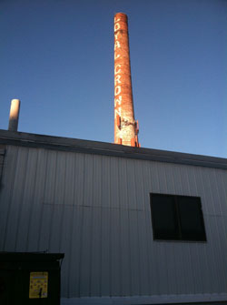
The lower-middle income neighborhood of squat brick buildings.
The boundaries of my site were drawn to include three distinct communities: the industrial park, a newly redeveloped middle class neighborhood, and a lower-middle class community adjacent to an old factory. I chose to include the portion of the industrial park bounded by Algers Street, Dorchester Avenue, and Middle Street. The cove is interesting because of a landmark smoke stack that reads “Royal Crown.” A parking lot littered with delivery trucks indicated that the Crown Linen and Uniform Service still operated there. Most of the neighboring buildings of similar size and same brick are closed. From the center of the lot I can see the next section of my site, the middle class neighborhood along Middle Street. The wealth is apparent from the expensive hardware on the custom wood and glass doors, higher frequency of luxury vehicles, and personal driveways. The inescapable sounds of the delivery trucks lower the property value so I hypothesize this injection of redevelopment is part of a long-term plan to rezone the immediate area. A minute away, down Dorchester Street and a turn on Dorchester Avenue, is a lower-middle class neighborhood. In large contrast to the pastel curb fronts and three story townhouses of their neighbors, these residents live in identical, squat brick buildings that immediately conjured images of the projects.
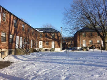
St. Mary's Our Lody of Czestochowa on Dorchester Avenue.
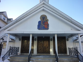
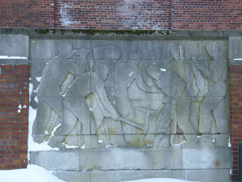
A smoke stack at the corner of Monsignor O’Callahan Way and Kemp Street is an intriguing anomaly. An adjacent mural of surveyors and construction workers was a clue that development plans are keen to preserve some of the industrial nature of the area. The name Monsignor is a nod to the large Polish, Roman Catholic community in the area, one of the final curiosities of my site.
 .
.
Mural of laborers on Kemp Street in the lower-middle class neighborhood.
Andrew Square is an ethnically mixed community, including a longstanding Polish population. On Dorchester Avenue there is a beautiful church whose architecture indicates its age with a sloping roof and wide front face. The mailbox of a neighbor two doors down belonged to “S. M. Wrezcion,” so I am certain some of the community is included in my site boundaries. Many of the shops and stores also indicated the neighbors’ Polish roots, such as the major convenience store at the three-way junction, “Tedeschi Mart.” I will be interested to see how redevelopment plans may reshape the neighborhoods demographics, especially as developers set high-income targets.