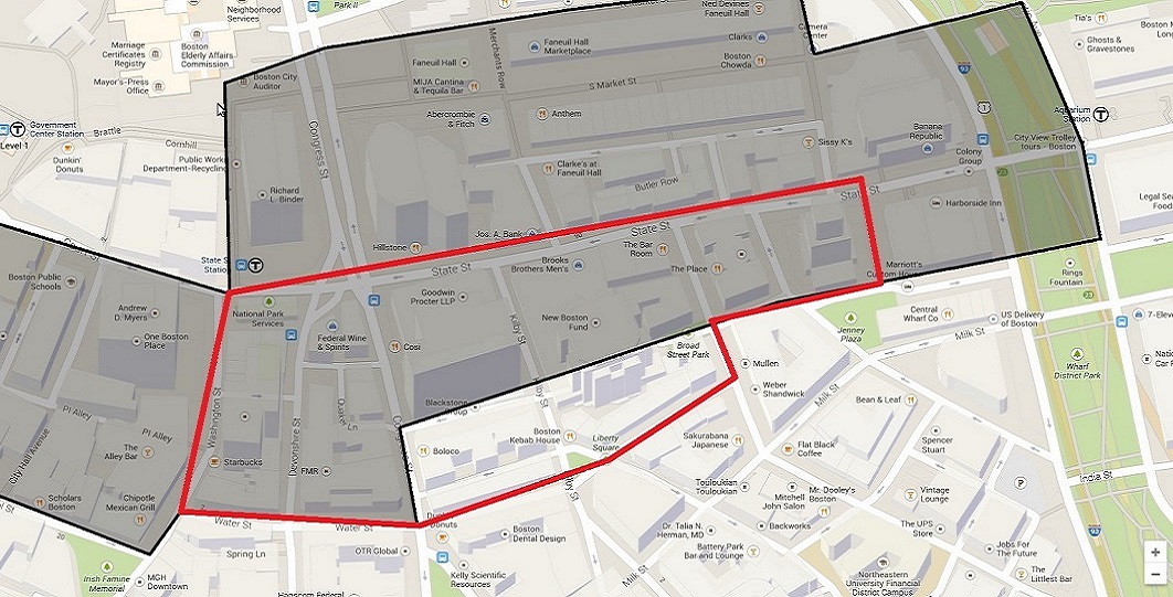
My previous site was far too big to be suitable for in depth analysis (the shaded region in Figure 1 amounts to approximately fourteen blocks). Therefore, I changed my site's boundaries to encompass fewer blocks. Determining where to draw the new boundaries took careful thought. I decided I would still be able to research how the interstate highway influences downtown Boston without containing it on my site. In addition, when looking at my site across Boston's entire history, I-93 will have little impact compared to older events. I shrank my site to encompass around eight blocks. State Street makes up the northern boundary and Water Street defines the southern boundary. The western boundary stretches far enough to include the State House and the eastern stretches to include the Custom's House Tower, built on filled land.
|
|
|
Cities may appear to be mankind's greatest achievement. They exuberate mans ability to change nature into a more civilized environment. However, under close analysis, nature is far from absent in cities. Natural processes dictate the locations of cities, how cities degrade over time, and how cities are repaired.
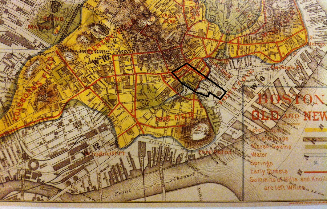
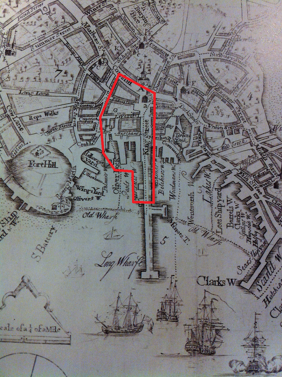
Boston's foundations began on the Shawmut Peninsula near a water spring. The peninsula provided an easily defensible area to build a city, and the water spring provided a clean source of water, cities' most imported resource (Spirn, pg. 232). Figure 2, a map of Boston in 1880, illustrates some of the earliest roads made in Boston during the late 1600's. Among them are Water Street and King Street, both of which are still present today. Water Street, was named after the ever so important spring, and King Street was the central artery of Boston. The Long Wharf, depicted in a map from 1728, was the predominant dock for unloading shipments from England (Figure 3). The Long Wharf connects directly with King Street, which originates from the State House. The significance of the name "King Street" correlates with its importance in connecting Boston to the British Empire. Therefore, it's no coincidence that King Street was changed to State Street after the Boston Massacre, Declaration of Independence, and Revolutionary War.
Shawmut Peninsula's topology heavily influenced the location of the State House and the Long Wharf. The Long Wharf protruded from the center of a natural bay allowing large ships to unload directly into the heart of Boston (Figure 3). The State House is elevated on high ground and oriented to point directly down King Street. It also lies at the intersection of the early major roads which were constructed around the early marshes and hills. Figure 2 depicts elliptical hills to the west of the State House. In "The Granite Garden", Anne Spirn describes these hills as drumlins created by a large ice sheet which transformed the Boston basin as it moved southeast more than ten thousand years ago.
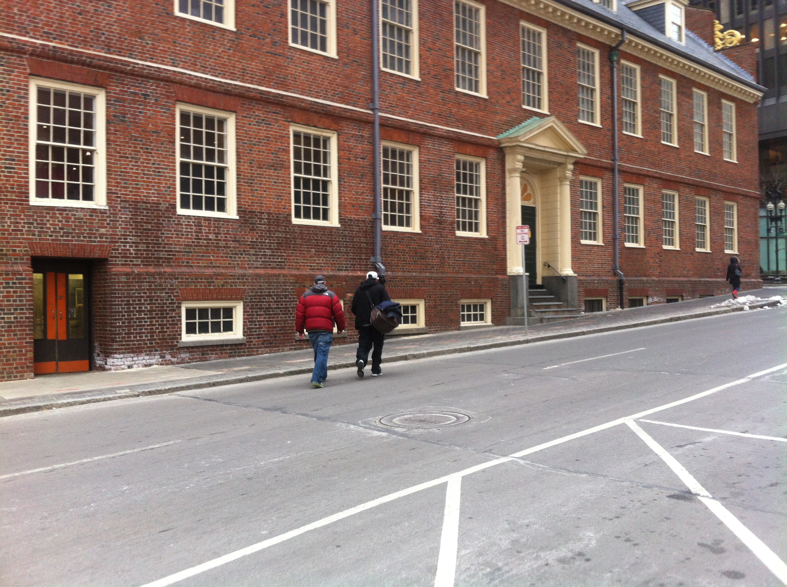 Figure 4: State House (Taken by Jaguar Kristeller)
From my observations, it appears that State Street's light grade could have originated from the glacier that shaped the Boston basin. Figure 4 shows the windows of the State House converging to the road. Also depicted in Figure 4 is a white color around the corner of an entry way. A possible explanation could be that the warmer air from Boston's underground train transportation system, the “T”, mixes with the colder outside air. Thus, causing condensation to evaporate on the side of the State House leaving salt residues behind.
Water:
|
|
|
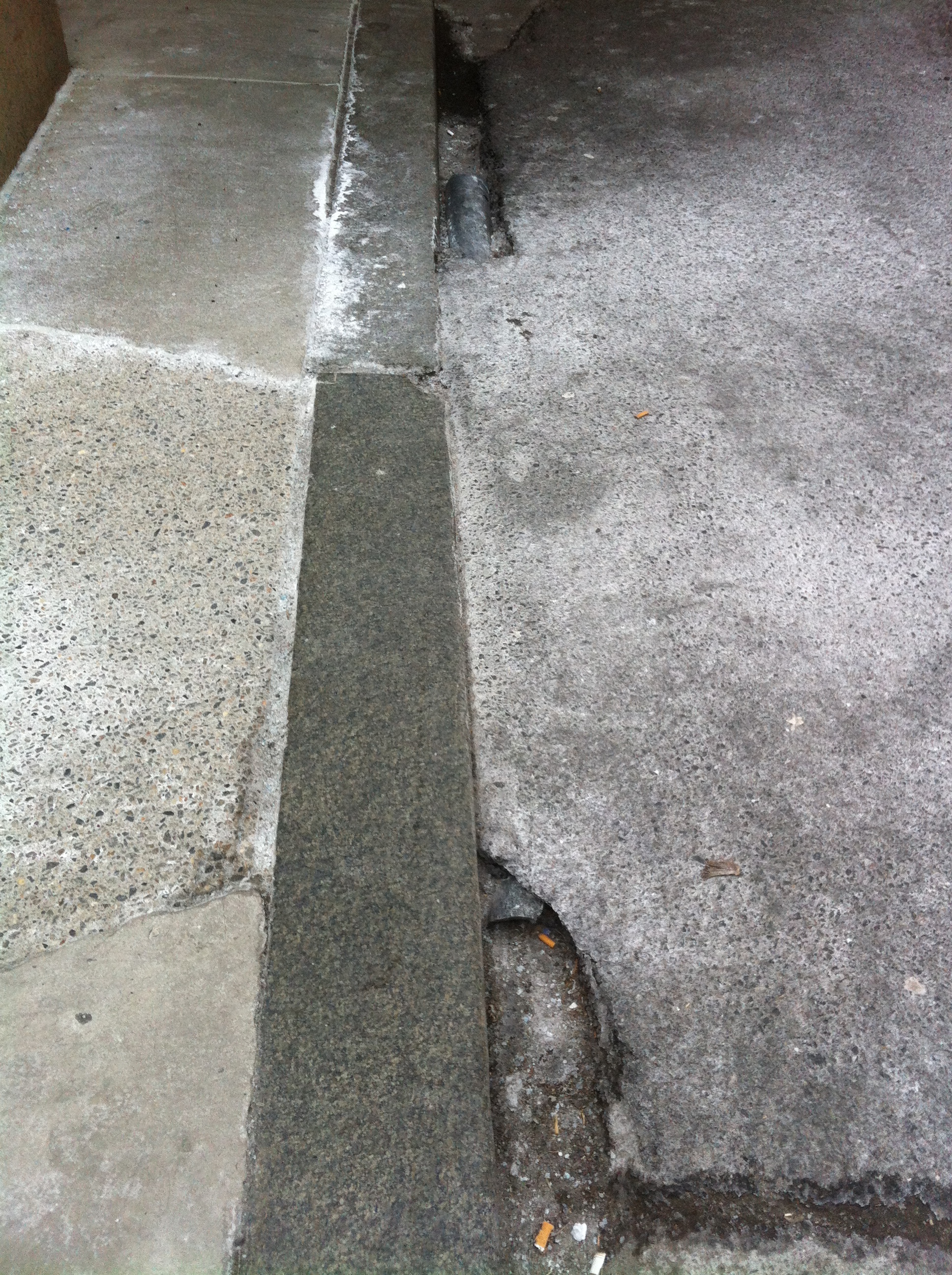
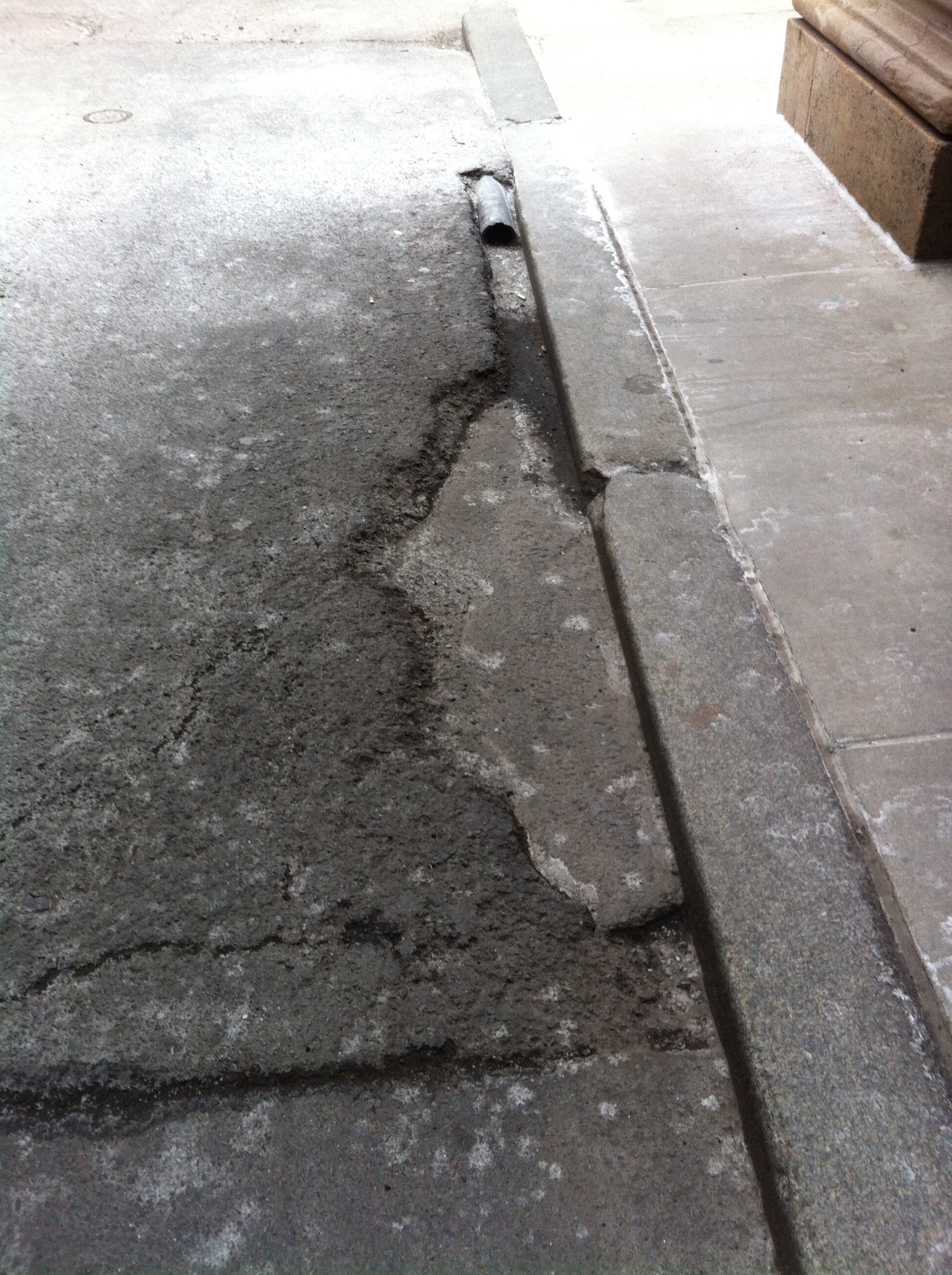
Cities are excellent at venting rain water off the streets, into gutters, and eventually back out to the ocean. So good, in fact, that the soil underneath the pavement hardly absorbs any water leaving the soil susceptible to sinking. Anne Spirn describes this process as "short-circuiting the hydro-logic cycle" (Spirn, pg. 130). The effects of water movement throughout Boston, and cities in general, can be observed on my site. In Figure 5, a very primitive culvert made by pouring asphalt over a plastic pipe appears to have little engineering thought behind its design. Despite its design, it does help drain water from Congress Street to prevent murky water from puddling in front of the sidewalk. However, the poor design has led to the intake filling with debris and inhibiting the flow of water (Elkins, pg. 16). This could result from the water carrying dirt, salt, and cigarette butts from the road and dropping it before entering the culvert. In Figure 6, the shape of the asphalt surrounding the culvert suggests that dammed water from the culvert slowly eroded the material and created a low spot. The low spot appears to have been filled by another type of concrete, a hasty quick fix repair approach to preventing further erosion to the asphalt driveway.
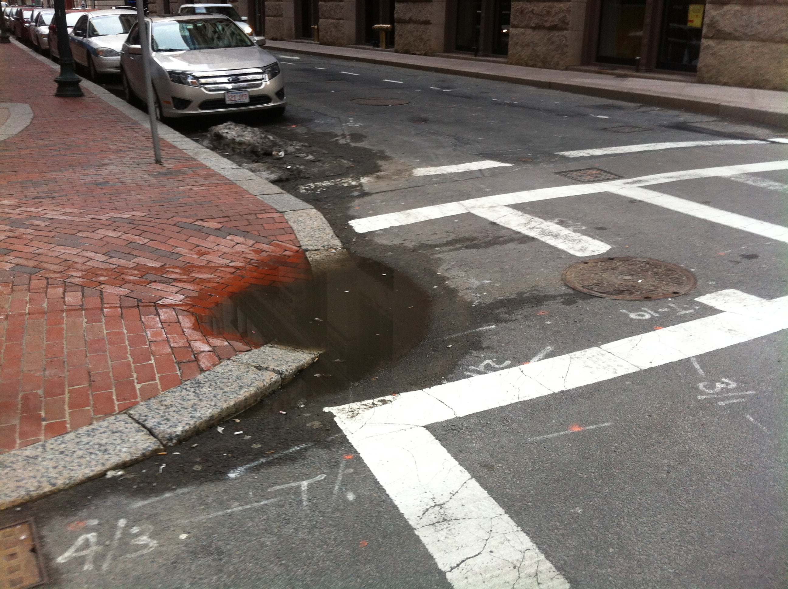 Figure 7: Stagnant Water (Taken by Jaguar Kristeller)
Water that isn't drained properly in cities tends to look like the water in Figure 7: dirty, brown, and polluted. When water runs along city streets it carries dirt, salt, tire particulates, pollutants absorbed from the air, and small pieces of trash (Spirn, pg. 129). Stagnant water can also appear from melting snow piles. In order to keep the city maintained and functioning, snow is plowed off the roads into piles. Thus, snow piles are concentrated sources of trash, dirt, and salt that has accumulated on the roads prior to the precipitation.
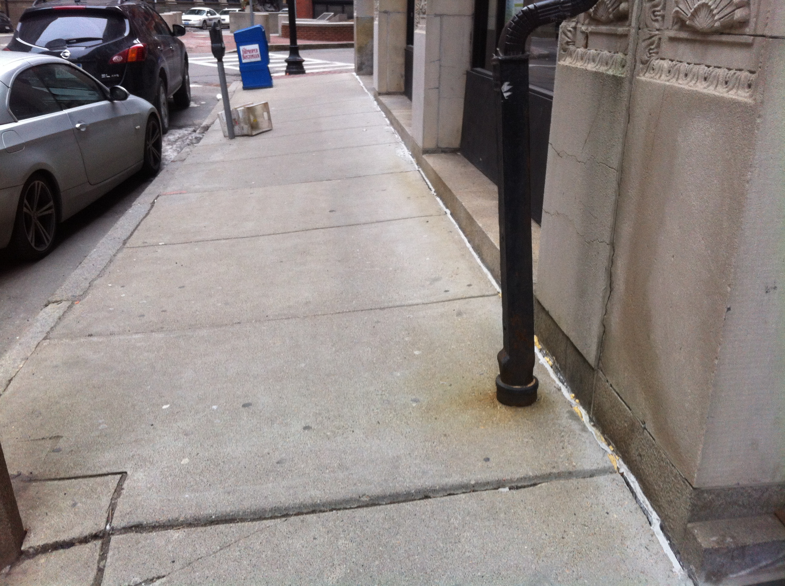 Figure 8: Leaking Drainage Pipe (Taken by Jaguar Kristeller)
Rain water from the roof tops of buildings gets collected by gutters and directed to underground water collection systems by vertical pipes such as the one in Figure 3. Cities are efficient at sweeping rain water off the streets and into storm water basins. A small scale example of this efficiency is found on my site. The water running through and around the outside of these vertical pipes can slowly degrade the material. The rusted color in the pavement suggests that the steel pipe is slowly rusting over time. The water that doesn't drain off immediately through the gutters seeps into the cracks on the sidewalk. The large crack between the sidewalk and the building could have formed from water pooling, freezing over night, and expanding. The yellow foam indicates a failed attempt to prevent water from increasing the gap between the sidewalk and building. The crack exposes the building's foundation to collecting water and degrading faster. The crack running parallel to the water pipe up the building could be a result from the water weakening the building's foundation. In addition, the underground transportation network borders two sides of my site. Te small vibrations and minor tremors caused by the T could also have played a role in the cracks running up the building.
Earth:
|
|
|
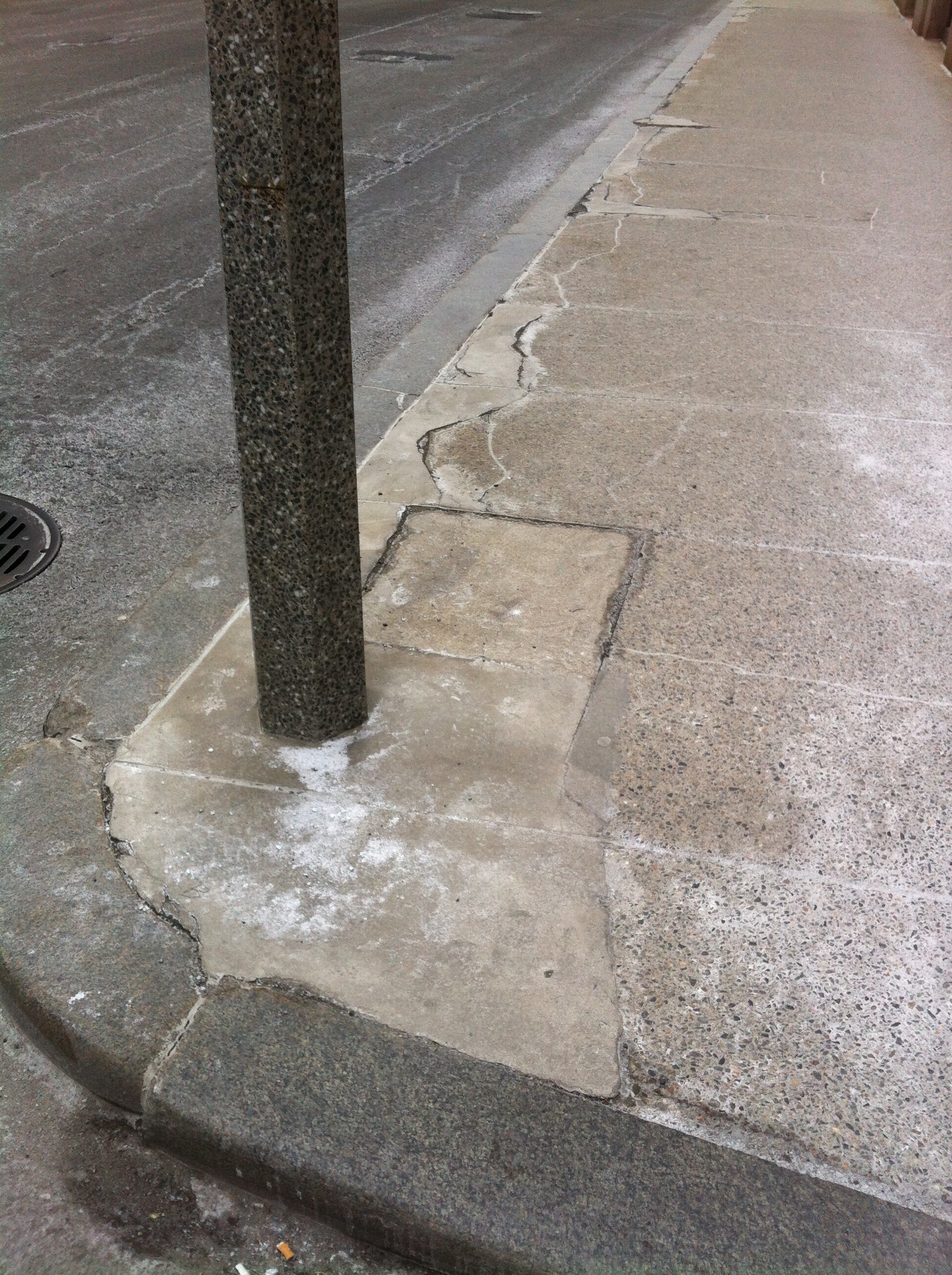
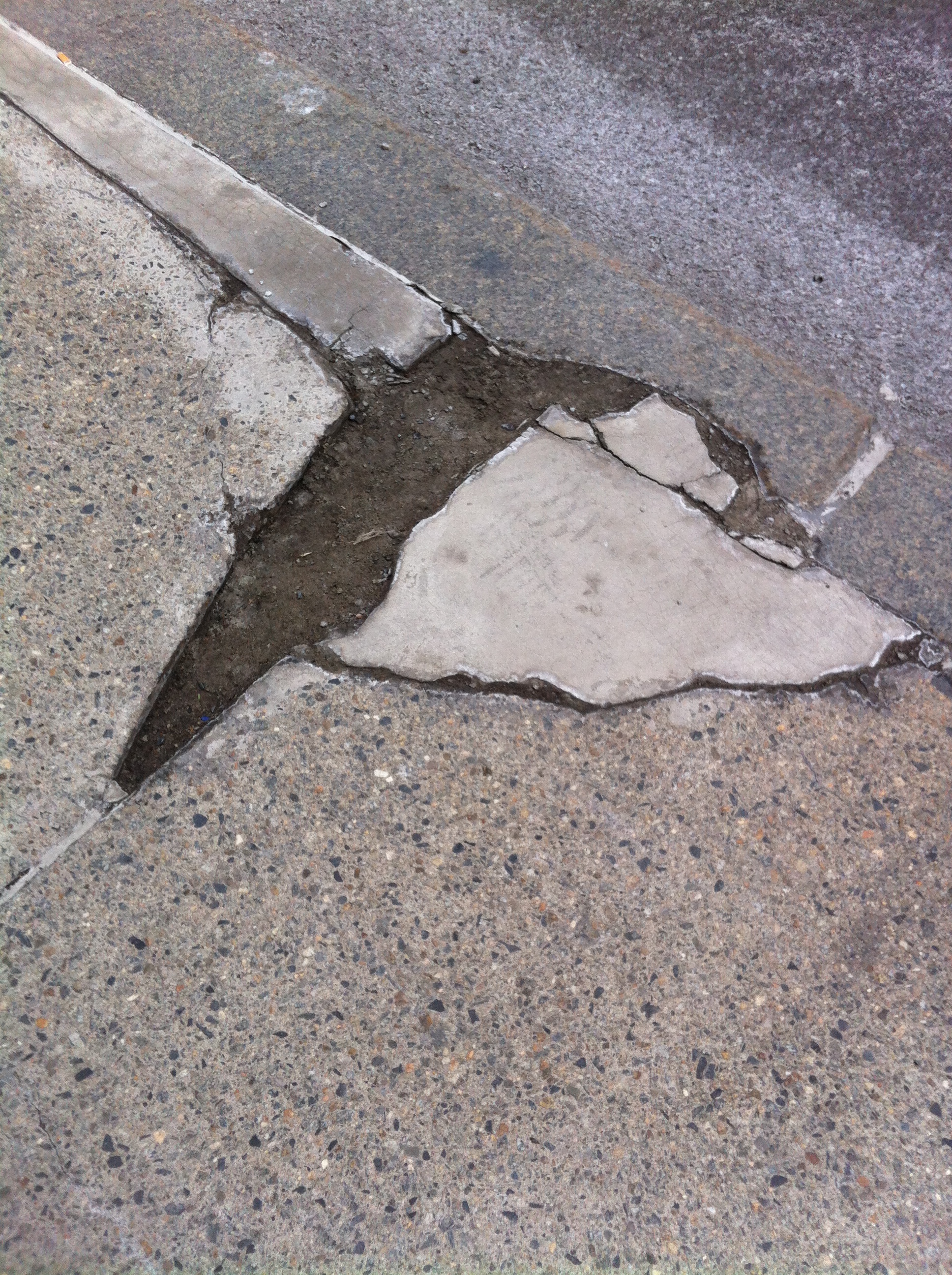
The sidewalk has been damaged enough by natural processes that its been repaired multiple times. Ironically, the repairs seem to degrade faster than the sidewalk. Where the concrete fill repair and the original granite curb meet, water seeps in, erodes, and collects dirt as seen in Figure 11. One might wonder why there are man-made cracks designed in the nearly every sidewalk. Splitting the sidewalk into sections allows for the anticipated settling of sidewalks to crack along the weakest part of the sidewalks. Thus, the understanding of settling soil influences how sidewalks are designed.
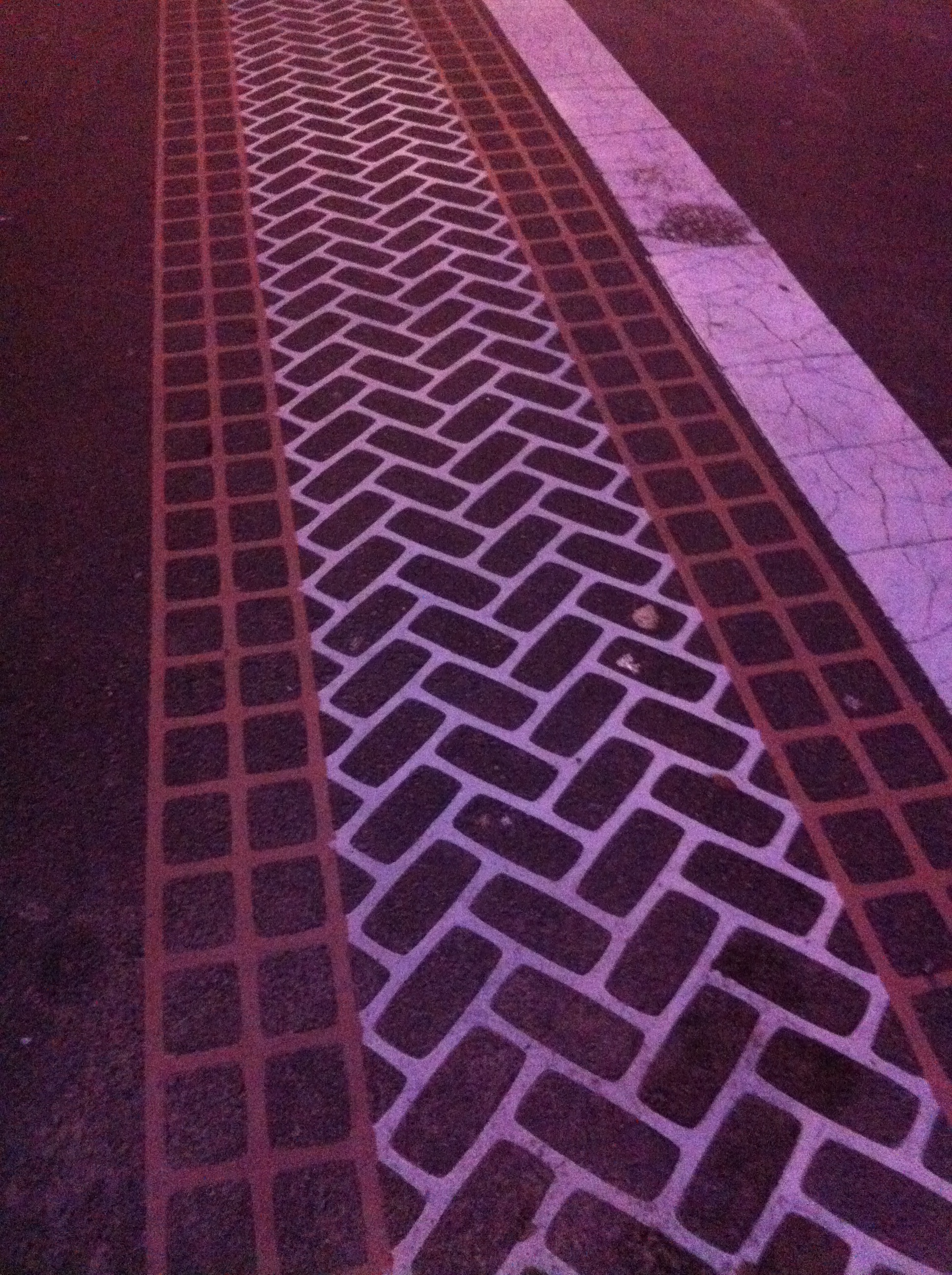 Figure 12: Painted Bricks (Taken by Jaguar Kristeller)
Faneuil Hall and its brick garden lay adjacent to the north of my site. The surface the bricks make surrounding Faneuil hall is not planar. It has imperfections, slight waves, and misaligned bricks likely because of the settling soil underneath. As a way to prevent such imperfections from happening on the State Street crosswalks, brick edges were painted on the concrete surface. Natural processes influenced how humans made the artificial brick crosswalk to increase its resistance to settling and catching water.
Life:
 Figure 13: Life as a Luxury (Taken by Jaguar Kristeller)
Space is expensive around state street; its been built on since 1645. Grady Clay mentioned, in "Close-Up: How to Read the American City", that lots in old cities have been built and rebuilt approximately five times over the past hundred years. The lack of vegetation, trees, green plants, and shrubs indicates that space is limited and expensive more so than the human desire to nurture and cultivate nature (Spirn). The new 75 State Street glass skyscraper can afford to have a miniature park in front of its grand entry. In a way, its utilizing nature to show off its power, prestige and dominance over its neighboring buildings.
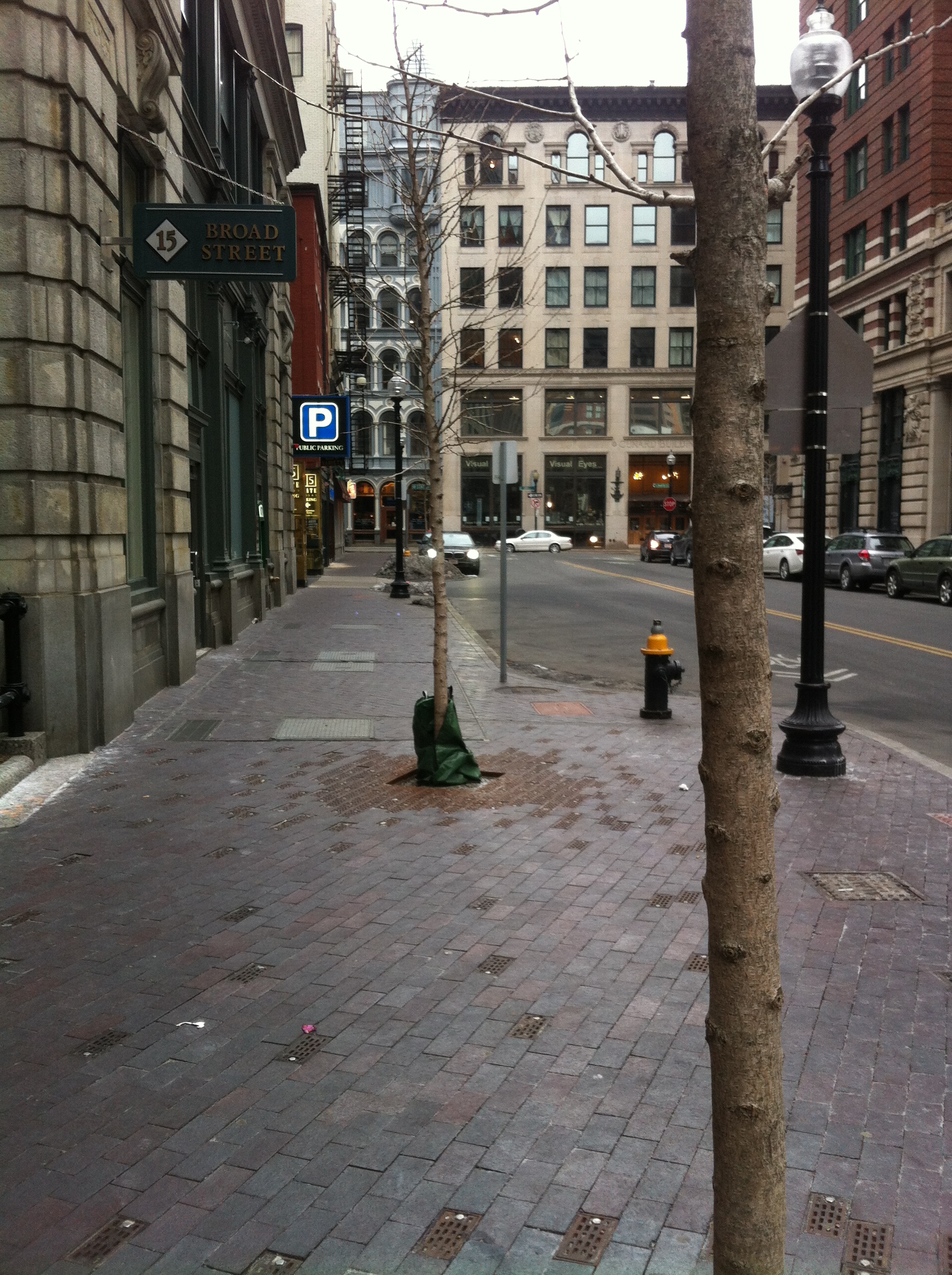 Figure 14: Trees (Taken by Jaguar Kristeller)
The steel brick-sized grates surrounding the trees help the soil absorb more rain-water. The red discoloration of the steel, caused by rusting, provides evidence that the grates do in fact help irrigate the soil underneath the bricks. The use of steel grates is similar to the Turf-block parking lot incorporated in the City of Dayton in 1981, "a pattern of lattice concrete blocks, with soil and grass in the interstices" (Spirn, pg. 150). The steel grates increase storm water retention in the soil, and helps irrigating the street side trees. The scattered grates suggests that there is soil directly underneath, rather than a basement substructure or subway. Maybe, similar techniques for irrigating street side trees aren't common over subways and underlying structures.
In conclusion, natural processes are extremely influential in how cities are shaped over time and in the present. Most of the repairs I observed around State Street were quick and easy discrete solutions to a continuous degradation due to natural processes. Many of the problems in cities due to natural processes are not fully understood. “Solutions need not be comprehensive, but the understanding of the problem must be” (Spirn, pg. 10). Once these problems are understood, cities can be built in harmony with natural processes and can significantly improve in efficiency.
Clay, Grady. Close-Up: How to Read the American City. The University of Chicago Press: Chicago, IL. 1980: pp. 11-16, 38-65.
Elkins, James. How to Use Your Eyes. Routledge: New York, NY. 2000: pp. vii-xi, 12-19, 28-33, 170-175.
Krieger, Alex, David A. Cobb, Amy Turner, and David C. Bosse. Mapping Boston. Cambridge: MIT Press, 1999: pp. 174, 177.
Spirn, Anne Whiston. The Granite Garden: Urban Nature and Human Design. New York: Basic, 1984. Print.