Since I grew up in Fairbanks, Alaska, where the buildings seldom reach 5 stories, I've fostered a specific appreciation for skyscrapers, freeway interchanges, transportation networks and bustling city streets. I often get neck aches when traveling to the centers of major cities, because I'm constantly looking up (figure 1). Fairbanks is a particularly young town compared to Boston, and my fascinated with history and the Revolutionary War time period led me to a site around downtown Boston and the financial district. I mainly want to focus on transportation and how the “Big Dig”, future closing of the Government Center T Stop, and the State House Station contribute to the Quincy Market and financial district's constant flow of people.
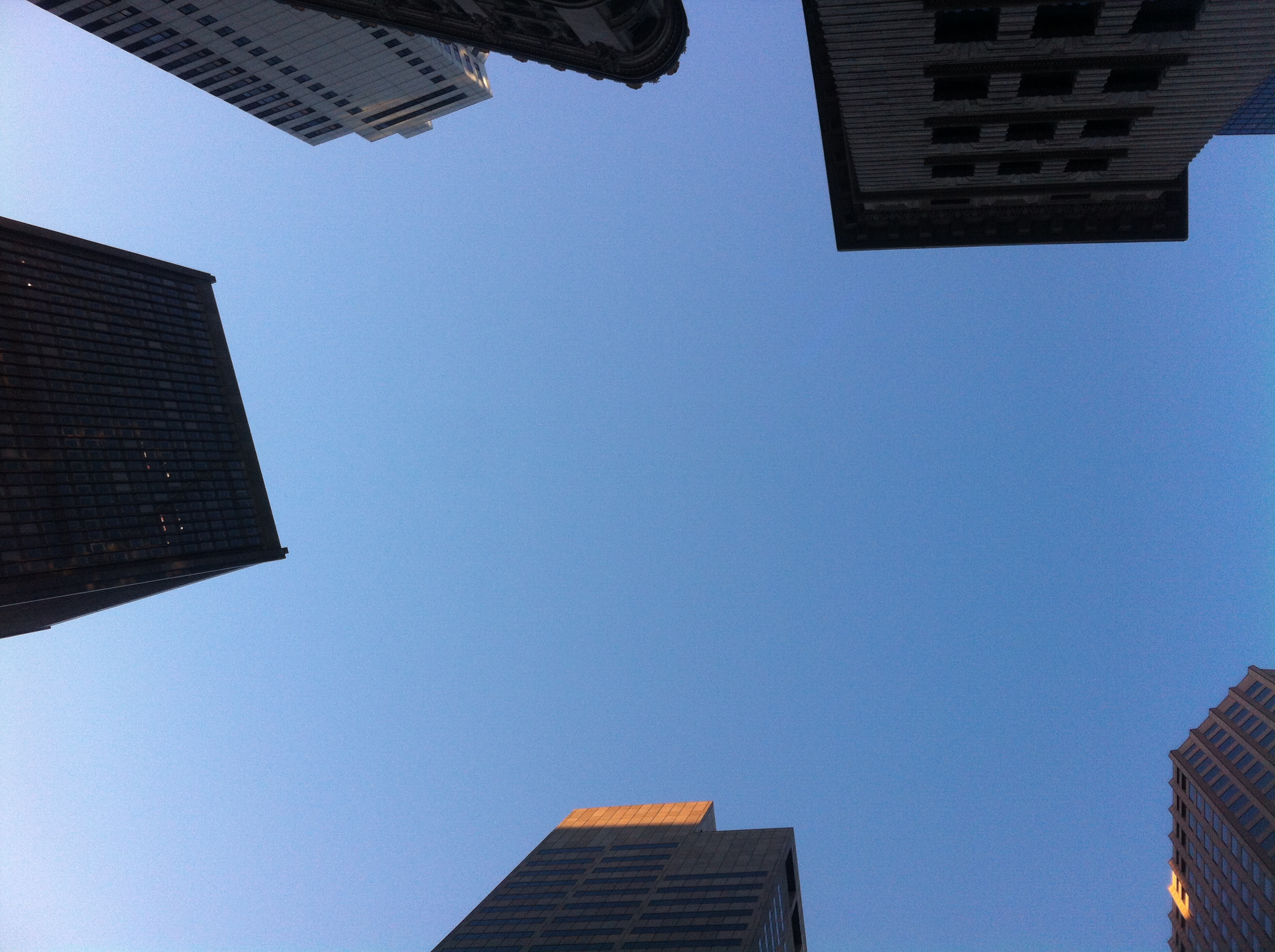 Figure 1: State House Skyview (Taken by Jaguar Kristeller).
The boundaries of my site (figure 2) border John F. Fitzgerald Surface Road and cut through Quincy Market Place between the Quincy and North Markets. It continues over to the City Hall, then cuts back parallel to Congress Street. It turns right onto State Street to encompass the skyscrapers in figure 1 and commercial shops West of the State House. In order to include the King's Chapel Cemetery and a few older buildings, the site boundary goes down Tremont Street and turns left on School Street. From School Street, the boundary continues along roads back to John F. Fitzgerald Surface Road.
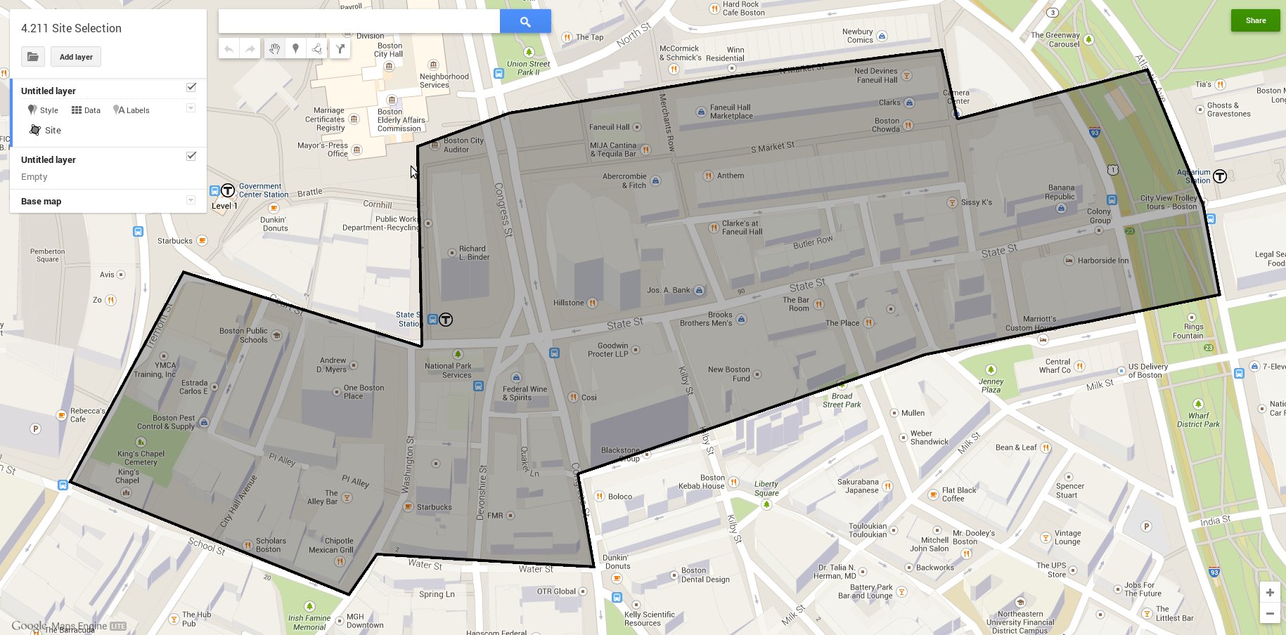 Figure 2: Site Perimeter (Provided by Google Maps).
My main inspiration for choosing this site was the State House Station, I-93, and Quincy Market. I'm fascinated by the old I-93 and how it used to “fly” around the skyscrapers in the financial district. Therefore, I positioned the right side on I-93 to investigate the “Big Dig”. One of the major reasons State Street is the artery of my site is the juxtaposition of the State House and the financial district. Standing in front of the Clock Tower looking down State Street, the State House is clearly visible among it's surrounding skyscrapers. It stands out like a soar thumb, an anomaly, amidst the bustling edge of the financial district (figure 3). Ironically, one of the oldest buildings in the area houses the underground transportation system which supplies consumers to the site. The site is heavily commercial focused, but is elongated in order to incorporate small shops, skyscrapers, and long market places.
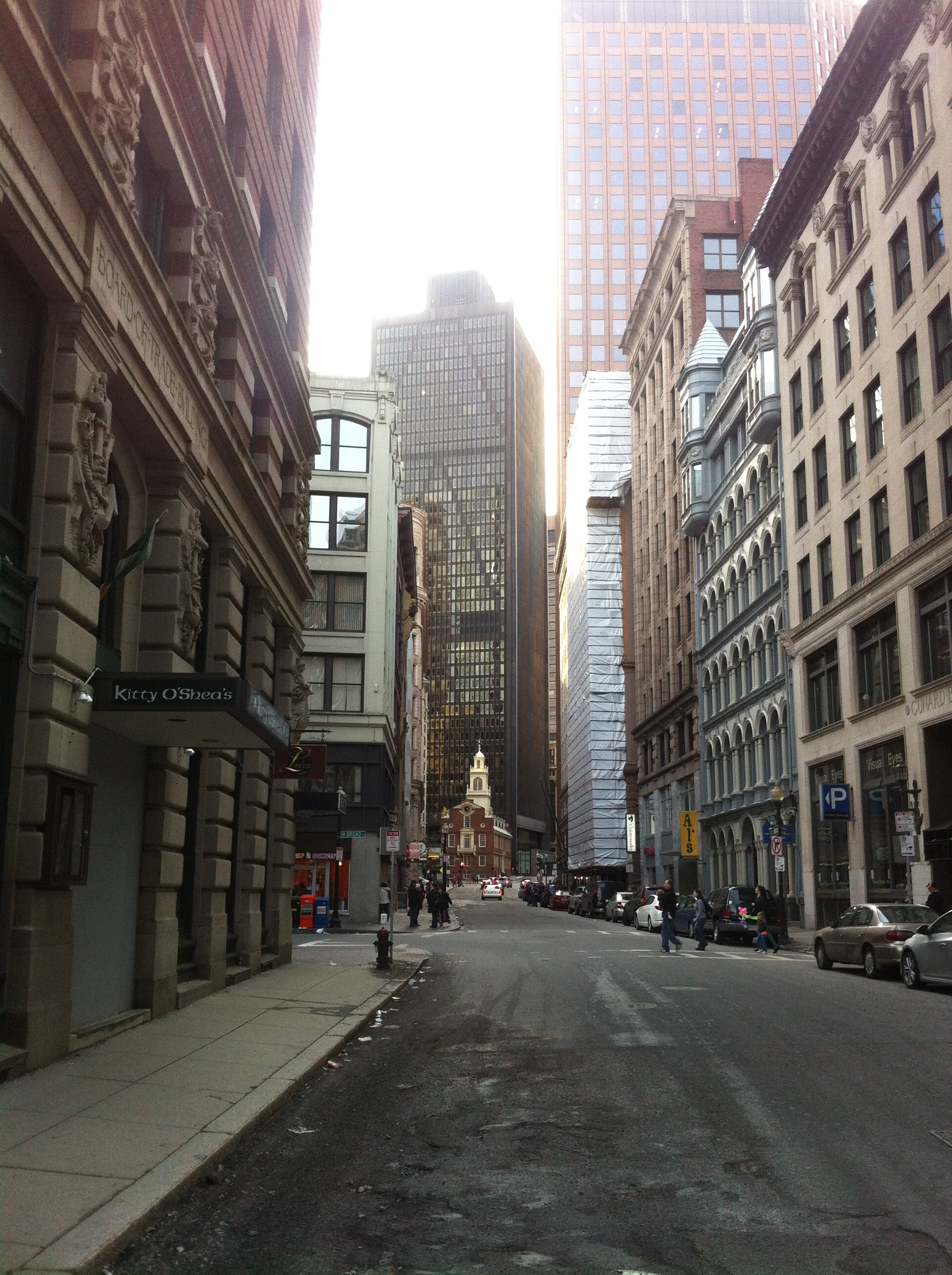 Figure 3: State Street (Taken by Jaguar Kristeller).
I'd like to investigate how the different stages of I-93: before the “Big Dig”, the massive construction decade long construction, and the completion of the underground I-93, affected the financial district. What were some of the more subtle reasons behind the “Big Dig”, other than increasing traffic flow? Has the change to I-93 created a pedestrian-free Victor Gruen type urban center as described by Grady Clay? I'm curious how the State House became a T stop and it's relationship with I-93. Was it a compromise to conserve the historical site by transforming it into a transportation hub? Did the financial district evolve before the T supplied it's workers? If so, how did people get to and from work? Which 18th and 19th century buildings had to be plowed to make way for the corporate skyscrapers? With these questions, I hope to find answers relating Boston's immense transportation networks to it's many skyscrapers.
Clay, Grady. Close-Up: How to Read the American City. The University of Chicago Press: Chicago, IL. 1980: pp. 11-16, 38-65.
Rueda, Jackie. State Street. 2007. Boston, Massachusetts. Panoramio. Photograph. April 19, 2007.