Over the course of the semester I've found observations and analyzed trends depicting some of the influences of social, historic, and economic forces shaping State Street. My site seems to have three interconnected forces shaping its development: the preservation of historical buildings and artifacts, tourism, and the pressures from the financial district for business expansion.
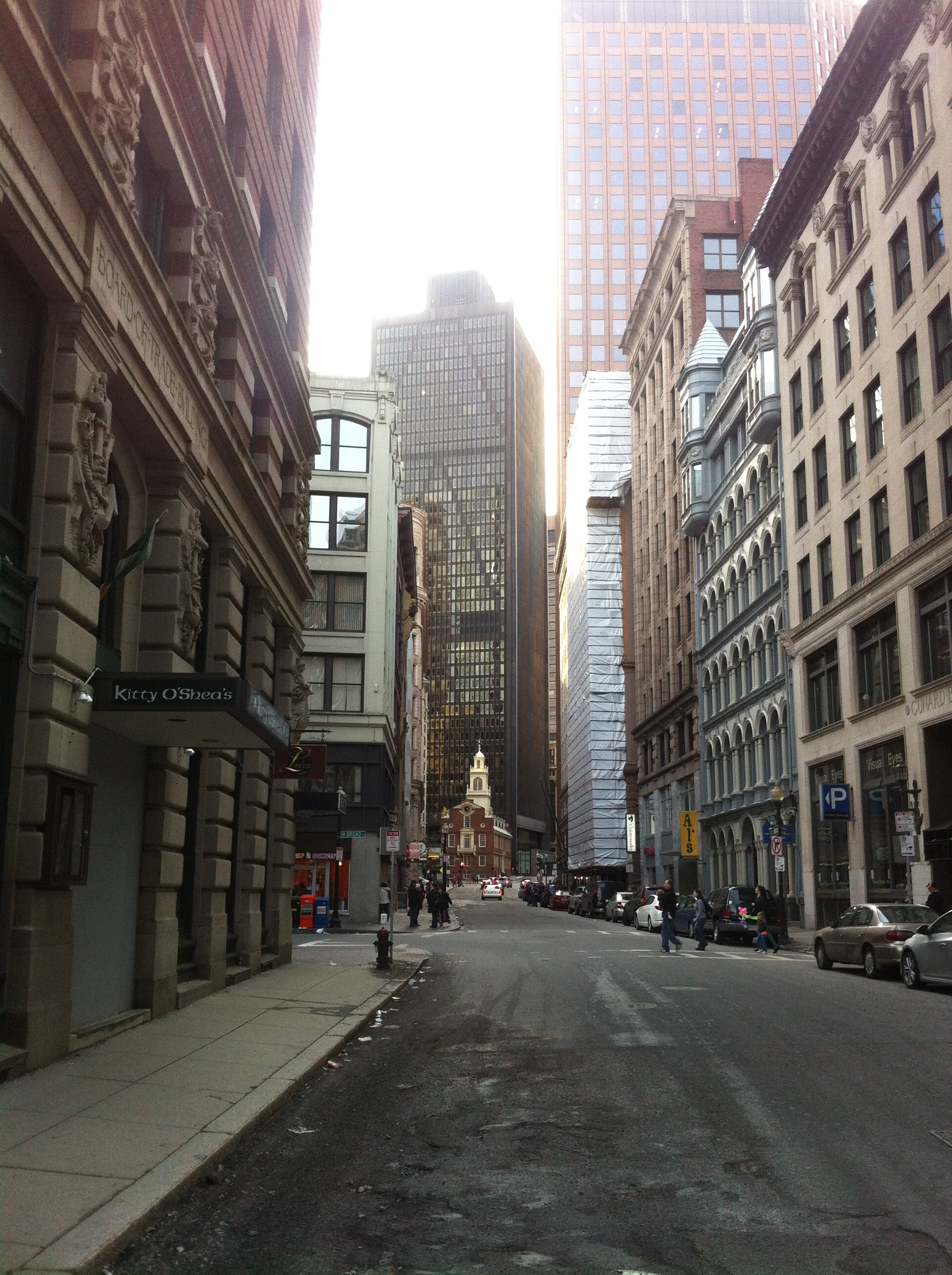 Figure 1: The famous juxtaposition of the old red brick State House nestled among the contemporary steel skyscrapers (which initially drew me to State Street) (Taken by Jaguar Kristeller).
I was first drawn to State Street because of the beautiful layers in Figure 1. It is probably one of the oldest layers present in Boston capturing the juxtaposition of the Old State House and the contemporary skyscrapers. Figure 1 captures Boston's emphasis on preserving historical artifacts. It also depicts the strength of such a movement (the Old State House occupies valuable land in the Financial District) and the vast importance of the Old State House (it's the oldest public building in Boston and had significant importance in the Revolutionary War).
PRESERVATION OF HISTORIC ARTIFACTS & TOURISM
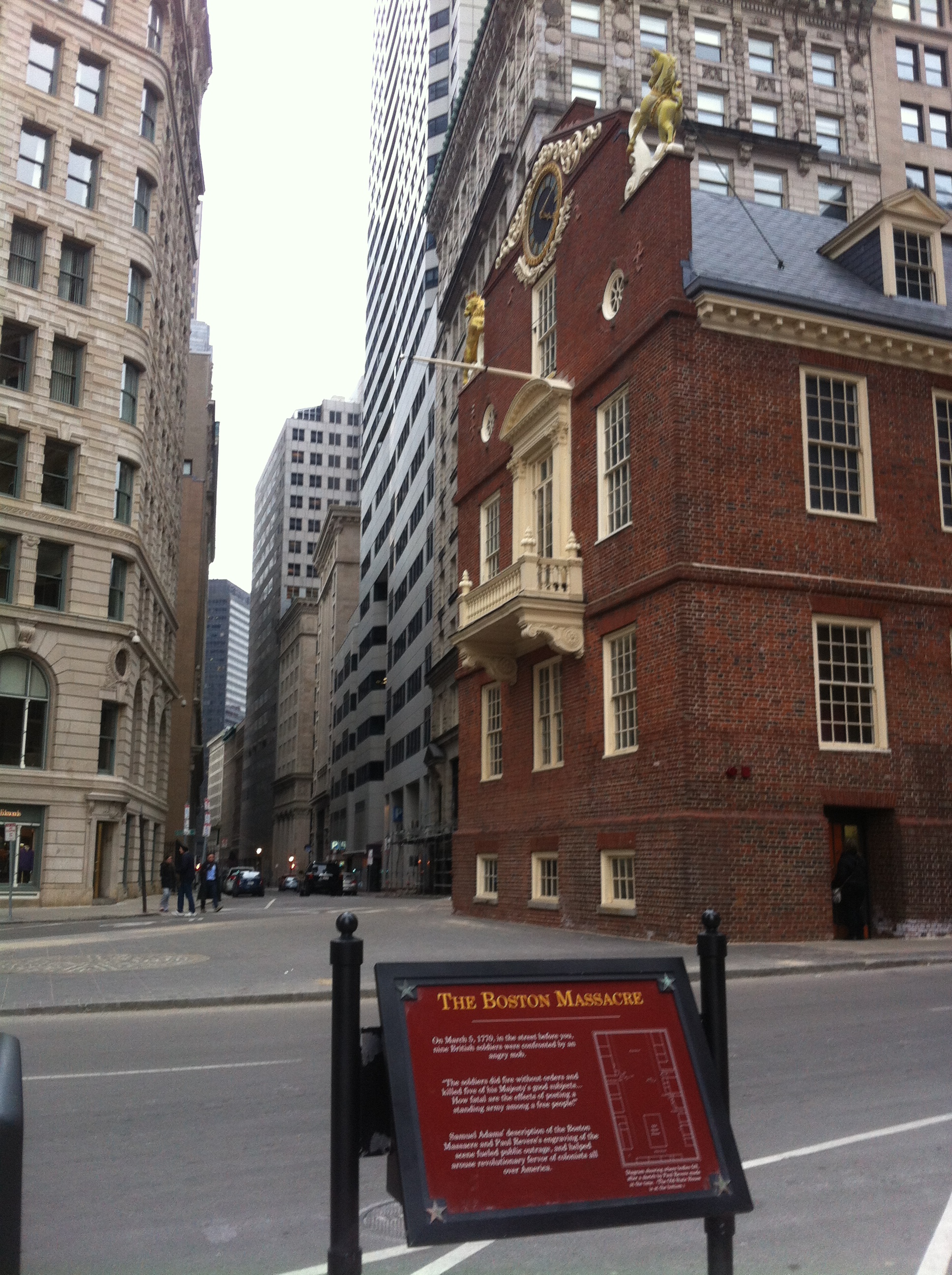 Figure 2: Boston Massacre informational sign containing Paul Revere's sketch of fallen victims in front of the Old State House (Taken by Jaguar Kristeller).
The Boston Tea Party started from the Old State House; a signal was given by some prominent figure from the front triggering one of the most famous rebellious acts prior to the Revolutionary War. Additionally, the Boston Massacre happened directly in front of the Old State House. In Figure 2, a plaque illustrates hand drawn map by Paul Revere of where the five victims fell.
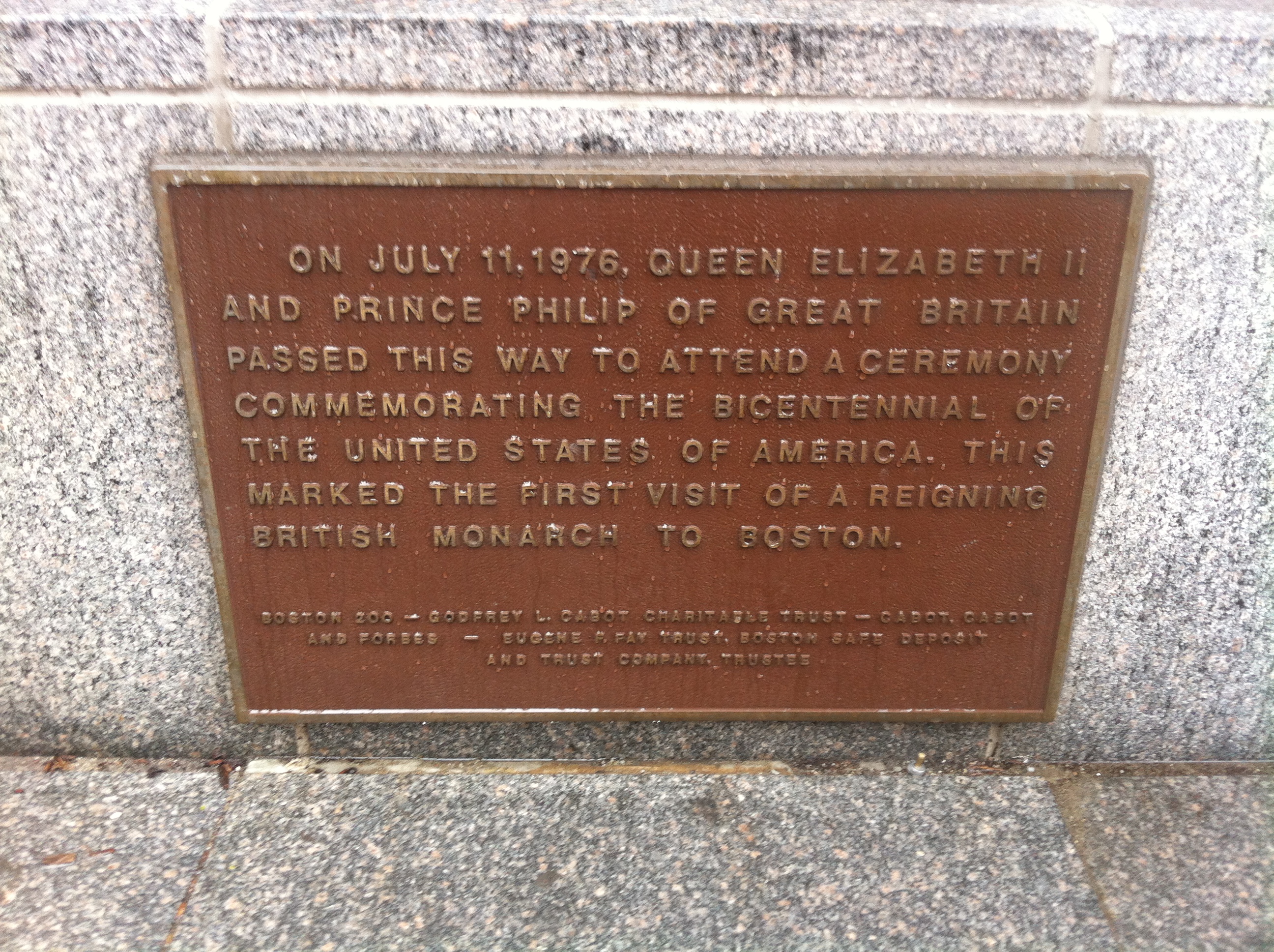 Figure 3: Queen Elizabeth II's visit in 1976 marked the first time a reigning British monarch ever came to Boston (Taken by Jaguar Kristeller).
Next to the Boston Massacre informational board, there was another plaque. It marks another little cookie for tourists to find, another story, another historical insight into the old Boston fabric. It explains the first time a reigning British Monarch set foot in Boston occurred in 1970. I’ve found many plaques scattered throughout my site, which leads me to believe that the preservation of history and past stories is an important part of the culture around Boston in general.
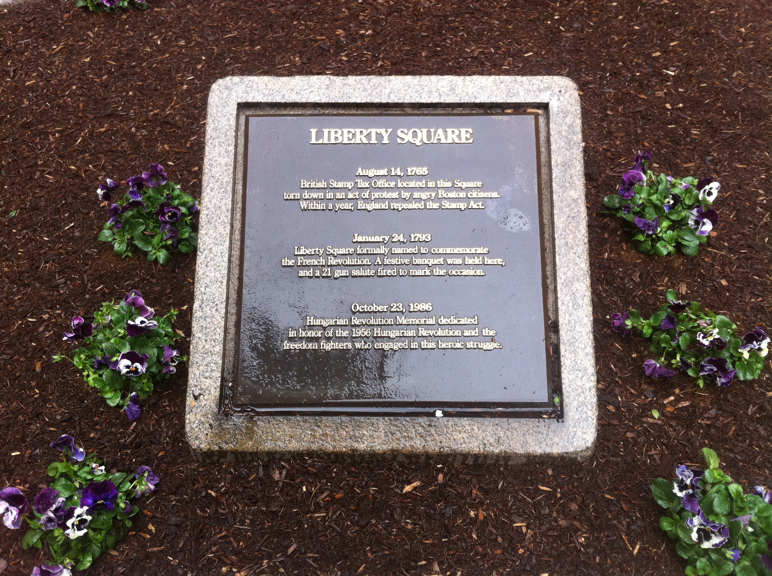 Figure 4: Liberty Square Park Plaque (Taken by Jaguar Kristeller).
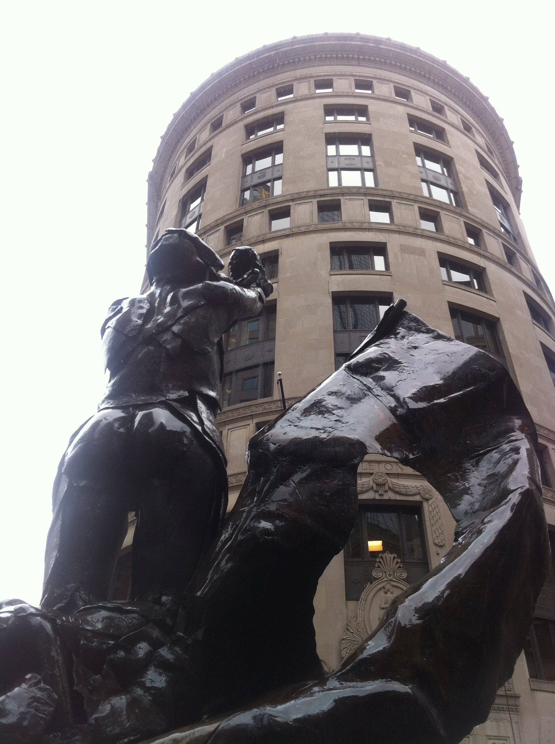 Figure 5: Liberty Square Park Statue in remembrance of the repeal of the Stamp Act, and the French and Hungarian Revolutions (Taken by Jaguar Kristeller).
I remember extending my site boundaries to include the Liberty Square Park. It represents another example of Boston's effort to preserve history. The statue symbolizes acts of liberty demonstrated during the American Revolution, the French Revolution, and the more recent Hungarian Revolution. While I was walking around my site, I saw a crowd of people gathered around the Liberty Square statue and listening to a tour guide. Boston preserves its history, which attracts people from around the world to experience Boston's past and hear its stories.
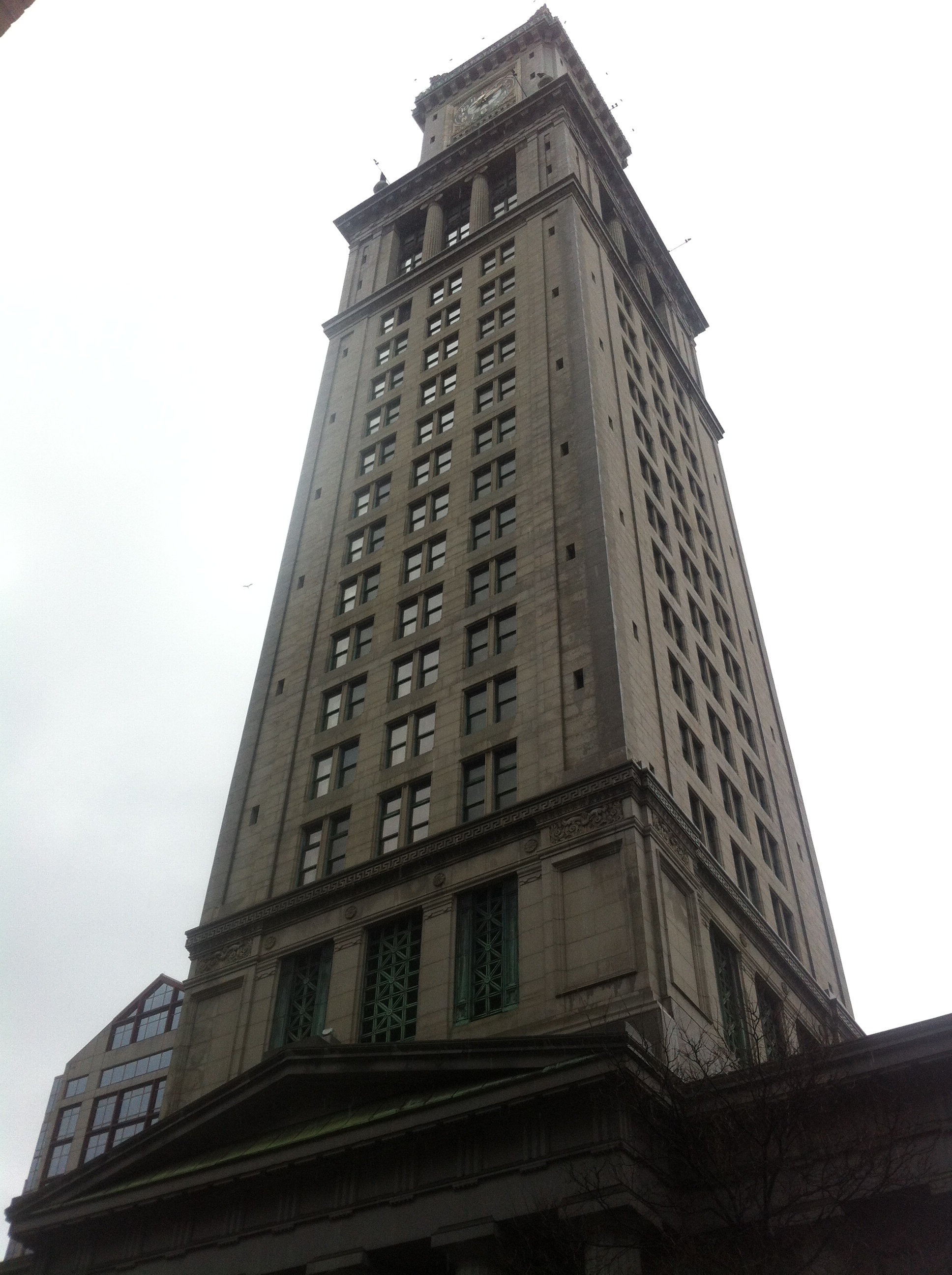 Figure 6: Marriott Timeshare Hotel (Taken by Jaguar Kristeller).
Tourism and historical preservation are intimately connected. A fantastic example is found at the US Custom House which once served as an important government building, and now serves as a temporary home for tourists. Rather than replacing old three-story red brick buildings with "for lease signs" in their windows to make room for a new hotel, Marriott renovated the US Custom House clock tower into a timeshare hotel. ]
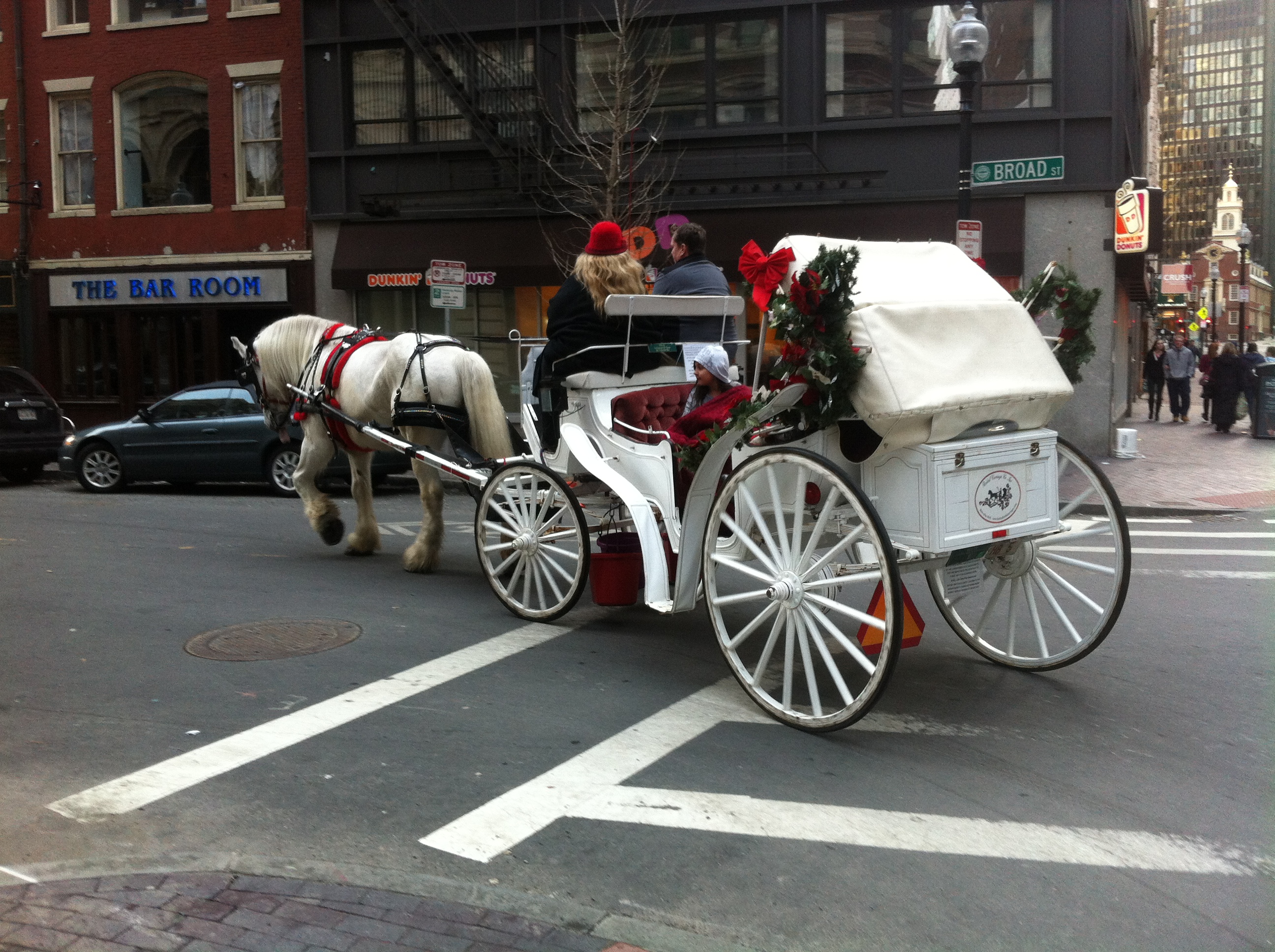 Figure 7: Tourists on a history tour in a horse drawn carriage turning onto Broad Street with the Old State House in the background (Taken by Jaguar Kristeller).
Tourism flourishes on State Street and around my site. Similar to the tour guides around Liberty Square Park, horse drawn carriages take tourists around State Street and Haymarket on a tour of old Boston (Figure 7). Since tourism is such a big industry around State Street, attractions and services are designed specifically for tourists. In a way, the influence of historical preservation has affected many attributes of the surrounding area, such as the type of advertisements.
BUSINESS EXPANSION
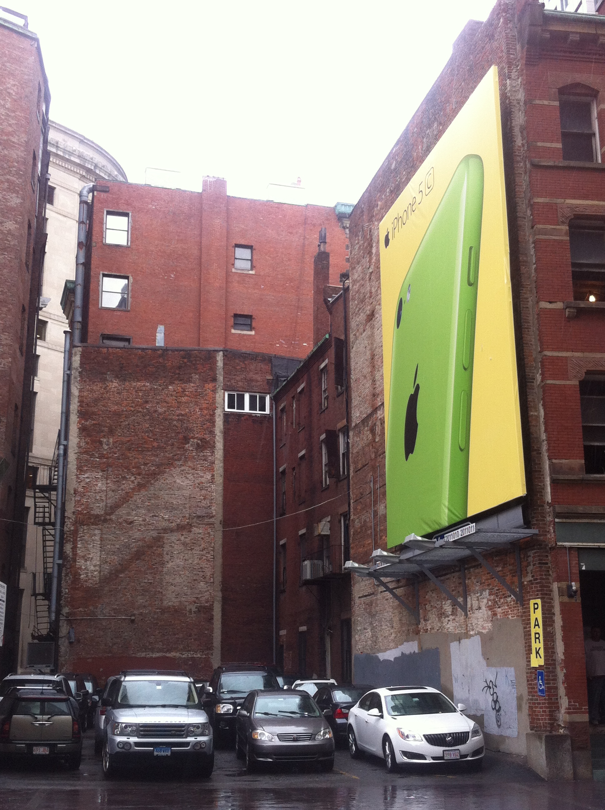 Figure 10: A quintessential picture of layers, traces, and trends around State Street. The iPhone on a billboard in front of a parking space with the traces of an old staircase imprinted on the building nearby depicts the trends of historical preservation and business expansion on my site (Taken by Jaguar Kristeller).
The iPhone billboard is a fantastic example of a layer. The advertisement medium itself is subject to the historical preservation influence and is confined to an older style of advertisement, the billboard, rather than the more contemporary form, flashy LED panels, found in Times Square. The advertisement itself speaks to the type of people who visit my site. Often wealthy tourists, white collar employees on their way to their offices in the nearby skyscrapers, or, more generally, people who could afford an iPhone, will walk past the billboard. The billboard hangs on the side of an old building with lease signs all over its windows. The parking lot next to the old building allows for a good opening that the iPhone advertisement utilizes. Compared to other densely populated American cities, Boston is an old city. Evidence such as the informational plaques, the Liberty Square Statue, and the Old State House supports Boston’s historical atmosphere. The iPhone billboard depicts the struggle and compromise between the ever growing financial district and the pressure to preserve historical artifacts.
The imprint of a staircase on the building adjacent to the billboard represents a trace of what might have stood before the parking lot was built. I imagine it was a similar old red brick building that wasn’t important enough to preserve and thus it succumbed to the increasing need for parking.
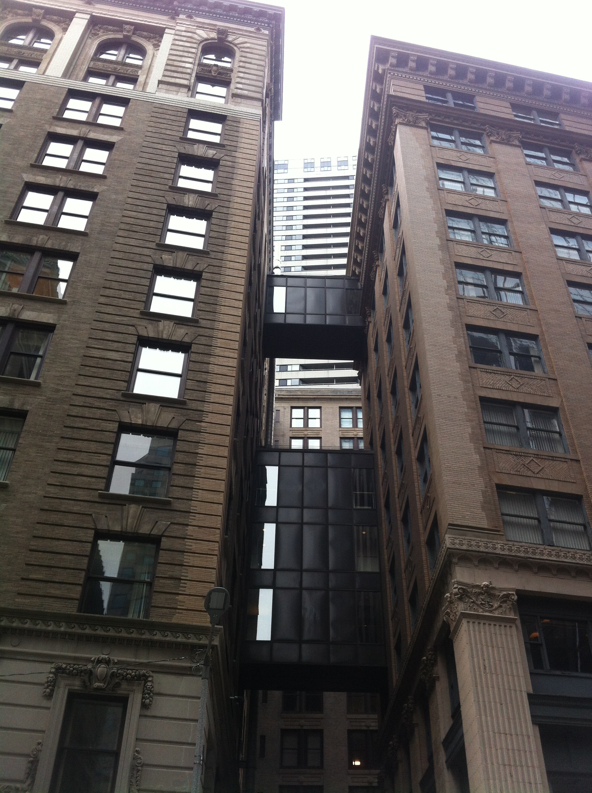 Figure 11: Old buildings connected by land bridges -- a solution to the preservation of historical exterior appearances and the expansion of business in the financial district (Taken by Jaguar Kristeller).
As businesses expand, they require more office space. In Figure 6, it appears that a company acquired both buildings and built land bridges between. This demonstrates a successful compromise between the competing historical preservation and office space expansion forces that shape my site. The inside might appear to be similar to a skyscraper, but the buildings still preserve the historical exterior facades.
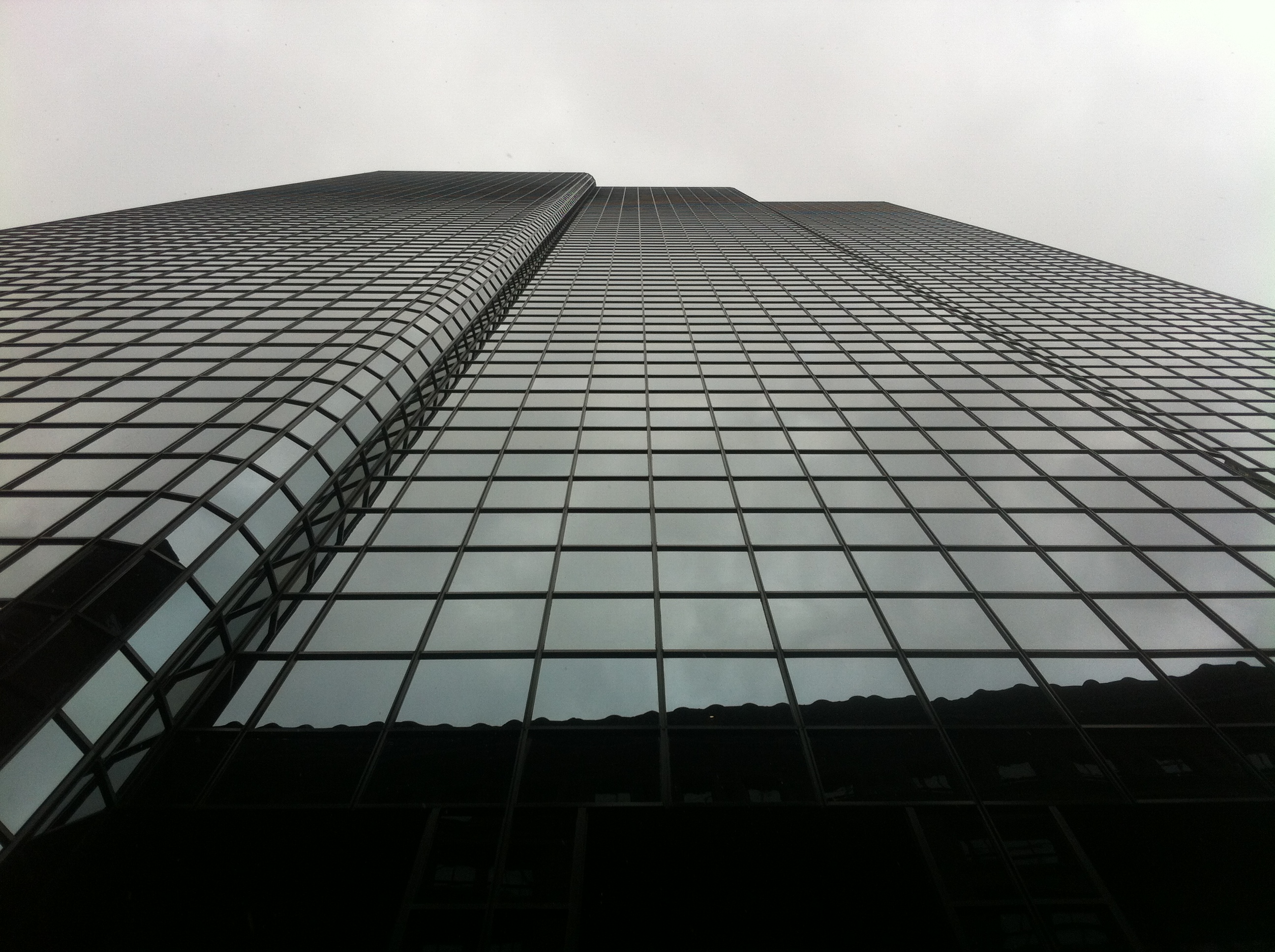 Figure 12: Merchant's Exchange Building transformed into a modern glass skyscraper (Taken by Jaguar Kristeller).
These efforts to preserve the exterior appearances only go so far. Sometimes skyscrapers are necessary. In the case of the Merchant's Exchange Building, the necessity for expanding office space led to a new glass skyscraper. As seen in the changes between maps from 1962 (Figure 13) and 1992 (Figure 14) a parking lot was turned into a submerged parking garage, and nearby offices were demolished. While excavating the old Central Street parking lot to prepare for 75 State Street's foundation, wood and artifacts from the old wharves, used for land fill, were dug up (Seasholes 2003). Ironically that old wood used to make the wharves that shaped State Street into a commercial hub for the American colonies was dug up to make way for a prestigious upgrade of one of the original commercial buildings.
 Figure 13: Image from Sanborn Fire Insurance Maps (1962). The red indicates commercial business and office spaces, the grey indicates parking space, and the blue indicates a institutional buildings. Full Source: Boston. Map. 1962. "Sanborn Fire Insurance Maps, 1929-Feb. 1951 vol. 1S, 1962, Sheet 40". Rotch Library.
 Figure 14: Image from Sanborn Fire Insurance Maps. Full Source: Boston. Map. 1992. "Sanborn Fire Insurance Maps, 1929-Feb. 1951 vol. 1S, 1992, Sheet 40". Rotch Library.
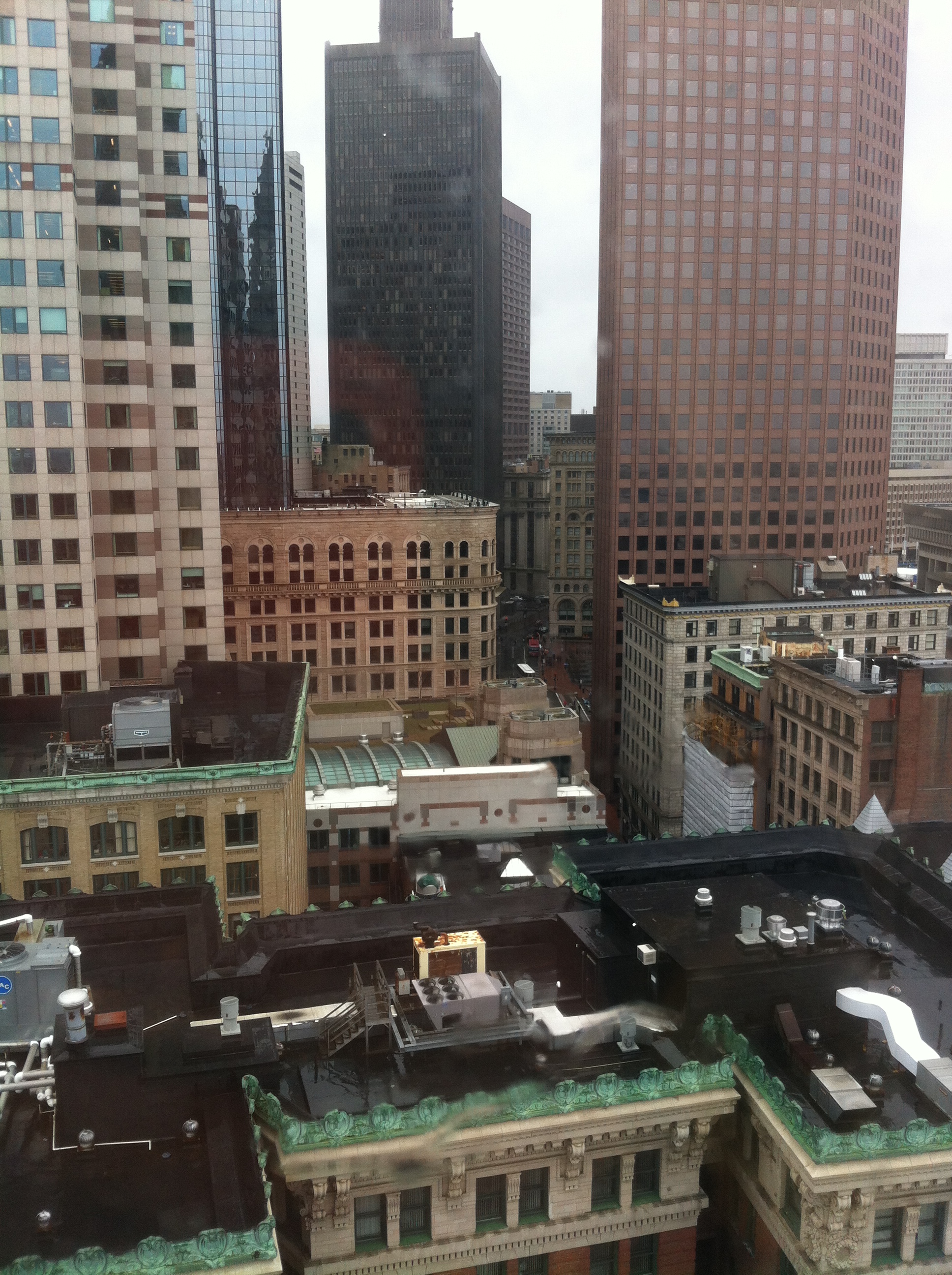 Figure 15: Building layers from the twelfth floor of the US Custom House clock tower (Taken by Jaguar Kristeller).
After walking around my site, taking pictures of layers, traces, and artifacts, and analyzing how past trends shaped State Street, I have a good sense for how State Street might develop in the future. Tourism and preservation of old buildings with historical importance play a huge role in the shaping of my site. I predict that these forces will continue to govern the state of buildings. State Street is a very mature part of Boston; its road network was laid at the beginning of the Boston settlement, and its land use has remained largely commercial. I expect that change will be slow, maybe the iPhone billboard building will turn into a skyscraper and the parking lot to a submerged garage, but overall I expect State Street to remain fairly unchanged in its mature state.
Boston. Map. 1885. "Sanborn Fire Insurance Maps, 1885-1888 vol. 1, 1885, Sheet 16a". Digital Sanborn Maps. Source
Boston. Map. 1962. "Sanborn Fire Insurance Maps, 1929-Feb. 1951 vol. 1S, 1962, Sheet 40". Rotch Library.
Boston. Map. 1992. "Sanborn Fire Insurance Maps, 1929-Feb. 1951 vol. 1S, 1992, Sheet 40". Rotch Library.
Hayden, Dolores. The Power of Place Cambridge, MA, 1995.
Jackson, Kenneth T. Crabgrass Fronteir: The Suburbanization of the United States. New York: Oxford University Press, 1985.
Sam Bass Warner, Jr. Mapping Boston. Cambridge: MIT Press, 1999.
Seasholes, Nancy S. Gaining Ground: A History of Landmaking in Boston. New York: MIT Press. 2003
Spirn, Anne. The Language of Landscape. New Haven, Connecticut. 1998.