Google Map of the Boston Harbor neighborhood
I walked around Boston for most of the day, looking for a place that made me notice it. I wasn’t just looking for the gorgeous churches and moss-covered bricks that get my mother excited. I was looking for Boston. And although I was not quite sure what that meant, I finally found my site in the Boston Harbor. In fact, as soon as I got out of the Blue Line at the Aquarium, I looked around and immediately knew that corner had everything I wanted. It really is an interesting corner - State St. and Atlantic Ave. Walk a little east and you are at the tip of the wharf that is the end of the “Walk to the Sea,” a path that goes through Boston and leads right to the piers. One block to the south is the Aquarium, an old wharf converted into a fabulous entertainment unit. And one block to the north is the lovely Christopher Columbus Park. This became my site - Atlantic Ave on one side and the Atlantic Ocean on the other. The Christopher Columbus Park above me and the Aquarium below. And alongside Atlantic Ave is a series of small, urban parks that set the site beautifully. Furthermore, there is so much history in the Boston Harbor, and I could already notice while walking around the difference between the older and newer buildings. I believe there is much to study here, and much to learn.
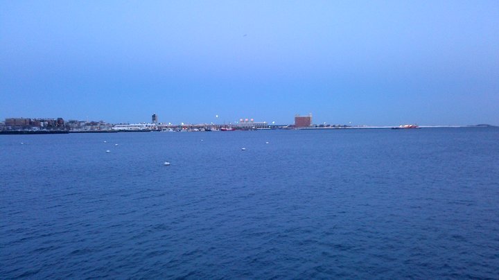 View of the harbor from the end of Long Wharf
I first walked to the edge of the wharf to take in the entire harbor. Its purpose is clear as soon as I lean over the rail. The harbor is extensive. Across the water, I can see a plane taking off from Logan Airport. To my right is the Boston World Trade Center. Behind me are offices and restaurants and people. The harbor is, in a way, the entrance to the city, even if it is different now than when the city was created. Although there are a few sailboats and small yachts spotting the harbor, one can visualize in their place the dozens of cargo ships and passenger ships bringing supplies and settlers to the New World and filling up the water. On my left is the Custom House Block. It’s an intimidating structure of grey brick or cement that looks like it may have been a warehouse in the past, but has now been converted into a couple restaurants and some office buildings. There is also a loading dock for the private boats that have been added over the years.
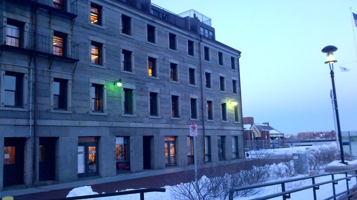 Custom House Block, located on the Long Wharf
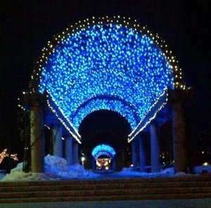 Christopher Columbus Waterfront Park, lit up at night
As mentioned before, one block north is the Christopher Columbus Park. It’s a sprawling lot with open grass and a beautiful canopy of lights lit above the walkway. When I finally got there, it was rather dark, so I could only see it from a nighttime perspective. But it was nice to see this area preserved as a park, almost as if it were protecting the Harbor. Instead of letting that prime real estate be sold to commercial buyers, the city government built a park that allows visitors to walk straight through and onto the wharf. I thought it was very charming. I had mentioned my interest in sustainable urban design in my last journal, which was one of the reasons I was attracted to the park. I did not find much additional information about how or why the park was built, but it did seem to be one of those cases of the city being designed with nature in mind, as was mentioned in The Granite Garden. While the park itself was not necessarily natural - it was very pristine and kempt and was obviously a man-made structure - it gave me the sense of preserving the natural history of the city - the large tracts of land and the harbor that welcomed life and trade into the city.
I did not notice too many anomalies in the design of these blocks, other than the harbor itself. As you walk to the waterfront, the buildings start to thin out, more patches of grass appear, and finally you are at the wharf itself. But it seemed very appropriate that one of the oldest parts of Boston had not changed significantly in its design over the years.
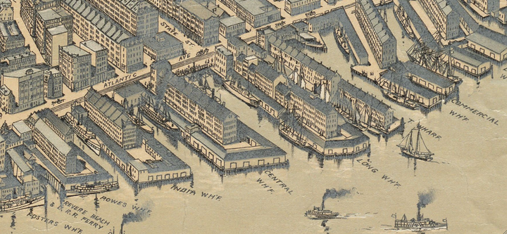 Detail Map of Boston Harbor from 1899
1. “Boston Harbor, MA” Map. Google Maps. Google, 17 February 2014. Web. 17 February 2014
2. Clay, Grady. Close-up, how to read the American city. Chicago: University of Chicago Press, 1980. Print.
3. Spirn, Anne. The granite garden. . . New York City, NY:Basic books. 1984, . Print.
4. Wikipedia. "Atlantic Avenue (Boston)." Wikipedia. Wikimedia Foundation, 02 Oct. 2014. Web. 21 Feb. 2014.