Introduction
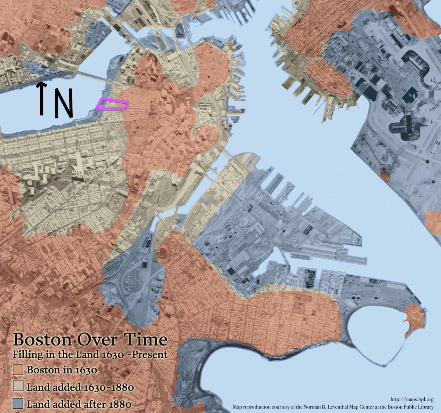
In the last three centuries, the area between Louisburg Square and Storrow Drive has undergone a significant topographical and natural change due to the massive settling of the Shawmut Peninsula. As the main driving force, the filling of the Charles River shore in the vicinity of my site has shaped its urban development since the late nineteenth century. This phenomenon has led to the formation of several other natural processes like the change of its topography, the development of a particular urban biome, and the patterns present in street structure and pavement composition. In a more general sense, the filling of the Charles River and the settling processes that followed modified my site completely by transforming a rural pasture into a residential and commercial area.
Environmental History
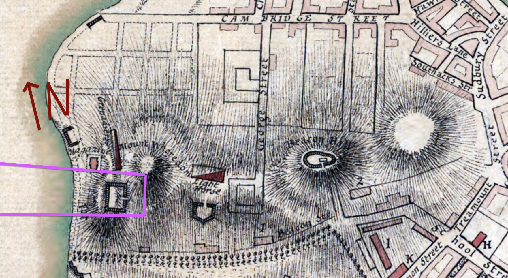
Originally, the area that comprises my site was significantly different to that neighborhood of Greek revival houses in the skirt of a small hill that we see today. As seen in Figure 2, back in the eighteenth century the area had three hills (Beacon Hill, Mount Vernon, and Pemberton Hill), known as the Tri Mountain. As described by Anne W. Spirn in The Granite Garden, the land around Louisburg Square (Mt. Vernon area) was “at the time mainly upland pasture; [but] four years later […] they not only made level building sites on the hill, but also converted tidal flats at the base to new land”(Spirn, page 18). The contrast between the “upland pastures” and the dense residential area present nowadays reflects the series of both natural and human processes that have shaped Beacon Hill. Thus, my site isn’t the result of a natural formation, but instead of a sequence of alterations that the settlers of the Shawmut Peninsula made to this environment.
This sequence of alterations in the Tri Mountain leads to a significant change in the topographical and hydrological composition of my site. Changing the nature of the area from a rural pasture to a residential block challenges the adaptability of different trees and wildlife species to this new urban biome. Also, this process provokes a rather soft and unreliable foundation prone to earthquakes, as well as having saturated soil and fluctuating water level (Spirn, page 19). This might explain that most of the residences built in the area of Beacon Hill (and most of the Back Bay) are between three and five stories high, compared to the skyscrapers seen in downtown Boston.
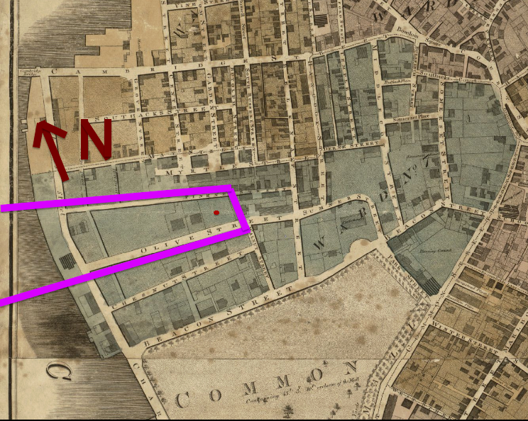
The continued landfilling process in the location of my site leads to a simultaneous development of urban patterns: streets, absence of extensive green areas, residential blocks, and commerce. As seen in Figure 3, by 1814 there where several streets and residential blocks in the area, including Charles Street bordering the river. This maps hints several important aspects of the development of Beacon Hill as it is today. For example, one can notice that Charles Street rapidly developed as a commercial and highly transited street due to the fact it was bordering the river. Also, the geometry of the streets arranges around the hill, forming a triangular shape in the area of my site, compared to the uniform and rectangular fashion of the residential blocks around Cambridge Street. Also, the block where today sits Louisburg Square was defined already (marked in the map by the red circle), suggesting the possible planning of this block as a potential green area suggests the early environmental concerns, and the efforts to counteract the negative effects of this urban process that affected the natural composition of the Tri Mountain.
Topography and Land
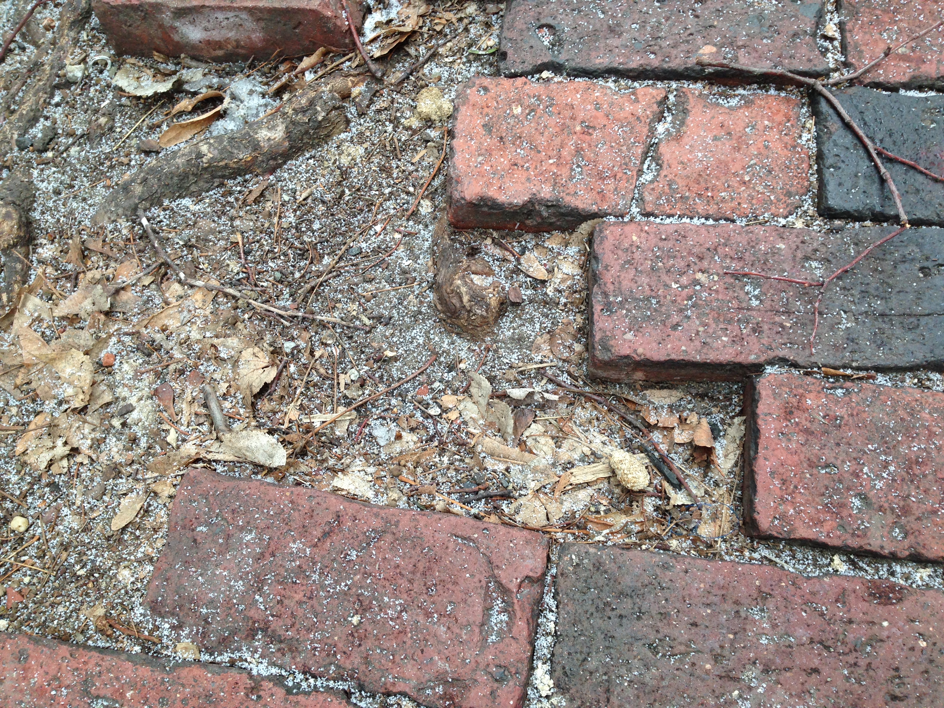
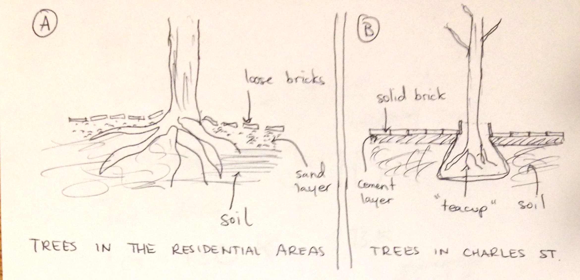
While walking around my site, from Storrow Drive and up the hill until reaching Louisburg Square, I wondered: how stable is this land after all the movement it has faced? To name a few: the cutting off the hill, the filling of the river, the paving of the roads, or the construction of houses and commercial stores. Looking at the sidewalks, their firmness and solid foundation differed depending on the part of the site. As one could expect, the area between Storrow Drive and Charles Street has a soft and volatile foundation, since most of it is filled land. As seen in Figure 4, the bricks are molded into a sand bed rather than being held together with mortar and concrete, resulting in a structure that is easily disturbed by heavy construction of buildings, or even the roots of growing trees. Besides that, the geological instability of this filled land leads to notable ripples in the sidewalks. These shapes that the sidewalks take due to the stresses exerted by trees or buildings lead to settling of water in particular spots, which further alters the form of these (Figure 5). The settling of water in the left of this picture also leads to potential pollution from cars, accumulation of salt and other particles carried by winds. As a result of this, nature’s forces and processes are able to endure in this urban environment, as we see continuous settling paths and trees fighting their way through the sidewalks and streets.
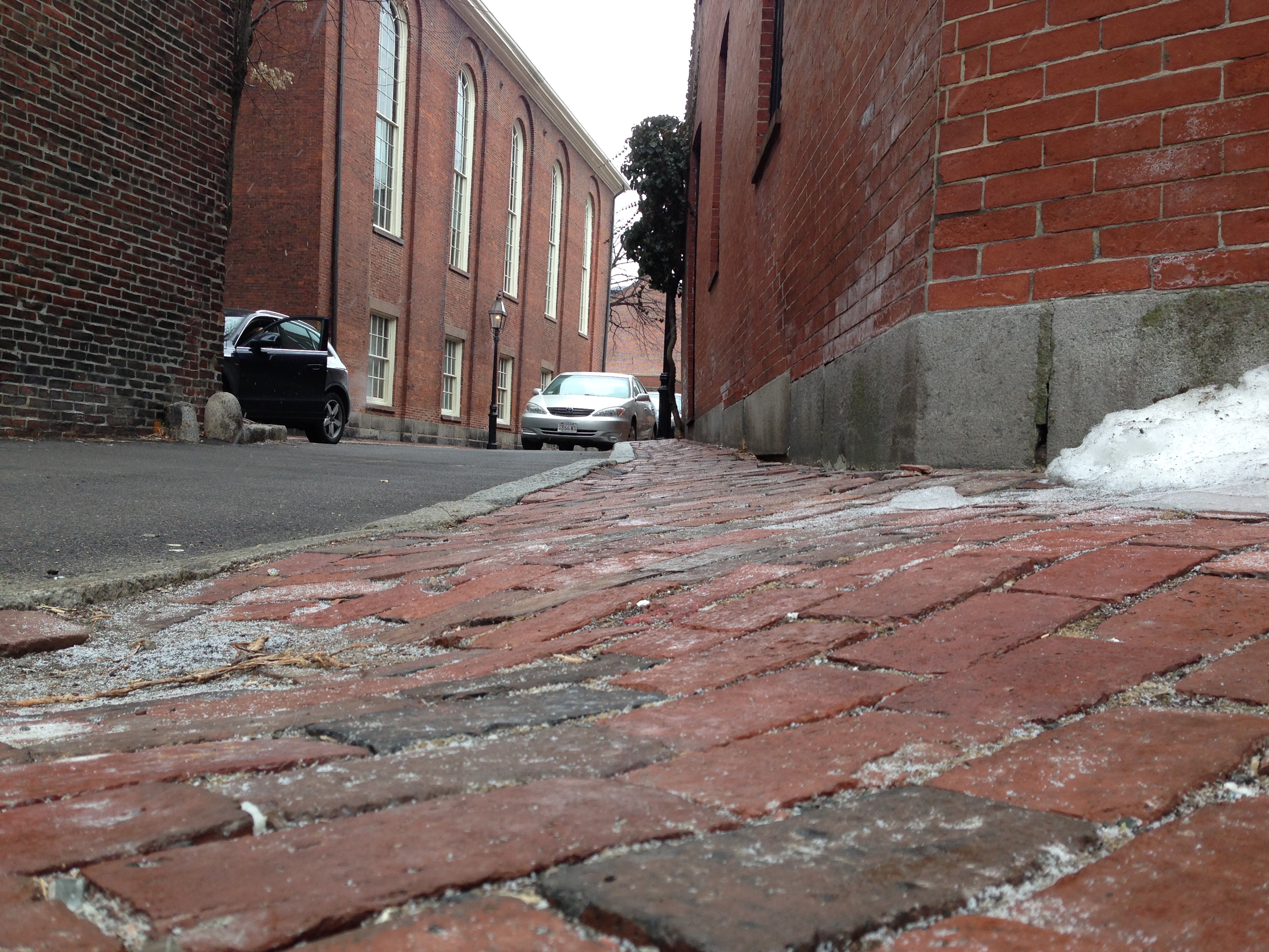 Figure 5: The settling of water in the sidewalk leads to a change in its shape, as well
 as accumulation of particles from salt, pollution, and dust.
On the other hand, Charles Street displays an aggressive environment due to the density of paved areas, heavy traffic transit, and intense heat. Here, the bricks in the sidewalks are sealed with mortar and trees are planted in a confined box bordering the street. As seen in Figure 6, bricks are arranged in a solid and strong foundation, unlike those described in the previous paragraph. This configuration of dense pavement complicates the environment in which the trees have to grow. As Spirn mentions in The Granite Garden, “streets could be designed to provide tree roots with the space, air, and water that they require. Instead, current practice aggravates already hostile conditions" (Spirn, page 176). These hostile conditions evolved after Charles Street became a densely paved commercial street, leading to change of soil composition and an increase in pollution and heat. All these forces augment the poor state of the trees along the sidewalk, shaping the natural development of the area. Unlike the residential areas of to the East and West of my site, where trees are subject to less hostile conditions, Charles Street displays a completely different urban biome due to the conditions it imposes to the emerging natural processes.
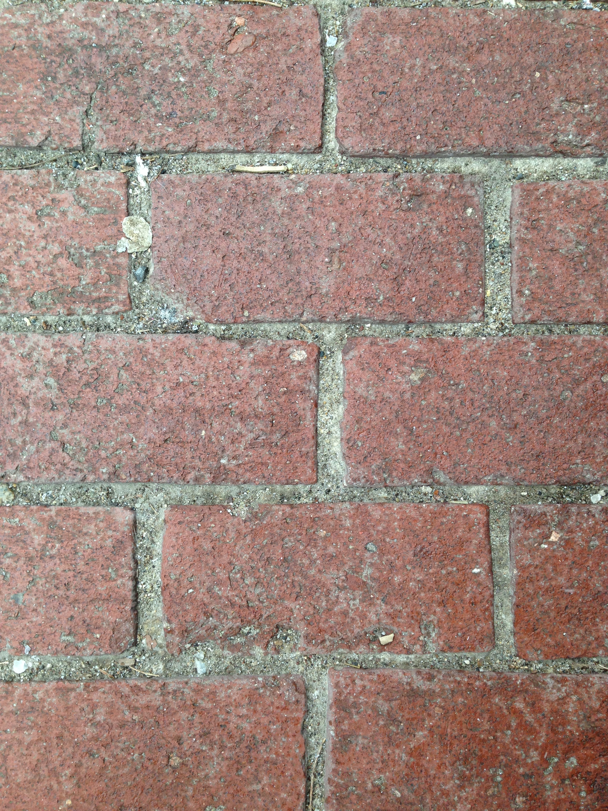 Figure 6: The topographic foundation in Charles Street is sound and
 solid, having bricks sealed with mortar, without much perturbation
caused by the trees’ roots.
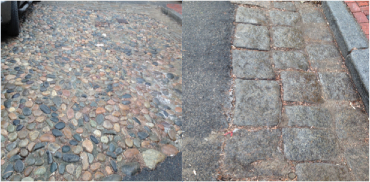
Finally, the area between Charles Street and Louisburg Square (the hill part) offers the most diverse topographic characteristics of my entire site. Once again, bricks are arranged in a sand foundation rather than being sealed with mortar and concrete. However, the most captivating part of this area was the floor composition around Louisburg Square. Surrounding it, the roads are built with spherical rocks in the side adjacent to the square, and a bed of flat slabs of rock in the edge where water usually settles (see Figure 7). In The Granite Garden Spirn describes the Dutch woonerf as a similar phenomenon: “the woonerf enhances the social role of the residential street. [It] is a precinct with its own traffic rules” (Spirn, page 69). Even though this area has a different traffic structure (there is a clear division between the sidewalk and street), it’s plausible that it was built to prioritize pedestrian traffic, and the presence of the spherical rocks give an implicit signal of entering a residential area. On the other hand, taking into account Louisburg Square is located in a hill, its possible that the rocks are employed to give the area more topographical soundness, and as well give the roots of the trees in the square more oxygen. As Spirn argues, “pavement waterproofs the ground surface and permits neither air nor water to reach tree roots below” (Spirn, page 176). The presence of these rocks also improves the hydrology of the Louisburg Square by avoiding settling patterns of water in the pavement. Due to the banking of the road, the water is accumulated in the rectangular rocks, which have a better response to settling. With this, we can look at the Louisburg Square as an urban biome and understand how each component shapes this environment. The rocks, pavement, and topographic composition contribute towards having a unique environment at the square. On the other hand, Charles Street and the West part of my site display different natural processes and as a result, develop different urban biomes. In this next section, we will look at how the land and topography further shapes the growth of trees in my site.
Trees
In the area of Beacon Hill I am exploring, trees are the main source of insight to understand how the ongoing natural processes behave in this specific urban environment. Described in previous sections, the both maps and topography give us hints of how the site has developed over time and how it has structured to accommodate said development. Trees are the protagonists of these processes, as they endure the forces exerted by human entities, and protect the development of nature in the area. In my site, trees have different behavior, state, and profile in different areas, as they are subject to different forces and processes that shape their development. Particularly, we see two emerging patterns relating tree growth: the trees in Charles Street and the trees in the residential areas to the East and West of my site.
In the residential blocks, trees have more freedom to grow since the pavement density is lower, allowing water and air to reach the roots. As a result, we can see big and healthy trees sprout around these blocks. Trees along the sidewalks are not confined to little soil space nor endure great stress from traffic or buildings. Shown in Figure 8, said tree is able to overpower the bricks in the sidewalk, and grow without any impeding force. As seen in this picture, instead of the pavement shaping the growth of the tree, the tree is the one who shapes the form of the sidewalk, and we can observe how there is a wreck in the sidewalk that coincides with the underground extension of the roots. Furthermore, the growth of this tree is enhanced by the privileged access to sunlight. As we see, it receives direct light even at sunset (moment when the picture was taken), taking advantage of not having high buildings around it.
On the other hand, the trees along the sidewalks of Charles Street face a different set of human-driven forces and stresses. Here, the trees suffer what is described by Spirn as the “teacup syndrome” (Spirn, page 192), due to their confinement to a compacted space of soil covered by pavement. In Figure 9 we can see the contrasting settings in which the trees in Charles Street and the residential areas grow, leading to not only a permanent effect in their growth but also the environment of the area, as the absence of trees enhances pollution density and heat intensity. As Spirn explains it, “the Norway maples on Charles Street in Boston’s Beacon Hill, normally very large forest trees, are more than ten years old, despite their small size and open form. […] In a hostile environment like Charles Street, these trees persist as dwarves until they die” (Spirn, page 177). Here, we can draw an important observation made by Spirn: the trees’ adaptability to the urban environment. In this case, the Norway maples are shaped by the urban setting, and as a result become feeble plants in an aggressive territory subject to traffic, pollution, and heat. However, one cannot simply conclude that this type of tree cannot endure an urban setting, since we see the same species along Mount Vernon Street almost twice as taller and healthier. Walking around the intersection between Charles Street and Mount Vernon Streets you can notice two of these trees within fifty feet, in almost identical environments (see Figure 10). Even though these receive the same amount of light, are exposed to similar pollution, traffic, and heat, the respective soil foundations in which they stand are very different (see Figure 9). Therefore, trees adapt to the environment where they have to dwell in, and their eventual shape reflects the conditions of this environment. For this reason, trees are the best indicator of natural processes in a specific area: they are the symbol of the duality between nature’s forces and human’s forces.
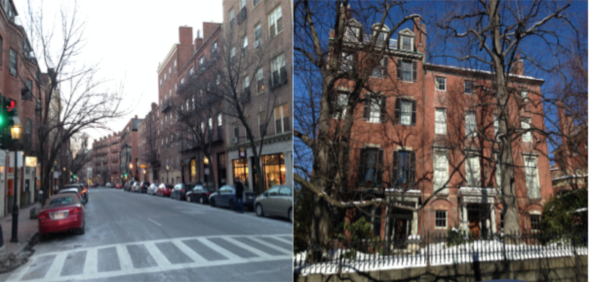
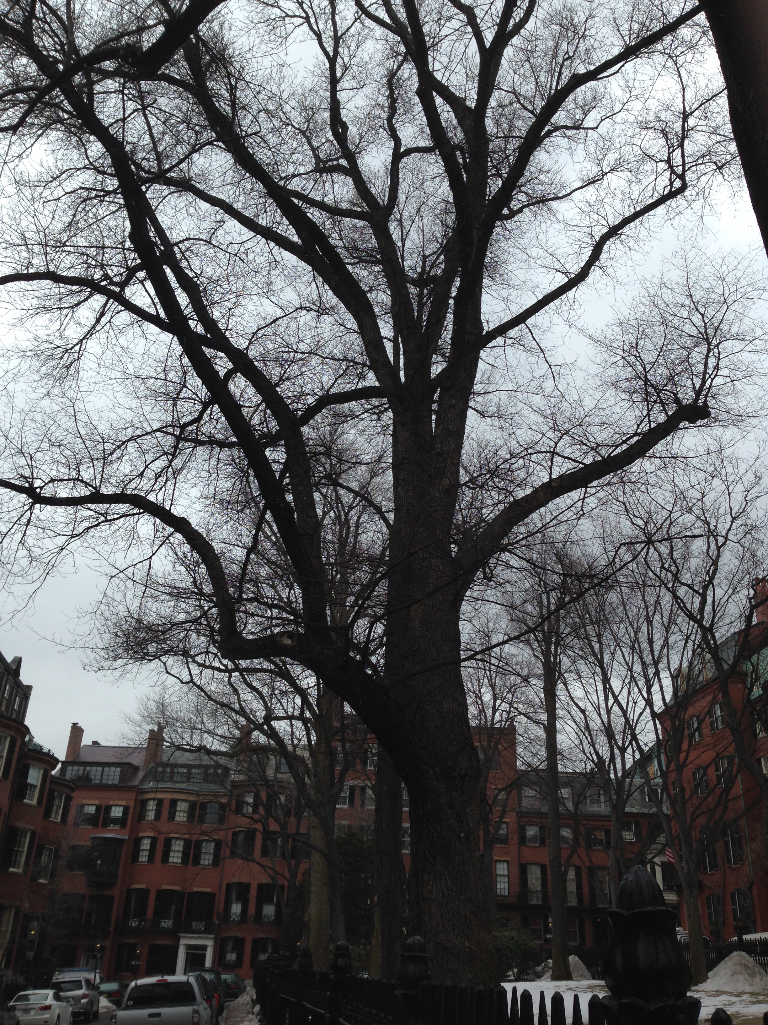 Figure 11: Picture of the trees in Louisburg Square. By being clustered
 into a single area, these trees form a microclimate by buffering
direct sunlight and establishing a refreshing and
cool residential environment.
However, this previous analysis only discusses trees that are shaped by their environment, usually spread uniformly along a street. In the case of Louisburg Square, we see how the tree-dense square shapes the ecosystem, having nature as the main force in the processes happening in this area. Spirn explains that planting trees in clusters aids growth, and also enhances the environmental setting of the surroundings. In Louisburg Square, the cluster of trees leads to the creation of a unique microclimate. Similar to the case of Paley Park described by Spirn, Louisburg Square’s tall trees serve as heat buffers without making the area completely dark. The high canopies of the trees make the square have comfortable shadow, as well as enhancing heat loss by blocking direct sunlight. Also, Louisburg Square’s trees are the perfectly straight (Figure 11), compared to trees in the sidewalks that are usually slanted, suggesting they don’t need to struggle to find light. With this, Louisburg Square develops a particular microclimate where natural and human processes complement each other: while nature provides a comfortable residential environment, the structure of this residential square nurtures the conditions for tree growth. Unlike city plazas, described by Spirn as “roof gardens, built over subways or underground office space and parking garages” (Spirn, 194), Louisburg Square rests on a hill, completely isolated from these burdens. Thus, the presence of this tree cluster in the middle of Beacon Hill swathes this residential area under a fresh microclimate, contrasting the polluted and heat-dense conditions of neighboring downtown areas.
Conclusion
Diverging natural processes emerge in the area of Beacon Hill due to the considerable topographical changes and human alteration that it has suffered. Looking at a map of Boston today, one can see the dichotomy between the three different areas that compose my site: the area of the hill (between Charles Street and Louisburg Square), the area between Storrow Drive and Charles Street, and Charles Street itself. By analyzing these patterns, we can conclude that this area of Beacon Hill has experienced a notable clash of human driven forces and natural processes. This suggests that cities shape as a result of a series of natural processes that evolve through these clashes, after human settlement and modification of a natural environment challenges the adaptability of this wildlife into a new urban biome. At Beacon Hill and Boston in general, several new urban biomes developed in the duality of designing an area where nature is constantly challenged. To change this paradigm, the area has to adapt to its natural environment, just how Louisburg Square is.
References
Spirn, Anne W. The Granite Garden: Urban Nature and Human Design. New York, NY: Basic Books, 1984.