Walking from the T-Station at Charles/MGH in the Red Line, towards Louisburg Square feels like travelling from the late twentieth century to the mid nineteenth century in just a couple of blocks. I had the chance to know of this place last year with my fraternity, whose previous chapter house was located in the heart of Louisburg Square. The dichotomy marked by Charles Street, separating the old Boston from the new Boston impacted me, and crossing that street along Mt. Vernon street felt like going back a whole century.
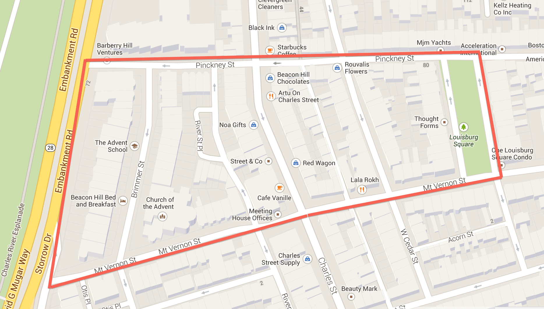
As I walked around Beacon Hill, between Cambridge St. and Boston Commons, the boundaries didn’t feel obvious at all. I wanted my site to represent my initial feelings walking towards Louisburg Square: like peeling an orange, where every street up the hill was like unraveling a new layer of history. Thus, I decided to make Charles Street the middle of my site, marking the division between the hill and the flat area. As a result of this, my site starts in the border of Storrow Drive and extends between Pinckney and Vernon Streets until reaching Louisburg Square.

Starting from Storrow Drive and walking up the hill through Mt. Vernon St. the loud traffic becomes quiet peace just within six blocks. Even though brick is still predominant in both the houses and sidewalks, the architecture feels modern in this west side of Charles St., or what is know as the “Flat of the Hill.” However, as soon as I cross Charles St., there is a break. As Clay describes, “it occurs usually where one gridiron of streets laid across flat land encounters a steep hill or a valley” [1]. Even though the geometry of the streets remains very similar, the symmetry and harmony of the house facades in the hill incite a different feeling. Also, by looking at the map, the street geometry portrays a trapezoidal shape, and the blocks progressively become smaller as we walk closer to Louisburg Square.
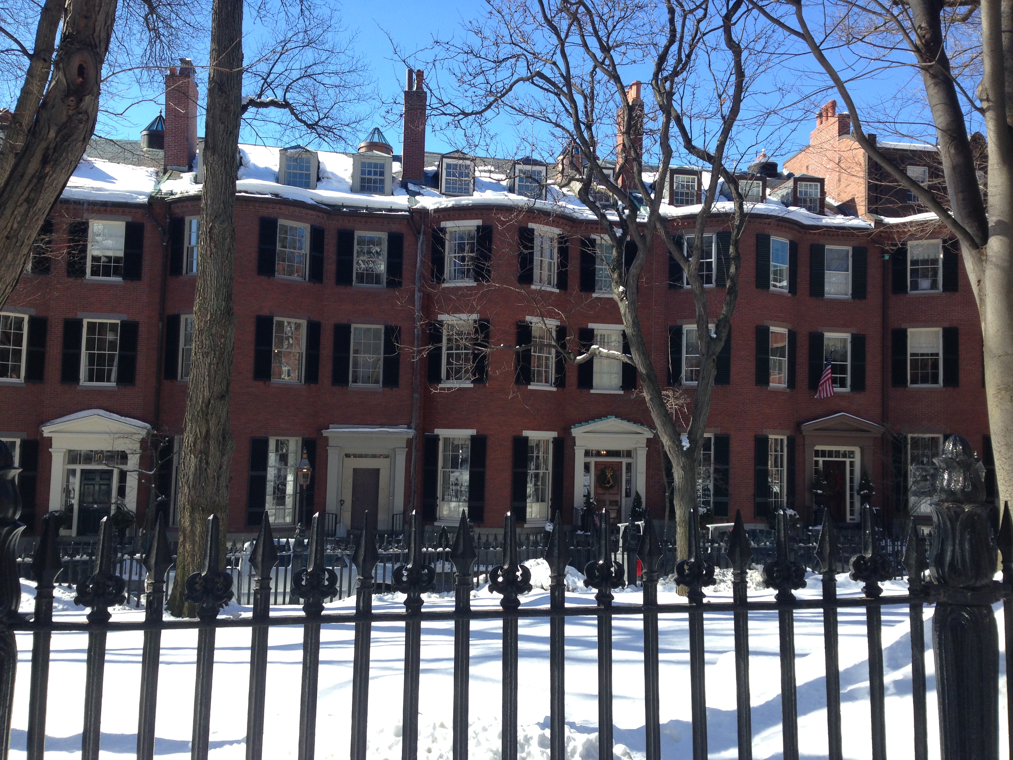
 FIgure 2: The symmetry and patterns of houses around Louisburg Square.
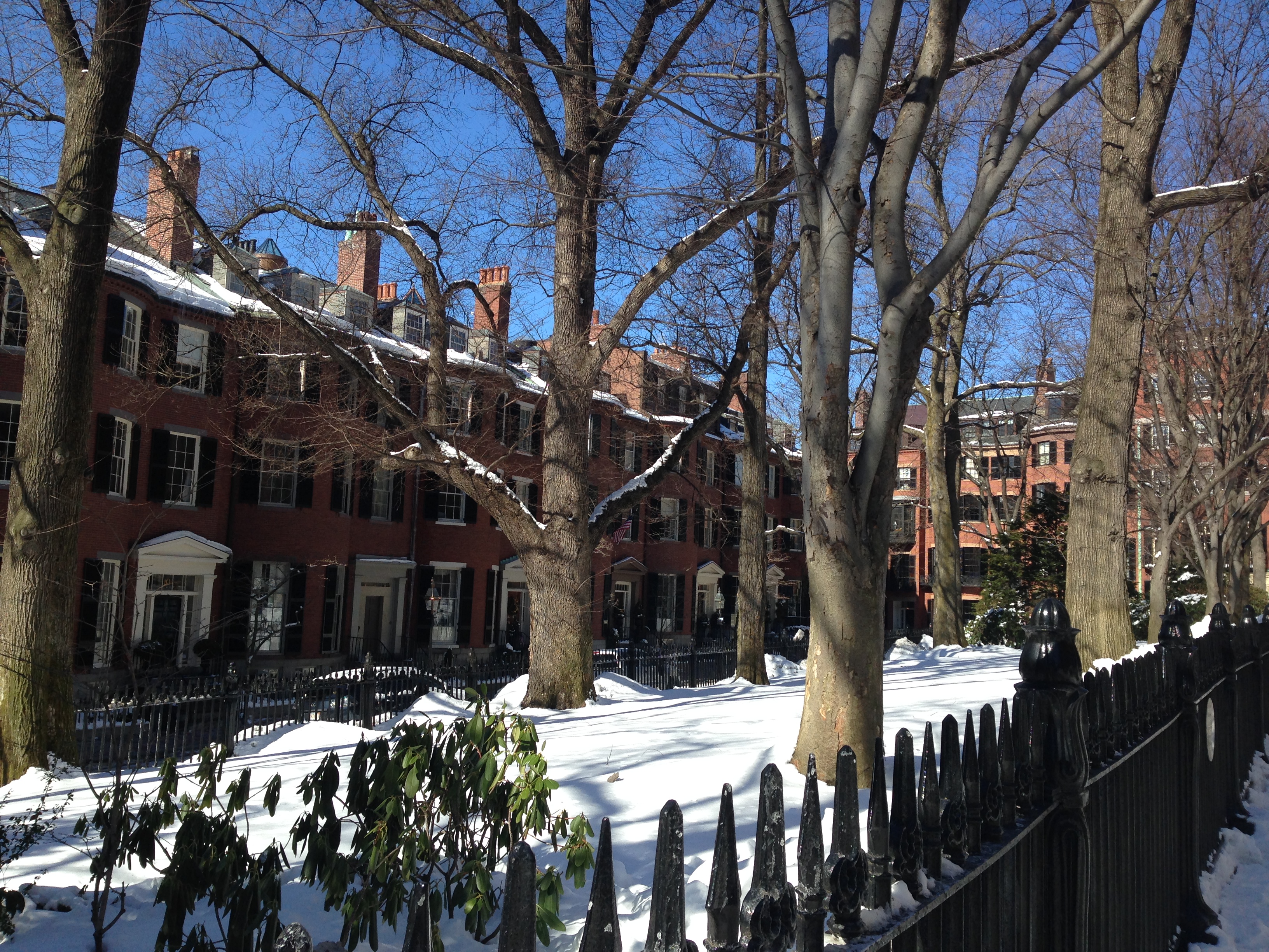
 At the end of my site, Louisburg Square epitomizes the heart of this historic bubble between Mt. Vernon St. and Pinckney St. Coming back here a year later, I still feel touched by the peace this area has even though its only a couple of blocks away from commercial streets like Charles St., Beacon St. or Cambridge St. Also, the presence of the square changes the pattern present throughout the blocks between Vernon and Pinckney. Sitting down in the middle of the square and looking around, as seen in Figure 2, I saw completely symmetrical facades, without any sound of traffic, or any visible skyscrapers. To me, it looks like an epitome district, as defined by Grady Clay as a place that carries “huge layer[s] of symbols that have capacity to pack up emotions, energy, or history into a small place”[1].It felt like being taken back 150 years ago.
As I walked back home, coming back to the rapid pace, noise, and congestion of twenty-first-century Boston, several questions came to mind: why is there a completely commercial street like Charles St. in the middle of two historical and residential neighborhoods? How did the filling of water lands in the Back Bay and cutting of Beacon Hill affect the shape and geometry that this area has nowadays? Looking forward, I hope my future analyses and visits to this site help me understand all of these details about its development, and connect the dots between its architectural and urban features with Boston’s history. Because, I still find it fascinating to see a bubble of history in the middle of tall skyscrapers, commercial areas, highways, and train tracks.
References
[1] Clay, Grady. Close-Up: How To Read An American City. Chicago, IL: University of Chicago Press, 1980