| TOPOGRAPHY |
|
| The topography of Philadelphia tells the story of natural pocesses that have acted on the land over thousands of years. Rivers have worn down the underlying schist and carved gentle river valleys. The flow of water over this time has carried sediments into the river valley, making them rich and fertile. Now the Schuylkill River and other tributaries in the region have wide floodplains that absorb rising water levels. |
|
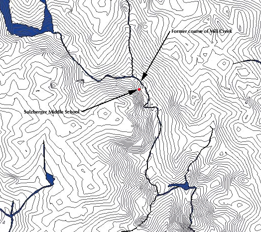
| The stream of
Mill Creek used to be a topographical microcosm of the entire Schuylkill River
valley. Gradual slopes led down to the stream which sat in a shallow valley, or
plain. In the map above, notice how the slope on the west side of Mill Creek rose
much more steeply than the eastern slope. This indicates that the floodplain was
located primarily on the eastern shore of the stream. Low places and valleys in West Philadelphia still collect water, even though there are no longer streams to carry that water away. Some surface runoff does not reach the intended storm drains and runs downhill to the low points. Other precipitation that does seep into the ground may also migrate downhill, towards the point where it once would have recharged Mill Creek. Since Mill Creek is now encased in a sewer, it cannot absorb any of the groundwater in the soil like it once did. Therefore, these soils become waterlogged, and flood streets and basements. This raising watertable also encourages soil expansion and subsidence, making greater problems for the residents of West Philadelphia. |
|
|
REFERENCES
|