 |
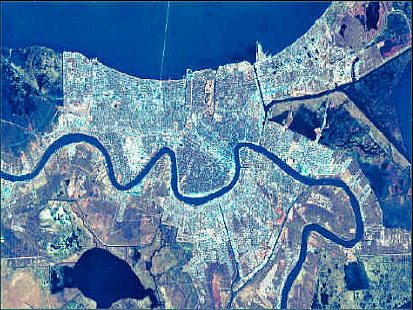
Can We Protect New Orleans?Team 4: Hurricane and Flood Protection |
LeveesThe Current Levee System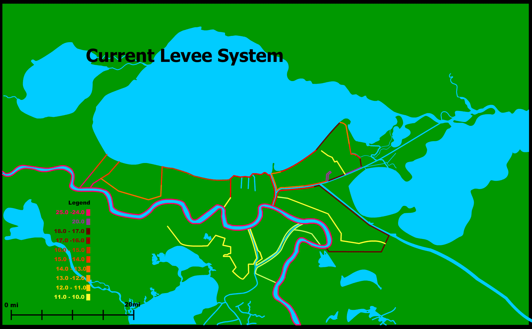
Our New Levee System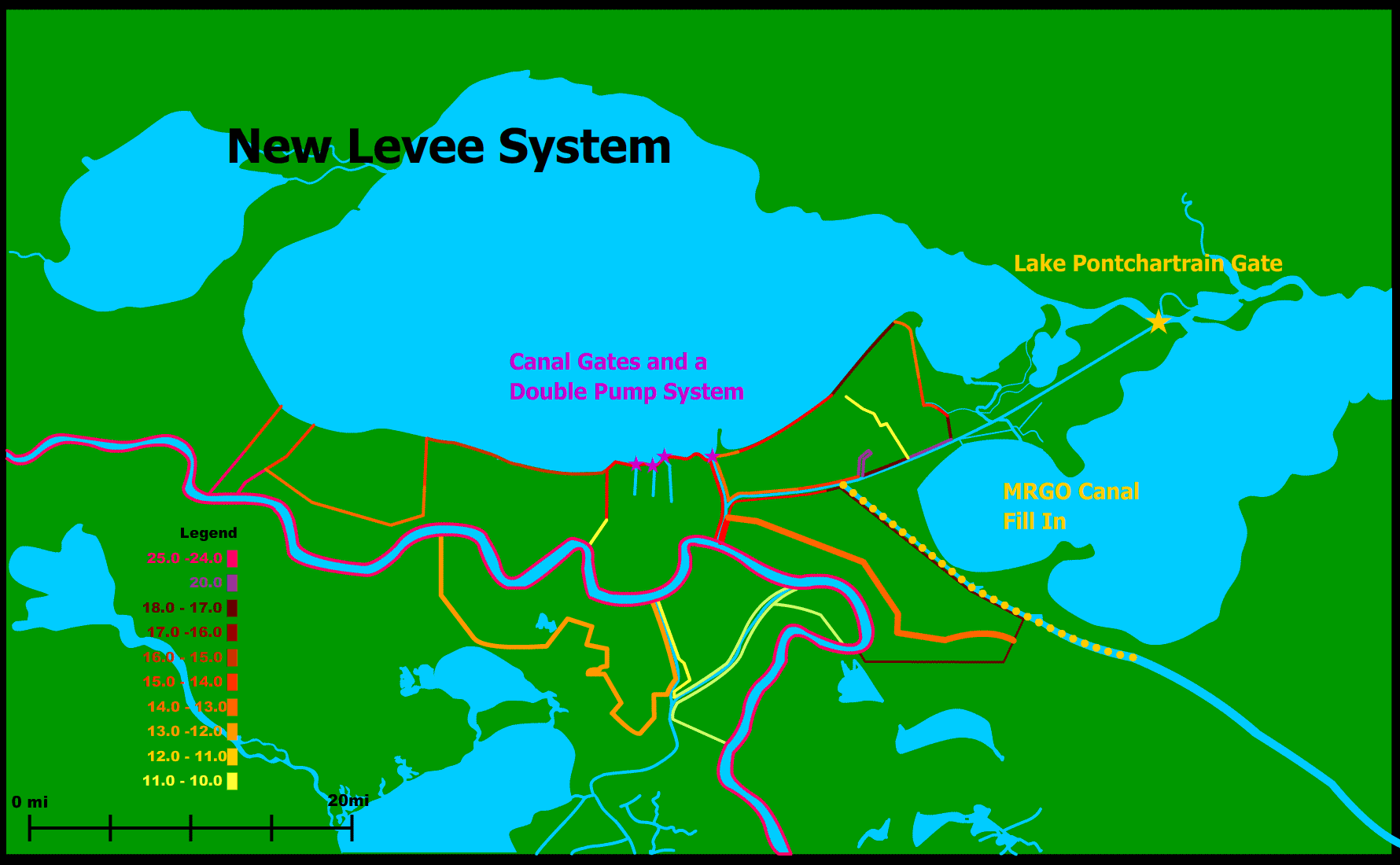
Levee Maps based off of USACE Maps and graphics from the Washington Post GIS DataGIS Data from the US Geological Survey If you would like to download these GIS Maps please click here Digital Elevation Models for New Orleans and the Vicinity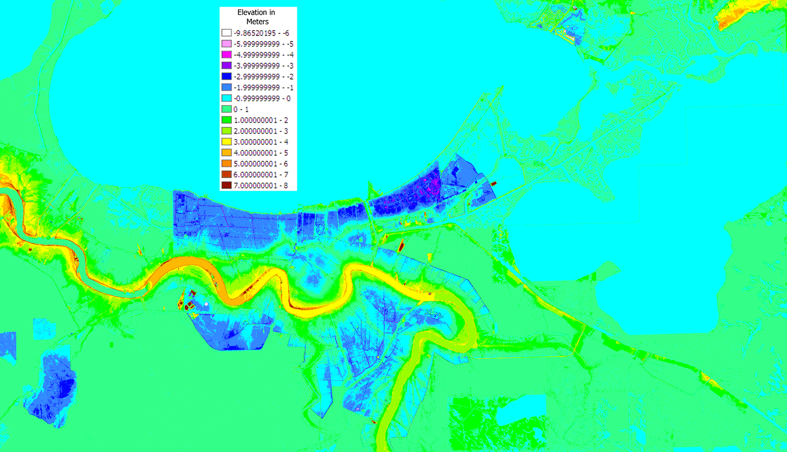
Land Use Maps for New Orleans and the Vicinity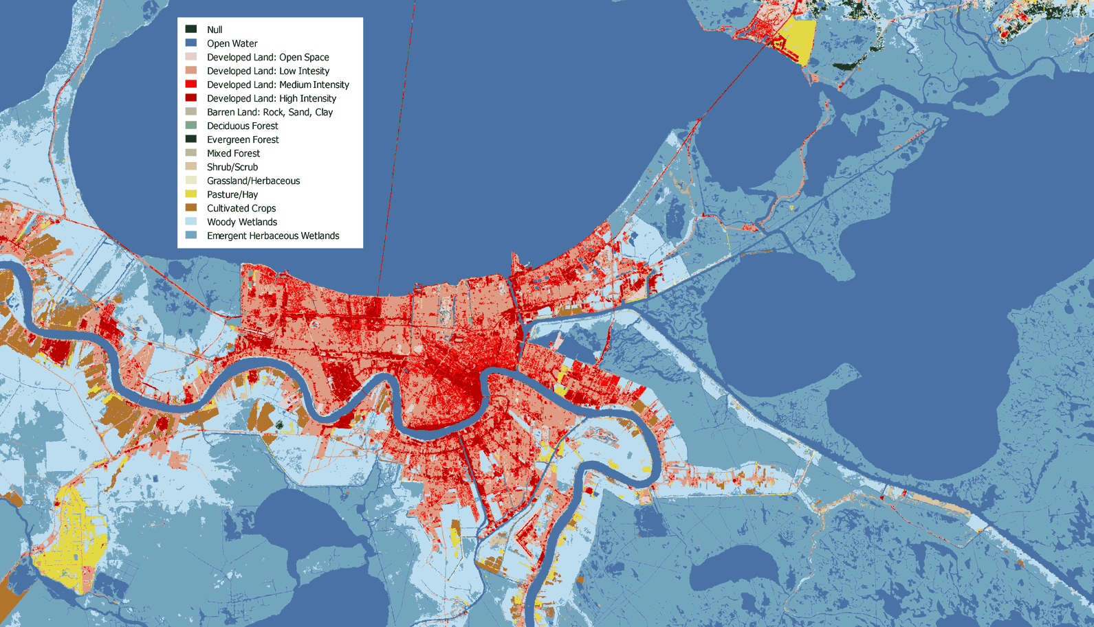 |
|---|