| STEP I
|
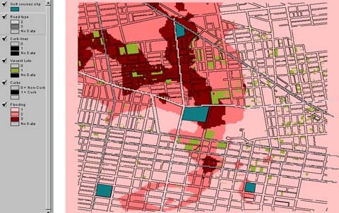 Choose road-type, vacant lots, and flooding to be my
major data bases.
Choose road-type, vacant lots, and flooding to be my
major data bases.
|
|
| STEP II
|
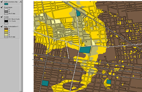
Use map calculation to image the situation when vacant lots
and flooding overlap together and get some spots which are heavy flooded
lots.
|
|
| STEP III
|
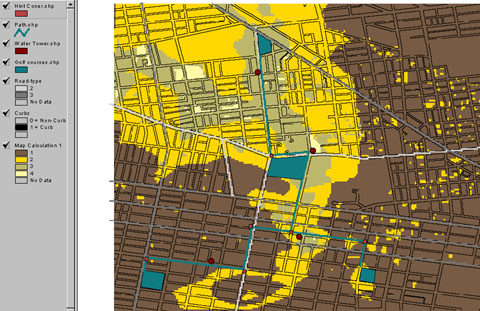
Locate water watchtowers on those spots and draw paths among
golf courses along main raods.
Locate hint corners to give people some hints which indicate
where they should look toward and follow it to go to towers.
|
|
| |
| BACK | |
|