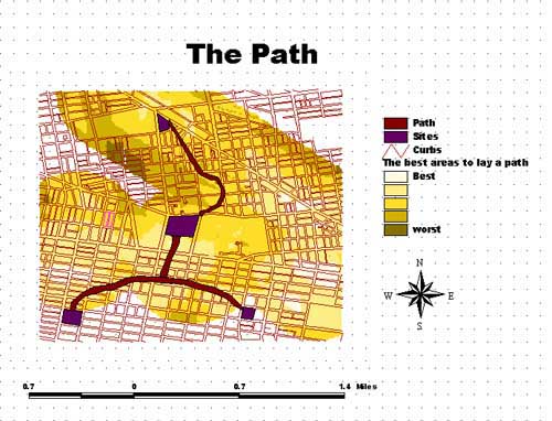
The unified general character of the paths should reflect the essence
of the golf game. It should have a sequence of focal points to attract the
public from one part to another, and to break the monotony of the path.
They should be expressive of the general characters of the path with some
level variety within each one of them, to enhance the since of unity. The
path is to be defined by introducing new street furniture that expresses
the points of interest nature, the golf courses, along its course.
The construction materials are to be very tolerant to al types of vandalism.Street
furniture can be used to highlight the character of the path we seek. Items
like; pre-caste medallions fitted into the existing paths with golf-related
patterns, light posts, planters, benches, trash receptacles, etc.
The character of the path should gradually express the theme of the golf
courses as they are approached. That will enhance the theme expression of
the golf course itself.
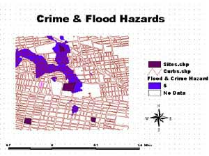
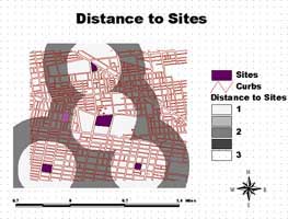
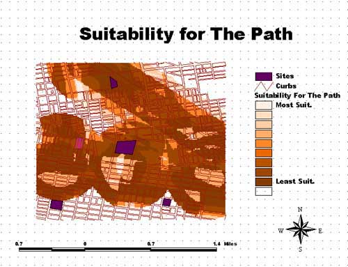
The most important aspects I found on the site are : accessibility, safety
hazards and distance from one course to an other. |