|
|
|
|
Urban Slivers: |
||||
|
|
An
Investigation of the Bow Street / Arrow Street Area - Cambridge,
MA
|
||||
|
|
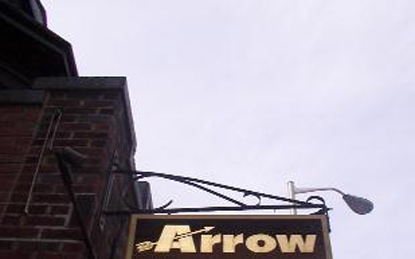
Sounds
There is the small, dainty bell ringing as the door opens to a
bookstore.
There are also church bells, not in the distance, but at close
proximity.
A recording of Vivaldi drifts outside from a small shop.
There is a chorus of footsteps from people walking on brick, with pauses
as
they peer into shops.
There is the generalized din of traffic on Massachusetts Avenue, and the
occasional
isolated rumble of the Number One bus careening around the curve of Bow
street.
Inside a bustling creperie, the chef with my order calls out
"Daahveeed!"
The creperie is a fitting
introduction
to the Bow Street / Arrow Street neighborhood, since it is the place in
the
vicinity I visit most often. On a springlike winter day, the amusing chef
was
calling out names a la Francais, even though the crepes are far closer to
San
Francisco than Paris. I discovered it while walking back from the
Cambridge
Architectural Bookstore, and whenever I return the young Polish woman who
makes
fantastic crepes recognizes me and remembers my name. On this part of
Arrow
Street, a collage of curiously angled shops tucked around the corner and
down
an incline from the vehicular density of Massachusetts Avenue, there is a
personal
character and specificity that makes it highly memorable and
recognizable, both
aurally and visually.
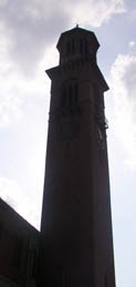
Further down Arrow street, beyond the towering Catholic church, the path
of
the Number One bus takes it in a curiously circuitous path down the
narrow Bow
Street before turning onto Mount Auburn. This is the other way I became
acquainted
with the area, while waiting for the bus back from Harvard Square to MIT,
yet
this area is visually and spatially distinct from Harvard Square
proper. There
is far more direct contrast in materials and topographical shape to this
neighborhood,
and it emphasizes linear paths rather than the centralized open space of
Harvard
Square. Furthermore, even though it is in close proximity to Harvard and
several
streets link the two areas directly, the pedestrian in the midst of this
neighborhood
does not have a clear visual orientation or connection to Harvard
Square.
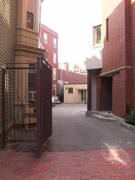
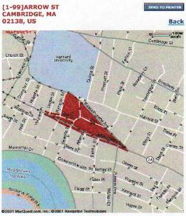
The Bow Street / Arrow Street neighborhood is situated between Mount
Auburn
Street and Massachusetts Avenue, from Sert/Jackson's Holyoke Center to
the intersection
of Mount Auburn Street and Massachusetts Avenue at Michael Sullivan
Square.
At both ends of the neighborhood on Mount Auburn Street, more explicitly
contemporary
concrete and glass buildings frame a highly varied amalgamation of mostly
older
brick and wood buildings punctuated by recent additions and
renovations. Inside
these busier and noisy main streets, the smaller Bow and Arrow streets
negotiate
the sloping topography in a quieter manner.
Silence
There is also silence, from both the buildings as a whole and from the
street
signs. For example, why does the curving Bow Street meet the narrow Arrow
Street
at this point? Which came first? Why were they named Bow and Arrow; does
the
relation to archery run deeper than a resemblance in plan? Their shape on
a
map is legible, but experientially their space and confluence emphasizes
the
delightfully quirky three-way intersection rather than a coherent
shape. A few
of the buildings have cornerstones or plaques that give clues to the time
of
their origin, but many of the buildings have visages that hint at
alterations
but refrain from revealing their histories so plaintly.
In the silence, there is a subtle dialogue of individuals and
institutions.
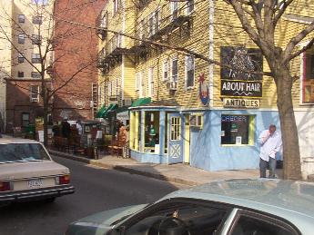
Within the neighborhood are private homes, multifamily housing, and
private
shops. There are older diners and newer trendy places that serve wraps
and crepes.
There are industrial business buildings like the Reversible Collar
Company Building,
while a clay-making shop resides next to the Center for Advanced
Research. Amidst
the individual establishments, there is also the more monumental
institutional
scale of the Catholic church, the Harvard Catholic Students' Center, and
other
buildings relating to Harvard University. Why does Bow Street seem to
enclose
the university-owned buildings from areas of private and religious
ownership?
Is the silence a tension between such wide variances in scale, or is this
a
comfortable relationship? I can't quite tell, and part of the reason is
because
of the strong presence of what is missing.
Stories
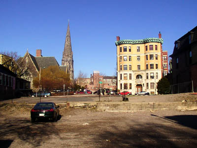
There is a large vacant lot between Arrow and Mount Auburn Streets; there
is
a large height difference resolved partially by the exposed vertical
concrete
fragments, but most of it is a gravel surface. Cars inhabit some parts,
but
there are signs everywhere prohibiting trespassers from parking. It is a
fabulously
visible site on the way to Harvard Square, and it also has a beautiful
view
northward of churches and older brick buildings. On one side are several
residences,
and opposite is the Reversible Collar Company Building, now converted to
offices
and art or architecture studios. How could such a prime piece of real
estate
remain vacant? I wondered this and snapped a few pictures last year, and
curiosity
regarding the unresolved question of this place's layered history is one
of
my major motivations for investigating this particular location.
As an architecture student, it is always tempting to remain passive and
interact
with the buildings through a camera lens, but as a tour guide I know the
importance
of talking with people that give these spaces character. The Polish crepe
creator
knew the lot had been vacant for as long as she had been in the United
States,
but knew that many customers' cars had been towed. The local postal
carrier
had the vague recollection of a grocery store, but emphasized that it has
been
vacant for many years. Someone else seemed to think the land's owner
wanted
to build on it, but was not being allowed to. The woman who is an antique
dealer
next door told the story that offered further intrigue; she recalls a
round
art deco bicycle and motorcycle store that was "quite
charming." She
also said the salmon-colored house used to be on the vacant site but was
moved
next door to the current location. Why was the house moved? What exactly
was
demolished? There are relatively few Art Deco structures remaining in
Harvard
Square (or Cambridge in general), but was the disappearance of the
building
due to economics or stylistic concerns? What is the relationship of this
whole
parcel of land to the industrial building next door? Was it always this
triangular
shape?
Slivers
My overall impression of this area after many quick visits and several
in-depth
visits for research and photography is that it is characterized by
fragmentation.
The narrow streets leave sharply angled slivers of land between them;
some buildings
even have double addresses because they are the entire width of the block
(12
Arrow / 25 Mount Auburn). There are also buildings and built spaces,
particularly
along Mount Auburn Street, that capitalize on their site's triangular
site and
make their sliver-like angles into defining characteristics visible from
afar.
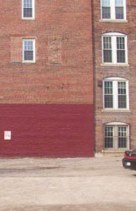
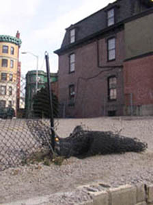
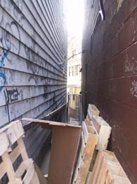
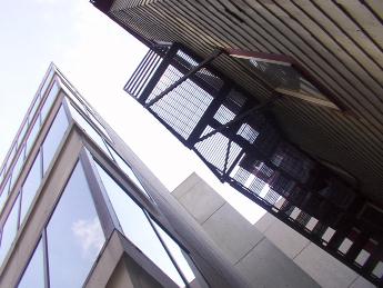
Besides the slivers of the built environment, there are slivers of space
between.
As the buildings meet at slight angles, there are dozens of vertical
fragments
of space that give tightly framed views of the buildings behind. Some of
these
slivers are well-kept niches of landscape, others are dirty corners with
splintering
wood pieces and trash stuck in them.
These visual breaks emphasize the fragmentation and variation of forms
and spaces
in the neighborhood, and serve as a contrast to the neater party-wall
arrangement
elsewhere in the Harvard Square vicinity. The presence of the vacant lot
is
so strong that it fragments the two parts of the neighborhood from one
another.
Many of these slivers' shapes seem strangely unmotivated; it is not
immediately
apparent what, if anything, these streets pointed towards or led to. Are
they
paths that happened to lie at close angles, or are the streets' origin
better
explained as incisions in an existing urban fabric? I have raised many
questions
I hope to answer regarding this fascinating little neighborhood and its
varied
nooks and crannies. Its stories dates back to the founding of this part
of Cambridge,
and the next step is to sort through the historical layers and
maps.
All images (c)
2001-2002
David M. Foxe, unless otherwise notated. All Rights Reserved.
|
|
 (c)
2001 MapQuest.com, Inc.
(c)
2001 MapQuest.com, Inc.