TREX 2003 - IAP Trip to Hawai'i

Field Research on Groundwater Intrusion into the Ocean:
Data taken from land, at sea and in the air

Aerial view of Kaloko Fishpond and Bay
Aerial view of Kaloko Fishpond and Bay photographed by Don Frankel from the Cesna 172 piloted by Harry Hemond.

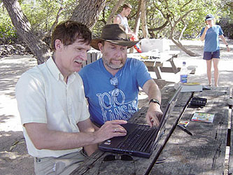
We had begun work two years before on estimating the flux of fresh groundwater into the ocean. It was a good first try but we decided to return, do a more complete study 
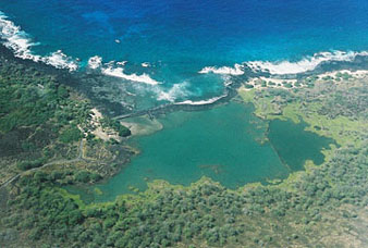
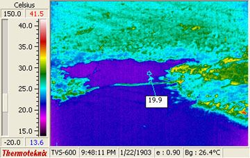
and broaden the scope of the research. We wanted to remotely thermal image the patterns of groundwater discharge into the ocean and ground-truth the measurements. Groundwater flux from the island could be estimated and used to calculate how much freshwater is available. This would then lead to development of strategies for sustainable management of groundwater use.
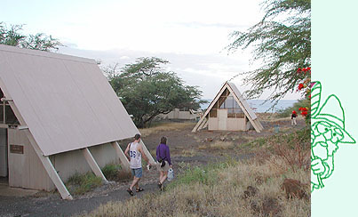
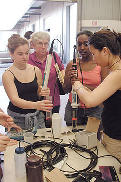
Students stayed in A-frames at Hapuna Beach State Park.

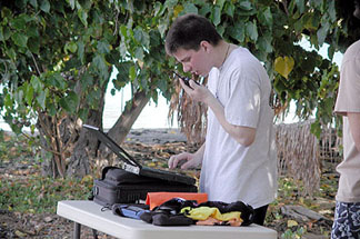
We obtained a research permit from the National Park Service and worked in Kaloko-Honokahau National Historical Park. Sallie Beavers, the park ecologist, hosted us and provided us with staging and storage areas for all our equipment as well as use of their Trimble GPS. She and her colleagues were extremely helpful. Our 
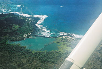
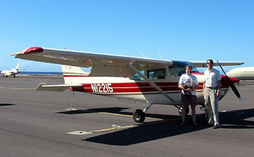
pilot, Harry Hemond, and our FLIR (Forward Looking InfraRed) cameraman, Don Frankel, flew over our research site in 
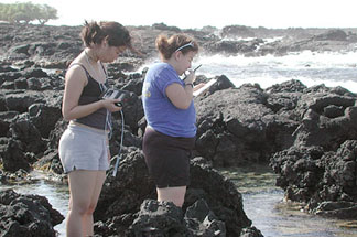
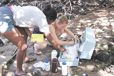
a Cesna 172. Down below, Kaeo and a few students were braving rough seas on a 30-foot dive boat to tow a CTD (conductivity, temperature and depth) meter along the coast and into the embayment. With the plane engine whirring 
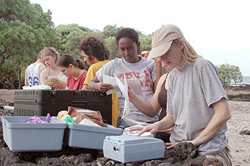
above, many students trudged along the coastline in knee-deep water to take conductivity and associated water quality data while other students took measurements from kayaks.

Harry, Don, and Airplane   Kim and Cecily kayak
Harry Hemond and Don Frankel ready to depart Kona Airport. While Harry navigates over Kaloko State Park, Don takes thermal images of the pond and bay.
 
Kim and Cecily kayak to the next location in Kaloko Fishpond to take temperature and salinity readings.


Aerial view of Kaloko Fishpond and Bay   Thermal image of Kaloko pond and bay
Kaloko Fishpond and Bay as seen from the plane piloted by Prof. Harry Hemond. TREX participants took temparature and salinity readings all over the area to try to match it up to the thermal images captured by Don Frankel.
 
Thermal image of Kaloko Fishpond and Bay taken by the FLIR (Forward Looking InfraRed) camera.

Don and Harry studying data
Don and Harry studying at infrared images of Kaloko Fishpond.

Our drogue experiment with radar tracking was set up and finally working, but rough conditions on the water drove the crew on board back in to shore.

Tom and Brian set up Radar   Students, Sheila, and Hydrolabs
Tom and Brian set up the Radar system to track the drogues.
 
Jamie, Wintana, and Kathy calibrate the Hydrolab as Sheila inspects their work.

Groups of students worked with park personnel who wanted to learn how to do field nutrient analyses. Using our portable spectrophotometer, nitrate and phosphate levels were measured in brackish ponds near the shore. Field- work occupied us for four days and went reasonably well considering adverse sea and wind conditions.


Radioing Data   Radioed data
Kathy & Laura radio in their data from shores of embayment.
Data were radioed into Command Central on the beach where students stood at computers and entered all the data.


Tina, Lisa and Wintans set up equipment   Lisa and Wintana analyzig pond water
Prof. Tina Voelker helps Lisa and Wintana set up the equipment to test for toxic chemicals in the local waters.
  Lisa and Wintana analyzing pond water for nitrates.


Field Research on Groundwater Intrusion
Fighting Invading Species
Investigations in Indigineous Hydrology, Agriculture, and Volcanology


Go To TREX Main Page


The Ralph M. Parsons Laboratory
Department of Civil and Environmental Engineering
MIT