Image from NOAA NCDC.
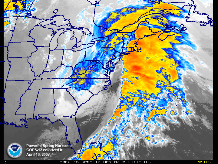
Above is an video of a particularly intense extra-tropical cyclone, from April of 2007. Storms like this that sweep up the East Coast of the US are often called Nor'easters, because they bring strong wind from the Northeast, to the Northeastern States. I've used this storm, the April 2007 Nor'easter as an example in pretty much all of my reports from the second half of this course, so I figured, why not continue? Extra-tropical cyclones are generally quite asymmetric, as can be seen here. Also, they can get pretty big -- at the end of the loop, the storm can be seen stretching from West Virginia to Newfoundland -- a distance of about 1500 miles! Extra-tropical cyclones are generally quite a bit bigger than tropical cyclones.
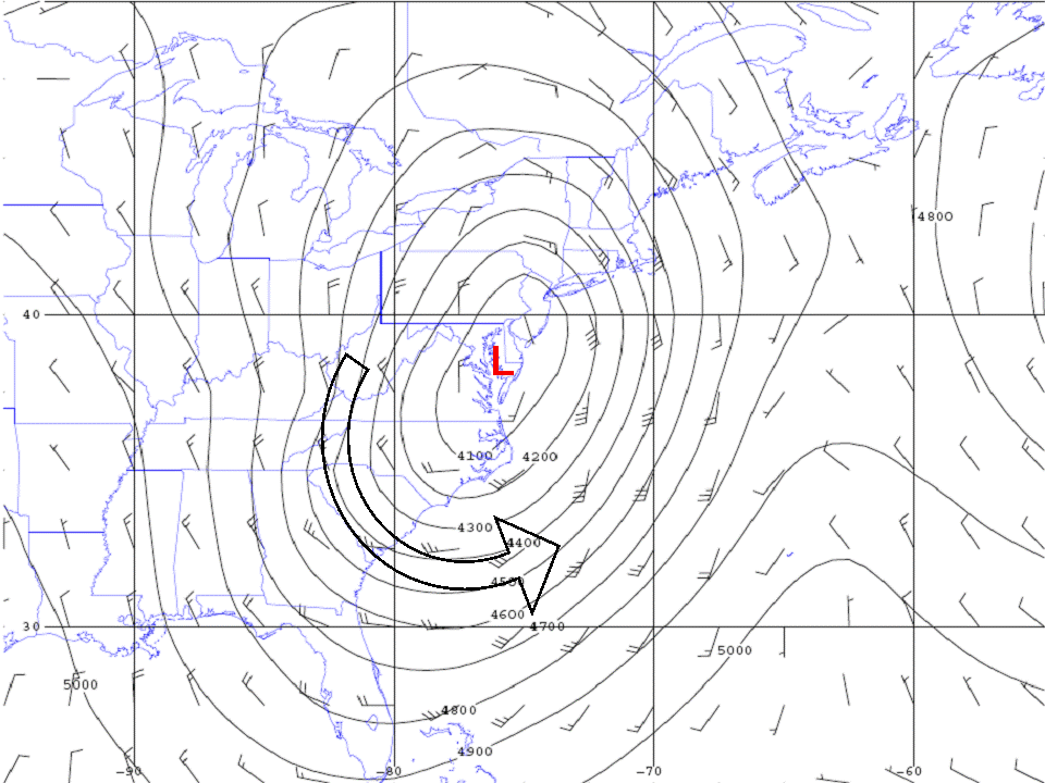
This is a map I made of the storm's winds and the height in feet of the surface where the pressure has fallen to about 85% of the mean surface value. This map is from the time when the storm was near its peak strength, around the same time as the above video. A surface of constant pressure with a low height means basically the same thing as low pressure. The winds blow counterclockwise around the storm -- they don't flow in towards the low pressure center because pressure forces aren't the only forces acting on the moving air, and because the air can be continuously accelerated toward the center of the storm and still move in a circle. The little lines are wind barbs -- they indicate how fast the wind is blowing and this plot shows the wind in meters per second. 1 meter per second is equivalent to a little over 2 miles per hour. The strongest winds shown here are about 40 meters per second, or about 90 miles an hour. Though peak winds are stronger in a tropical cyclone, they look stronger here than in Tropical Cyclone Lupit. Why? Basically, it's about the way that pressure varies with proximity to the center of the storm. The low-pressure center here is pretty spread out, and doesn't change very rapidly as you approach the cneter of the storm. For a tropical cyclone, the low pressure center is a lot tighter, and changes very rapidly as you approach the center of the storm.
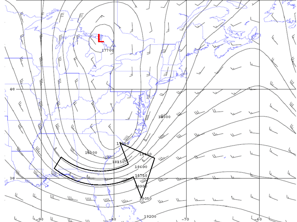
Above is a map of the storm around 18000 feet above the surface. It looks a lot different -- instead of the low pressure center being over Delaware, it's over Lake Huron! The winds are even stronger up here, blowing as fast as 60 meters per second -- that's about 130 mph! These are much different features than are found in a tropical cyclone, where winds are strongest lower down in the atmosphere, and the low pressure center is aligned through the column.