Travels
March 17-19, 1998
I think one of the best times of year to do the Utah national park circuit must be in March. Not that I have ever tried any other time of the year. But it seems you get the best overall climate, not too hot, kick it off with some runs at Brian Head, and few motorhomes to clog the roads.
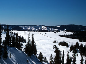
Brian Head is apparently where you go when you live in Vegas. Looking out from the summit says it all. You're in the desert. Don't worry, at 11,000 feet there is usually plenty of snow. Brian Head is not a particularly large mountain but rather serves as the oasis surrounded by desert, Cedar Breaks National Monument, Zion to the south and Bryce to the east. It would only make sense to stop here and take a brown break before moving on to Salt Lake.
You haven't lived until you've seen a sunrise at Bryce Canyon. We shacked up at Ruby's the night before and made sure to get a good seat for the show.
Breakfast back at Ruby's, stock up on supplies, long drive ahead.
For a person who doesn't yet own a car, I've driven around a lot. Utah 12 is top of my list. It beats the Pacific Coast Highway.
You first drop in alongside Bryce, making your way down off the Grand Staircase. Just remember to keep the car on the road. Moving eastward, the red rocks of Bryce disappear in the background. There's a few interesting spots along the way but today we would make a straight run for Capitol Reef. This means only a few detours.
Most of the day is actually spent inside one place. Escalante National Monument. It just achieved national status 18 months before this trip. 1.7 million acres of the most wild rock formations and some of the most amazing vistas imaginable. We'd stay on 12 and head to Boulder.
Boulder is home to Anasazi State Park. You get to see ancient remains of the ancestors to the Navajo and Hopi Indians. It's also home to a gas station.
There are two routes between Boulder and Capitol Reef. If you stay on 12 you drive up a mountain through the Dixie National Forest and probably will encounter a snow storm. Great views into the park from there.
The other is the Burr Trail through to the middle of the park. Burr Trail it is.
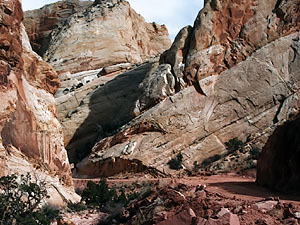
Once you get into Capitol Reef the paved road ends and it takes you through various canyons and around some hairpin turns until you arrive in the middle of Capitol Reef. Worth every piece of dirt on your rented SUV.
The trail ends at an intersection with another dirt road going north south (someone should really put a stop sign there). Left takes us north to where there are places to stay so we can do some hiking in the park the next day. Never been to the right before. Right it is.
Some 30 miles later Paul speaks up: Umm.. I Think you were supposed to make a left back there.
I know.
Popping out of the south part of Capitol Reef is one of the more annoying roads in the universe. Up down left right these twisty rolling hills were giving be a headache and went on for miles and miles. It just made it all the better when over one hill the huge bright blue mass took over the horizon.
I needed to see a different color today.
Good idea.
We made our way down to the lake and played with the water for a while. Scooting around on one of the many houseboats on the lake seems like a fun thing to do (Paul promised to take us out on one of those one day but that day hasn't arrived yet). The lake was a needed visual break.
We ate at a (the) restaurant on a hill overlooking the lake while the sun set.
Then we drove back to the north side of Capitol Reef because we really should have made a left back there.


