 |
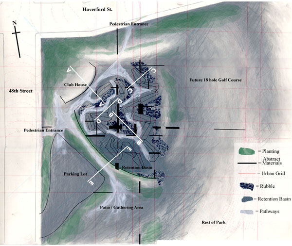
The Plan is a mix of soft undulating topography and strict geometry
of the material interventions. The grid system is based from the euclidean
geometry of modern urban planning. The curves are abstractions of diagonal
lines that often interrupt this grid. |
 |
The exact site location for the golf course takes advantage of the
fact that the program is too small to fill the site. This begins to set
up a strategy for how the rest of the site will be used. Sufficient room
is allocated for additional parking, additional golf course holes and other
park events. The golf course is just part of what can be a much larger park/entertainment
area. |
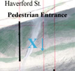 |
Entrance to the couse is provided thru the parking lot as well as
the two pedestrian entrances off of Haverford and 48th Streets. (Sketch) Once inside, visitors must pass bye the
club house which is nestled into the topography. The club house view extends
over the golf course and out into the rest of the park. |
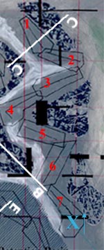 |
The first seven holes transcend down the elevation weaving in and
out of the topography. The sequence of the descending holes is the same
as the water drainage. The players become aware of the presence of water
as they move thru it. The increased weathering/staining of the materials
increases with the presence of water and time. (Sketch) |
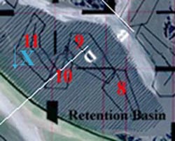 |
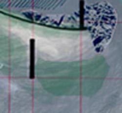
Holes eight through eleven are actually located inside of the retention
basin. (Sketch) On wet days, these holes
may be entirely submerged under water. On other days, the players might
have to get their feet wet if they want to play. |
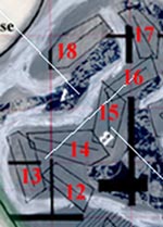 |
The remaining holes traverse back uphill going against the drainage.
On the way back uphill, the player passes by familiar materials at familiar
topographical levels. The 18th hole looks out over the golf course and the
journey that the player has travelled. |