Masachusetts Institute of Technology - Department of Urban Studies and Planning
11.521
Spatial Database Management and Advanced Geographic Information Systems
11.523
Fundamentals of Spatial Database Management
Lab 7: Web Mapping and Geoprocessing Services
3 April, 2018
Administrative
Problem Set B
(database design) - due Thursday (April 5, after extension)
That ends the 11.523 portion of the semester
Lab #5
(Raster analysis and model builder) - last part (model builder) is due today
Lab #6
(Metro Boston Modeling using TINs, zonal stats and QGIS - mostly optional) - due today for those in 11.521
Overview
Comments and discussion about hands-on test
Expanded solutions have been uploaded to exam page of class website
Graded exams have been uploaded to Stellar
Introduction to Web Mapping and Geoprocessing Services
Examine MassGIS webmapping services that we have used
Today: Lab #7 - Web mapping exercise (no need to turn in anything)
Eric Huntley: Make a Web Map Using LeafletJS
Lab Exercise (DUSPViz tutorial):
http://duspviz.mit.edu/web-map-workshop/leaflet-js/
Presentation slides:
http://duspviz.mit.edu/tutorials/web-maps-101
Thursday lecture:
Eric Huntley: An Intro to Carto with PostGIS
DUSPViz tutorial:
http://duspviz.mit.edu/web-map-workshop/databases-leaflet-cartodb/
Class Project part of semester - beginning Tuesday, April 10
Visit Projects webpage:
http://web.mit.edu/11.521/www/projects/index.html
Look at last year's project reports:
MAPC: Housing Rents:
http://mit.edu/11.521/proj16/project-reports/mapc_craiglist.pdf
Singapore: Simulation of Housing Dynamics:
http://mit.edu/11.521/proj16/SingaporeModel.pdf
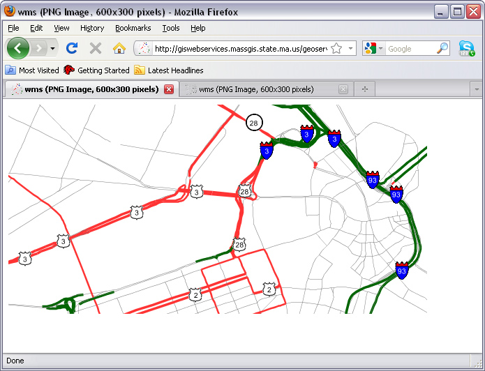
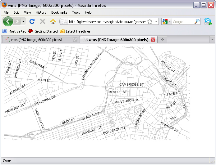
Examine MassGIS Web Mapping Service
http://giswebservices.massgis.state.ma.us/geoserver/wms?dpi=120&request=GetMap&layers=GISDATA.EOTMAJROADS_ARC&srs=EPSG:4326&bbox=-71.1,42.35,-71.0,42.37&width=1000&height=300&format=image/png&service=wms&transparent=true
http://giswebservices.massgis.state.ma.us/geoserver/wms?dpi=120&request=GetMap&layers=GISDATA.NAVTEQRDS_ARC&srs=EPSG:4326&bbox=-71.1,42.35,-71.0,42.37&width=1000&height=300&format=image/png&service=wms&transparent=true
Do you recognize the meaning of the parameters? Play with the values...
http://giswebservices.massgis.state.ma.us/geoserver/wms?
dpi=120&
request=GetMap&
layers=GISDATA.EOTMAJROADS_ARC&
srs=EPSG:4326&
bbox=-71.1,42.35,-71.0,42.37&
width=1000&
height=300&
format=image/png&
service=wms&
transparent=true
Note that some services only produce maps at particular scales
Otherwise, get xml-tagged error message
MassGIS web services homepage:
https://wiki.state.ma.us/display/massgis/Overview+of+MassGIS+Web+Mapping+Services+and+Applications
Today: Lab #7 - Web mapping exercise (no need to turn in anything)
Eric Huntley: Make a Web Map Using LeafletJS
DUSPViz tutorial:
http://duspviz.mit.edu/web-map-workshop/leaflet-js/
Home
|
Syllabus
|
Lectures
|
Labs
|
CRON
|
MIT
Created by Joseph Ferreira
; last m
odified: 2 April 2018 [jf]