
| Home Mission 2007 Team Research Sources Progress Journal |
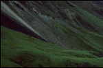
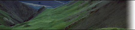
Research - Geologic History Moore, T.E., Wallace, W.K., Bird, K. J., Karl, S.M., Mull, C.G., and Dillon, J.T., 1994, Geology of northern Alaska, in Plafkler, G., and Berg, H.C., eds., The Geology of Alaska: Boulder, Colorado, Geological Society of America, The Geology of North America, v. G-1. BIRD, K.J. (1999). Geographic and Geologic Setting. In The Oil and Gas Resource Potential of the 1002 Area, Arctic National Wildlife Refuge, Alaska. By ANWR Assessment Team, U.S. Geological Survey Open-File Report 98-34. Geographic Placement The 1002 area of the Arctic National Wildlife Refuge is a 1.5-million-acre area in northeastern Alaska. It is bounded on the east by the Canning and Staines Rivers, on the north by the Beaufort Sea, on the east by the Aichilik River and the Canadian border, and to the south by Brooks Range. Most of the 1002 area lies within the Arctic Coastal Plain physiographic province, a marshy area that slopes gradually towards the Arctic Ocean on the north. A small part along the southern margin that constitutes less than 5% of the total area lies within the Arctic Foothills physiographic province, a series of hills and ridges that descend from more than 500 m in the Brooks Range to 300 m in elevation to the northern foreland. Beaches, low steep cliffs, barrier islands, shallow lagoons, and river deltas form the coast of the 1002 area, with hills rising to more than 300 m in the south. Many rivers and stream flow between these hills towards the Arctic Ocean. Origin The North Slope and its continental shelves, Brooks Range and the northeaster part of Siberia are considered to form the Arctic Alaska microplate, a small lithospheric plate with boundaries that are not clearly known. One hypothesis for the plate tectonic history of northern Alaska suggests that the region was originally next to the Canadian Arctic Islands. Creation of oceanic crust in the Canada basin during the Jurassic and Early Cretaceous caused the microplate to rotate 60 degrees counter clockwise, placing it in its current position. Surface Geology Nearly all of the surface of the 1002 area is covered by a thin layer, less than 30 m thick, of unconsolidated, frozen silt- to gravel-sized sediments of nonmarine origin. They originated from the erosion of the Brooks Range during the late Cenozoic. The surface exposures of rock formations inside the 1002 area are mostly restricted to deposits of the Sagavanirktok, Jago River, and Canning Formations of Tertiary age. There are some smaller outcrops of Hue Shale, pebble shale unit, and Kingak Shale from the Cretaceous and the Jurassic. To the east of the Sadlerochit Mountains, in the southern border of the 1002 area, some of the oldest exposures, of limestones from the Mississippian Lisburne Group, are found. Subsurface Structure
During the rifting that separated northern Alaska from the Canadian Arctic Island, the Barrow arch, a structural high, was formed. The northern side of the Barrow arch formed the continental margin, while the southern flank received the thrust of the formation of the Brooks Range orogen. The part of the 1002 area located to the south and east of the Marsh Creek anticline and north of 69-degrees is the Brooks Range orogen. The Brooks Range is more than 1000 km long and up to 300 km wide, and the distribution and character of its major structures is not symmetrical. Deformations in this region occurred during the Cenozoic era, forming both east-northeastward and eastward structures. Parts of Jurassic to Cretaceous shales, Mississippian shales, and of a horizon in the pre-Mississippian basement rocks were separated from their source due to extreme folding and compression. The structure of the Brooks Range is formed by a series of broad anticlines with a core of pre-Mississippian rocks and younger rocks deformed on the borders. To the north of the Brooks Range, the structure, called thin-skinned deformation, is composed of numerous folds and faults developed in rocks of Cenozoic and Mesozoic age. Several broad domes are present in pre-Mississippian rocks in that area.
The stratigraphic record of the North Slope is divided into three sequences: Franklinian, Ellesmerian and Brookian. The Franklinian sequence comprises a thick succession of mainly sedimentary rocks with a minor amount of igneous rocks of Cambrian to Devonian age that lie beneath the pre-Mississippian unconformity, where a gap in the geologic record exists. Two separate layers of rock are present in northern Alaska. The shallow marine carbonates are composed of rocks of Proterozoic age and rocks of Lower Devonian age, separated by unconformities where Silurian strata are missing. They are composed of quartzite (metamorphic rock consisting of quartz grains, formed by recrystalization of sandstone), argillite compact rock derived from mudstone or shale, product of weak metamorphism), and basalt (dark-colored igneous rock), with intrusions of sandstone (the consolidate equivalent of sand, with 85-90% quartz), and shale (fine-grained sedimentary rock, formed by clay, silt or mud). The deeper marine layers include quartzite, conglomerate, phyllite (metamorphic rock, finer than schist), argilite, limestone (sedimentary rock formed by calcium carbonates), and granite (light-colored, coarse-grained igneous rock). The compression, uplift and erosion of this sequence during the Ellesmerian orogeny formed the pre-Mississippian unconformity. The Ellesmerian sequence is hundreds of meters thick, and is composed of layers of marine and nonmarine sedimentary rocks of Middle Devonian to Triassic age, that rests on top of the pre-Mississippian unconformity. The lower unit of this sequence is the Endicott Group, which, in the 1002 area, consists of Mississippian coal-bearing sandstone, conglomerate, and shale of the Kekiktuk Conglomerate and Kayak Shale, of Devonian and Mississippian age. The Kekiktuk Conglomerate is a proven oil-bearing reservoir. Large amounts of limestone and dolomine of the Lisburne Group were deposited in the North Slope up to a thickness of 500 to 1000 meters during the Mississippian and Pennsylvanian. It is separated from the overlying Sadlerochit Group by an unconformity formed during the Middle Pennsylvanian to Early Permian in when sea level fell.
Snow: The North Slope is covered in snow from October to May of every year, and while snow might fall during any month, the precipitation during the summer is mainly rain. In spring, melting snow is the main source of water for lakes and streams in that region, and water stored in snowdrifts is released slowly and provides water for them during the summer. In the 1002 area, the depth of the snow increases considerably away from the coast. Ice: Around mid-September, water bodies freeze across the North Slope, with an average maximum thickness of 1.80 m at the end of winter. By the middle of January, the ice is thick enough to support a loaded C-130 Hercules or a D-8 tractor. Ground water: There is very little liquid ground water in the coastal plain, but there is ground ice underlying the surface, which can't be used as a water supply. |

| Mariela Perignon - perignon@mit.edu Team 1 - m2007-1@mit.edu |