|
monitor
'01
aegean
'01
hunley
'01
defence
'00
black
sea '00
black
sea '99
ashkelon
'99
black
sea '98
midway
'98
skerki
'97
|
BLACK SEA 1998
 In July, 1998, a team led by David Mindell
of MIT and IFE conducted an undersea archaeological survey of the area
surrounding the city of Sinop, Turkey in the Black Sea. Preliminary results
indicate significant archaeological data as well as raising a host of
new questions for future surveys. This survey focused on relatively shallow
water, between 50 and 80M depth (which defines a rather large area outside
the port of Sinop). In 1999 plans are to return to the site with a larger
ship and a specialized deep search system and to begin surveying in very
deep water, down to 2000M. Also in 1999 a robotic vehicle will make video
inspections of the sonar targets identified during this survey. In July, 1998, a team led by David Mindell
of MIT and IFE conducted an undersea archaeological survey of the area
surrounding the city of Sinop, Turkey in the Black Sea. Preliminary results
indicate significant archaeological data as well as raising a host of
new questions for future surveys. This survey focused on relatively shallow
water, between 50 and 80M depth (which defines a rather large area outside
the port of Sinop). In 1999 plans are to return to the site with a larger
ship and a specialized deep search system and to begin surveying in very
deep water, down to 2000M. Also in 1999 a robotic vehicle will make video
inspections of the sonar targets identified during this survey.
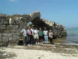
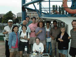
Science
Team:
| David Mindell |
Chief Scientist |
MIT/IFE |
| Fredrik Hiebert |
Project Archaeologist |
U. Penn |
| Francesco Torre |
Consulting Geologist |
Archaeological Museum,
Trapani, Italy |
| Martin Wilcox |
Sonar Engineer |
Marine Sonics Technology
(Gloucester, VA) |
| Cathy Offinger |
Logistics Coordinator |
IFE |
| Brendan Foley |
Graduate Student |
MIT |
| Sarah Webster |
Undergraduate
Student |
MIT |
Milestones &
Statistics
First undersea
survey designed specifically to mesh with an adjacent land survey.
6 days survey (avg. 13 hours each)
2 days lost for weather
25 Tracklines
254 Targets identified
>70 miles of survey lines (~13 sq. mi. of area covered)
This survey
was designed and undertaken in conjunction with a series of land surveys
conducted concurrently by Fred Hiebert's group at the University of Pennsylvania.
By studying, in a systematic manner, the distribution of archaeological
data simultaneously on land and at sea, we hope to create more a complete
picture of ancient trade, manufacturing, agriculture and society in Sinop
and the Black Sea than would be achieved by studying land and seafloor
in isolation.
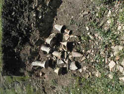
 The land area of Sinop is archaeologically rich; in
some places pottery literally saturates the soil. Here a Roman bridge
seems to head off into the ocean, the road it connected to having eroded
away. The land area of Sinop is archaeologically rich; in
some places pottery literally saturates the soil. Here a Roman bridge
seems to head off into the ocean, the road it connected to having eroded
away.
 The technology used were 150khz and 600khz "SeaScan"
side-scan sonars provided by Marine Sonics Technology Limited (Gloucester,
Virginia), combined with differential GPS accurate to about 3M. Most survey
lines were conducted with the 150kHz sonar, with the 600 used for imaging.
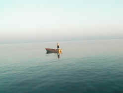
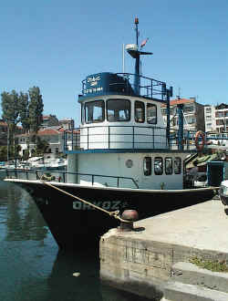
The survey was run from the Orkoz II, a local fishing vessel with an excellent
crew and a first-rate cook. The technology used were 150khz and 600khz "SeaScan"
side-scan sonars provided by Marine Sonics Technology Limited (Gloucester,
Virginia), combined with differential GPS accurate to about 3M. Most survey
lines were conducted with the 150kHz sonar, with the 600 used for imaging.
The survey was run from the Orkoz II, a local fishing vessel with an excellent
crew and a first-rate cook.
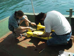
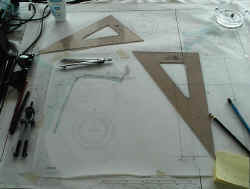
Below
left, Marty Wilcox and Sarah Webster prepare the sonar fish for launching.
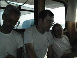
We all spent many days
glued to the screen of a small laptop which displayed the sonar data as
it came in. All data was recorded digitally on computer (sonar),
plotted by hand (positions), and logged in a book (operations and comments).
The triple redundancy ensures against data loss but also helps with planning
the survey and greatly eases finding data afterward.
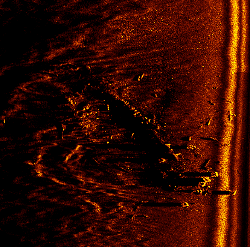 Much of the data is still being processed, but the image
on the left appears to be a 19th-century sailing vessel, and one can clearly
see a number of guns which have been scattered around the seafloor with
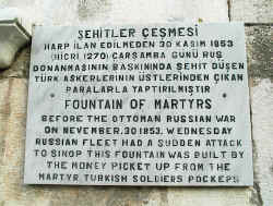
great violence. Did we find one of the ships from the Turkish fleet which
was destroyed by the Russians in 1853? This was the first use of exploding
shells in combat, and influenced the European powers to consider ironclad
ships to protect against them. Much of the data is still being processed, but the image
on the left appears to be a 19th-century sailing vessel, and one can clearly
see a number of guns which have been scattered around the seafloor with
great violence. Did we find one of the ships from the Turkish fleet which
was destroyed by the Russians in 1853? This was the first use of exploding
shells in combat, and influenced the European powers to consider ironclad
ships to protect against them.
|