The 1800s-A Time for Expansion
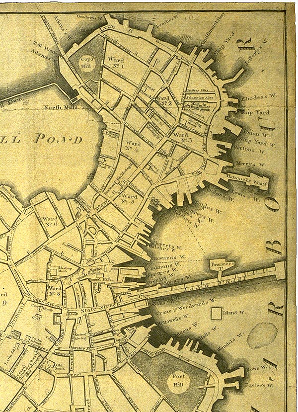
click here for a larger version of the 1800 map Ā
The next development in the North End was in the first decade of the 19th century. This is when the plan for filling in Mill Pond was developed and the North End was expanded. Back (Salem) Street was moved over to where it is currently located with the Mill Pond plan. Streets to the northwest of Back (Salem) Street were designed in a stricter grid pattern; this pattern does not match up with the street pattern that was already established. You can see this today looking down the streets and alleys that run perpendicular to Salem Street; some of them are even impassable. Middle (Hanover) Street is more noticeably wider than Back (Salem) Street, further supporting the greater amount of commercial development on Middle (Hanover) Street.
Another important development in the 1800s was the burying of the Mill Creek. From comparing the early maps with current ones, it was hard to determine if the Central Artery of Blackstone Street had been built over the site of Mill Creek. However, on my last visit to the North End I finally found the answer. After leaving the North End and walking under the Central Artery towards City Hall Plaza, I happened to glance up and saw a plaque on the building on the corner of Hanover and Blackstone. The plaque read:
Blackstone Street
Built over Mill Creek
1833I finally had my answer: Mill Creek had been covered and replaced by Blackstone Street, not the Central Artery.
A closer look at an 1890 Bromley Atlas gives more insight into why Salem and Hanover Streets developed so differently, which was the main question I proposed in the first assignment. It appears that one reason for this may have been the ownership of the buildings. The individual buildings on Salem Street where owned, with only two exceptions, by an individual family. However, on Hanover Street, parcels of land where owned by individuals. These parcels of land held many buildings, some of which stretched into the middle of the block between the two streets. It would have been much easier to purchase a set of two or three buildings from one individual than to purchase them from two or three individuals if you wanted to build a restaurant. This is another factor that contributed to the different feeling that is given of by the two streets.
Ā