The North End has been home to many different types of people over the years. At first, only the wealthy could build their mansions in the exclusive North End. However, they were eventually forced out and replaced by immigrants from Ireland. Then, about half a century later, the Irish left the North End and Italian immigrants took their place. Today, the shops and restaurants of the Italians are still operating in the North End, yet the majority of the Italian immigrants do not live there anymore.
The first people to settle the North End were very rich and proper. Most of them were wealthy merchants who wanted to reproduce the beauty of England. They built large mansions with elaborate carvings and designs. Around these houses they planted ornate gardens with a definitive English style. The largest mansions were built on Garden Court Street, just north of North Square and Paul Revere's house. Two famous rich families, the Hutchinsons and the Fitzgeralds, first built their family mansions on Garden Court Street. John J. Fitzgerald, known at the time as "Honey Fitz," became Boston's governor as well as a ward boss, congressman, and mayor. His daughter, Rose Fitzgerald Kennedy, later became the mother of President John F. Kennedy. Thomas Hutchinson also became the governor of Boston.
Many Jews used to live in the North End. They built stores and commercial districts to accommodate the people of the North End. They used the proximity of the wharves to acquire many expensive imported goods. Also, they built several banks in the area. Mounted on a window on Commercial Street, there is a golden-colored vault door that has the words, "First National Bank of Boston 1784," inscribed on it. However, the area that the monument is now on was underwater in 1784. Therefore, this bank must have been built further inland. Most likely, the Jewish people in the area built it since the Puritans were not allowed to charge interest on money that they lent out. Other banks were also built in the area during this time.
The remnants of these ancient mansions built by the prominent families of the time are still quite visible in the area surrounding Garden Court Street. On the corner of Garden Court Street and Prince Street, there is a wooden cylindrical projection from the house. Several small carvings can be clearly seen on the wood. Most of the carvings are of vines and plants, intertwining around each other in an intricate pattern. Also, the letters MGD are carved in the center of the wood. The letters are very stylish and overlap each other, which actually makes them hard to discern. However, it seems that this remnant is part of an old house that was originally built in a Georgian style. Surprisingly, the wooden carving is in very good shape and does not show any visible signs of decay.
Right across the street is another building that has fancy wooden carvings on it. Two wooden cylindrical shapes projecting from the building have both windows and carvings on them. The carvings are all decorative floral patterns that fill in the space between the windows. The windows themselves are fancy and decorated with carvings. Both the windows and carvings seem to be in good shape. There are no cracks or holes in the woodwork.
A few blocks away, on Lewis Street, there is another house that has large stone carvings on it. The carvings project from the house in two trapezoidal blocks that hang over the sidewalk. Most of the carvings seem to be purely decorative. There are many plants and flowers, but there does not seem to be any letters or numbers. However, most of the stone is heavily blackened and some seems to have been chipped off. I assume that this is the result of automobile or industrial pollution or smoke. If there used to be a name or year included in the stone carving, it cannot be seen anymore. However, it can clearly be seen that this used to be a very beautiful and expensive addition to an older mansion.
Very close to the intersection between North Street and Lewis Street, there is another seeming remnant from the English mansions that used to cover this area. Over each of the windows of this house, there is a stone decoration. In a way, the white stone is relatively simple, having no carvings or drawings on it. However, the pattern is not so simple, consisting of a thick vertical stone in the center with increasing smaller, slanted stone slabs going off to the sides. This house was probably owned by a merchant who wasn't as rich as those on Garden Court Street, yet still wanted to decorate his house with some stone decorations. While the stone on this house is not blackened like the stone carvings on Lewis Street, it still shows many signs of decay, with bits of the stone having small holes and cracks in it. Also, the color is a little faded and is now more off-white than white.
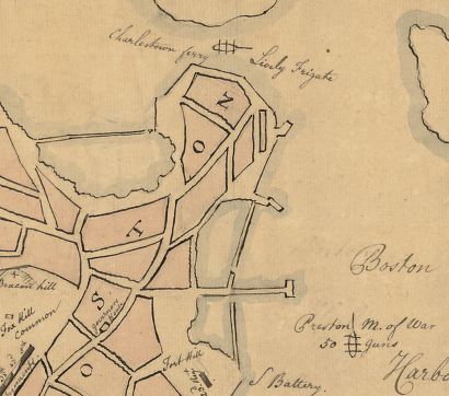 A basic outline of Boston in 1776.
The Paul Revere House is another ancient building in this area. The first house built on this site was used by Increase Mather and his family. Increase Mather, and later his son, Cotton, were Ministers of the Second Church of Boston. The house burned down in 1676 and was later rebuilt by the rich merchant Robert Howard. The building was renovated and a partial third floor was added to the house. In 1770, Paul Revere bought the house and moved his large family into it. The house is not as beautiful as many of the others in the area. There are no wooden or stone carvings or other forms of fancy decoration. Although it does not match the English mansions and gardens in the area, it was still built at about the same time.
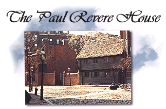 Paul Revere's House from the front.
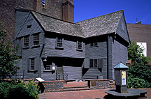 Paul Revere's House from the back.
Many churches sprung up around these early prominent citizens of the North End. The first church was built in 1649 on the corner of Sun and Moon Street, which is now the site of Sacred Heart Church. The first building was a Congregational church that was soon burned down in the Great Fire of 1676. The church was rebuilt, but was burned down again in 1770.
The Puritans built the Second Church in the same area in 1650. It was built to hold the overflow from the First Church, which was in the center of Boston. This church was known as the "Old North Meeting House" and the "Church of the Mathers." Both Increase and Cotton Mathers held services at this church. In the year 1673, the building was destroyed by fire. However, it was immediately rebuilt the following year.
A school was also built on the block between Moon, Lewis, North, and Sun Street. It was a Puritan school that taught the wealthy children who lived in the North End, especially those around the North Square. Rose Fitzgerald Kennedy attended the school when she was young.
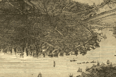
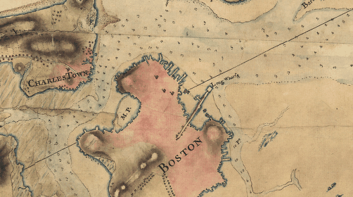 The general topology of Boston in the 1770's.
During the revolution, many of the British soldiers were quartered in houses in the North End. Prominent among them was Major Pitcairn, who was second-in-command during the march to Concord and was killed while leading the final charge of the marines during the Battle of Bunker Hill. The billeting of the British soldiers caused many fights and arguments among the citizens of the North End, the majority of whom considered themselves to be revolutionaries. In fact, many men who lived around North Square took place in the Boston Tea Party. However, the only significant change that the British soldiers made while they were quartered in the North End was that they tore down the Second Church and used it for firewood during the winters of 1775 and 1776. The church was never rebuilt and is now the site of several apartments and a restaurant.
 The North End in 1776.
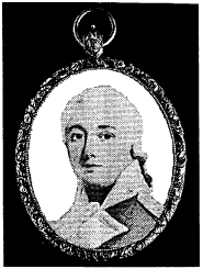 A portrait of Major Pitcairn.
In the years after the revolution, the North End became much more commercial because of the proximity of the wharves. Many people started moving in, making the area much more crowded and pressed for space. During this time, many of the wealthy inhabitants of the North End moved their families to Beacon Hill, where they built large mansions and once again lived in privacy.
Throughout the nineteenth century, the North End became a great commercial center. Many older houses were sold and the land was used to build up several smaller houses or apartments. There are dates imprinted on the walls of several houses in the area that go back to the nineteenth century. This suggests that most of the houses currently standing in the area were first built during this time. They were primarily made of brick and stone and were not very decorative. They were often very narrow and built up as high as possible.
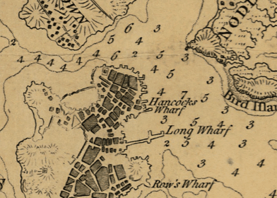
At first, only Clarke's Wharf was connected to the area around North Square. However, by the year 1826, several other wharves had been built. Clarke's Wharf was expanded and became Hancock's Wharf. Also, The Lewis Wharf and Exchange Wharf were built just south of it. In the following years, much of the bay was filled in with land. Everything east of what is now Fulton Street used to be underwater. This caused a large extension and expansion of all the wharves in the area. The Exchange Wharf was destroyed and rebuilt as the Commercial Wharf.
 The orange line shows where the coast used to be.
These wharves became the central hub of countless merchant ships. The Lewis Wharf became the home of the famous American Clipper ships during the 1840's and 1850's. The Commercial Wharf was mainly used by foreign sailors who wanted to drop off their cargo and take some shore leave.
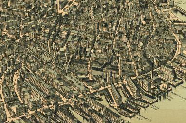
 The North End and its wharves in 1873.
In 1833, a new church was built on the corner of Moon and Sun Street, the former site of the two Congregational churches that had burnt down. The church was called the Seamen's Bethel and was a place for all the sailors to worship. Father Taylor, the famous sailor-preacher, was the minister of the Bethel.
The Mariner's No. 11 House was built on March 24, 1847, to accommodate all the new sailors. It was constructed by the Boston Port Society and "dedicated to the service of seafarers." It was, and still is, a private residence for sailors, merchant marines, and military personnel.
During the Great Potato Famine of 1846, many Irish immigrants came to the North End and started to build their own community. They opened up several Irish shops, restaurants, and pubs. By 1885, about 54% of the 26,000 people living in the North End were Irish.
 Boston and the North End in the 1870's.
At the beginning of the twentieth century, the Irish started moving out of the North End. With them, they took their shops, restaurants, and other cultural icons. New immigrants, the Italians, soon came and replaced the dwindling Irish. They too built up the area with their own cultural shops and restaurants. By 1920, 37,000 of the 39,000 people in the North End (95%) were Italian. Over time, the North End developed into a very popular place to eat and shop, becoming Boston's own "Little Italy."
 The North End in 1899.
As housing became scarce in the area, renovations were performed on many of the houses to add an additional floor. Other houses were destroyed and rebuilt to accommodate more people. As evidence of this, some of the buildings have two different dates inscribed on their walls. The first date, which is on the middle floor, is much earlier than the date that is inscribed higher up on the top floor of the building. Several buildings in the area were renovated to hold more people because of the constantly increasing population.
The Seamen's Bethel was purchased and renovated in 1871. It was renamed the Sacred Heart Church and began to serve the Italians in the area.
The Italians also bought the old school right next to Sacred Heart Church. In 1895, they converted it to the Catholic St. John's Parochial School. It is still operating today, teaching the kids who live in the area.
In the 1950's and 1960's, the Italians started moving out of the North End. However, they maintained their shops and restaurants in the North End. That is why the North End is still a major center of Italian culture.
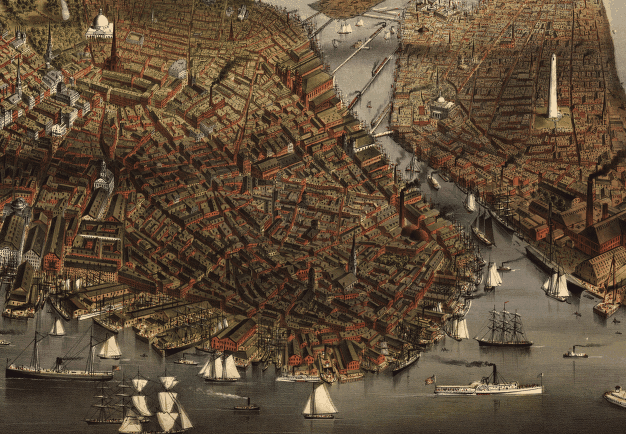
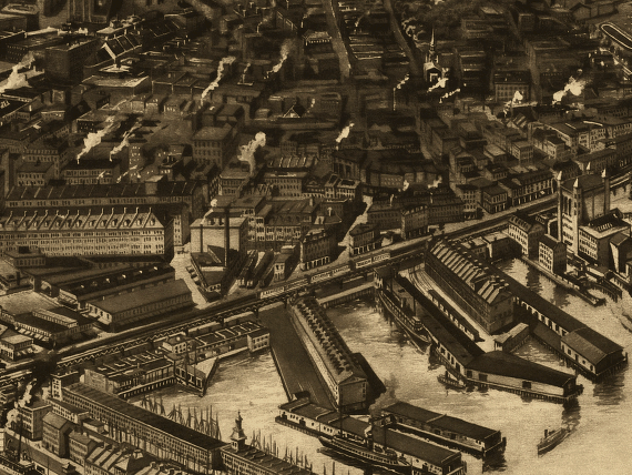 The North End and its wharves in 1905.
In the second half of the twentieth century, many of the older buildings were knocked down and replaced with newer housing. The Ausonia Apartments were built in 1977 by the City of Boston. The apartments are part of the Elderly and Disabled Housing Program, which is run by the Boston Housing Authority (BHA). Many older homes were torn down to make way for the new apartments.
Also, the Columbus Housing was built in 1978. It was built on what used to be Commercial Wharf Square. Several warehouses that used to store goods from the ships at the Commercial Wharf were destroyed in the area to make way for the new residential building.
Also, blocks of homes in the area were torn down and replaced with large commercial buildings. Other businesses bought out residential homes and renovated them into offices. The remaining residential areas became increasingly crowded as the government and several companies bought out more and more homes.
Currently, my site is still in the middle of this transition. Scattered among the older residential buildings are several renovated offices and commercial space. On some blocks, huge, newly built, commercial buildings dwarf nearby residential houses. In many places, there is an alleyway full of apartments right next to a fancy restaurant or elaborate law firm. In one area, there is a playground right next to a power plant. A sign outside the little fenced-off area says "High Voltage." The government and many companies are buying out the land, starting at the wharves and slowly moving inland. The people living in these areas are striving to find enough space to breath under the shadows of these large new buildings. My site is currently a war-zone in which the residents are slowly losing ground.
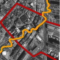
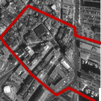 My site in 1995, outlined in red.
Click on this link, then the Time Lapse button to compare the maps of several different time periods.