|
One cold day during IAP, my fiancee and I trekked through the Freedom Trail, armed with a little guidebook and many layers of clothing. This was the first time that I had been able to really see Boston. It was fun to walk around the city, taking in its unique feeling and atmosphere. While traveling around the North End, I was fascinated by the large variety of buildings and land usage. However, what most interested me was the Mariner's No. 11 House (Figure 1). As we walked by the building, it struck me as seeming very odd and out of place in the neighborhood. It was a large, plain brick building located between two older houses that had several ornate stone carvings on them. I searched through the guidebook and found a short paragraph explaining that it had been a religious residence for visiting sailors. The purpose of the house was to take in sailors who did not want to join in the usual chaotic behavior that tended to take place when ships came to port. |
|
|
|
This building continued to hold my interest and was the first place I thought of when trying to select a site. I boarded the "T" and took the ride to Haymarket. After walking under the Central Artery amidst the construction of the Big Dig, I made my way through the winding roads to Garden Court Street in the North End. I started walking around and ended up finding many interesting things that I had never noticed before. |
|
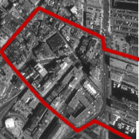
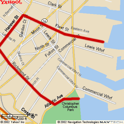
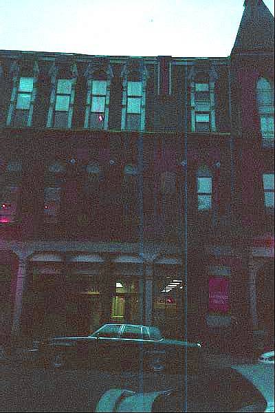
I continually expanded the borders of my site as I found new and interesting details in the area. However, I eventually had to narrow down the borders of my site. The western border is Hanover Street, the main artery of the North End. Fleet Street to the north and Richmond Street to the south further define the boundaries of my site. Also included in my site are the Lewis and Commercial Wharfs. Paul Revere's House, Mariner's No. 11 House, and North Square are major parts of my site as well as the Ausonia Apartments, Columbus Housing, Dog Park, and Sacred Heart Church and Parochial School. (Figures 2 and 3) |
|
|
|
As I walked down Garden Court Street, many questions were raised in my mind. First of all, several of the buildings seemed to be very old and sophisticated. They must have been very beautiful when they were first built. On the corner of Garden Court Street, I found a house that had several intricate wooden carvings on it. Most prominently, 8 MGD 9 was elaborately carved in large letters in the center. It seems to be an address of some sort. However, MGD does not match either of the intersecting streets (Prince Street and Garden Court Street). Therefore, it is probably the initials of the original owner and the year in which it was built. The origin and meaning of these carvings intrigued me and I desired to learn more about them. The houses around this artistic structure are very plain and ugly in comparison. They are built differently and are not taken care of. Peeling paint and rust adorn them. However, there are a few houses in the area that have ornate stone carvings and are built like the old mansion (Figures 4 and 5). I found these older houses while continuing down Garden Court Street and while walking down Lewis Street. The stone carvings are not in very good shape though. They were all blackened with smoke and partially chipped off. This large difference in residential buildings surprised and interested me. It seemed like there had been a large amount of change that had taken place in the area over the centuries. When were these two types of buildings built? Did this whole area used to be full of rich mansions? And why is one house in good condition while the others are not? |
|
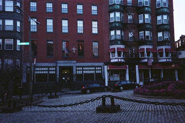
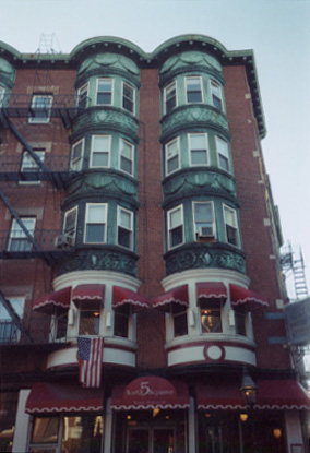
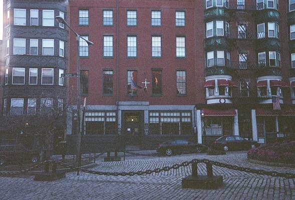
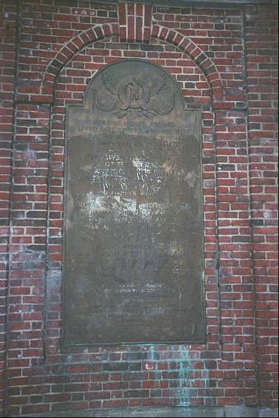
As I continued down Garden Court Street, I noticed more differences between the residential buildings in the area. The Mariner's No. 11 House is right in between the Gift Shop (established in 1894) and the No. 5 Restaurant (Figure 6). The Mariner's No. 11 House is very plain and made of brick and concrete. However, the Gift Shot and No. 5 Restaurant have intricately carved stone extensions. These three buildings are right next to each other, yet have very different styles of architecture. Because of this difference, the three buildings were probably built during different times for different purposes. So when were they built, who built them, and what purpose did they initially have? As I studied the Mariner's No. 11 House (Figure 6), which first attracted me to my site, I was intrigued once again. There were two plaques on the wall put up by the Boston Port Society. The first one states that the Mariner's No. 11 House was erected on March 24, 1847. The second one states that the house was rededicated to the service of seafarers on March 24, 1999. Another sign on the window states that this house is a private residence for merchant marines and military personnel. Was there a time between 1847 and 1999 when it was not dedicated to seafarers? And if so, what was it used for during this time? |
|
|
|
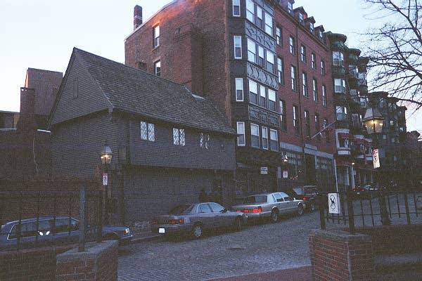
Paul Revere's House (Figure 7), a stop on the Freedom Trail, seems very out of place in the area. It is made of wood and is not very compact, leaving a lot of empty space on its land. This is very unlike the other houses in the area, which are made of brick and use up all of their land. What caused Paul Revere's House to be saved while most of the other houses were destroyed or refurbished? I know that he was famous, but it seems that a lot of the changes in this area happened a long time ago and I'm surprised that no one tore down the house to make way for a new commercial or apartment building. |
|
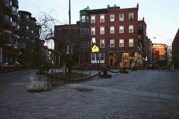
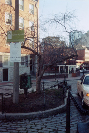
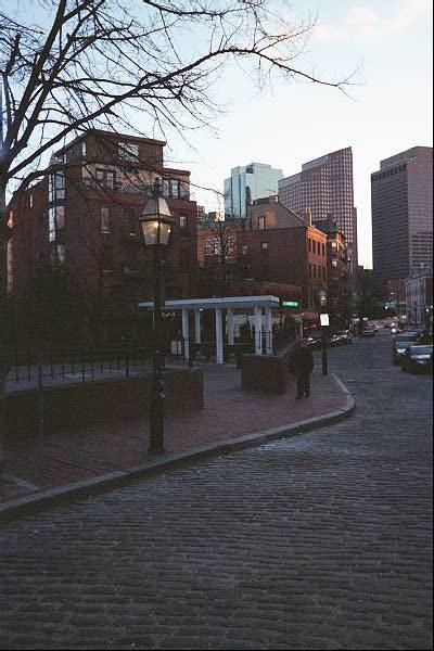
North Square itself seemed very strange (Figure 8). It was completely cobbled over with only a few trees and plants. Surrounding the square are large steel links that are usually attached to anchors. What was this square used for in the past, since it does not seem to be much of a park today? Maybe the visiting sailors used it in some way. Also, I found a strange box (Figure 9) in the corner of the square. I could not read any of the writing on it because it was rusted and full of peeling paint. What is this box and what was or is its purpose? |
|
|
|
Right next to North Square is an open space that has a large plaque on it (Figure 10) stating that Paul Revere lived in this area. It also states that Major Pitcairn of the occupying British troops lived in this area in 1775. Were many of the British soldiers stationed in this area? Or was it just the British commanding officers? Is that why several of the older buildings have intricate wooden carvings on them? Also, the plaque states that the open space was dedicated in August of 1946. What was on this land before that? |
|
After exploring all around Garden Court Street, I decide to move on. As a rounded the corner and began to walk up Hanover Street, I noticed that the Sovereign Bank (Figure 11) has a very unique structural design. Each of the floors has a different style of window. The top floor has a Victorian style, the middle floor has a Gothic style, and the bottom floor has a Classical style. Also, the top floor is a different color than the rest of the building. Were the different floors built at different times? And if so, what was the building used for during these times? As I continued around my site, I noticed that the top floor of most of the buildings seemed to have been built in a different style than the rest. Were the top floors added later to accommodate the growing population? As I strolled down North Street, I found a small residence that looked like a church. It had a large arch projecting from the building and a circular window right under the arch. Under the window, "1941" was printed on the wall. The building now seems to be a residential home. Did it used to be a church? If not, why was it designed to look like one? |
|
|
|
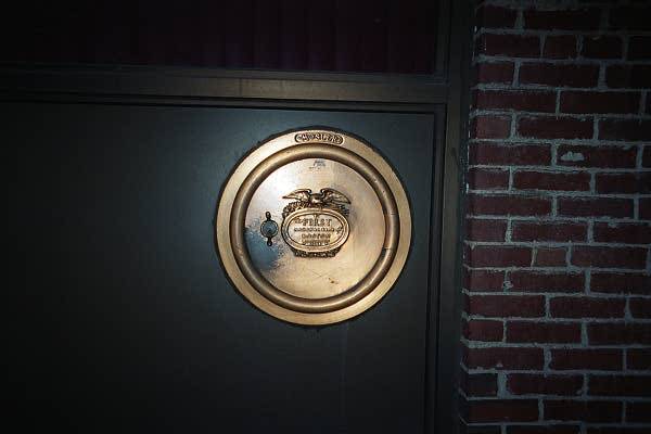
On Commercial Street, I discovered a small golden-colored bank vault door (Figure 12) on the side of a window. Printed on the vault are the words "First National Bank of Boston 1784." There seems to be a place to put in a key. Now, the building is a law firm. Did this building used to be a bank? Was this actually the original vault door? As I continued down Commercial Street, I ran into the Ausonia Apartments. This apartment complex takes up a large portion of one of the blocks on my site. It is run by the Boston Housing Authority and is part of their Elderly and Disabled housing program. According to a plaque on the wall, it was dedicated on April 15, 1977. What used to be there? Also, was this part of the Public Housing Program deployed in the 1960's? |
|
At the end of Commercial Street, I found a park right next to the Columbus Housing called Dog Park (Figure 13). However, it is completely tiled over with stones. There are no grassy or even dirt-filled spots in the park. This does not at all seem like a place to take your dog. Did it used to be a grassy park where owners took their dogs? If not, how did it get its name? |
|
|
|
On Fulton Street, I located a small parking lot that has an old rusted sign on it that says, "Oil Delivery - no parking." Right next to it are two shiny new signs that state, "No Parking - B.H.A. Property," (Figure 14). B.H.A. most likely stands for the Boston Housing Authority, which runs the Ausonia Apartments right by the parking lot. However, the old sign intrigued me. There does not seem to be an oil depot or refinery anywhere close to this site. Did there used to be an oil-related industrial building in this area? Also, I noticed that none of the cars in the parking lot had any identifying markers. If that's true, how can the police enforce the No Parking sign? |
|
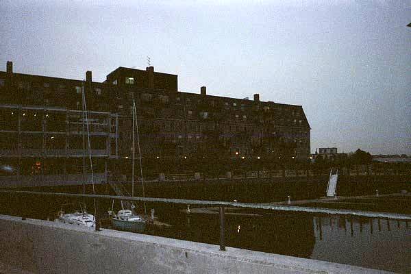
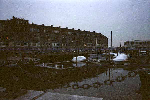
As I finished walking the streets of my site, I decided to explore the two wharfs. Both Lewis Wharf (Figure 15) and Commercial Wharf (Figure 16) seem to have changed a lot. Now, they are mostly residential buildings with commercial office space on the ground floor. Surprisingly, the Commercial Wharf is only open to authorized personnel. What used to be there? I assume that it used to be a highly commercial area with lots of boats going in and out of port. How did this area become so residential? And why is the Commercial Wharf only open to authorized personnel? |
|
|
|
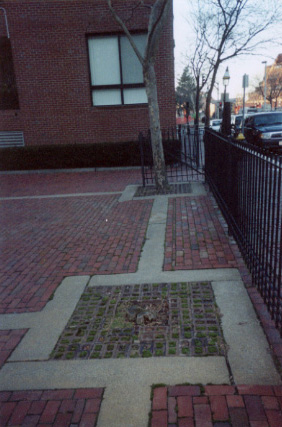
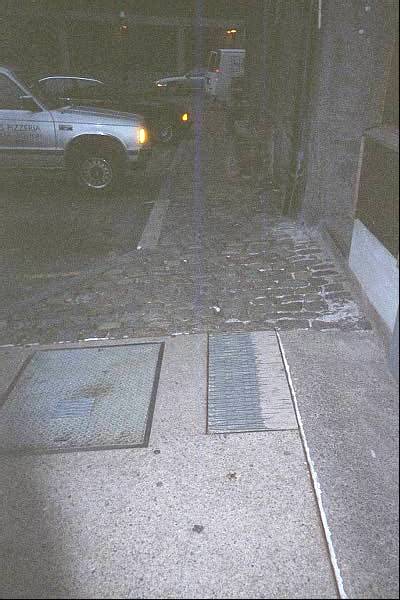
As I looked over my site, several small things of interest became apparent to me. Both the sidewalks and the streets seemed to change a lot randomly. At one point I would be on a cobblestone street and sidewalk. A few steps later, I would be walking on a patch of bricks. The next corner would be filled in with slabs of concrete (Figure 17). Why are the streets and sidewalks so varied in their materials? What caused these changes? |
|
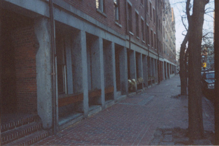
Also, I noticed that many of the doorways are made of concrete (Figure 18). However, most of it seems to have chipped away. How long have some of these buildings been built? And if they are relatively new, why are they wearing down so quickly? |
|
|
|
I found the streetlights in the area (Figure 19) very fascinating. Several of them seemed to be very old in their structure and design. Others seemed to be newer and more modern. How old are these lights? Did the older ones used to carry candles if they were built before electricity? Also, I noticed many alleys around my site. The doors to many of the apartments are in these alleys. They do not seem to have been planned out thoroughly since they crunch together and form several odd angles. Were there always alleys here? Or are they a result of time? |
|
During my initial visit, I found several things of interest on my site. However, the most intriguing observation is the wide variety of buildings and land usage. There are several residential areas, although most of them are more inland, close to Garden Court Street and Hanover Street. Other than that, there are a lot of commercial buildings. There are many office spaces and law firms in the area. Also, restaurants are everywhere on my site. Most of them are Italian in origin, although there is some mix, especially close to the wharves. Several churches and shops are also on my site. There are several parks and a power plant, too. Plus, the buildings themselves are very different in style and architecture. Several of them seem to have been built during different time periods and for different reasons. Also, their uses seem to have changed over time. This huge variety on my site has really attracted and intrigued me. I can't wait to revisit, study, and learn more about my site. |