 |
 |
 |
 |
 |
 |
 |
Mississippi River: General
Written
by Melinda Medlock
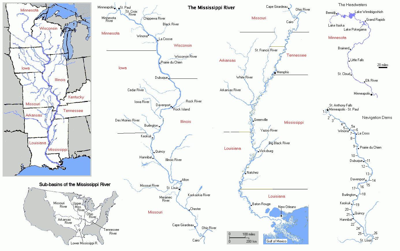
The Mississippi River is divided into the upper and lower basin at Cairo, Illinois where the Missouri River enters as the last major tributary. The river’s drainage basin includes up to 41% of the continental United States (USACE, 2004), including a lot of fertilized agricultural area. Runoff from these agricultural plots and sediment flowing into the river from other tributaries give the Mississippi a very high sediment concentration. Deposition of this sediment on the river’s floodplain occurs during periods of high water, when more runoff and increased erosion of the banks increases the sediment and water load of the river. When the water level is high, the river deposits sediment first on its banks, building up its own natural levees. When even these natural levees fail to hold in the rising water, the river floods its banks and deposits sediment across the floodplain. This process has continuously extended the coastline and built up the surrounding floodplain.
This sediment is also important for maintaining the wetlands that fringe the Louisiana coastline. These areas depend on a steady supply of sediment to provide substrate for plant growth and a current of fresh water to prevent the ocean’s salt water from encroaching and killing the freshwater plants and animals.
The course and position of the mouth of the river into the gulf has changed at least seven times in the past 10,000 years (Heller, 2006). The river gradually builds up its floodplain until it is much higher than the surrounding land. Then the river would find a new, lower, shorter path to the ocean by cutting through one of its banks and eroding out a new bed for itself.
Floods have been a major part of the Mississippi delta ecosystem for as long as the river has existed. They deposit sediment to build up the natural levees, increase the elevation of the surrounding floodplain, and sustain the wetlands that protect the coast from large storms and also filter the water, particularly for fertilizer, before it enters the Gulf of Mexico. This means that the disappearance of these wetlands is increasing the amount of fertilizer that flows into the Gulf of Mexico, which is responsible for the huge hypoxia zone at the mouth of the river.
The crops and people settled along the banks of the river are protected from its periodic floods by levees and other flood control structures like spillways and dams. The banks of the river are also armored along several stretches to prevent further erosion and loss of developable land. Dams and large reservoirs, particularly on the Missouri and Arkansas river tributaries, have reduced the sediment load of the river by at least 50% since they were built in the 1950s (Meade, 1995). Several of these dams are filling up with sediment that is dropped by the river as it hits the dam and slows down. As a result, their capacity and effectiveness for flood control is being compromised. Currently, there is no solution to this problem other than dredging, which is expensive.
The levees extend all the way into the Gulf of Mexico, channeling sediment straight out into the Gulf and over the continental shelf, where they are essentially lost to the wetlands and land-building processes. The levees also prevent the river from building up its natural banks and floodplain with sediment deposited during times of high water. Instead, the river just deposits the excess sediment it picks up during flood stages on its own bed, gradually building itself higher and higher above the surrounding floodplain. This means that the current river bed is artificially maintained because of its high elevation relative to the surrounding land. This is why, in New Orleans, people have to look up to see the ships on the river.
If the river were to continue shifting positions every time it found a shorter, steeper route to the Gulf, many port cities would need to be periodically relocated. This happened often before the Army Corps of Engineers built up and monitored the levees, preventing the river from changing course (Twain, 1967). The Corps built the Old River control structure during the 1950s to prevent the Mississippi from shifting its flow entirely into the steeper, more direct route to the Gulf via the Atchafalaya river bed. The Mississippi currently empties about 30% of its water into the Atchafalaya (Sparks, 2006). The Mississippi bed is much higher than the Atchafalaya at Old River, so without the control structure, the Mississippi would send 100% of its flow down the Atchafalaya. This would leave all cities currently located along the Mississippi below Old River completely dry, and flood most of the cities currently located along the Atchafalaya.
Spur dikes, or wing dams, are used to control the width and depth of a channel of flowing water (Hendrickson, 1999). They are porous barriers, usually constructed of quarried rock laid down during times of low water. The dike extends only partway out into the channel, where it slows down the water that passes through and around it, causing the river to deposit sediment and further build up the dike. If the opposite bank is armored, preventing the river from maintaining its original velocity and hydraulic radius, the spur dike serves to narrow and deepen the channel, thus increasing the river’s velocity. A higher velocity also increases the river’s carrying capacity. This means that it will pick up more sediment, and if it cannot do this by eroding the banks outward, it will cut the bed deeper.


