


We often take for granted the expansive flats that line the Charles; many do not realize that it is land not true. We overlook the fact that the original landforms compose only a fraction of modern day Boston: at the tip of this sits the North End.
 Figure 1: A map of Boston from1777 showing topographical features. Taken from A Plan of the Town of Boston with Entrenchments (Library of Congress – Geography and Map Division). Scanned from Krieger’s Mapping Boston.
The North End resides on the headland of the Shawmut Peninsula. Naturally formed and easily defendable, it was a natural choice for the location of the some of the first settlements of the Boston colonies. Being the oldest part of the city, it has also grown to be one of the densest: buildings four or five stories tall with little to no gaps between them line the narrow streets. The resulting natural processes are unique to this unique urban layout: nature’s behavior has adapted to the urban curiosities of the North End.
Though old topographic maps (see Figure 1) indicate that only the north east corner of my site sits the side of Copp’s Hill, the entire site is gently sloping. This natural gradient lends itself to many natural processes: the water, for example, is given a general direction to flow. The streets are guided to an extent by the topographical contours, and these in turn guide the air that streams through them. The Peninsula itself is composed mainly of naturally occurring compacted clay. While this is not landfill, it is still heavily compacted by natural processes but also from the years of weight from the buildings upon it. The compaction of this clay “retards water infiltration and drainage… prevents root growth, and increases thermal conductivity”(Sprin pp.104); thus, the sheer antiquity of the settlement has in turn caused settlement on the natural forms upon which it was built.
Air flow in my site is dictated by the shape of the urban landscape. The built up, terrace-like nature of the residential buildings gives rise to an abundance of alcoves and other man made ‘topographical’ features with which the elements can interact. The layout of the residential buildings forms atriums behind the front-facing street façades; these spaces in turn form environments often seemingly independent to those on the street. Figure 2 indicates locations of such atriums in my site.
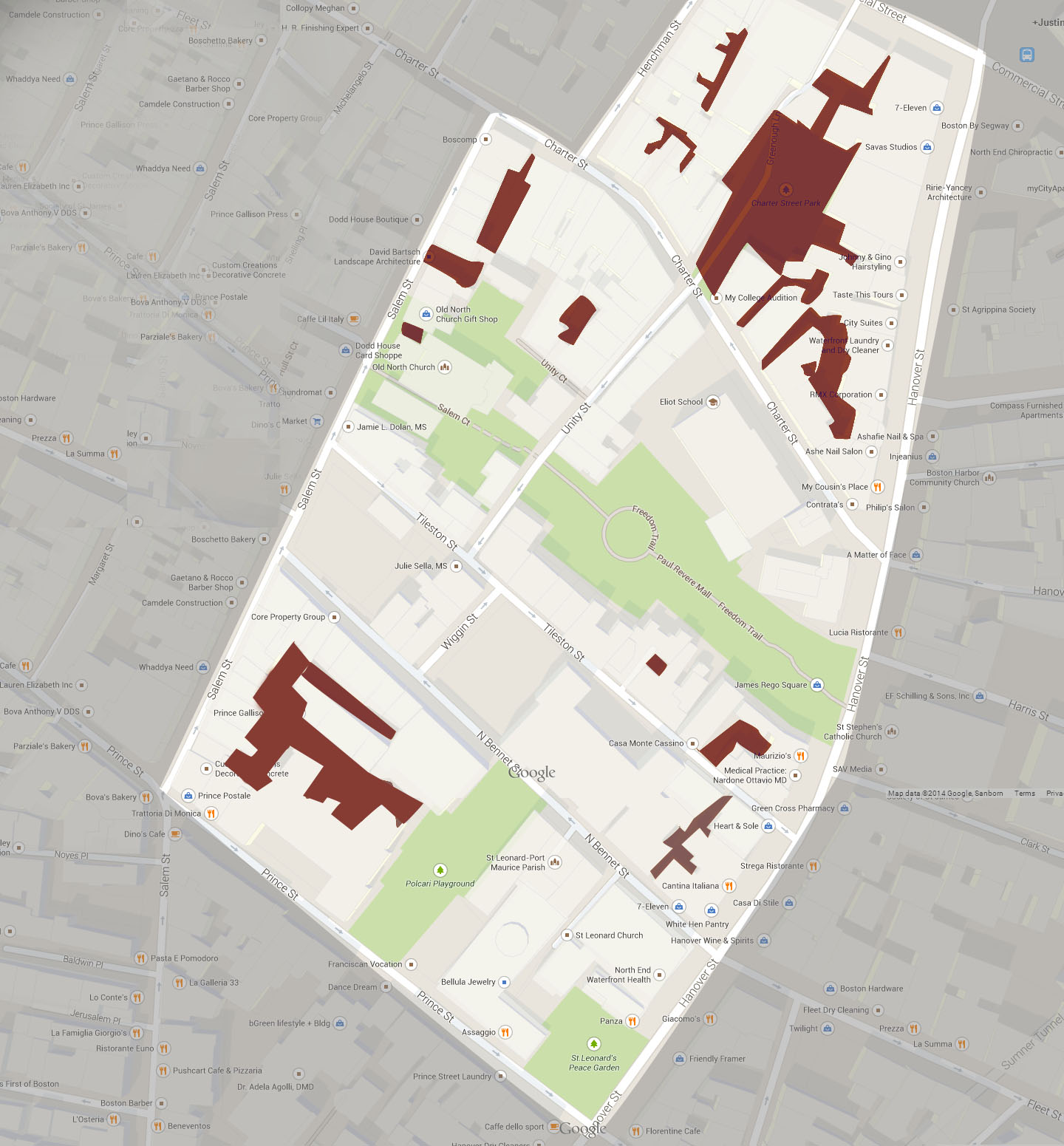 Figure 2: A map of the site with atrium spaces marked in burgundy. Original Imagery ©2014 Google Map data ©Google, Sanbom
In Figure 3 we see the view of the pavement in front of the gate into one of the aforementioned atriums from the street. The façade is dry and bare of greenery. The view through the gate, however, shows a different environment: inside, snow still sits on the ground (indicating a lower temperature), ivy crawls up a wall. The wall itself is made of wood and appears moist, and thus caters to the growth of thick algae. This atrium is separated from the street by perhaps eight metres of corridor, but it is the eight metres of brick that extend fifteen metres upwards that create the difference in moisture levels and temperature between the neighboring spaces. This is to me the most interesting effect of the urban environment on the adapted natural processes of the site: its creation of noticeably contrasting microclimates that exist only meters apart.
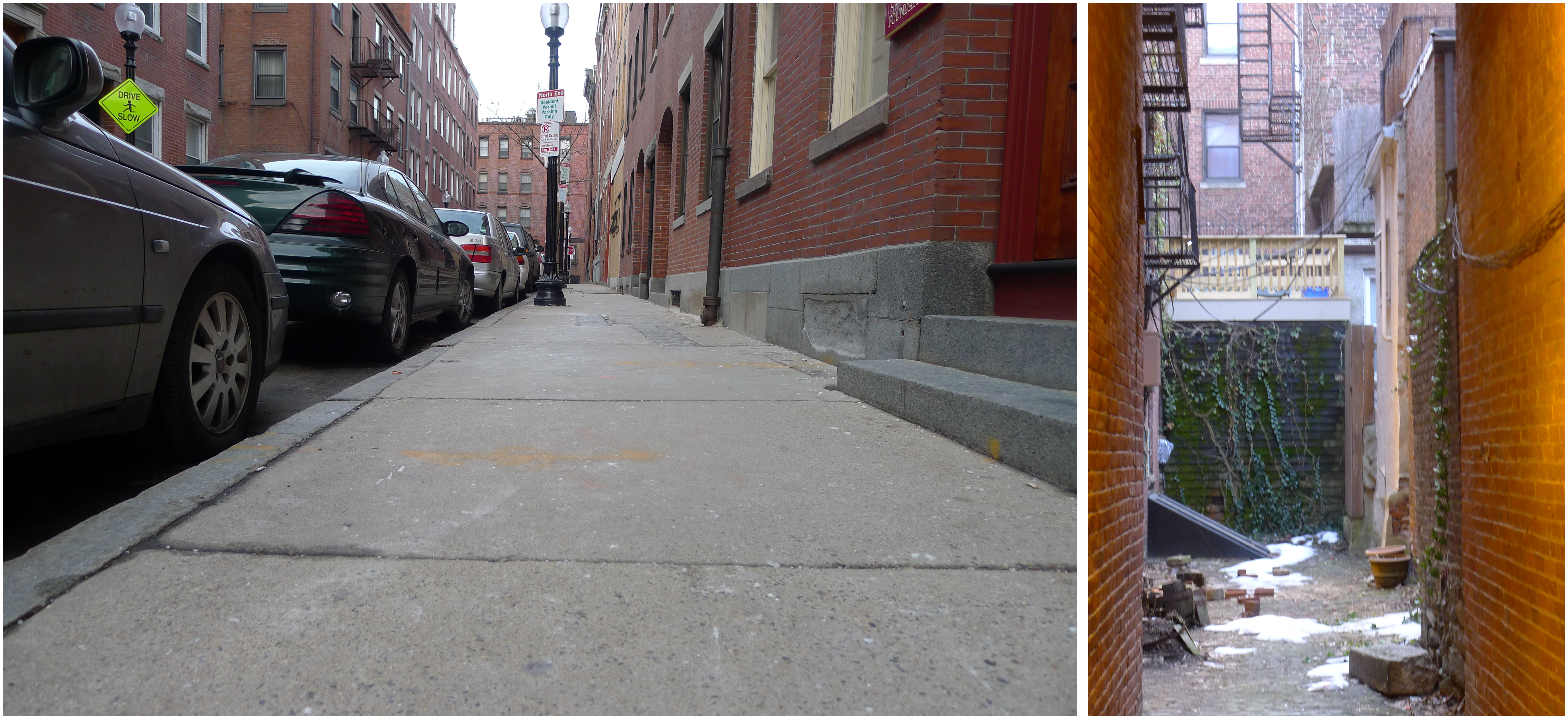 Figure 3: Views of the entrance of and inside an atrium. There is a marked difference in microclimate.
Perhaps the most dramatic example of an induced microclimate was in Paul Revere Mall. This public monument is an open promenade that connects Hanover and Unity Street, running north-west through the block. The area is symmetrical along this axis, at least in planned layout: trees line the central path, which leads to a fountain in the centre of a circular space. The relative microclimates are, however, wildly different on either side of the path. The northeastern half of the mall endures a substantially warmer microclimate than the other: when visited, it was clear of ice (temperatures were around 4 degrees Celsius). The pavement on the other side, lying on the southwest, was instead still covered in ice. Such a juxtaposition of phase indicates at least a five degree Celsius temperature difference (to maintain the ice’s solid state). What could cause this disparity? On the southwest side, the park is surrounded by buildings that encroach on the area’s borders so closely as to share the dividing wall; these buildings, I hypothesize, cast shadows on the colder side of the park and block the warmer afternoon sun. Furthermore, it seemed windier on this side, perhaps caused by the sheer walls of the buildings and the lack of windbreakers (such as arches and scattered buildings) that are present on the other side. As such, we see a form of what Spirn calls a “street canyon”; the same processes that trap noxious gases in Spirn’s examples here play with heat and the lack thereof.
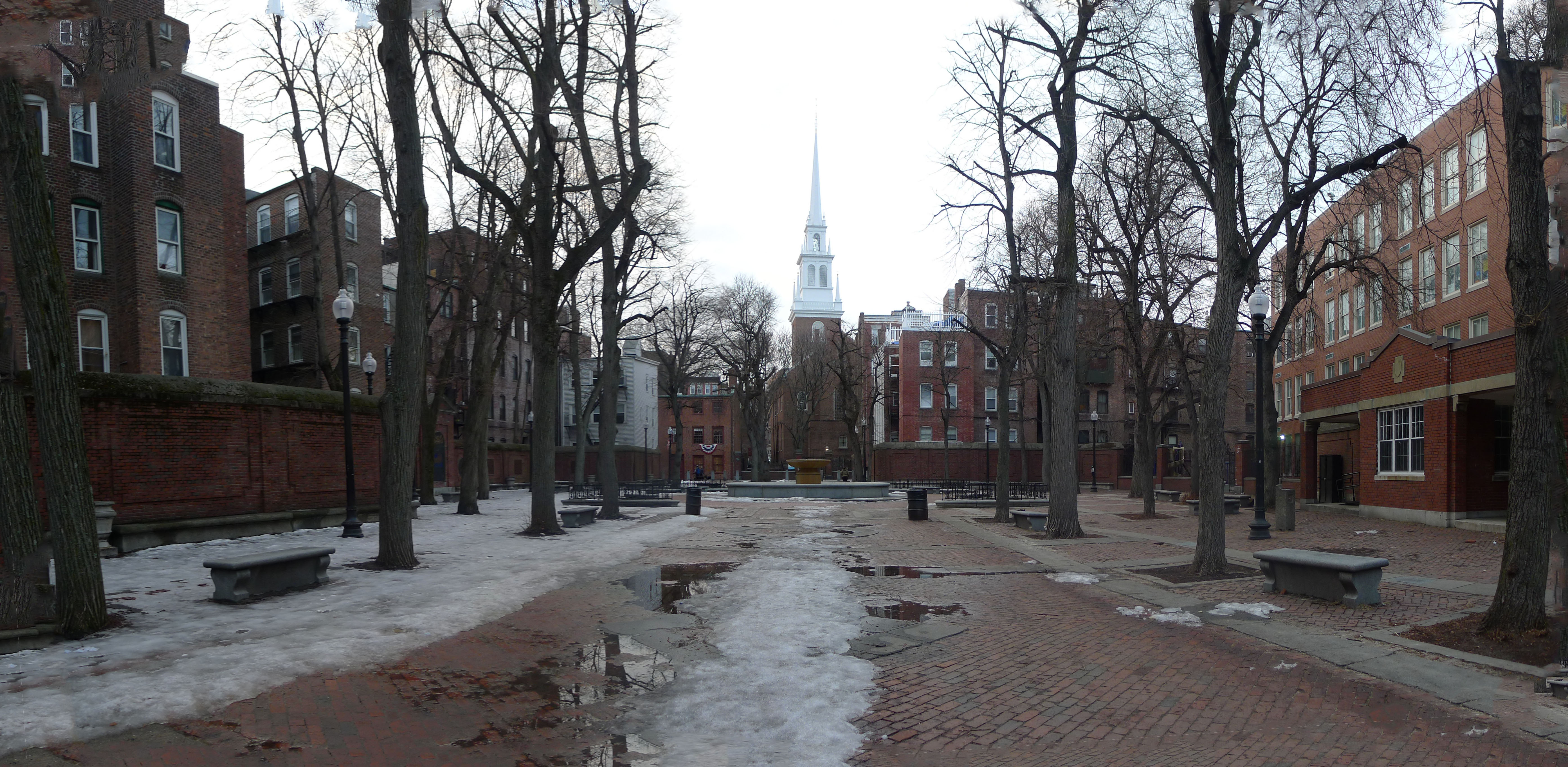 Figure 4: Paul Revere Mall. The left side of the mall is lined with unbroken residential blocks while the right is bordered by a school complex, which sports open playgrounds and is thus less obtrusive to the sunlight.
Temperature is not the only microclimatic difference in Paul Revere Mall; moisture levels, too, varied on either side. I observed algae growing far more vigourously on the colder side, in the shadows of the buildings, indicating also a higher moisture level.
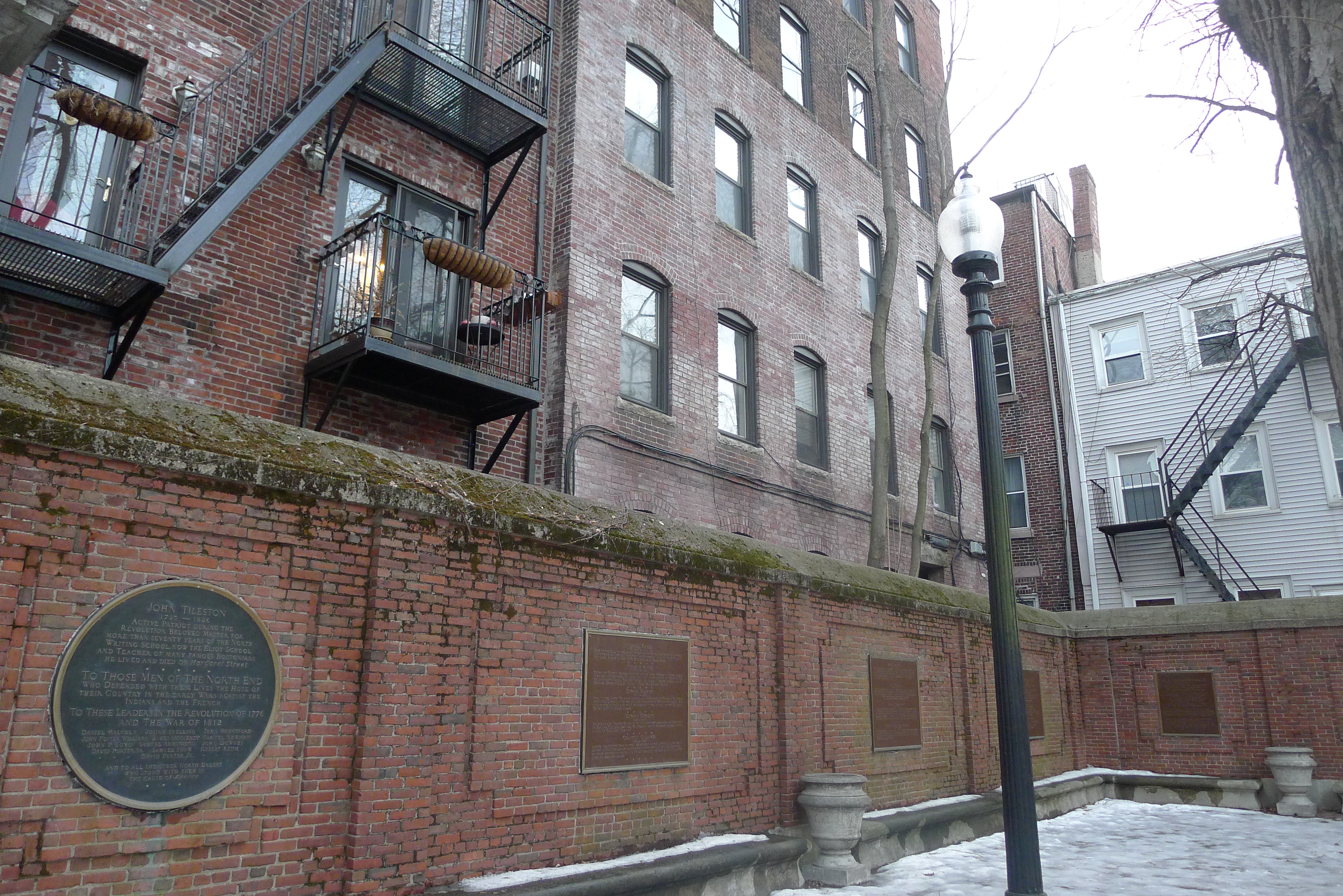 Figure 5: Algae growing atop the southwest walls of Paul Revere Mall. Note that the far wall (northwest facing) has much less algae coverage.
Water flow in the site is greatly influenced by its natural topography. While many urban locations in Boston must deal with the flatness of landfill by employing concave streets and inward sloping pavements, the North End is equipped in many places with a unique combination of natural gradients and the use of the older paving materials such as cobblestones. Typical pavement slabs form large barriers between incident water and topsoil; cobblestones, on the other hand, are laid on top of sand or clay and thus allow a much more rapid drainage of stormwater. In the hillier areas of the site, water naturally flows down the slope: thus, pooling and sedentary water damage was not common in these areas.
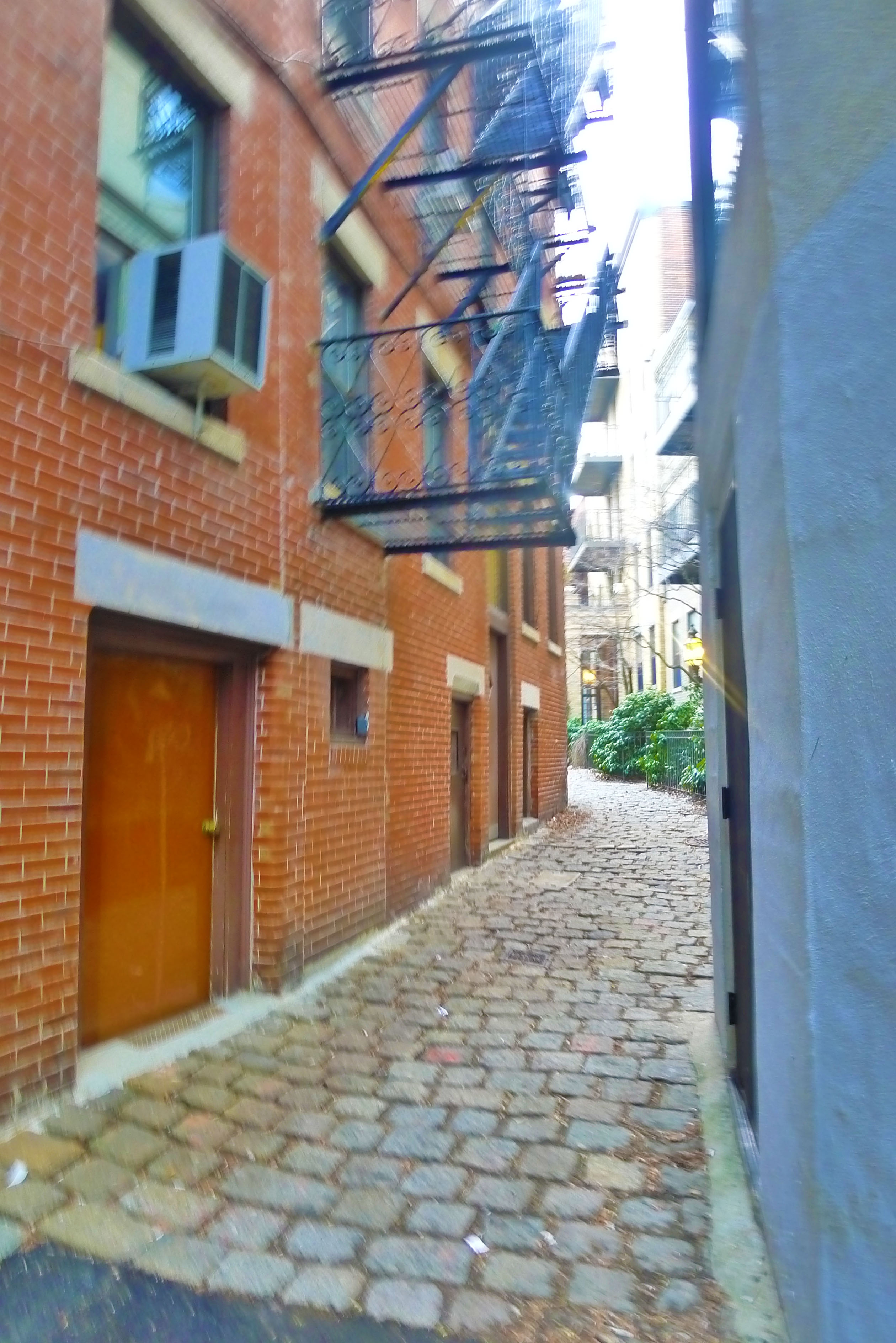 Figure 6: An alleyway to an atrium that ascends a hill. The cobblestone pavement assists the already capable gradient to channel water from the atrium to the harbor outside.
In flat areas or those where the hill has been leveled out, the cobblestones have either naturally or deliberately aligned to drain water in specific directions. Charter Street Park is a paved public area in an atrium formed by a collection of residential apartment buildings; upon entering it I noticed a trail of snow (Figure 7) that lead from the entrance and through into the central plots of the area. Here, the cobblestones all sloped down towards the centre, a result of either deliberate water runoff plans (away from building foundations) or the building of the park on softer ground, as opposed to the concrete foundations of the apartments.
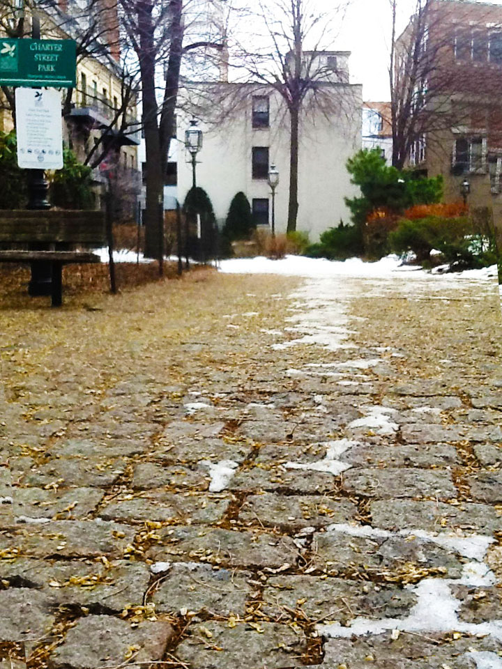 Figure 7: Water collected first in a trail and then a pool, and had remained frozen (as snow and the pool as ice). Furthermore, there was a noticeable increase in algae growth in these areas due to the increased moisture. Many of my observations of water flow were informed by snow and ice deposits.
Despite the chanced water drainage systems employed in the site, water damage is still markedly prevalent, especially in areas that had been modernized with traditional pavements. Flatter areas gave rise to pooling and in turn erosion around drains (Figure 8), and even sloped roads that also endured heavy traffic had been further worn down by water flow (Figure 9a). Flat cobblestone and bricked areas also gave rise to pooling especially between the individual elements; mortar had been worn down and replaced by algae.
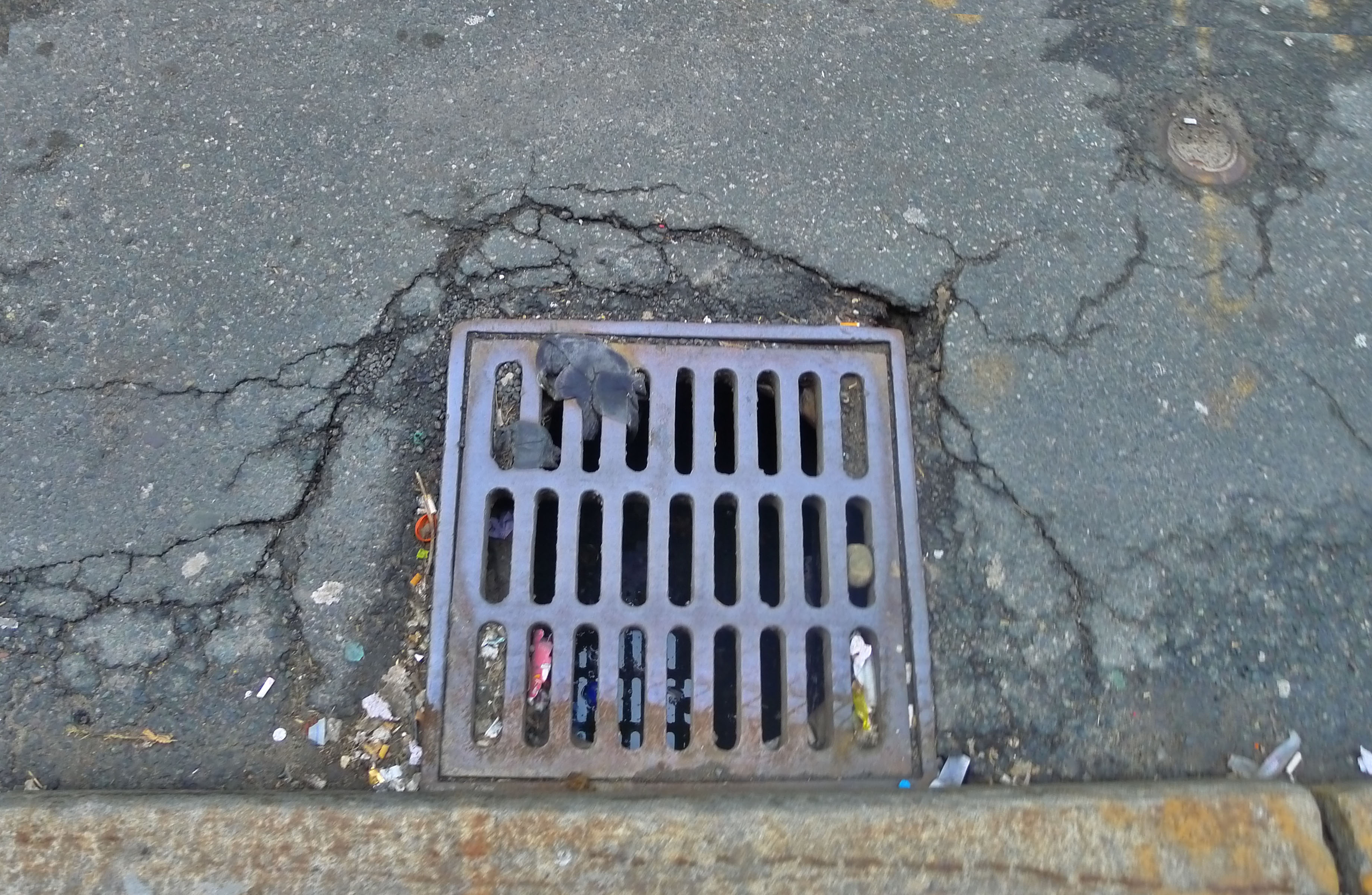 Figure 8: A drain that has been eroided at the edges due to sedentary water pooling around it.
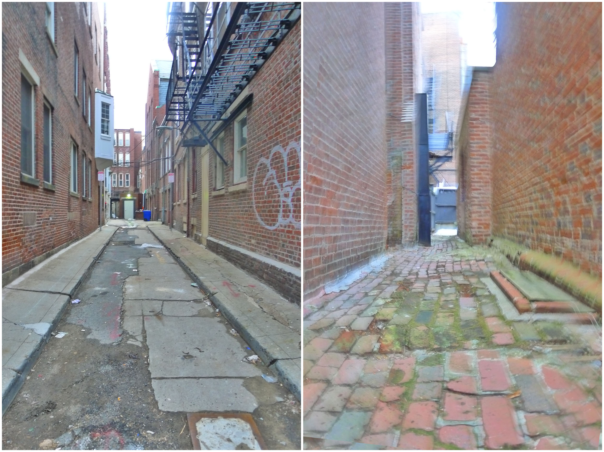 Figure 9a: A sloping road struggling to stay in shape. Figure 9b: A flat path into an atrium space. Here the bricks do not serve to assist drainage; rather the grouting spaces provide pooling opportunities and thus foster algae growth.
The density of the streets places a noticeable stress on plant life in the site. There is evidence of attempts to plant trees along the sidewalk, but in many of these instances growth has not been readily achieved. Many of those which reside in the pavement show obvious stunting; as Spirn describes, “the [street] tree roots … are imprisoned as surely as if they had been placed in a concrete pot.” This “tea-cup” effect is seen in the early processes of damage in Figure 10; another tree had been planted in what was in fact an actual concrete pot. (Figure 11)
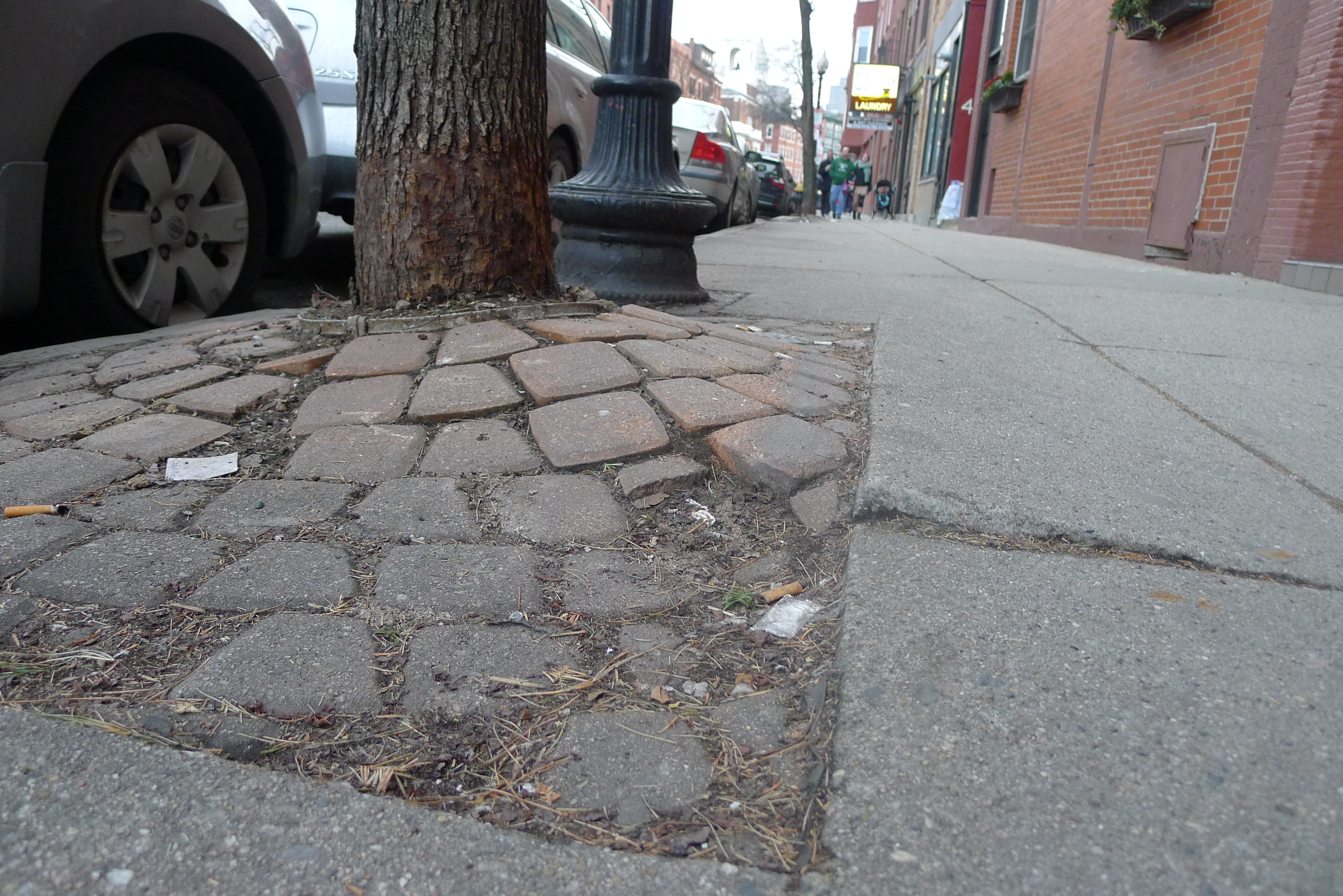 Figure 10: A tree breaking from its teacup
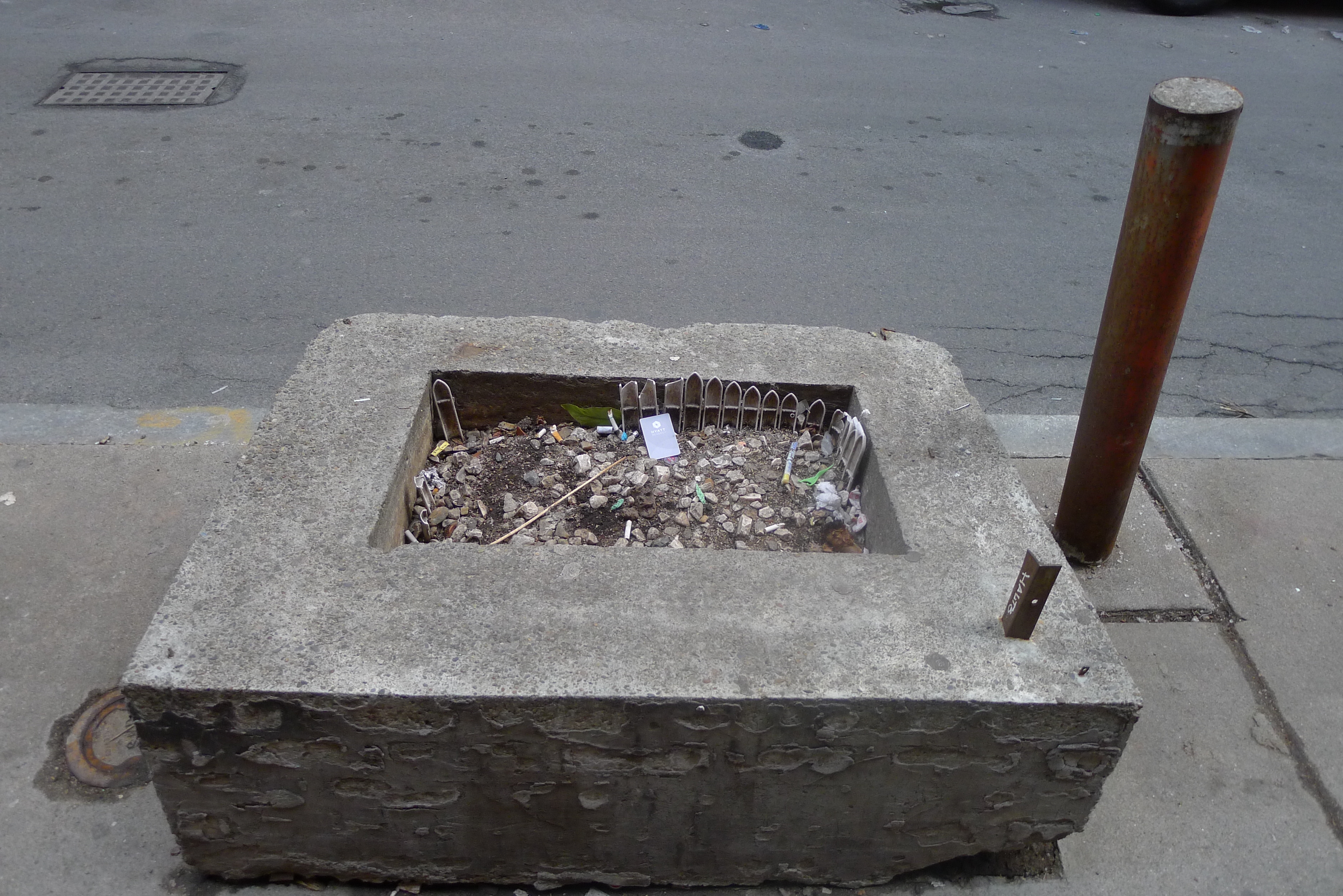 Figure 11: A failed concrete planter box.
The lack of suitable soil conditions and vicinity to road and building were not the only effects of the crowded urbanity on the plant life. Trees on the West side of Hanover Street had a peculiar shape to them. Their counterparts on the other side were typically shaped and perhaps one and a half stories tall. But these on the west side had trunks about two metres tall with bushy outgrowth, in the shape of a standard; upon closer inspection, the distance between annual buds was rather small, and furthermore grew outwards and downwards rather than up and out. These two factors resulted in a ball shaped, stunted looking tree, made to look slightly more eye-pleasing through a resident’s added Christmas lights. Spirn explains that trees like these “eke out a marginal existence”, “condemned to perpetual shade cast by the adjacent buildings”; this effect is amplified due to the narrow sidewalk.
Another interesting natural process is the peer to peer interaction between the cultivated plants in the area (note that there are little to no volunteer plants in the site). The council, in an attempt to ‘renature’ and create in this dense urbanity what Spirn calls “an expensive aesthetic, has planted trees on both sidewalks and in public plazas, but did not think of the future interaction of the plants at the intersection of the urban elements. This is particularly noticeable at the edge of Paul Revere Mall. The Mall is lined with trees, huge and ancient, probably planted over fifty years ago. These form a promenade perpendicular to Hanover Street, which is itself lined with smaller trees. One of these stands at the intersection of Hanover and the trees of the Mall, and its growth path is noticeable affected by its much taller neighbor: firstly, it is much smaller, thinner, with shorter yearly growth lengths, but most noticeably leans away from the mall and into the street. I deduced that this is likely because of the shade produced by the trees of the Mall; the Hanover tree is reaching out into the open air of the street, but must nevertheless compete with its neighbor for both sunlight and nutrients.
The sparse volunteer plant life that has found home in the dense urban forest comes mainly in the form of wall climbing ivy. These were found generally in wetter areas (often in atriums) and latched onto surfaces that provided some form of tactility. This was seen in Charter Street Park: the side of one of the buildings lining the public space showed the remains of a previous terrace building that had been torn down. Stubs of concrete and bricks still protruded from the walls, but no longer did they support a wall: ivy was thriving on the unmaintained surface and the abundance of grips it provided.
The intimacy of the buildings accentuates the differences between the responses of different building materials to the same weathering processes. The effect of water is most noticeable. Rust is abundant in the North End, eating away at the older fire escapes that still serve the buildings. In Figure 14 we see a curious example: a single building is split down the centre and is heavily weathered on the left, with blackened stone cornices and completely rusted iron walkways. My first instinct was to assume that it was the simple result of biased re-painting, but upon closer inspection I realized that it was indeed biased rust: the right hand side had not been recently painted over. I assumed, then that the cause of this phenomenon originated from the rooftop; the left hand side likely is slightly lower and thus is the point of runoff during rain and storms. This falling water has blackened the stone cornices and rusts only the section of the iron walkway that falls under its path.
The air takes its toll on buildings too. Copper facades stand out in their verdigris patina, the green streaked with darker browns where water has not touched as intensely. This stands out to the largely unweathered brick that makes up most of the site’s buildings. Some however, have been affected: in Figure 15 we see another hard division that has been picked out by the elements. The white, powdery appearance of the lower half of the building looks similar to salt buildup on the side of buildings; whether this is the substance or not it, the division is likely caused by a difference of coatings in each region. Old maps show that the Mall was built after these buildings; what we see is likely the outlining of a previous neighbor. Such a past would have gone unnoticed to the mapless if the wind had not defined it so.
The urban intimacy of the North End fosters not only an environment fit for hearty meals and wines, but also for a unique set of natural processes. Spirn’s concepts of flow are well evoked in this site: buildings form channels and gradients give them direction as water and air are diverted to create microclimates and alter the flow of its human residents. These processes have adapted to the urban forms that themselves have arisen due the age of the area’s settlement; it will be interesting to discover the urban processes that have so shaped the natural.
Bibiliography:
Bibliography:
Spirn, Anne W. The Granite Garden: Urban Nature and Human Design. New York, NY: Basic Books, 1984.
Krieger, Alex, David A. Cobb, Amy Turner, and David C. Bosse. Mapping Boston. Cambridge: MIT Press, 1999.
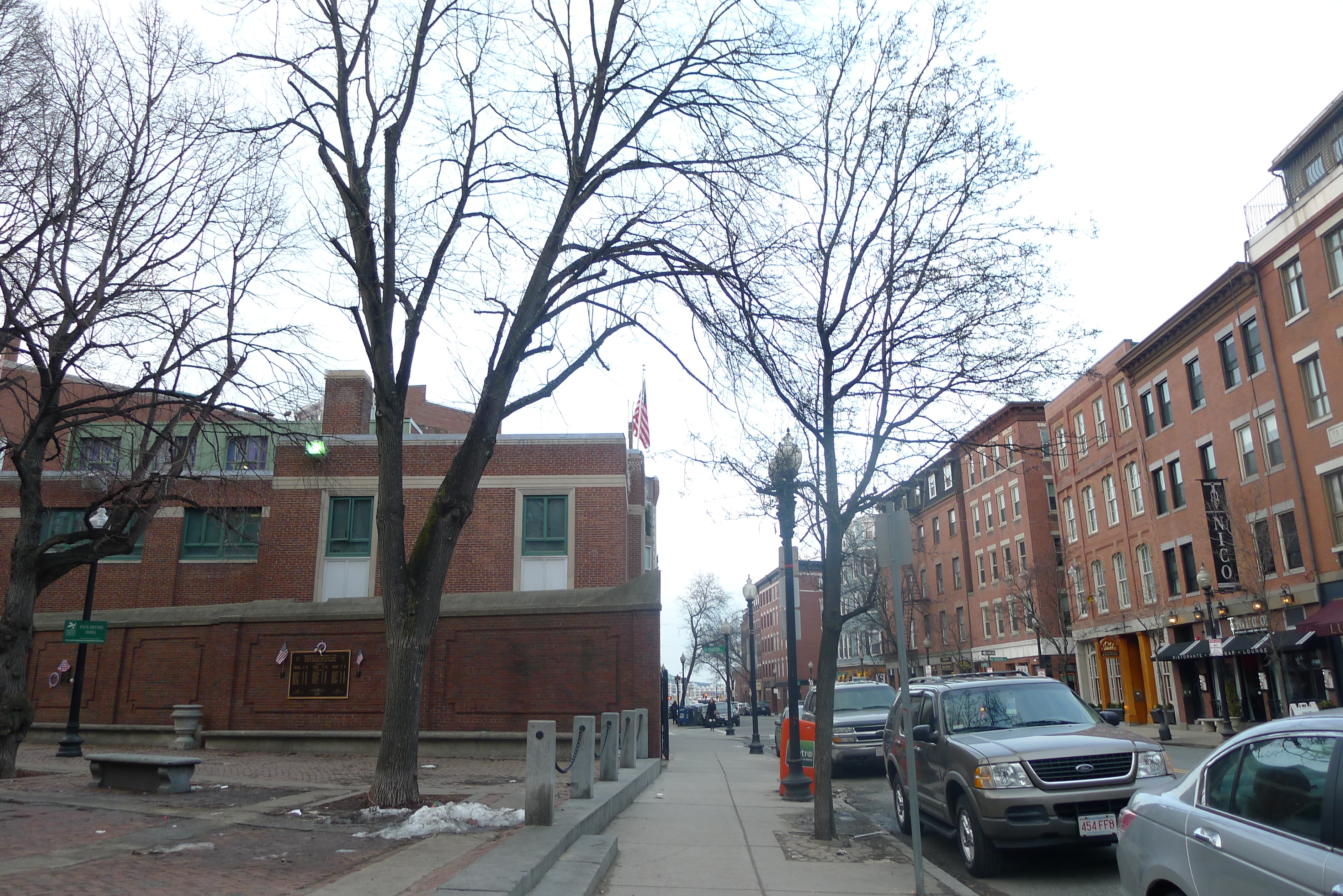 Figure 12: At the intersection of two council foliage endeavours, one conquers the other. The tree on the right (lining Hanover) must lean away from Revere Mall.
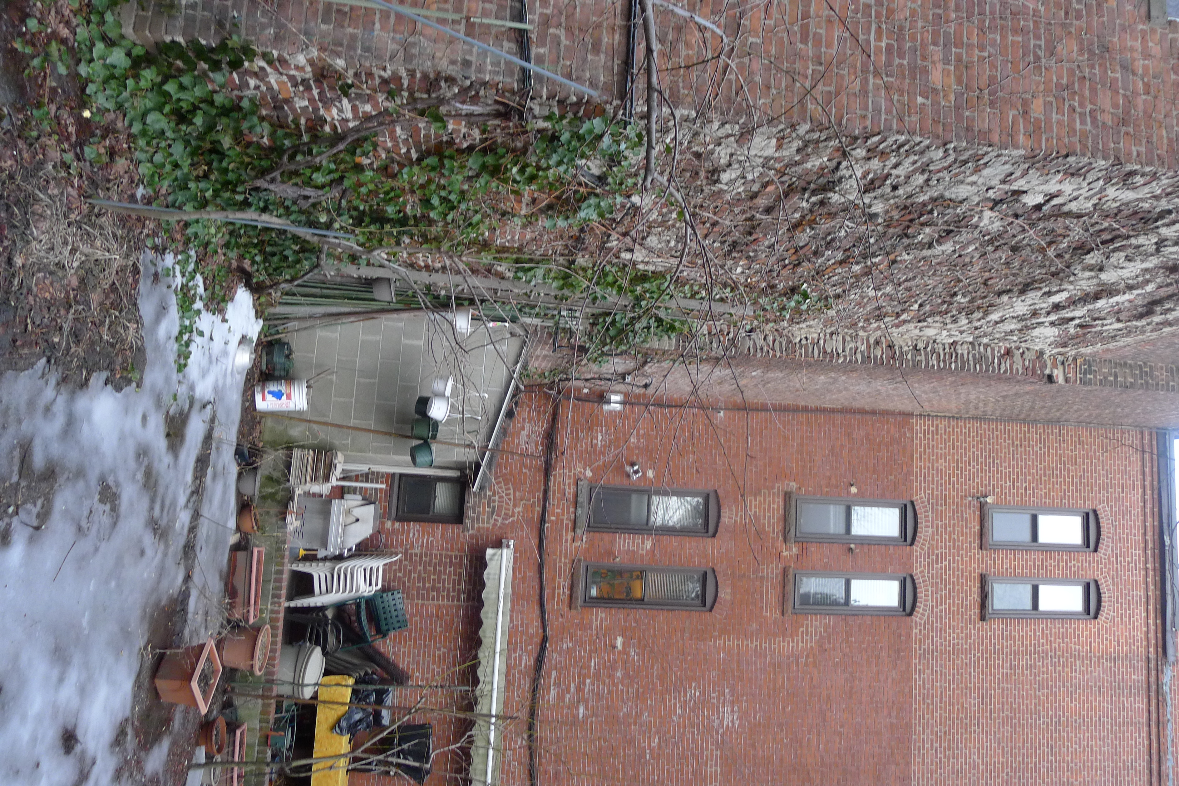 Figure 13: Ivy spotted on the side of a building. I wondered whether this plant growth was pre or post demolition: it was obvious in some places that the ivy had grown into holes in the brick (and thus likely affected the structural integrity of the building).
.
Figure 13: Ivy spotted on the side of a building. I wondered whether this plant growth was pre or post demolition: it was obvious in some places that the ivy had grown into holes in the brick (and thus likely affected the structural integrity of the building).
.
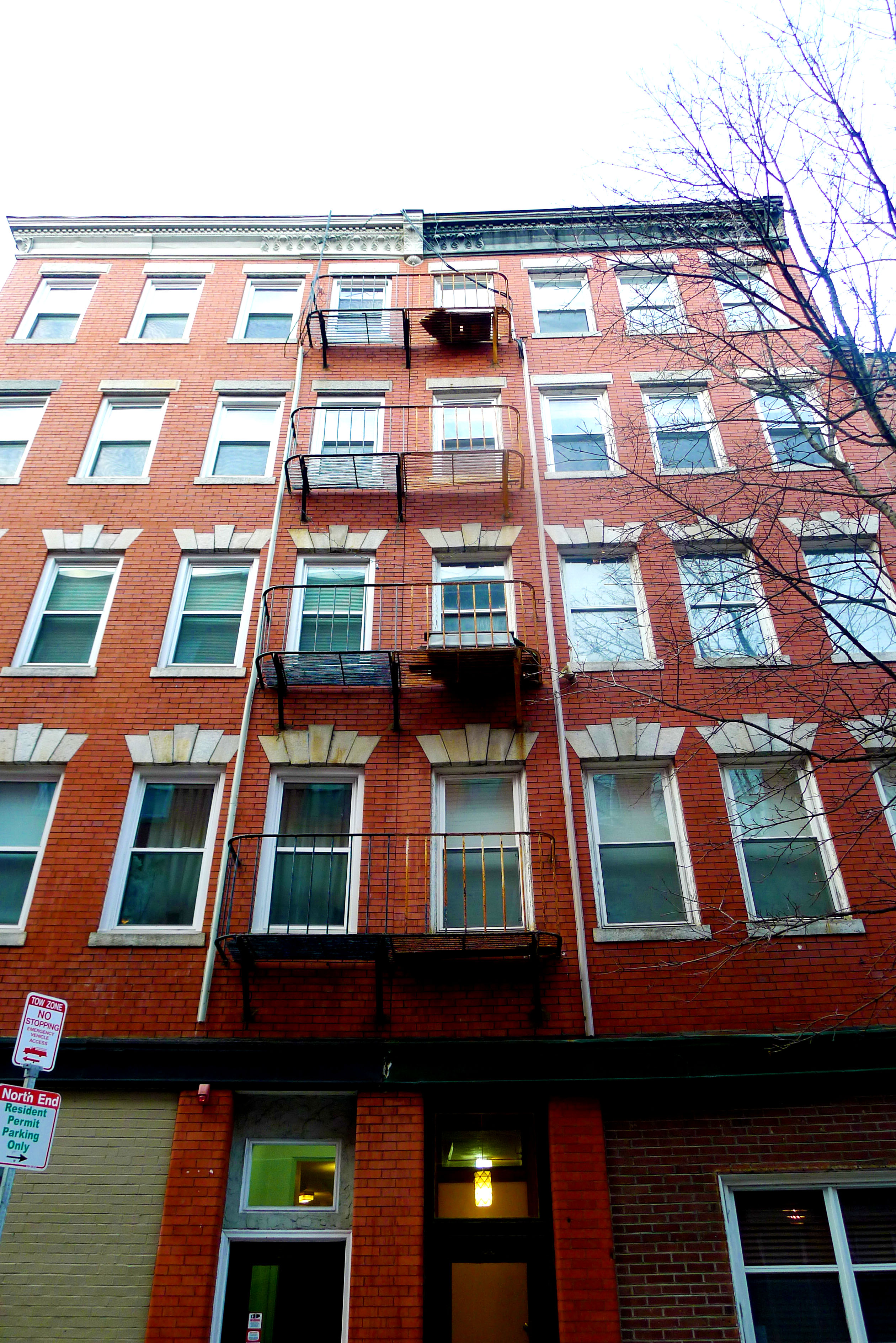 Figure 14: A curious building! Split down the middle by weathering processes. This is most obvious in the rust of the fire escape and in the different levels of patina in the ornamental features of the building.
 Figure 15: The white marking had an interesting powdery affect to it; the demarcation line was very sharp.
 Figure 16: A corner block in its verdigris glory. Note the stark contrast with the untainted original ochres of the brick.
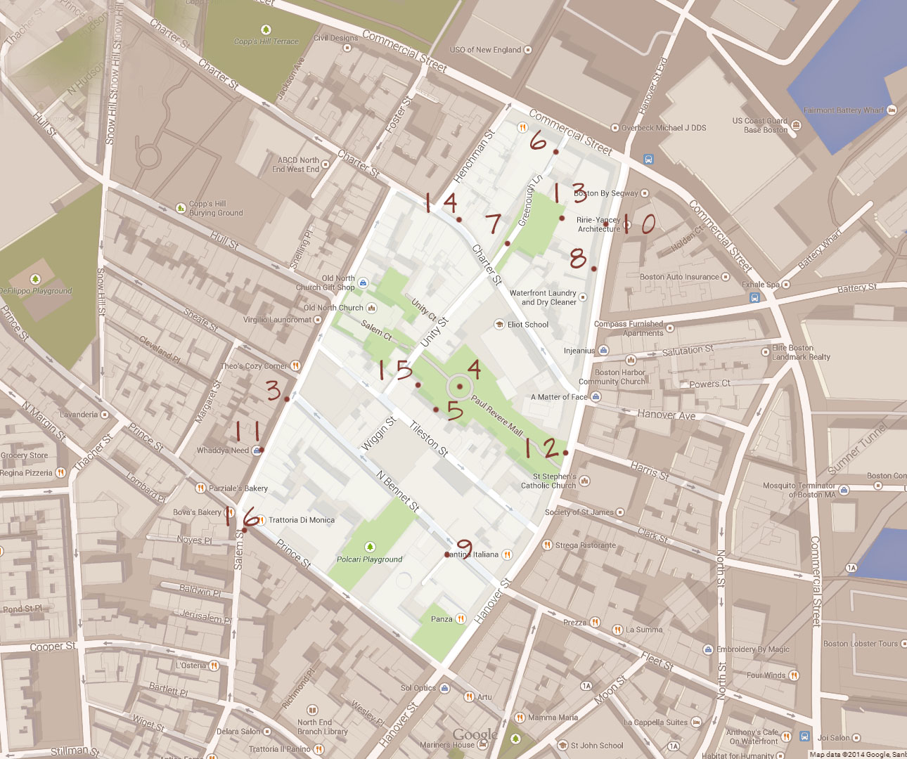 Photo locations by figure number. Original map c Google Maps 2014 Sambom