


I have for a long time been enamored by Italian culture. I grew up in an Italian neighbourhood, went to school in the Little Italy of Australia, learnt Italian, and lived in Trieste for three months last year. From my time in Italy grew a fascination with the organic flow of their cities (similar to but not quite the same as the organic confusion of Sydney’s) in the way Italian streets were laid out, not in a grid but conforming to the landscape or human function of each site. Thus, upon my arrival in Boston, I was naturally drawn to the North End. Here I found an urban landscape which seemed to me not typically American, but not Italian either: it seems to me that through the cultural repurposing of the land the site has settled somewhere in between.
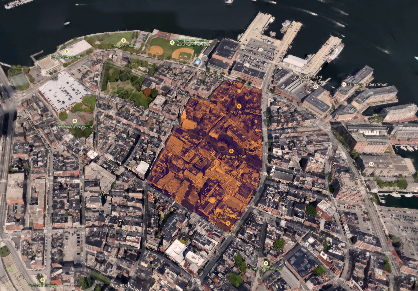 Satellite image of the selected site. Imagery ©2014 Google Map data ©Google, Sanbom
My site is bordered by three main roads: Prince Street, Hanover Street, and Commercial Street. Hanover, the busiest and widest, is filled with markets, restaurants and boutiques, perpetuating the bustling image the area is known for. Prince Street, smaller, is home to salumerias and smaller diners or boutique restaurants. Notably, however, it is much more residential: apartment windows fill the upper stories above the ground floor shops. Commercial Street marks the edge of the residential area: on one side it is purely housing, on the other reside athletic fields and commercial buildings. The fourth edge of the site is formed by Salem and Henchman Streets, smaller and slightly more residential versions of Prince Street, but notably the location of the Old North Church, originally an 18th century house that has become a landmark in the North End. Smaller streets and back alleys fill the centre of the site, from which one can see the backs of the buildings whose facades line the site’s borders.
In this way, my site simultaneously contains one of Clay’s ‘epitome districts’ (Hanover and Prince Streets are two of the most historically weathered streets of the area) and an encapsulated (and to many, hidden) residential one, complete with housing and public recreation: I chose this site in an attempt to capture the multitude of land uses amongst the density that is the North End. Within the site boundaries there are four public recreational spaces, all termed slightly differently: a ‘park’, a ‘mall’, a ‘playground’ and a ‘garden’. All share their blocks with private housing and commercial establishments.
What presents itself to me as the biggest mystery is the nature of the North End’s streets. There is little to no grid, and the resulting irregular streets are much narrower than their counterparts in most of greater Boston; the buildings that line the roads are single faceted tall structures that form a continuous 12 metre high wall of bricks of different ochres and windows of different eras.
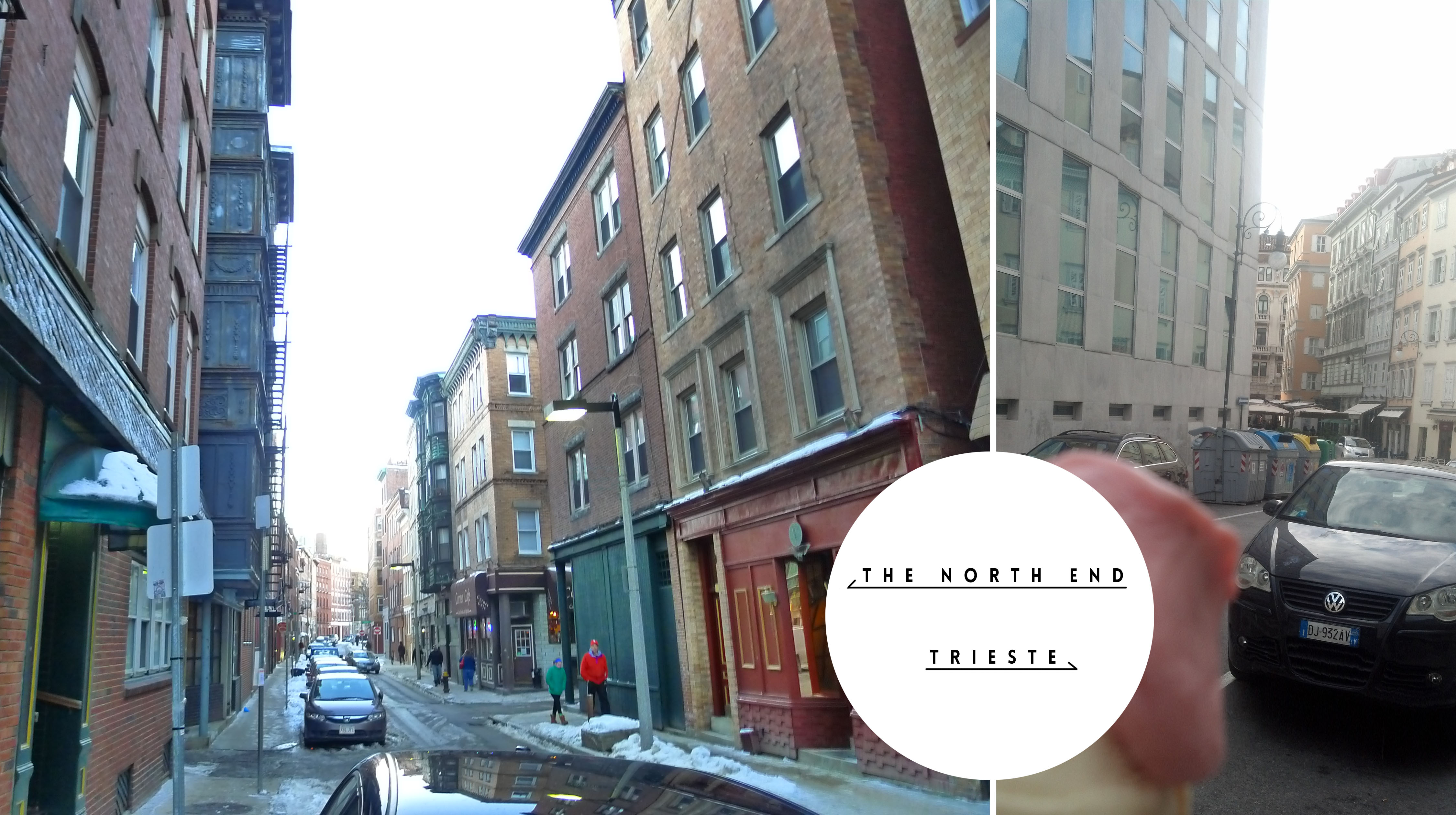 Comparison between a North End Street and a street in Trieste, Italy. Images taken by the author.
These roads wind like those in Italy; they create trapezoidal blocks that can serve to disorient but also to fascinate; in an area that began as the first residential district of Boston, one wonders whether the site’s streets always had such a ringing European air to them, or whether it was a change brought about through immigration and its inherent influx of foreign culture. Using this topic of investigation as a starting point, I hope to in turn examine the urban processes associated with cultural transitions, coming to an understanding of how the North End has grown and adapted to the changing needs of a changing people.
Bibliography:
Clay, Grady. Close-Up: How to Read the America City. The University of Chicago Press: Chicago, IL. 1980: pp.11-16, 38-65