|
|
|
|
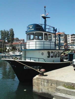
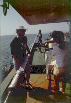
BLACK SEA 1999 From: Brendan Foley Hello All - It's July 8, and time for the next Sinop '99 Expedition update. Your faithful scribe today is Brendan Foley, a PhD student in the Program in Science, Technology, and Society at MIT. This is my second year on the project, and when I arrived in town last week the Turkish friends we made last year in Sinop made it feel like a homecoming. In 1998 we chartered a local fishing boat, Orkoz II, and ran our sonar survey from its deck. This year we again charted Orkoz. Most of the Turkish crew from last year is aboard again this year, and though they speak no English and I speak no Turkish we manage to get along quite well. For complicated directions or questions we rely on an interpreter, but for a lot of the mundane or routine communications I find hand signals and tone of voice convey the meaning amply. MIT's Sarah Webster has been kidding me because the skipper (Ali) and I jabber at each other perfectly happily, fully understanding each other without actually following a word. For the past three days the researchers on the Orkoz have been hovering over the site of a relatively modern shipwreck outside of Sinop harbor while the remotely operated vehicle (the National Geographic Minirover ROV is called "Gump") drives around the wreck 60 feet below us. The wreck is a great classroom for all of us to learn new skills and apply our practical knowledge.
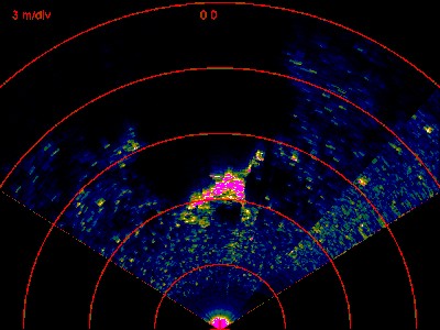
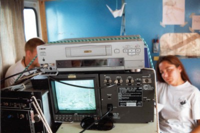
One of the main problems facing us is basic navigation. The Woods Hole ROV has a scanning sonar mounted on it, which allows the science crew to "see" at least 50 meters ahead of the vehicle. Gump has no sonar system, so we have to rely solely on the view afforded by its video camera. David Mindell likened optical ROV surveying to crawling around a mountainside at night with a flashlight in a snow storm.
Fortunately we can get some idea of the ROV's position in relation to the Orkoz by an acoustic device called a Track Point, which gives a relative range and bearing from the transponder hung over the side of the boat. To make things a bit stickier, we have been "live boating" in a 20 knot wind lately, meaning the boat is not anchored or held in place by computer controlled navigation systems. Ali has to swing the boat through nearly 180 degrees as the wind blows the vessel around. The ROV pilot therefore has to keep mental track of the vehicle's position relative to the wreck, the potential hazards lurking to snag the cable connecting Gump to the boat, and the vessel's heading and position while flying a skittish robot around a site full of sharp pointy things. Martin and Keith have a tremendously complicated job to do, and the apparent effortlessness with which they accomplish the task is impressive. Even though the crew on the Yildiz marked the wreck site with our hi-tech brick-twine-soda bottle buoy system, we had to drive over a flat, featureless seabed for what seemed like an eternity before the wreck finally came into view. Once we had some pieces in sight on the video monitor, we had to correlate the features to the sonar images we captured last year. Sonar images take some time to understand, and it is not easy to figure out if a bright spot on the sonar trace relates to the bit of metal or wood depicted on the video screen. After two and a half days on the site, we feel like we have a good understanding of the spatial relationships of features both on the seafloor and on last year's sonar images of the wreck.
Over the past couple of days the crews of the various boats have been coalescing into real teams, with representatives of all the different institutions brainstorming solutions to the seemingly endless series of challenges that arise: broken generators, relocation of targets, ways to anchor the boat more securely. For me, this sort of interaction is the most fun I have on projects like this. The science is the reason we are here, but the social part makes the trips truly enjoyable. We are preparing to go back out on the boats, so I will sign off for now. I promise the next message I write will not be as dry as this one - Katy Croff has been reading over my shoulder and chiding me for the lack of humor!!
|